Tuesday, August 16, 2011

Neighborhood Mystique: Belmont Village

Neighborhood Mystique is a semi-regular series on unheralded yet handsome neighborhoods in Philadelphia.
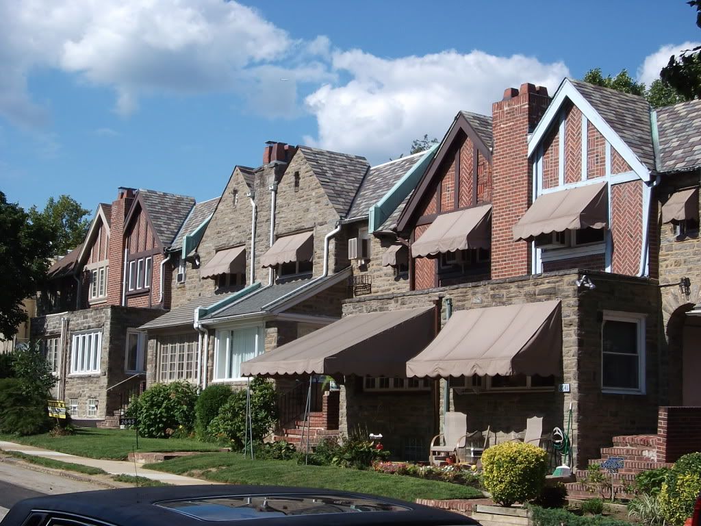
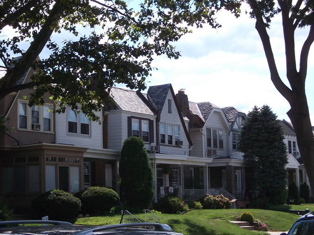
Typical Belmont Village airlites
Bounded by Belmont Avenue, City Line Avenue, and the Bala Country Club golf course, Belmont Heights is one of the City Line's smallest neighborhoods. Across from Bala-Cynwyd and close to Center City, this neighborhood has always been within easy walking or transit distance of the region's major shopping and jobs centers.
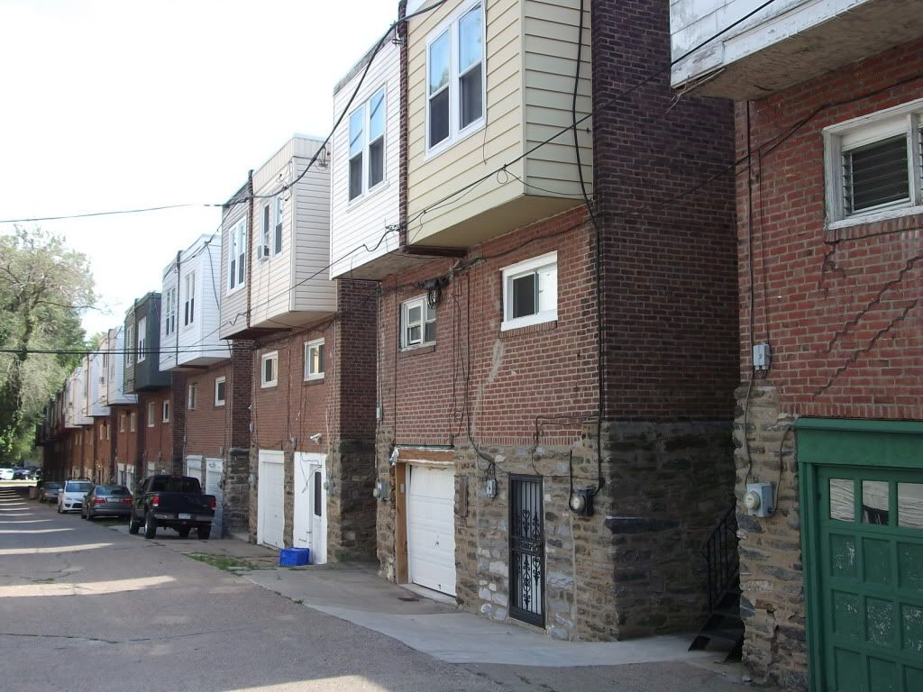
Airlite rears. Notice alleyway and ground-floor garages
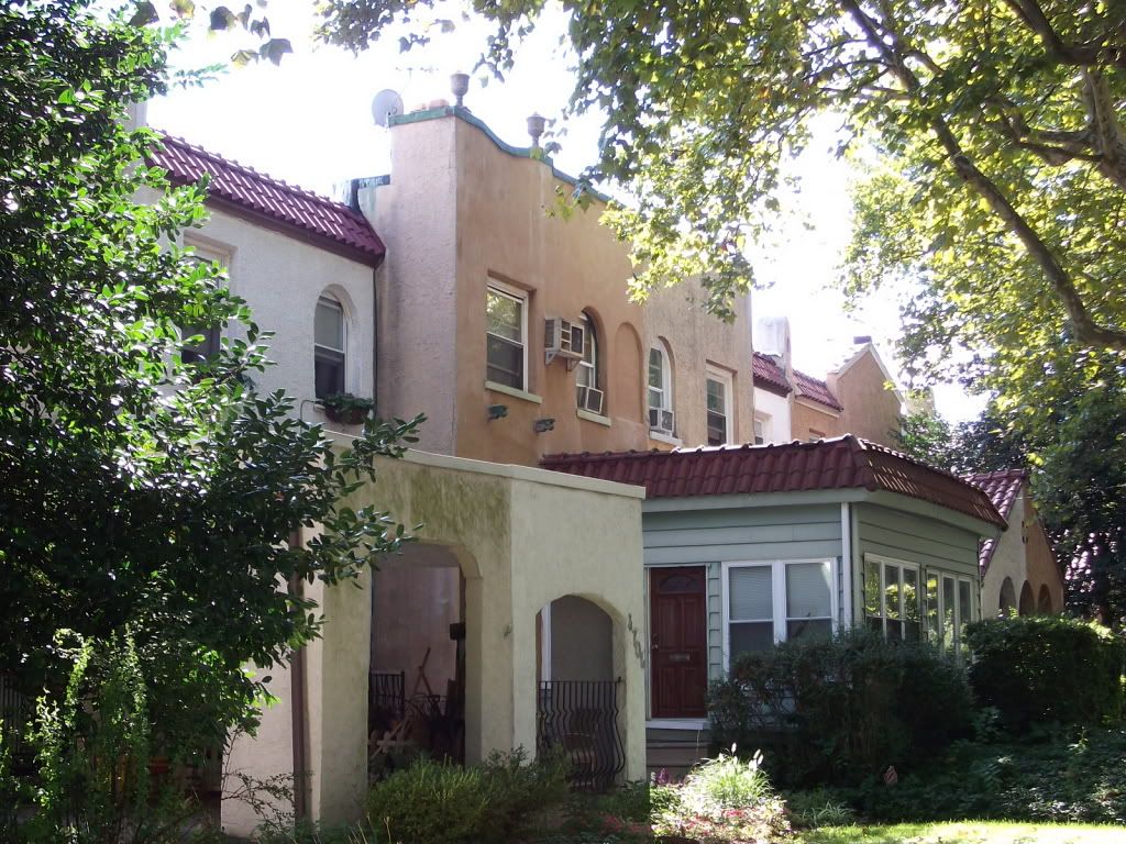
Built almost all in one go in the 1920s, Belmont Village's primary housing stock is the ubiquitous (for that time) airlite, primarily Tudor, although more Deco and Modernist looks creep in amongst newer airlites. Along Conshohocken Avenue, the Mission style, however, holds sway.
Mission-style airlites along Conshohocken Avenue
Larger apartment complexes abut interior Belmont Village's airlites along Belmont and City Line Avenues; shopping lies across the street and at the corner of Monument, Ford, and Conshohocken in nearby Wynnefield Heights. As with all City Line neighborhoods, however, the retail corridor is autocentric; redevelopment into something more pedestrian-friendly would go far in shoring this area up.
A more Colonial style of airlite
Historically, Belmont Heights is more an urban Main Line neighborhood than a suburban Philadelphia (County) neighborhood. The airlite pattern of development, like garden apartments, rose in the 1920s as a way to accommodate that new necessity, the automobile, and bring "light and air" into urban environments via the use of a deeply set-back front yard (which replaced rowhomes' rear yards) and garage-fronted alleys. It is a style that is being adapted in modern suburbia...poorly. This early attempt to accommodate the auto without having it take over a fundamentally pedestrian environment is light-years better than what we see today. As is the building quality.
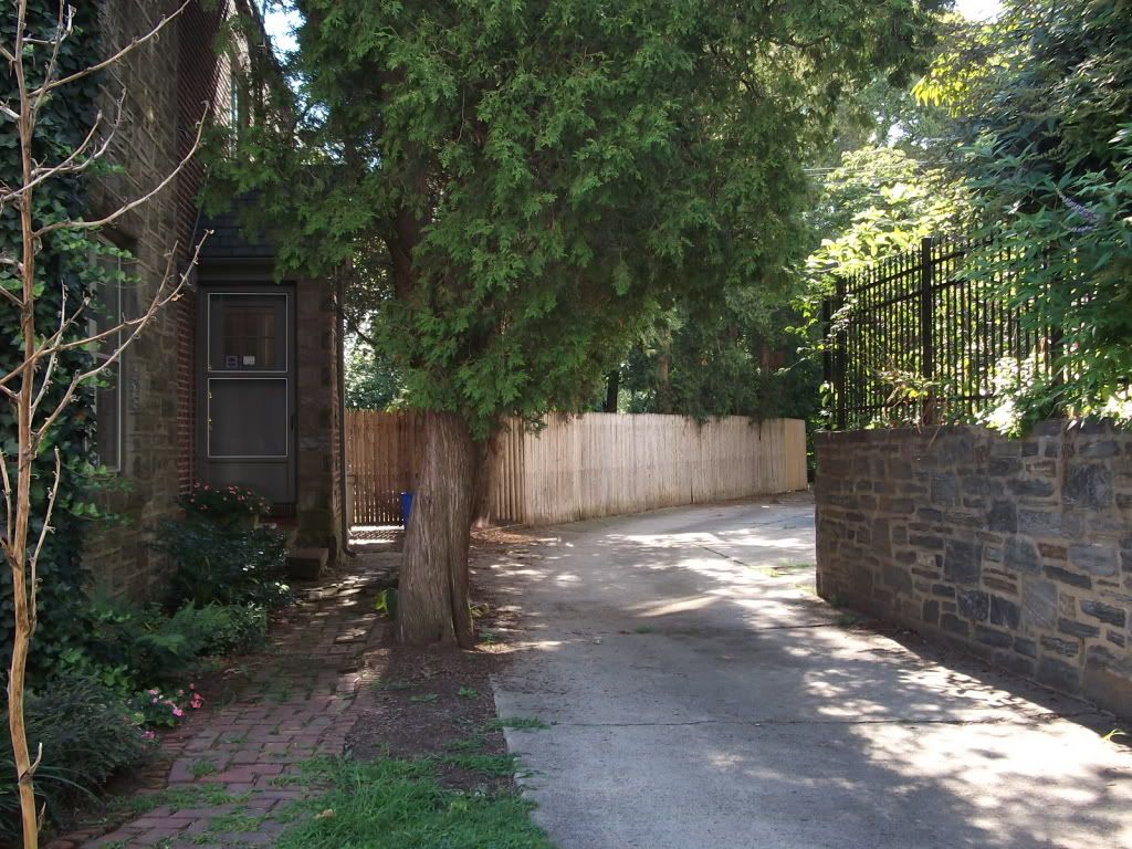
An alleyway integrates into the local environment. Automotive, but not autocentric, space
Like Wynnefield, Belmont Village is today a mainly African-American middle-class enclave. Like all the City Line neighborhoods, however, there is a growing influx of young professionals moving in and maintaining stability, even as African-American populations continue to suburbanize.

Friday, August 12, 2011

In the Pipeline

Just because I haven't been posting doesn't mean I haven't been working on stuff! Here are some projects I'm hoping to publish in the near future...

1. Continuing "Neighborhood Mystique"...actually, what I want is for somebody like Plan Philly or Naked Philly to pick it up and pay me to write it. Next stop's Belmont Village.
2. Analyzing SEPTA's route changes. This should be up early next week.
3. John had some good comments on the MARC proposal. In light of these ideas, and other connections that need to be made, I'd like to work on the structure of the system some more.
4. I walked up to the Cynwyd* Trail last week and boy was I amazed. A linear park 30 feet wide and they're managing to fill all of it with trail! How is that even possible...? Criticism of excessive infrastructure, obviously, in the works.
5.Criticism of BRT. My general critique is that it's much too amorphous, it tends to be competitive with other modes more often than complimentary, and that it's often politicized by anti-rail factions who cite (illusory) cost reductions. This is spurred in large part due to Human Transit's recent BRT-love, and is not to say there isn't a place for it so much as to say it hasn't really found its place.
6. Talking about challenges and opportunities of the West Chester and Octoraro branches (the latter goes to Chadds Ford and eventually the Herr's plant down in Nottingham).
7. Talking about integrating the Reading and Quakertown proposals into a unified network. The current disunified way these proposals are being worked on undermines the considerable strength, via economies of scale, that unifying them together would offer.
8. A Center City frequent grid network. Developing a schematic has been troublesome for me. Well, coming (as I do) from an Illustrator background, Inkscape has been troublesome for me.
9. Improving service frequencies on crosstown buses that connect with the Broad Street Line.
10. Building a commuter bus network. One of my ideas is to turn some disused space near 30th Street Station into a commuter bus terminal for SEPTA and NJT. This would help cut down on the excessive number of bus routes along Market and consolidate service in such a way to make it easier to build on more.
11. The Lower East Falls, Wynnefield Heights, and Parkway plans are still in development. Actually, I haven't really worked on them (lazy...). I would really like to finish at least one soon.
12. Last, but not least, I want to ask the question, why is ridership so low at Bala station?
_____________
* KIN-wood.

Friday, August 5, 2011

Thoughts on Old Urbanism

The first thought I have on Old Urbanism is about street width. Old Urbanists--particularly Nathan Lewis and Charlie Gardner--argue that our streets should be narrower. A lot narrower.

I have no quarrel with this, in principle. There really can't be much of an argument that postwar streets are excessively wide. When I learned in Land Use Planning 101 that the 1960 Philadelphia Subdivision Code mandated streets of at least fifty feet wide, I was shocked; in the lived environment of urban Philadelphia, 50 feet (three traffic lanes and two sidewalks) is the widest a street feels comfortable at.With the exception of the grand boulevards or proto-grand-boulevards (for example, Broad, Market, JFK, Washington, Spring Garden, Girard, Delaware, the Ben Franklin Parkway), no street in Philadelphia's urban core is ever historically* more than 50 feet wide, and the traditional driving of alleyways through the middle of blocks results in a network of ever-narrower streets and mews. Even so, since Philadelphia's primary grid is built up of 50-foot-wide streets (arterial streets, to the Old Urbanists), the mix here is closer to 49-49-2, in terms of narrow streets, arterial streets, and grand boulevards. This hasn't impinged Philadelphia's urbanism a bit.

Secondly, traffic density can also be a determinant of walkability or human-centrism. The primary Chestnut and Walnut Street shopping core is aligned along a pair of 50-foot-wide streets with two ten-foot sidewalks, two traffic lanes, and a parking lane**, but pedestrians and automobiles are segregated due to no more than the sheer force of traffic. Midcentury planners attempted to pedestrianize such streets--Chestnut was pedestrianized for a while--to disastrous results.

That said, I think that no more than the barest handful of streets need be more than 50 (or at the very outside, a very dense 60, like Ridge Avenue here) feet in width. Beyond this, they split rather than knit. Different neighborhoods also require different street widths to feel comfortable. Neighborhoods built on the picturesque-suburban model*** (such as Wynnefield) feel most comfortable with 50-foot roads; more urban neighborhoods are more comfortable with roads that run between 15-20 ft. and 50 ft., with each city having its own idiosyncratic alchemy of the two: this subtle alchemy helps creates a sense of macro-place: we are here and nowhere else.

The second thought I have--since streets are so wide and setbacks so deep--is that we can narrow our streets, and cities with excessively wide streets can make a pile of money by literally selling off excessive street width, in addition to other densification strategies--granny flats along the alley, carving excessively-deep front yards into new buildable parcels, and flat-out per-parcel redevelopment. In places like Detroit, where, for example, the widest streets can reach 200 ft., you can get whole new blocks.****

There are other ways to ameliorate excessively wide streets. Transforming their centers into various types of green space (hedges, swales, and even alamedas) is a good way to make them less excessively autocentric; an alameda is--additionally--a good way to provide bike facilities in underutilized street space. In a handful of instances, going farther is also an option: a trolleyway down the center of this greened space in the center of the street, maybe?
____________
* Some streets have been widened since. Some the numbered streets accessing the postwar office core of Market West have been widened to 60 or as much as 80(!) feet.
** I do dispute on-street parking a bit...although not by much. The occasional on-street parked car helps control speeding and defines the carriageway, for autos, and effectively becomes a piece of street furniture presenting a lived feeling in the neighborhood for pedestrians: good examples are this narrow (30 ft., I think) street in Manayunk and this street in Wynnefield.
*** Picturesque suburbia is heavenly. Post-picturesque-suburbia becomes ever more hellish.
**** This is not to say that Detroit has a market that can take this additional density, however.

Thursday, August 4, 2011

What Does It Cost?

I spent some time the past couple of weeks researching fares for commuter rails in the U.S. What I was after was a way to compare these fares, so I decided to use the rather arbitrary benchmark of a one-way 20-mile (as the bird flies) peak-hour trip as the basis of my fare comparison.

Of course, it's impossible to expect a regional rail network to have a station exactly 20 miles away from the CBD--although some come darn close. In one extreme example, I had to use a station 25 miles away as there were none closer to the 20-mile mark, despite a town along the railroad being approximately 20 miles from the city center and in another, the line wasn't 20 miles long. Finally I excluded rail lines operating non-FRA-compliant equipment, as part of what I'm getting at is how much a fare costs for equipment that mixes--or, more accurately, can mix (at a regulatory level)--with freight rail in this country.

Agency Trip Fare (One-way station peak)
LIRR (New York) NY Penn-Hempstead $10.00
MNRR (New York) NY GC-White Plains $10.50
NJT (New Jersey) NY Penn-Woodbridge (NJ) $10.00
MBTA (Boston) Boston South-Framingham $6.25
SEPTA (Philadelphia) 30th Street-Lansdale $6.25
MARC (Maryland) D.C. Union-Gaithersburg $5.00
VRE (D.C.) D.C. Union-Woodbridge (VA) $7.85
Metra (Chicago) Ogilvie-Glen Ellyn $4.50
South Shore Line (Chicago) Millennium-Hammond $4.75
Northstar (Minneapolis) Target Field-Elk River* $5.50
Music City Star (Nashville) Riverfront-Martha $5.00
Tri-Rail (Miami) Central-Hollywood Airport $3.75
Trinity Railway Express (Dallas) Union Station-Hurst/Bell $5.00
Rail Runner (Albuquerque) Albuquerque-Los Lunas $2.00
FrontRunner (Salt Lake City) Central-Layton $3.75
Sounder (Seattle) King Street-Mutilkeo $4.00
WES (Portland) Beaverton-Wilsonville** $2.35
Caltrain (San Francisco) 4th & King-Redwood City $4.75
ACE (San José) Diridon-Pleasanton $7.75
Metrolink (Los Angeles) L.A. Union-Sylmar $7.25
Coaster (San Diego) S.D. Union-Solana Beach $4.00

* Closest station to 20 miles is 25 miles (or greater).
** Line extends for less than 15 miles. Assume at least one zone increase were line lengthened.

Observations about this table:
  1. The cheapest fares in the country are in the Southeast and Desert Southwest, with Albuquerque's Rail Runner being, by far, the cheapest fare of all. (I was shocked by how cheap it said it was on their website.)
  2. The most expensive fares in the country are in the Northeast and in California. The three most expensive fares, overall, were all concentrated in the New York Area, while the next two most expensive were in L.A. and Northern Virginia.
  3. It's more expensive to commute to downtown D.C. from Virginia than Maryland. Additionally, it's substantially cheaper to commute to San José from the Peninsula than from Altamont Pass.
  4. Of the five largest cities in this country with commuter rail (New York, Los Angeles, Chicago, Philadelphia, and San Diego), the cheapest fare is San Diego's (at $4.00).
  5. Three of the ten largest cities in the U.S. by population have no commuter rail whatsoever (Houston, Phoenix, and San Antonio).
  6. Two of the ten densest metropolitan areas in the U.S. have no commuter rail whatsoever (Pittsburgh and Louisville). *Pittsburgh is especially surprising, given how much rail infrastructure exists in and around the city.
This list, of course, brings up further questions. According to Metrolink's website, AAA calculates the cost of driving at $0.541/mile, which means that every commuter rail network in the country offers a cheaper fare than the $10.82 it would cost to drive the 20 miles...even the Metro-North to White Plains, the most expensive fare on the table. So why is ridership depressed despite the cost savings?

Secondly--and this applies more for the cheaper fares--what is the farebox recovery ratio? With commuter rail (or any sort of mass transit, really), a farebox recovery ratio of 50% or better is preferable; some systems have it 75% or better; NJ Transit usually operates at a profit. Granted, networks that use a proof-of-payment system have lower labor costs, but the majority of commuter rail systems in this country use F59PHIs or MPI MPXpresses and gallery cars, and there's considerable cost disparity between these systems. It is impossible to believe that Rail Runner, for example, realizes a farebox recovery ratio better than 50%, based on this cost figure.

Neighborhood Mystique: Wynnefield

This is a new series, called Neighborhood Mystique. Here I document some underappreciated neighborhoods in the city with excellent "bones". This is not about neighborhoods such as Northern Liberties or Manayunk; instead, this is about the neighborhoods that could be the next Northern Liberties or Manayunk.
I, like, totally want to live in a house like this.
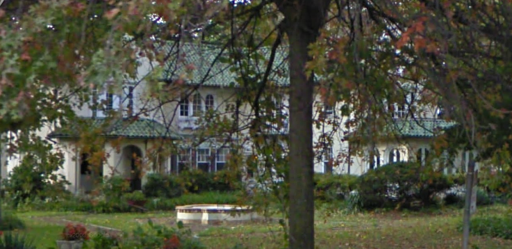
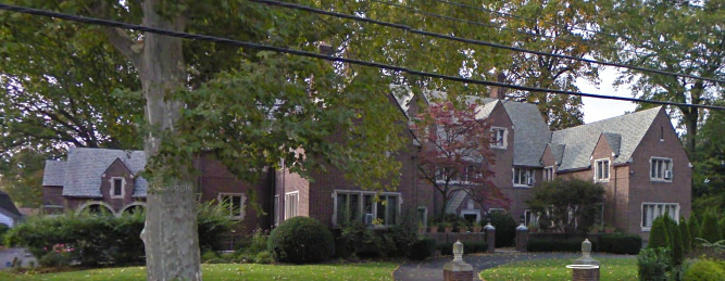
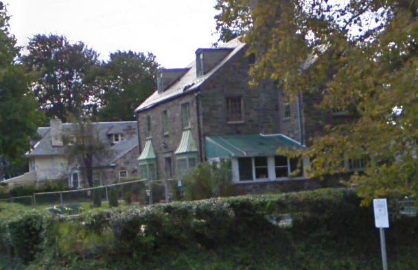
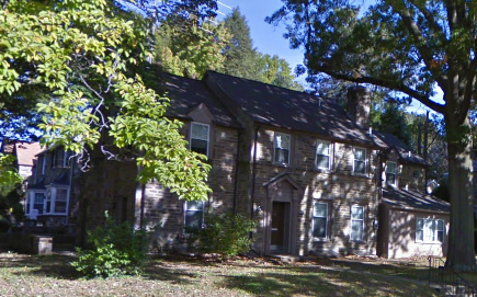
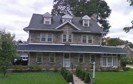
A true gem. Wynnefield is one of the two Philadelphia neighborhoods traditionally associated with City Line Ave. Developed primarily in two major phases, the bulk of the neighborhood is a late picturesque suburb built for Philadelphia's Jewish population, back when the major Jewish neighborhoods in the city extended around Fairmount Park's west side. Luxuriant mansions in various styles were built along Parkside Avenue, while a beautiful mélange of turn-of-the-century houses stretched back all the way to City Line Avenue.
And this house. Ooooooooh.
Later, in the 1920s, the less-desirable southern third of the neighborhood was developed as a series of Tudor airlites. However, as this was Wynnefield, a neighborhood that at the time was the most desirable Jewish neighborhood in the city, the quality that went into these airlites was far greater than in most other parts of the city. More houses keep getting added--all the way down to the present day--in the relatively few lots left after these two major phases of development.
Another beautiful picturesque estate
Its beauty, however, didn't stop it from changing, as the Jewish population left for more suburban neighborhoods during the 1950s. By 1960, Wynnefield had become a middle-class African-American neighborhood, and in the 1980s the crack epidemic hurt it hard. Even today, the more urban Tudor airlites of lower Wynnefield are home to a lot of drug problems, even though the earlier picturesque suburban areas have cleaned up and are once again a major bastion of African-American financial security.
A Colonial-style from upper Wynnefield
Saint Joseph's University, Philadelphia's premier Jesuit college, stretches along City Line Avenue through Wynnefield, all the way from 52nd Street out past Overbrook Station. Its existence provides Wynnefield with its major economic anchor, and also with the neighborhood's most recent changes, as housing close to the college gets repurposed into student apartments for those who wish to live nearby--a change occurring in nearly every campus-proximate neighborhood in Philadelphia. These changes are starting to shift Wynnefield's demographics again, but the bedrock of wealth, whosoever owns it, in this neighborhood, isn't changing.
Once upon a time this was what a suburb would look like

Wednesday, August 3, 2011

Improving Transit in Baltimore

Some time ago I started a 3 (now 3.5) part series on improving transit in Maryland and D.C. The first part designed improvements to the Washington Metro via targeted extensions to underserved areas--especially jobs centers--and a more complex downtown D.C. network with more routes and increased interlining. Also recommended was the installation of an express track between Rosslyn and East Falls Church (the extent, that is, the Orange and Silver Lines are interlined outside of Central Washington). The second targeted improvements to MARC, firstly by merging it with VRE, and secondly, by greatly increasing commuter rail services around Baltimore. The second-and-a-half took this a little further, discussing natural extensions of the core network proposed and the technical issues inherent in creating an S-Bahn-like network through downtown Baltimore. This third post discusses improvements that can be made in Baltimore.

...Except my work's already done for me. More or less.

What the MTA has proposed is a wide-ranging light rail network that builds on the two existing mass transit lines in Baltimore (the Central Light Rail Line, marked blue, and the Baltimore Metro, marked green, on the map). Even though this proposal dates back to 2002 now, and has not seen much in the way of new work, the plan, the principles behind the plan, and the plan of implementation are all sound. When I argue for more long-range mass transit planning, this is exactly the kind of thing I'm arguing for. The Washington Metro wasn't built in a day; in fact, it took roughly 30-40 years from the start of the planning process to the completion of the first-generation network. The first-generation Baltimore network would take on the same look, but done with more light rail and less heavy rail. See below.
Of course, there are still issues and longstanding mistakes. Extending LRT towards Columbia is nowhere near as effective as extending commuter rail (i.e. a variant on the Orange Line); similarly, the Blue/Yellow Line towards Hunt Valley, following ex-Northern Central Rwy. rights-of-way is nowhere near as effective as an alignment towards Towson, following ex-Maryland and Pennsylvania right-of-way (assuming it still exists) would be--although the northern Yellow Line proposal (along Charles Street) would go quite a long way in rectifying that. And the Red Line proposal that has the most traction has piss-poor interconnection with the existing lines (not so much a network as a motley connection of lines).

Even so--a strong long-range framework for local transit exists, or seems to, in Baltimore--much stronger than what you would find in e.g. Philadelphia. Which, again, is the point of this blog.

In the long run, I would encourage Maryland to consider the MTA and MARC as layered networks in a wider system, and quit trying to (like Dallas) overextend its light rail network.

Tuesday, August 2, 2011

MARC, Revisited

A little while ago I wrote a post describing my ideas for improving Maryland commuter rail service. They included:
  1. Combining MARC and VRE to create an S-Bahn environment in D.C. via the First Street Tunnel;
  2. Extending new MARC lines from Baltimore to Annapolis, Frederick, Gettysburg/York, and Westminster (mislabled "Westchester" on the map...bugger); and
  3. Creating a linkage between Camden and Penn Stations to provide an S-Bahn routing through Baltimore, along with
  4. Electrification of all routes (drrr...).
First of all, I'm going to return to the downtown Baltimore tunnel. After spending some time researching the history, I realized it's easier than originally thought: the Howard Street tunnel already does my job for me. This plan thus assumes the reuse of the Port Royal station shed as a new passenger station with an easy pedestrian link to Penn Station (about three blocks away).

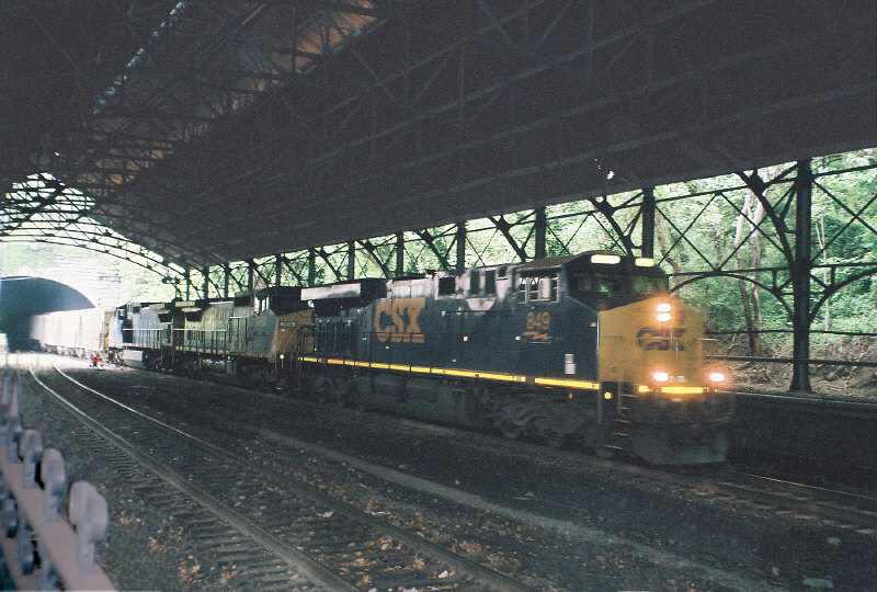
However, the Howard Street Tunnel is currently a CSX main line--the one I like to call the "Royal Blue Line" after the B&O name train that once ran it. Combining the operational density of this New York (and beyond)-Washington (and beyond) freight main with two passenger routes at hourly frequency off-peak, 15 minutes peak, is a cocktail for disaster. Hence, in order to use this tunnel, through freights must be shifted off this line.
Current conditions: Mt. Royal station, Howard St. Tunnel.
The question is, how? There does not seem to be any good freight bypass of either Pennsylvania or B&O heritage around central Baltimore, the way there is (for example) a high line freight bypass around Philadelphia's 30th Street Station, and furthermore, both major mainlines through central Baltimore follow shallow tunnels, rendering both unfit for double-stacks; this situation implies that fast freight must follow a significant bypass--the most obvious route heading straight north, via the route being proposed for the Pennsylvania Line trunk, and tying into the former Alphabet Route mainline at Hanover Junction (where the branches to Gettysburg and York also split) towards New York and Philadelphia via Reading...but this routing is, on the face of it, baldly insufficient, especially for CSX, which must run its fastest freights a full day's travel along trackage rights to overcome the insufficiencies of the main line. A hazmat fire in 2001 crystallized the need to vastly improve the facilities at hand, but no option is cheap. Even so, the fact that no freight route through Baltimore currently allows for the transshipment of the tallest equipment the U.S. freight network uses absolutely must be rectified--both to improve the nation's freight network and to free up the Howard Street Tunnel for passenger rail use.

That said, another issue arises. With the Howard Street Tunnel vacated by CSX, MARC can extend the Camden Line (and indeed, all possible lines entering Baltimore from the south via ex-B&O ROW) north to Mount Royal--which offers a close connection to Penn Station--but new lines coming from the north, following the former Western Maryland main to (a) Westminster, (b) Gettysburg, and (c) York would naturally terminate at Penn Station (as Penn Station was once the Western Maryland's Baltimore terminus); changing the access to one that enters Mt. Royal would either need (a) new portals on the Great Circle proposal, or (b) a cutoff from the ex-WM main to the ex-Northern Central main (now the ROW of the Blue Line light rail) somewhere between I-695 (an optimal locale for a park-and-ride) and Druid Hill Park--preferably one at or near the closest (and therefore cheapest) point between the two--or, if possible, following an old ROW connecting them together (such as the one indicated on the map below between Garrison and Lake...Roberts(?); this line appears, from Google Maps, to be (mostly) unmolested.
The former Northern Central Rwy. branch offers, at its nether end, a spur with good curvature to take up the two new lines running northward from Mt. Royal, which is rather useful since the larger-scale projects to alleviate freight and passenger congestion through P&B and Howard Street tunnels will almost certainly form an infrastructural maze in the Jones Falls valley just north of North Avenue. By establishing a close parallel with the light rail infrastructure, the new line is able to traverse this maze using one of the existing ROWs for guidance.

Now my discussion turns towards Virginia. In my original post on the subject, I mentioned merging MARC and VRE--a merger of administration, operations, and equipment. This merger also implies that the combined new agency (which I am provisionally calling MARC) would take over any useful expansions into Virginia. Two exist, both from Manassas junction: one towards Charlottesburg, and the other, Front Royal; VRE is already studying an extension towards Gaither and Haymarket along the latter. Provisionally, I have added both as a pastel-shaded possible extensions of the Manassas Line.


Another possible extension is conceivable along the former Western Maryland main line from Westminster to Hagerstown, and finally, a suggested extension is shown from D.C. (L'Enfant) down to Waldorf and La Plata, communities with tough car commutes. Initially, I had discounted this line because the most obvious running is to Bowie, but I have it on good authority that the former right-of-way from Brandywine Jct. towards Anacostia has been preserved; if true, then this route would be amenable to either commuter rail into the urban core (via Greater Landover) or an interurban extension of the D.C. streetcar.


Following these new ideas, as well as the possibility of a second Annapolis line via the former line from Annapolis Junction, I've made a couple of new provisional maps of this D.C. commuter rail network, showing how these expansions extend the reach of commuter rail to the nation's capitol. The Google Map is linked to; below see the map based on the broader MARC map.

Wednesday, July 27, 2011

Rt. 17

The proposal I'm putting forward is a simple one--consolidate the 17 and 33 into a single new route, eliminating the current Market East jog both take in favor of connections offered to the Market Street buses at Market and JFK. This route would run service at a 15-minute headway and would be, like the 2, 7, 23, 47, 57, and C buses (and Broad Street Line and Philadelphia2050's proposed Loop Network) part of a frequent service core in the, er, urban core.

Consolidating this service would still allow for connections to other core frequent services at Cecil B. Moore (3), Girard (15), Spring Garden (43), Market/JFK (10, 11, 13, 34, 36, and the MFL), Chestnut/Walnut (21, 42), and Lombard/South (40)--as well as possible frequent service route modifications along Race/Arch (31, 48) and Spruce/Pine (12, 30), and expanded light rail service along Girard (37 proposal) and Washington (49, 64) (see here). The bus sections of this proposal can be implemented with relatively minimal cost: putting out a new schedule and map, and putting up new bus station signs; the buses (and drivers) taken off the now-defunct 33 would go to augment some of the more poorly bused routes in this network (mostly east-west).

Sometime in the near future I'm thinking of showing a map of this (unwieldy-named) Core Frequent Bus Network and connections, in the contexts of both current, and suggested Philadelphia2050, operations.

Thursday, July 21, 2011

Death of a Retailer

The bankrupt bookstore, Borders, announced a couple of days ago that it will liquidate its remaining assets, after a deal with the Najafi Companies fell through. Borders was the second-largest bookstore chain in the U.S., after Barnes & Noble, with a presence in most of our larger cities and urban areas. (The third largest, Books-A-Million, is a long way behind, with locations primarily in the Southeast and a brand that lacks, um, gravitas.)

A lot of people, me included, grew up browsing the local library, Borders, and Barnes & Noble, picking something off the shelf that looked interesting, and learning about topics as disparate as high literature, philosophy, and cosmology. More so than any other bookstore, Borders was a place where you could just plop down and read and sometimes even doze. While that might have been a problem, in terms of business-model sustainability, it certainly made Borders feel like the center of a community--a private but publicly available information repository.

I grew up with Borders. My mom worked next to one, so whenever I had to wait for her I waited there. Whenever I found myself having to wait in Center City, I waited at the Borders at Broad and Chestnut. Most of the books I bought, I bought from Borders. They were always my favorite bookstore--the first one opening up in my area had been a revelation. I've never really felt at home in Barnes & Noble's stacks; I'll miss Borders.

So what's next? A big push by Books-A-Million? The company is far too small to compete with B&N--and even then B&N hasn't been having a good year? What about Amazon deciding to maintain a physical presence alongside a Web presence? (Its market is the descendant of mail-order, after all, and it would be following in the footsteps of brands such as Sears and Montgomery Ward.) American expansion by the Canadian chains Indigo and Chapters? (Kobo, because of Borders, certainly has some American presence.) Or of European and Oceanic firms, such as Waterstone's, W.H. Smith, fnac, Weltbild, Angus & Robertson, or some other established chain? Or a contraction of the publication industry in general? (I hope it's not that, I want people to read.) But there's the rub--despite the doom-and-gloom claims that Borders went bankrupt because its core business model wasn't sustainable (especially in wake of Amazon), the fact that so many other companies are successful in their fields, coupled with bad business decisions Borders made (most especially its early-2000s partnership with Amazon, which really served to poach Borders' customers), and the destabilizing effect of the recession, was more what brought the store down. The need to browse is human, and these big chain bookstores are consequently always stuffed with browsers. Browsing leads to impulse purchases: this creates a market bricks-and-mortar retailers can capitalize on that mail-order catalogs Internet retailers can't. This is why firms such as Sears and Ward's made the leap from the catalog to the showroom and physical store--and why the physical store will never die: because the psychology of the shopper changes subtly from the catalog (or website) to the physical store: the site feels more like a wish list ("what if?") while the store feels more concrete, more there, and easier to think about getting. Impulse purchases on Amazon are unlikely; at Barnes & Noble, they're a certainty.

Monday, July 18, 2011

Zoning and Transportation

A common criticism of zoning is its often-asinine parking requirements. Why, for example, should every new rowhome on an urban block have to have space for a vehicle--which in practice always means a garage? This emotional question is one which commonly initiates zoning reforms--yet, by the end of the process, community input from organizations who are continually worried about their neighborhoods' parking conditions--how hard it is to find a spot--will always ask for the re-inclusion of those exact same parking requirements, thereby frustrating the goals of transit activists, conservationists, New Urbanist planners, and others trying to shift the transportation mode share away from cars and more towards more sustainable modes, such as walking, biking, and mass transit.

To that end, the bonusing system of highest-density zones in many cities involves cutting parking requirements when alternative transportation access is included. This often comes in the forms of bike parking and/or access to local mass transit stations and concourses. In initial rezoning, these bonuses are structured such that they can potentially eliminate parking requirements altogether; yet after the community review process they come out so mangled they barely reduce parking, and hence promote alternative mode shares, at all.

Cap'n Transit today suggests a new approach: creation of zoning mirrors that either (a) eliminate parking or (b) promotes transit, by requiring a direct contribution to the local mass transit agency of roughly the amount it costs to add a garage. The full set of mirrors he suggests increases the number of possible zones, however, which would undermine another goal of zoning reform--reducing the number, and complexity, of zones to make the system more legible to both developers and community organizations.

When the use of mirrors is seen in light of this counter-demand, however, a new idea comes to mind: why not just rethink what we mean by parking requirements? For the provisioning of parking requirements is nothing more--and nothing less--than a policy meant to ensure transportation access to and from the site by the resident, patron, employee, whatever. It is thus intended to ensure economic access through the means of zoning. But the high autocentrism of the language--the way the requirements have been warped, either accidentally or deliberately--undercuts the aspiration behind providing this requirement in the first place. Parking requirements--instead of transportation access requirements--are an ossified remnant of the grand 1950s ideal that driving would be truly liberating.

The simpler way to offer what Cap'n Transit is suggesting is, thus, to simply offer a menu of different classes of transportation access instead of simply requiring parking. A developer could offer (a) parking to every unit or (b) a bike parking facility or (c) insurance of transit access via a grant to the local mass transportation agency to ensure a continuance of service, of roughly the per-unit cost of a garage or carport, or (d) a mix-and-match of the above options. Any options, by themselves, would be by right; mixing and matching would trigger a minor variance (to ensure that the percentages being allotted to each mode is in line with city mode-share desires). Transportation access requirements would then be built on the framework parking minimums offer, while superseding the detrimental effects, when scaled, those minimums create. It is also far simple to insert, and interpret, a transportation access table with different expectations and requirements pertaining to access of each mode at the beginning (or end) of the code, than it is to overstuff the code with reams of variant zones whose only purpose is to delineate different classes of transportation access.

Wednesday, July 13, 2011

Paying for Infrastructure: At the National Level

So, since the Democrats dawdled their way out of a supermajority that could have easily allowed them to pass a good urban-oriented national transportation bill, the now Republican-controlled House has (finally!) produced a new national transportation bill*. This bill controls Federal expenditure on transportation for the amount of time it takes until the bill expires; historically it's been treated as a sort of Five-Year Plan for the Interstates.

While others have done a better job pointing out the bill's many obvious shortcomings, I'd like to focus on how we need to reorient and refocus our transportation bill. Since Mica's orientation paradigm is entirely reactionary--stripping out all of the most important features the bill has and retaining precisely what needs to be stripped out--understanding this new orientation is absolutely necessary, especially in terms of a public transportation policy shifting along with the changing transportation demands of the public.

What is happening is the beginning of a generational modal shift away from cars to walking, bikes, and mass transit. This shift is currently happening as a choice, as recent college graduates, more aware than ever of problems with the status quo, deliberately eschew the freedoms offered by the automobile (the ability to go anywhere, anytime) in favor of the freedoms offered by other modes (the ability to do your work, or snooze, or read while commuting). Hence, since the popular zeitgeist is a refutation of autocentrism, it should be expected public policy is shaped by it.

Mica's policy is reactionary in that it follows a caricature of 1950s transportation policy--namely, the stereotype of the era as being highway-centric--and thus seems like an attempt to force perception to bend to the will of policy, rather than the other way around. Instead, passage of this bill would just further pen up demand for alternative, walkable, urban, urbane places and lifestyles. It would grossly subsidize status quo exurban construction, even as demand for those types of places collapsed in the wake of the Great Recession--and not subsidize enough to artificially create any demand, either. In other words, it would be a boondoggle on a truly colossal scale, a scale at the same level as the 1950s' urban renewal. And unlike the 1950s, we don't have the liquidity to invest poorly anymore. We need to force a high ROI out of any investment we make...in making this claim, the conservatives are ideologically correct, regardless of how when it plays out in practice, conservatives seem attracted, like mosquitoes, to projects with the lowest public ROI (but the highest subsidies, visible or otherwise, for corporatist interests).

This logic of forcing the highest ROI out of transportation leads to me calling for a tripod scheme of Federal-level transportation investment. This scheme calls for:
  • Leveraging current public transportation assets to provide new liquidity into the system;
  • Leveraging new liquidity to (a) maintain public assets and (b) provide a national-level network in what is currently the most undercapitalized section of the transportation sector; and
  • Providing planning and implementation monies to ensure transportation security at the national, state, and metropolitan levels.

Translated into plain(er) language, this means:
  • Leasing and/or selling limited-access divided highways, particularly the Interstates;
  • Investing capital gained in aforesaid process into endowing an infrastructure bank (focused on road maintenance and new rail infrastructure); and
  • Ensuring that monies disbursed from aforesaid infrastructure bank are equitably divided between (a) national-level freight and passenger rail, (b) state-level freight and passenger rail, and (c) mass transit for interconnecting cities and urbanizing suburbs.

This is the broad framework the bill needs to operate in. Notice how diametrically different this framework is from the current framework, which focuses on highways and strips away all other funding--blindingly stupid when highways currently have the lowest ROI of any public infrastructure investment. Since we are overcapitalized on highway investment, with a handful of exceptions, and undercapitalized on rail investment, with almost no exception, eliminating excess capital from the highway network and plowing it into rail--as the only network able to operate with the same efficiency as highways--makes eminent sense.

This proposal would provide for, in general terms:

1. Decreased overall road spending. Road spending focus on repair. Sale or leasing of limited-access highways (primarily Interstates) to private transportation providers to provide capital for funding most of the rest of the bill, primarily through national- and state-level infrastructure banks.
2. Massively increased rail spending. Freight rail mainline electrification mandate; passenger rail mandate to provide daily service to all cities of 50,000 people or more; high-speed rail mandate to provide high-speed service to all metropolitan areas of 500,000 people or more, with 600 overland miles or less to the nearest similarly-sized metropolitan area. Reform of FRA and FTA to meet European and Japanese standards. Elimination of Buy America on small orders. Tax breaks for domestic railroad equipment manufacture and for shipping by rail.
3. Massively increased mass transportation spending. Mandates to provide transit access to 80% of all addresses in metropolitan areas and potential capacity enough to move half of the metropolitan area's population; mandate to provide a comprehensive implementation plan to that effect by the end of the decade. Increase of Small Starts and New Starts funding; enaction of America Fast Forward proposals.
4. Provision for planning of port and maritime facilities on a national scale. Ensurance that all large metropolitan areas (500,000+) with maritime access has national-level port. Planning and implementation of Maritime Interstates, following the coastlines, Great Lakes, and major navigable rivers.
5. Monies to maintain airports. Effort to reduce short- and medium-haul flights to increase long-haul capacity. Make airports profitable, and do not publicly fund profitable ones. Privatize airports in the same manner as the Interstates.
6. Pedestrians, bicyclists, and streets (as opposed to roads). Maintain a complete streets/shared space policy. Provide sidewalk access on all streets that are not to be shared space. Provide separate bicycle access parallel to arterial traffic roads, usually via a complete street. Finally, create national-, state-, and metropolitan-level "bicycle highway" multi-use trails, to be funded in cooperation between transportation and parks departments.
7. The infrastructure bank. Privatization of limited-access highways (primarily Interstates) and airports offers an excellent opportunity to fund an infrastructure bank. Land value of these holdings is in the many hundreds of billions, and transportation value in the trillions. Getting fair value for these holdings consequently offers enough liquidity to fund new public infrastructure projects for a decade or more. By providing infrastructure banks at the Federal and state levels, this liquidity is managed, and with a strong vetting infrastructure, poured into projects offering the biggest bang for the buck.


No transportation bill option currently on the table offers the value, stability, liquidity, and security of an infrastructure bank system financed via the privatization of currently-public infrastructure.
 
If you want to read the more specific proposals:

Roads: Leasing or sale of Interstate or Interstate-grade highways (privatization) will enable user fees to be bought to bear on an overutilized socialist commons; as a mature technology, the time is ripe to undertake this endeavor.

Public road maintenance will be funded through the infrastructure bank.

Roads will be maintained according to how much access they offer; rural (primarily access) roads will be funded at an appropriate level, as will urban roads.

Since funding transportation also entails eliminating overcapacity, funds will also be disbursed for the elimination of excessive roadway capacity implemented two or three generations ago (i.e. removal of urban freeways) in favor of the higher ROI generated via land development.

Preferentially fund roadway projects which (a) do not increase capacity (that is: repairs first) and (b) have strong state and local financial support. No project with less than 25% state financial support and 10% local financial support should be Federally funded (in essence, this caps Federal funding at 65%).

Rail: Current funding for Amtrak would stay intact. Future funding for Amtrak improvements would be folded into the infrastructure bank.

High-speed network proposals and funding would be folded into the infrastructure bank.

A new mandate for electrification of all freight mainlines by 2040. National standard would be 25kV 50 Hz catenary able to handle double-stack container trains. Funding for this mandate would be accomplished through infrastructure bank disbursals to freight line owners.

Special committee for the total rewriting of FRA and FTA regulation to make them internationally-compliant. Repeal of Buy America for smaller orders (sub-100 units) balanced with a rail manufacture-and-utilization tax break to better balance transportation modal shares and promote a domestic rail manufacturing industry.

Mandate daily passenger rail to all cities with a population greater than 50,000 and high-speed rail between all metropolitan areas with a population greater than 500,000, 600 overland miles or less from the nearest equivalent population center, both by 2050. Passenger rail is an Amtrak mandate, funded through the infrastructure bank, while HSR would likely utilize PPPs. Note also that the HSR mandate just applies to linking individual cities into a network. Note also that 600 miles is just a tad longer than optimal corridor viability, but connects nearly every middle-to-large city in the U.S. to one another via multiple transportation modes. Assume that HSR will utilize new rights-of-way while slower-speed trains will utilize existing rights-of-way outside of urban centers.

Mass Transit: Match Federal and state funding for all mass transit systems, nationwide.

Establish and fund planning-and-implementation programs for mass transit systems to eliminate gaps and optimize service, nationwide. Different local mandates will of course create different conditions, but when oil is expensive the need for greater mass transit service will be more pressing. All metros of 500,000+ must be capable of reaching 80% and moving 50% of their population via mass transit by 2060.

Plans to reach this mandate must be complete by 2020.

Implement funding strategies as suggested in America Fast Forward (L.A. 30/10).

Tie reception of all federal urban development monies (for 500,000+ cities) to the successful planning and implementation of mass transit. Mass transit is the key competitive advantage of the 21st century; cities which understand this are those best poised for long-term growth. Cities which choose not to implement mass transit are thus those least able to maximize returns on Federal investment.

Increase New Starts and Small Starts funding by at least 100%. Fund projects with maximal people-movement potential first, maximal non-people-movement-based environmental impact potential second, and maximal developmental potential third. Vet and penalize projects with inefficient expenditures (for example, overdesigned stations relative to service levels, overpriced equipment, new equipment when used equipment can suffice) and projects with low returns on investment viz. station-side development (reward TODs and penalize the overuse of park-and-rides). Preferentially fund projects with strong state and local financial support.

Provide Federal matching monies to rail agencies which sell, lease, or develop upon excessive park-and-ride capacity.

Preferentially fund projects with strong state and local financial support. No project should be funded with less than 25% state and 10% local financial support. (That, in essence, implies a 65% Federal spending cap.)

Maritime: Establish a ports policy at a national level. Port capacity should be greatest where port needs are greatest. Plan and implement a policy of national-level alpha, beta, and gamma ports, and fund repairs and improvements at those ports in kind.

Plan and implement a network of maritime Interstates following major waterways. Interstate maritime traffic is relatively underrepresented in the United States, and much more freight can, and should, be moved along the coasts and Gulf, on the Great Lakes, and down the major navigable river systems (Mississippi, Columbia, Hudson, etc.) than current levels. Traffic along these maritime routes would run between ports of four classifications: alpha, beta, gamma, and delta (non-nationally-important ports, particularly along the rivers). Most of the physical infrastructure for this network is already built-out; repair and expand were needed, and promote maritime freight operations with a minor tax break.

Ensure that all large metropolitan areas (500,000+) with maritime access (along a coast or navigable river) have access to a national-level port.

Airports: Maintain funding for airport repair.

Work to shift short- and medium-length trips from the air network into other modes in order to free up greater long-haul capacity without physical airport expansion.

Work to make airport facilities independently profitable for sale or lease (à la the Interstates).

Pedestrians/Bicyclists/Streets: Fund and improve pedestrian links.

Mandate that all non-local road projects have pedestrian infrastructure. This would be absorbed into larger-scale road funding.

Plan and implement national-, state-, and metropolitan-level bike highways (multi-use trails). Funding for this network would come from a combination of DOT and Parks Department monies.

Prioritize funding for complete streets and shared spaces projects.

Infrastructure Bank: The financing centerpiece of this policy is the establishment of a Federal-level and state-level infrastructure bank. This bank will be initially funded by the sale or lease of limited-access divided highways, Interstates and otherwise, as well as the sale or lease of airports. Money from this sale (land value of these properties is likely in excess of $500 billion, and transportation value greater still) will be divided 60-40 between Federal-level and state-level infrastructure banks.

The infrastructure bank will assess, vet, and disburse for projects which maximizes ROI in the following areas: (1) maximal transportation access, across all modes; (2) increased land values and human-scale development patterns nearest transportation access nodes; (3) has high degree of patronization (for rail projects, for example, 100 persons per mile or above); and (4) is economically efficient (a commuter rail example: it uses existing equipment wherever possible, has station engineering in line with ridership projections, places stations in established centers preferentially or else has a land-use plan in place to develop a town center around the station, uses park-and-rides only sparingly, and in places where park-and-ride patronage will be highest, etc.) Highest-impact projects are those with relatively minimized costs, calculated in metrics appropriate to mode, and maximized returns on cost, in terms of the triple bottom line. The national infrastructure bank will contribute between 50% and 65% to public projects, and the state infrastructure bank between 25% and 35%. Remainders--usually in the 10% to 15% range--are to be contributed via local and/or private matching funds.

____________
* Yes, I'm deliberately shying away from calling it a "highway bill" for reasons explained further along in the post.

Monday, July 11, 2011

Basics: Parking Requirements

Nearly every American zoning code takes minimum parking requirements for granted: every habitable structure has to have a minimum of so-and-so parking per unit (if residential) or square feet (if commercial or industrial). Yet this practice runs counter to international best practices. European cities, for example, are purposefully making themselves car-hostile. And changing thoughts on parking requirements are creating a patchwork in which some cities have parking minima and others parking maxima.

The major problem is that since 1950 American cities have seen auto access as a given; rather, its proper place is a luxury. Streets need to be there for service vehicles, but they don't need nearly as much space as they claim. (Japan, for example, proves that.) Automobiles are merely one mode out of many of transportation access--their usage is enforced when we create environments where there is no mass transit and other modes of personal transit (pedestrian, bike) are well-nigh suicidal, but their usage is also encouraged when we overbuild automotive infrastructure where there is great access via all other modes as well. European cities understand this. The idea of building an apartment building next to light rail, to take an example from the Times article, is reasonably urban (indeed, that is the root of transportation-oriented development), but by giving such a structure a massive parking deck for residents, you abrogate the development opportunities gained by being transit-oriented and instead merely make it transit-proximate. In an era where resources need to be shifted to better use less energy, providing a parking space per unit just doesn't make any sense.

TOD planning has helped bring about change--see places like Rosslyn, VA--but the reality is that with fewer resources we can put toward transportation better transportation planning is necessary. TOD is only an element in broader planning--and Philadelphia, and every city, for that matter, needs to start planning to ensure that every citizen has adequate transportation access to every mode, and an environment conducive to less energy-intensive modes of transportation and more gung-ho about more energy-intensive modes. In other words, the way we zone needs to make it easier to walk, ride a bike, or take the bus or train than drive.

To that end, along with the development and implementation of a 50-year transportation plan, such as Philadelphia2050, every metropolitan area in the U.S. needs to reconsider how it accommodates automobiles, through both roadway design and construction and planned transit access and network design--and through parking requirements. Parking minima should only be enacted in places where mass transit access in a 50-year timeframe is simply not a viable option, and zoning massing densities* complemented with a gradation of parking maxima relative to density, with the highest-density and closest-to-high-capacity-transit locales having no parking requirements whatsoever.** Ideally, this would be bundled with market-rate pricing of parking throughout the urban organism, such as what Market Urbanism suggests, and the complete-street/shared-space network I have previously described--a one-two punch that would effectively eliminate several hidden subsidies for cars in the urban cores and provide a long-term ridership base for mass transit and regional bike trails.
___________
* In either Euclidean or form-based frameworks.
** Philadelphia's new zoning code would have been trailblazing in enacting something not much different from this, but Center City neighborhood associations--particularly the perennial thorn-in-the-side LSNA--succeeded in having such progressive language removed from the bill, due to parking concerns. The idea that parking would be removed by removing cars from the road never seems to have been considered.

Tuesday, July 5, 2011

Improving MARC

This is the second in a three-part series on improving transit in the southern part of the Northeast. The first focused on the Washington Metro, and the third will focus on mass transit in Baltimore.

MARC is Maryland's commuter rail system. It certainly does its job, with three lines emanating from Union Station, and three lines emanating from downtown Baltimore. The Penn Line runs from Perryville via Baltimore Penn Station to Union Station; the Camden Line from Camden Station in downtown Baltimore to Union Station; and the Brunswick Line from Martinsburg, WV, to Union Station. Along with the two VRE lines from Union Station to (a) Fredericksburg and (b) Manassas, MARC offers adequate commuter rail for the D.C. area. In concert with the Metro, this means the D.C. metropolitan area has the third-best transit infrastructure in the Northeast, and fourth-best in the nation, after New York, Chicago, and Boston.
MARC, current conditions. Wikipedia.
MARC could, however, be better. Its charter doesn't just call for D.C.-area commuter rail, it calls for commuter rail for all of Maryland. Its Baltimore lines are relatively poor, concentrating along the Royal Blue/Northeast Corridor axes rather than branching out throughout the metropolitan area, and it lacks service to either Maryland's state capital, Annapolis, or its sixth largest city, Hagerstown, despite reaching all the way to Martinsburg. MARC's paucity of lines, relative to potential (VRE has two lines, but all of the historic lines heading from D.C. into Virginia are accounted for between it and the Metro's Orange Line) makes it the Northeast's worst commuter rail system in terms of service scope.
VRE system map. VRE.org.
My improvements to MARC go well beyond just extending the Penn Line to Wilmington to interconnect with SEPTA. To offer excellent rail transit options at a commuter and low-level intercity capacity, the proposal is to merge MARC and VRE and to transform the system into a double-S-Bahn-type network, with an S-Bahn set emanating from Baltimore and a second from D.C. The current MARC network, when combined with VRE, produces a three-line double-S-Bahn network (Penn Line, Cumberland-Fredericksburg Line, Camden-Manassas Line), but only one of these three lines has a Baltimore nexus.
Line additions thus concentrate on Baltimore. Two new lines are proposed, extending from Gettysburg, PA via Baltimore to Frederick, with a branch to York, PA, and one from Westminster to Annapolis. Additionally, a branch of the Cumberland Line from Duffields (WV) to Hagerstown (MD) is proposed.
The plan of action for this new system would be to activate the lines into the city center first. These would take the form of two new lines terminating at Camden Station (one to Annapolis, and the other Frederick), and two at Penn Station (one to Westminster, and the other Gettysburg/York), constituting Phase II. Finally, once the lines are all in use, the interconnection between Camden Station and Penn Station will be built, linking the two sections of the Gettysburg-Frederick and Westminster-Annapolis lines together.
The line names are interesting. After thinking about it a bit, I decided to go with a 3-letter initialism, such that each line has the north origination first, the via city second, and the southern terminus last. Thus the Penn Line becomes WBW, or Wilmington via Baltimore to Washington, and the Cumberland-Fredericksburg Line becomes MWF, or Morgantown via Washington to Fredericksburg. This system is elegant and seems easy to apply to other networks, too.
MARC, improved. Five lines offer service throughout the Baltimore and Washington metropolitan areas.
A couple of interesting features are present in this system. First, because Martinsburg and Hagerstown are opposite poles of a micropolitan area, a shuttle train between the two would be immediately suggested; this shuttle, due to the nature of the system just outlined, would have a fare union with the broader network. Secondly, this network passes several Civil War sites (both Bull Runs, Fredericksburg, Gettysburg, Antietam), which effectively makes this system a Civil War railroad and thus able to provide excursions for reenactors, history buffs, school trips, Scouting trips, etc. Excursions, by their nature, are not scheduled trips; however, the equipment needed to run this system normally makes providing them a worthwhile promotion--a good loss-leader, if you will. And finally, this network suggests further extensions, including one to Harrisburg, another from Westminster to Hagerstown, and a third from Martinsburg to Cumberland.

MARC is an average system, by American standards. Let's make it better.

Wednesday, June 29, 2011

Locust Street Connection

This is an outrage.
So a legally-mandated bridge crossing that has been in the works for three years and was designed with a lot of community involvement (I should know, I voted on the design myself) is being held up by a bunch of idiots who remained willfully ignorant. They are complaining that it will (a) destroy "mature shade trees" and (b) destroy their belovèd dog park.
I don't call trees planted in 1980 "mature shade trees". And, while the current dog park will be out of action for a little over a year, a decent alternative will be provided. Look at the site plan! And furthermore, after construction, the dog park will reopen bigger and better than ever. It's a win-win for everybody.
So shame on you, Fitler Square dog owners who couldn't be bothered to inform themselves for 156.5 weeks that their park would be temporarily modified for a legally-mandated bridge project. And especially shame on you, Damon Roberts, City Council also-ran, for demonstrating that you are incompetent for the job: it is a Councilman's job to know what public projects are happening in their district, and the fact you are filing suit demonstrates that you did not. You have lost my vote now and forevermore.
I can only hope that whichever judge this asinine case goes in front of laughs it out of court. This is a suit they cannot win. This will only cause a delay--and a delay means a wastage of public funds. Thank you for wasting our tax money, Damon Roberts. You truly do not deserve an elected position of any kind.

Tell the Friends of the Schuylkill River Park to call Damon Roberts out here.

Monday, June 27, 2011

Triangle City

In the comments to my post on grids, Charlie over at Old Urbanist suggested that I create a physical representation of my ideal city from scratch.
Protip: Click on it to make it bigger.
Well, here it is. Carved out of the South Jersey backwoods, Triangle City is the hypothetical conversion of a bunch of farms into a small city of about 30,000. It is done via several design techniques:

1. Street hierarchy. ...Wait? Yep, street hierarchy. Yes, that bane of the suburbs makes an appearance here. The reason is that it's not the hierarchy that makes suburban streets so darn wide, it's the prescribed width of the streets. Here, the hierarchy is:
(a) Intercity highways. Complete streets about 75 feet wide. These are the roads which connect Triangle City to other towns and cities.
(b) Through-roads. Complete streets, or bike-sharrowed streets, about 30 feet wide. These are the arteries of the city.
(c) Local streets. Naked streets, 15 to 20 feet wide.These are the streets that actually go past most addresses.
Unlike autocentric suburban hierarchies, however, this one assumes connectivity. The reason why residential streets stay quiet is because they're so narrow hardly anyone'd think to use them. Pedestrian connectivity, however, is quite strong, since these roads normally interconnect between various parcels.

2. Reserved park and civic space. Three major reserved spaces show on the plan. The central one is Center Park (duh), a large reserved centerpiece civic park, of the type most communities this size lack. The funky-shaped one southeast of it is Civic Square, reserved for governmental buildings (think City Hall). Finally, the long linear park along the northern edge is the nature preserve, Forest Park. Within each neighborhood in this city, however, at least one (1) public park about a block in size and one (1) public playground, same size, is required in the development plan.

3. Reserved space for prime properties. Prior to releasing the land for development, the City will also reserve chief parcels (wonky corners, hilltops, etc.) for prime civic buildings--schools and libraries--and a plot, pursuant to a prior location plan, for combined police and fire stations. Three civic health centers would also be placed.

4. Gridlike Grid. As I noted in my previous post on the topic, the best way to design a grid is to modify it. By using laneways and a few other tricks, the otherwise-strong grid of the city is modified enough to create place and interest.

5. Urban Density. The average density would be about that shown in this post, where wealthier neighborhoods would use this model as single-family detached and less wealthy ones twins or four- to six-unit apartments. This is a density similar to suburbia most everywhere else in the world (Europe, Japan, South America), and is an ideal density for a place that exists at the fringe of the Northeastern megalopolis.

6. Connectivity. (Not shown). A light rail line would connect to the nearest transportation hub, Vineland.
Triangle City lot density
These are traditional techniques laid over a substrate of Pennsylvania pragmatism. The primary failure of Victorian grid was the lack of provisioning adequate public green space; this issue is retained even in sprawl. It is an issue some people just don't get. By utilizing an overarching plan for prime structures and amenities, and enforcing provisioning of secondary ones in land-use covenants, this issue would hopefully be curtailed.

Saturday, June 25, 2011

Washington Metro, Improved

This is the first post of a three-post series (maybe) on improving transportation in Maryland, D.C., and northern Virginia. In the first post, I concentrate on the D.C. Metro. In the second post, I will talk about commuter rail in Maryland and northern Virginia (MARC and VRE), and the third, improvements to the Baltimore metro.

The D.C. Metro is among the most convenient subway networks in the U.S., being about equally as convenient as, say, Boston's or Chicago's (though nowhere near as convenient as New York's). However, it has two conflicting mandates: at its nether reaches, it acts as a commuter rail line, and in the city, a traditional subway. This would work a lot like New York's Far Rockaway or Jamaica Bay subways...if there were express tunnels. Instead, since the tunnels are all two-track and there doesn't seem to be a way for overtaking to be scheduled in, all trains are effectively local trains. This works well on lines, in theory, where there are connections with MARC or VRE, since it enables local/express passenger transfer--that is, passengers originating on the Metro but wishing to skip intermediate stations and go straight downtown can use the commuter rail going to Union Station from places like Alexandria, Silver Spring, or New Carrollton, or passengers originating at Manassas and going to Bethesda, or Gaithersburg going to Rosslyn. However, since the ticketing networks of MARC, VRE, and the Metro are mutually exclusive, this is made prohibitively difficult for most passengers. Therefore, the first major action needed is to unify the ticketing schemes and operational patterns across the three networks, in a way that mirrors European S-Bahns. This is, of course, organizational improvement.

Even so, there are real concrete improvements that do need to be made. The network offers poor access (service gaps) into parts of the metropolitan area to the north, south, east, and west of downtown--most pronounced all along the Potomac, in east D.C.'s poorer neighborhoods, and directly west of the Pentagon. Additionally, as the core of the system was designed with the 1970s downtown in mind, it offers an increasingly inadequate service. (See Exhibit A.)
Exhibit A. Note how current system, while adequate by American standards, has major gaps in several directions, and downtown service can be improved.
Greater Greater Washington recently ran a series on second-generation improvements to the Metro, and while some of the ideas were pretty good (such as running the Yellow Line out to Union Station via 2nd), others were merely okay (the north-running Blue Line idea and its Silver Line kin: same idea, different lines), while others were just atrocious (the how far outside D.C. would the Brown Line be extended, anyway?
Exhibit B. The new network idea.
Taking the best three ideas--the Yellow Line tunnel out to Union Station, the southerly separate Blue Line tunnel, and a modified version of the Green Line spur to National Harbor, I came up with Exhibit B. This Metro system sports two new lines (Brown and Pink), and, to complement the new tunnels, extensive new interlining. This interlining would, in addition, offer superior Generation II downtown service. A final addition is the construction of an express track along the interlined Silver/Green section between Falls Church East and Rosslyn; this track would allow for faster commutes along what is now the single longest interlined section in the network (see Exhibit C).
Exhibit C. Downtown lines and interlining.
These lines would be as follows:
Red Line would be unchanged.
Orange Line would be unchanged.
Green Line would be unchanged.
Blue Line would run a new downtown tunnel from the Anacostia River, via H Street, to Union Station, where it would curve down to the National Mall, servicing the primary jobs and cultural centers in the city. It would then curve up through Foggy Bottom to Georgetown and return to the current Blue Line at Rosslyn.
Yellow Line would (1) be extended south from Huntingdon to Beacon Mall, (2) run a new tunnel via I and 2nd Sts. to Union Station, and (3) follow a new alignment north along North Capitol Avenue to Rhode Island Avenue and thence 18th St. NE out to Langdon and Howard Divinity School.
Silver Line would be extended along a new route along North Carolina Avenue, Tennessee Avenue, and the Bladensburg Road to Bladensburg and thence across the Anacostia out to Riverdale, where it would terminate in a new transfer stop with the MARC Camden Line.
Purple Line light rail would be unchanged. (It's a Maryland project, anyhow.)
Brown Line would run from Carderock, MD, via Langley, VA, and American University through Georgetown and thence interline along the Yellow and Green Lines into Anacostia, where it would peel off and continue running south to Forest Heights and National Harbor.
Pink Line would run from Walter Rand Medical Center in northern D.C. down through Columbia Heights, where it would interline with the Green Line to L'Enfant Plaza, and then interline with the Yellow Line to Pentagon, where it would follow a westerly route into Virginia via Columbia Pike to Bailey's Crossroads and Annandale.

This network would implement service to the D.C. area's major service gaps and greatly improve downtown circulation (especially around the Mall). Combined with fare and schedule unions with MARC and VRE, making cross-platform connections infinitely easier, this network would offer the D.C. area an impressive Generation II metro/commuter rail network.