

- Combining MARC and VRE to create an S-Bahn environment in D.C. via the First Street Tunnel;
- Extending new MARC lines from Baltimore to Annapolis, Frederick, Gettysburg/York, and Westminster (mislabled "Westchester" on the map...bugger); and
- Creating a linkage between Camden and Penn Stations to provide an S-Bahn routing through Baltimore, along with
- Electrification of all routes (drrr...).
However, the Howard Street Tunnel is currently a CSX main line--the one I like to call the "Royal Blue Line" after the B&O name train that once ran it. Combining the operational density of this New York (and beyond)-Washington (and beyond) freight main with two passenger routes at hourly frequency off-peak, 15 minutes peak, is a cocktail for disaster. Hence, in order to use this tunnel, through freights must be shifted off this line.
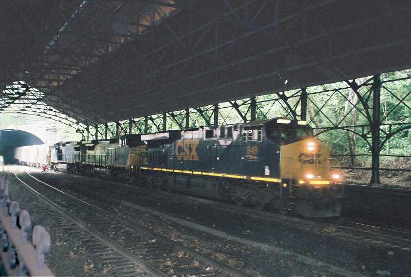 |
| Current conditions: Mt. Royal station, Howard St. Tunnel. |
That said, another issue arises. With the Howard Street Tunnel vacated by CSX, MARC can extend the Camden Line (and indeed, all possible lines entering Baltimore from the south via ex-B&O ROW) north to Mount Royal--which offers a close connection to Penn Station--but new lines coming from the north, following the former Western Maryland main to (a) Westminster, (b) Gettysburg, and (c) York would naturally terminate at Penn Station (as Penn Station was once the Western Maryland's Baltimore terminus); changing the access to one that enters Mt. Royal would either need (a) new portals on the Great Circle proposal, or (b) a cutoff from the ex-WM main to the ex-Northern Central main (now the ROW of the Blue Line light rail) somewhere between I-695 (an optimal locale for a park-and-ride) and Druid Hill Park--preferably one at or near the closest (and therefore cheapest) point between the two--or, if possible, following an old ROW connecting them together (such as the one indicated on the map below between Garrison and Lake...Roberts(?); this line appears, from Google Maps, to be (mostly) unmolested.

Now my discussion turns towards Virginia. In my original post on the subject, I mentioned merging MARC and VRE--a merger of administration, operations, and equipment. This merger also implies that the combined new agency (which I am provisionally calling MARC) would take over any useful expansions into Virginia. Two exist, both from Manassas junction: one towards Charlottesburg, and the other, Front Royal; VRE is already studying an extension towards Gaither and Haymarket along the latter. Provisionally, I have added both as a pastel-shaded possible extensions of the Manassas Line.
Another possible extension is conceivable along the former Western Maryland main line from Westminster to Hagerstown, and finally, a suggested extension is shown from D.C. (L'Enfant) down to Waldorf and La Plata, communities with tough car commutes. Initially, I had discounted this line because the most obvious running is to Bowie, but I have it on good authority that the former right-of-way from Brandywine Jct. towards Anacostia has been preserved; if true, then this route would be amenable to either commuter rail into the urban core (via Greater Landover) or an interurban extension of the D.C. streetcar.
Following these new ideas, as well as the possibility of a second Annapolis line via the former line from Annapolis Junction, I've made a couple of new provisional maps of this D.C. commuter rail network, showing how these expansions extend the reach of commuter rail to the nation's capitol. The Google Map is linked to; below see the map based on the broader MARC map.


