Showing posts with label Emergent Urbanism. Show all posts

Monday, June 15, 2015

Zoning, the Static City, The Dynamic City

At the beginning of the year, Charlie Gardner at Old Urbanist offered an academic's findings on zoning, especially where American practice is in conflict with European practice. Perhaps the most important part, however, is a paragraph buried deep in the piece:
How this exceptionally American land-use system came into being during the late 1800s and through to the 1930s is the primary focus of Hirt's book.  In chronicling this period, many apparent paradoxes present themselves: for instance, although the United States of the late 19th century prided itself on being the most democratic nation in the world, its citizens had a low level of trust in their elected municipal officials.  The progressive municipal reformers of the time might therefore have campaigned for planning to be guided by state or federal governments, but instead pushed for non-discretionary municipal-level zoning.  As Hirt observes, zoning reformers such as Lawrence Veiller argued that "zoning rules should vary as little as possible in districts that were as large as possible and that zoning relief should be granted only under a very limited set of circumstances, if at all." 
But if the planning powers were delegated from state to city, and the city was to have little power to alter the apparently infallible choices of the initial zoning commissions, who was left to actually engage in city planning?  No one, as it turns out.  Planning commissioners were seemingly intended to be little more than curators of the city zoning map, and Hirt finds, as I have also noted, that zoning maps have changed relatively little in their basic allocation of space since the 1920s.  As I've written about before, the actual policy that zoning was intended to serve was almost an afterthought, and was primarily concerned with protecting the investments of wealthy homeowners.  By default, and perhaps unintentionally, city planning (to the extent it existed at all) was turned over to the emerging highway engineering profession. 
American zoning policy, in sum, was a negative and reactive vision -- through its implementation, it viewed cities as incapable of honest and effective self-government, and by its actual regulations, it viewed urbanization as a threat to not only investments but to civic spirit and even the American way of life itself. As Hirt writes, "[t]he single-family home had the right to the city: it was always seen as being there first. It was the gracious host, the delicate victim, and the original citizen that was always haunted, followed, invaded, and taken advantage of by other housing types." In this sense, Hirt's book echoes the conclusions of Steven Conn's recent Americans Against the City: Anti-Urbanism in the Twentieth Century.
The key takeaway of this is fairly simple: American zoning was already being used as a tool to prevent redevelopment as early as the 1920s. Zoning theory, while it grew out of nuisance law and European (especially German) practice, was already being adapted to exclude rather than include -- zoning, by design, is a hyperlocally-devolved tool. Indeed, the basic idea seems to have been to zone land such that intensification of existing development was made impossible, a practice which inevitably would concentrate redevelopment in the most intensively-used areas -- and on the greenbelt edges. 

And because there was no systemic planning practice designed to rezone, it has been left to politicians' whims, which often result in downzonings once communities realize that existing zones allow more intensive land use than what currently exists, and state DOTs -- whose highway extensions (and not mass transit extensions) have been, since midcentury, what has opened new land up to development.

What is curious to note, then, is that American sprawl is driven by what is essentially a units problem. In the hard sciences, units problems rise when units are misapplied, or when they're inadvertently mixed. For example, while a velocity calculation might be mathematically simple under constant acceleration, the result has to be in the same units as the inputs (e.g. m/s, cm/s, mi/h, etc.). Mix up the units -- say, by measuring an object's weight when what you want is its mass -- and you throw your calculations off. Similarly, inappropriate aggregation can often hide more than it illuminates: this is one of Jane Jacobs' key critiques of mainstream macroeconomics, that the sovereign nation is fundamentally an inappropriate unit for economic measurements, as it almost always represents an aggregation of very much economically disparate regions. 

By over-empowering land use planning at the hyperlocal scale, we inadvertently disempower reasonable land-use planning at the scale where it matters most, as far as optimizing spatial efficiency relative to amenitization is concerned: the greater conurbation. Static land use paradigms undercut the efficacy of mass transit (as has often been pointed out at Urban Kchose); because zoning law is not designed with spatial efficiency in mind -- and, indeed, almost every solution to any given land-use problem increases spatial inefficiency -- we find ourselves unable to respond save by sprawling more ... and more ... and more.

Sometimes small-scale intensification is not aesthetically pleasing: witness D.C.'s pop-up house, which, now that one has been built, has been banned. Indeed, this has generally been zoning's modus operandi -- regulate nonconformity into nonexistence. The problem with this is, however, that at a certain level, small-scale intensification requires aesthetic flexibility. Indeed, this may be old urbanists' strongest criticism of New Urbanism: that it overfocuses on form, while underfocusing on the land-use development process -- the true locus of the sprawl process. This is perhaps where Strong Towns has come into play: it has gained traction and has been growing, as a grassroots movement, precisely because it has correctly identified the core problem: a broken process: a process that enshrines a static, rather than dynamic, vision of the city.

But here is an interesting issue, and once where there might actually be natural friction between Strong Towns and old urbanists: short of total curtailment of land use regulation (an extremely libertarian solution), while the issues in transportation engineering are clearly defined by its excessively top-down paradigm, the problems with spatial planning are caused by it being excessively bottom-up. That is, resistance to change is driven not by new inhabitants but by the ones who already live there, and have the time and energy to mount opposition (which, due to the way the playing field is skewed, is almost always effective opposition). Even very simple changes -- for example, liquidation of excessive parking regulation, making small multiunit structures legal, moderate height increases, and other examples of incremental redevelopment -- are opposed so fiercely that, outside of large urban cores where an effective development counterpresence can be built, they are unlikely to get any traction.

The long and the short of this can be summed up by saying: The current land-use planning paradigm is fundamentally broken. Moreso, it is fundamentally broken because current American regulation creates a static vision of the city, rather than a dynamic one; this fundamentally empowers interests that favor their static vision (NIMBYs) while disempowering ones whose vision is dynamic (developers). And, despite many planners' attempts to make dynamic redevelopment easier, the truth is that the discipline's entire toolkit, over-oriented towards a static vision, greatly inhibits what can be done, and yields marginal results of even the most sweeping efforts.

Wednesday, February 19, 2014

Three Links

Apex Urbanism is another excellent blog in the old urbanist vein, heavily influenced by Nathan Lewis and Charlie Gardner. Still fresh, it's worth checking out.

A local blogger puts out Munson's City--lots of excellent and interesting ideas, critiques, etc.

Finally, check out the Allure of By-Lanes and Cobbled Streets Pinterest page. Beautiful photos of great urban places. This latter reminds us, especially in old urbanist contexts, how much modern regulation has actively hindered, not helped, placemaking.

Thursday, February 6, 2014

Colonias

Stumbled on this post about what are called colonias (colonies) down by the border.
A colonia is actually produced the same way most neighborhoods usually are: Take a plot of land and subdivide, subdivide, and subdivide again. Property owners can build as they wish.
This usually starts out as a collection of trailers or other types of temporary dwellings.
Over time, intensification happens. Soon enough, it is impossible to tell colonias apart from their township and hutment brethren.

But it doesn't stop there. Over time a colonia starts to look like a gecekondu, campamento, or favela--that is, it has become essentially identical in built form to a "formal" neighborhood. This is emergent urbanism, the purest manifestation of our community-building impulse.
That isn't to say they don't have problems, of course. Infrastructure provision is weak to nonexistent. The water is filthy, and illnesses spread like wildfire. More than a few commentators call colonias "third-world slums".
But that's the problem, isn't it? Slum is too general a word, and we confuse ourselves when we use it. There are two classes of slum problems--infrastructural problems and socioeconomic problems. We often assume all "slums" have both, and that all neighborhoods inhabited by the less well-off are "slums", and in so doing, not infrequently, offer exactly the wrong solutions for the problems at hand.

The real problem of mature informal settlements--like mature favelas, campamentos, gecekondular, or, yes, colonias--are not socioeconomic. Attaining maturity by definition means intensification, which implies adequate internal solutions to socioeconomic issues to maintain a positive economic trajectory. No, the real problems of such communities are infrastructural.
And to solve infrastructural issues--requires formalization. It requires that the community be recognized as a community and not derided as a slum. It requires, in short, that we stop assuming that every place that isn't as well-off as Suburban America is "poor", a "slum", and needs to be "cleared"--a bias inherent in certain advocacy organizations--
--and instead work to identify what causes socioeconomic problems, understand a community's socioeconomic trajectory, install physical and social infrastructure as needed, and allow the community to continue incremental progress.
See, here's the bulldozer problem, the bulldozer bias, the bulldozer fallacy: When you flatten a slum, you don't make the slum go away. You make it go somewhere else. But what you do make go away--are the solutions embedded within the slum. The bulldozers just make the problem worse.
Some* people, fortunately, understand. But they are the minority.
__________
*That said, "solid homes with garages and paved driveways"? Really?? That's your idea of incremental improvement? Can you be more biased???

Wednesday, October 31, 2012

An Emergent Main Street?

Something interesting is happening in the village of Lafayette Hill. A Main Street is coming to be.

This, despite the majority of this Main Street consists of mid-century strip malls and commercial pads. It's a Main Street in use, though decidedly not form. Take a look.
It runs like this from Joshua Road to Church Lane.

But, since the buildings are aging, the majority of chains have moved out, to newer, shinier digs around the Plymouth Meeting Mall. In their place are more locally-owned stores, more boutiques, more inns, and what are generally considered the two best Persian cuisine joints in the region.
Lafayette Hill is the overgrown agglomeration of two older villages: Barren Hill and Marble Hall, which has led to its bipolar development and a small gap in the middle. But the density, the connectivity, the ingredients are all there--and, as the buildings age and rents come down, the more interesting uses, too.
Which leads to the greatest problem in front of Lafayette Hill: its very autocentrism. Strip malls don't create a pedestrian atmosphere, and despite the fact that it's the same size as e.g. Lansdale, walking rates are much, much lower. So what's to be done?

Brand it. Give it a "Main Street Lafayette Hill" identity; play upon its existing strengths. Have a citizens' day; take over a parking lot and use it for a farmer's market; install sidewalks all the way up and down. Make de jure the de facto parallel parking already in front of the Wawa and extend it all the way up and down Germantown.

And in the long term, change the zoning code to remove setbacks and favor rear parking*. Curb minimums, and encourage walking plans for the bars. Preserve the Manayunk vernacular and Victorian buildings already here, of which there are a few. And allow structures to grow to 3-5 stories.
___________
* Transit access is relatively poor, unlike Conshy or Paoli or Lansdale.

Thursday, December 1, 2011

Occupy Philly As Spontaneous Urbanism, Part III

As we watch the bulldozer and trash trucks arrive this morning at Dilworth Plaza, and read of a 5AM face off between Occupiers and police on North 15th Street, let’s wander through Occupy during a more bucolic time–last week, in fact.

In the beginning, the encampment had features ... Continue reading at Hidden City Philadelphia.

Sunday, November 13, 2011

Photopost: Occupy Philly as Spontaneous Urbanism, Pt. II

This is the long-awaited weeks-late follow-up to the first part of this photo essay--especially important since Charlie, Emily Washington, Linda DePillis, and Phillip Kennicott, have all picked up on the same idea. Emily additionally suggests that the same pattern is likewise evident in the annual Burning Man festival.
Primary north-south avenue through Occupy Philly. This Baroque way seems to have come about through campsite reorganization.
A back street in Occupy Philly.
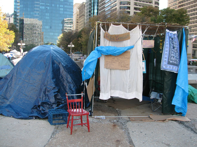
Another Occupy Philly back street.
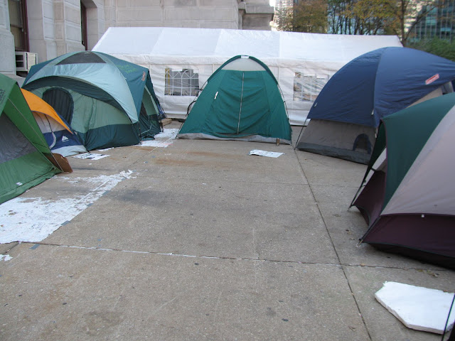
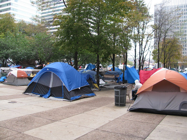
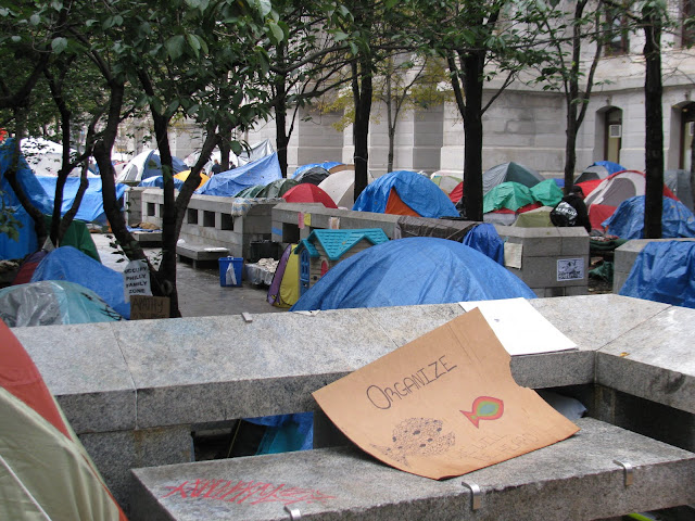
Packed in tight, but with variation. Here we see how the structural variety and footprint uniformity create emergent urban form--even in a tent city.
Urban panorama, looking south.
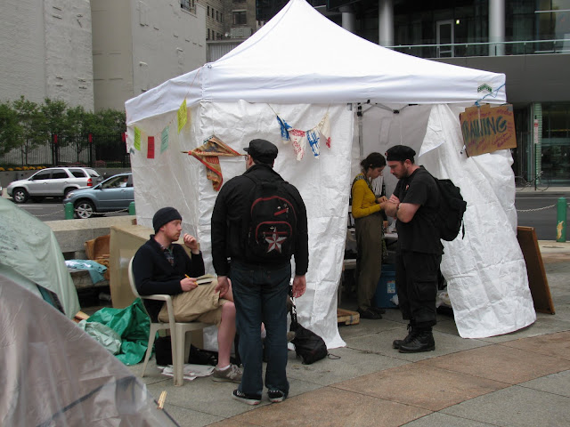
Back street. To the right is the tech tent.
This court is a remnant of a previous major artery through this burg. The tech tent, in the background, when erected blocked the through street off and forced the Baroque boulevard to be driven through.
No longer is the homeless tent on the main road.
On the north side of town, space between dwellings grows. Urbanization eats this space away, though.
The north plaza, a huge unurbanized space at the north edge of the encampment.
Heavy-duty urbanization along alleys behind buildings facing the north plaza.
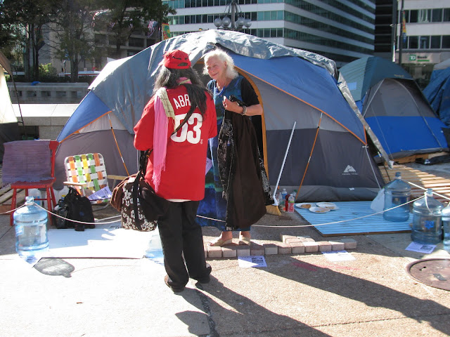
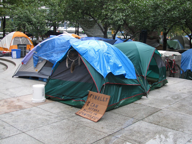
Some tents, such as this, even have claimed "yard" territory.
Another look.
This wide avenue branches off the north plaza and is a sleepy village in comparison with the concentrated downtown area along the Market Street axis.
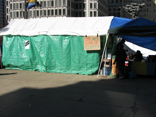
The north meal tent.
Higher-use tents nestled in a suburban downtown on the north side.
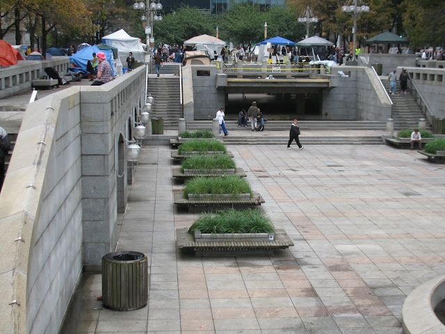
Dilworth Plaza's great sunken area has not been filled in by tents, despite its bordering downtown. It is as much a barrier as a lake or fen, and is clearly separating the central urban area from the north side.
This is not some isolated thing, either. Even the most rudimentary group camping self-organizes as a village around the center of the campsite (i.e. where the picnic tables and campfire are).

I may well get around to a Part III...Stay tuned!

Wednesday, October 26, 2011

Development of Philadelphia

Philaphilia and Philly Bricks, with their love of historical images, give us two looks at the development of Philadelphia from more or less the same vantage point.
In 1707 the city had just been founded, and this view shows how it was still basically just a small country town, built entirely in an area that is easy to walk around: south of Arch, north of Spruce, and east of 4th. Most of it was on the Old City side of Dock Creek (thus explaining Elfreth's Alley's age). Notice the building placement: it is not random. Since time immemorial, blocks--especially planned blocks--have had their first buildings built in the middle of the block, and as time progressed, to the edges (which became the most valuable properties) and deep into the core, nested around a series of ever-narrower alleys. The residential parts of Wash West preserve this structure quite well.
Looking at this mid-nineteenth-century view of this same spot, the pattern of densification can clearly be seen, with most blocks bi- and trisected by alley networks of varying complexity. Furthermore, the first major intervention to the grid is visible: Dock Street, following the old Dock Creek, curves around, sweeping inland. The creek's headwaters were at what is today 4th and Market; Dock Street, however, terminates around 3rd and Sansom (about 1.5 blocks southeast). This is because the land value along Market and (especially) Chestnut* is so high that the expense of eliminating interventions can be borne by the landowners--typically banks and financiers--looking to locate at the center of the action.
__________
* Philadelphia's PLVI at this time was essentially the 400 block of Chestnut.

Tuesday, October 25, 2011

Photopost: Occupy Philly as Spontaneous Urbanism, Pt. I

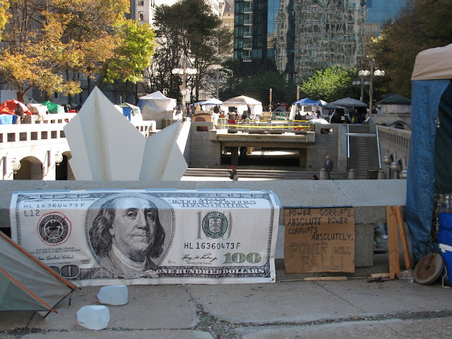
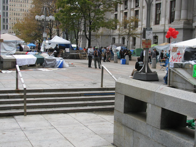
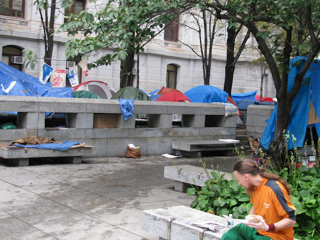
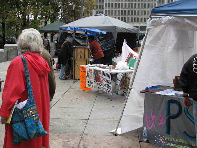
The Occupy movement has been getting increasing traction and airtime over the past few months, and roughly a month ago (already?) now a branch set up in Center City Philadelphia. Occupy Philly lays on the landscape of Dilworth Plaza, and occupies it the way a Mediterranean city a hillside.

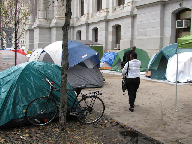
The reason Occupy's tent city is emergent is because it is assembled from a fairly standard collection of individual units (tents), combined together in a highly complex and nonstandard order. It has both the virtues of high interconnectivity and quiet streets, achieved through a natural dual-level street hierarchy. The primary streets are, however, curved slightly and bend along City Hall's façade: the only perfectly straight road is the one between Market Street and City Hall's portal, currently being used as an amphitheater for voicing grievances.

So, without further ado, pictures!
South entrance
Looking towards the core. Note how broad path is being built over
South fountain area. The dry fountain seems to be a staging space
The library
This view shows the concentration of density around the City Hall portal
Looking north along a wider path
The art farts' corner...supposedly
A series of major plazas mark the north side of the Occupy Philly site now
Sharp boundary between urbanized and non-urbanized
Work ongoing. Foreground guy has a rather lackadaisical attitude...
Registration tents at the entrance to the site, 15th and Market
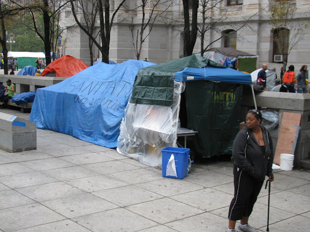
Sanitation tent just off the Market Street path
Amen, bro!
The city: the densest section is on the south side of the site
Looking towards a more pastoral north side
The homeless tent is surprisingly well away from the action. It is, however, on the main path right now.
Occurring urbanization. Lower tent densities, a slightly more pastoral vibe.
A yawning expanse between the edge of the urbanized area (approximately where I stood) and the north services area.
Looking south across this expanse
The sunken "waiting room" for transit--a space shied away from, even by Occupiers
Tents with a view seem to be in demand
The north services area
Far from the centers of the site--the Market Street area and the north services area--the libertarians set up camp at 15th and JFK.
That's all for this post. Next post I'll be documenting changes to the site in the week elapsed.