In today's Metro, planning theorist and PlanPhilly head Harris Steinberg envisions burying I-95 along the Delaware Avenue waterfront from Washington to Spring Garden. Pragmatist and Deputy Mayor Rina Cutler (if you're reading this, I'm still looking for a job), on the other hand, has espoused a "rebuild-in-place" position whereby existing infrastructure gets renewed as need be, but no new far-reaching plan is espoused.
The forest I fear both are missing for the trees is that I-95 doesn't need to be there in the first place. The purpose for which it was originally designed--transporting goods to and fro along an active, pier-studded waterfront extending all the way from League Island to Torresdale--lapsed long ago with the containerization revolution and the implementation of the modern practice of concentrating port facilities in large terminal complexes. In terms of its original design concerns, it is obsolete. (This is true of most waterfront expressways.)
In terms of interstate travel, it is duplicative. There are no fewer than four different major routes between Baltimore and New York through the Philadelphia metropolitan area (to wit: I-476-PA TPK-NJ TPK, I-95, I-295, and the NJ TPK) via limited-access highways; travel time differences on three of them are, at best, limited. Yes, I-95 is a spinal Interstate--but it's because of this reason it should be routed around the city center instead of through it (as it is in D.C., Baltimore, and Boston).
I-5 in Seattle is also spinal (running essentially between Vancouver and Tijuana), but there is a strong debate there whether to bury it or eliminate it*. Arguments in favor of elimination are strong and applicable to the Philadelphia situation. Rerouting I-95 via either the Blue Route, I-295, or the NJ TPK (or, as I have suggested before, a combination of the latter two) would shift through traffic out onto the beltways instead of the urban core, thereby making closure and eventual (urban) redevelopment of the section from Oregon to Allegheny** feasible. Once you've closed the expressway, you've also gained redevelopment parcels, some which even come with ready-made basements, which in the long run will eventually destroy and reurbanize the gap between city and waterfront. This plan is also much cheaper than even Cutler's, since it would mostly constitute re-signing and bureaucratic transactions leading to the sale of developable parcels.
Current traffic along I-95 is split between through traffic (although the directness of the NJ TPK makes this not as much as you'd think, particularly southbound) and local traffic originating or terminating in Center City. Local traffic needs can be met, in the urban core, via good surface arteries, and I-95 happens to parallel one such: Delaware Avenue, which has been re-signed Columbus Boulevard through Center City and South Philadelphia. This road has plenty of capacity--especially when augmented by the grid--to pick up 95's slack.
To summarize: closure of I-95 through Center City Philadelphia would be (a) cheap and (b) productive in terms of releasing developable parcels in revitalized areas, as well as in terms of reuniting city and waterfront. The structure can also be reused for other purposes (one possibility that springs to mind, congestion issues aside, is an El spur) or simply auctioned off, the easement destroyed. Land clearance does not even have to happen prior to conveyance--some plans may well find the existence of the deck a useful amenity for e.g. the provision of a roof, or postindustrial-grit ambiance, or even for parking. In fact, infrastructure clearance in certain segments--i.e., where I-95 is already sunken--is counterproductive in that it destroys existing amenitization, thereby undermining the land value, and reducing the amount recoverable through conveyance. Through traffic needs can be met by rerouting I-95, and local traffic, via Delaware Avenue (Columbus Boulevard), which parallels this easement most of the way along this corridor. In this way, redevelopment of infrastructure past can be used to meet urban needs of the future.
_________________
* Presumably by rerouting it along current I-405 (eliminating that designation), extending I-90 to Tukwila, and re-designating the resulting spur from Lake Union to Lynnwood I-305.
** The Oregon terminus accesses Packer Terminal and Allegheny the Richmond Terminal. North of Allegheny the expressway would be re-designated as a spur road (possibly I-395? I-695? I-995?) to the juncture with current I-276, which may or may not be so designated in the new numbering scheme.
Friday, September 30, 2011
Thursday, September 29, 2011
Sharing Space
In the past I've (blasély) talked about naked streets, or as they are more euphemistically known, shared space, mostly in the context of other work, such as understanding street hierarchies. Now I would like to offer a few suggestions on realizing shared space:
1. The essence of shared space is that the travel ways (carriageways or cartways) are shared between all modes. Very narrow streets in older cities are often naturally shared spaces.
2. The lone useful metric of success in measuring fully shared space is whether or not walking in the middle of the road feels comfortable and natural; this is because of pedestrians' tendency to favor sidewalks wherever feasible; when pedestrians can effectively lay a territorial claim to the middle of the road, the motorist's response must be to accommodate to the pedestrians' territory, rather than pedestrians being excluded from motorists' territory. The pragmatic application of this is that shared space forces a natural speed limit, for motorized transport, in the range of 15 mph or 20 kph. In other words, sharing space naturally caps design speed.
This is the theory. Not rocket science, is it? Now to some application guidelines.
3. There is a clear hierarchy of streets even within the shared space paradigm; this hierarchy manifests as the distinction between residential and commercial shared spaces. This is in part because commercial shared space can be a bit more forgiving than residential.
Let us now elaborate the design guidelines for what both types have in common.
4. The street is narrow to very narrow. In most North American settings, this narrowness can be accentuated with onstreet parking.
5. The street is unidirectional (one-way).
6. Buildings alongside shared spaces are close together and cluster on, or close to, the lot line.
Now, let's get on to what describes a residential shared space.
7. There is little, if any, differentiation between carriageway and non-carriageway on shared-space streets. A small "sidewalk" may still be allowable as a space for street furniture (such as stoops, benches, trash cans, or street trees), but this space should not extend further than 3 feet from the lot line: pedestrians will still favor sidewalks when the sidewalk is as narrow as 5 feet.
8. The street is rarely more than 35 feet wide, and is, indeed, frequently less.
9. There is almost always only one travel lane; this travel lane is usually 10 feet wide when it accommodates automobile traffic.
10. The street must be quiet, that is, with an AADT under 500.
11. Parking lane(s) can be provided on either side of the travel lane: shared spaces can thus vary in width from sub-10-foot (very rare) to about 35 feet (fairly rare). Because the cars are parked close to the lot line, there is little comfort space for pedestrians there, bringing them out into the middle of the road. Onstreet parking is often an excellent way to artificially narrow a road.
12. Residential shared spaces tend to break into three typologies: the 10-foot class, with only one lane and no onstreet parking; the 20-foot class, with one travel lane and one parking lane, and finally the 30-foot class, with one travel lane and a parking lane on either side.
Commercial shared spaces are a bit different.
13. Commercial shared space is different from residential primarily due to the presence of storefronts facing the street.
14. Where there is shared space with a parking lane and commercial facing one side of the street, the parking lane always goes on the other side.
15. Commercial shared space can have deeper sidewalks: up to 10 feet, due to the importance of window-shopping in commerce. This is especially true where there is parking on both sides of the all-mode travel lane.
16. It may be the case that commercial shared space can handle multiple travel lanes (no more than two). However, if this is so, the travel lanes still must be unidirectional if side-by-side, and bidirectional if and only if the parking lane is provided between travel lanes, and that if there are two travel lanes, then there must be direct access from the sidewalk to the travel area on at least one side (i.e. no parking lane).
17. This necessarily means that commercial shared space can be no more than 50 feet wide in most cases, with the possibility of 60 foot in the extreme case of having two parking lanes sandwiched between the travel lanes.
18. Through-traffic not wishing to use the commercial street needs to have a bypass easily available. This is particularly important since space sharing in popular commercial areas is likely to massively depress AADT along that particular road.
From this discussion, I would like to suggest that good 30-foot typologies would be (a) storefront-sidewalk-travel-sidewalk-storefront or (b) storefront-sidewalk-all mode travel-onstreet parking-lot line (non-storefront); 40-foot, (a) storefront-sidewalk-travel-travel-sidewalk-storefront or (b) storefront-sidewalk-travel-parking-sidewalk-storefront; and 50-foot, (a) storefront-sidewalk-travel-travel-parking-sidewalk-storefront, (b) storefront-sidewalk-travel-parking-travel-sidewalk-storefront, or (c) storefront-sidewalk-parking-travel-parking-sidewalk-storefront. Commercial streets narrower than 30 ft. can also, of course, occur; indeed, at the narrowest widths, they would be busier versions of residential shared space. Madrid's Calle de Preciados is one such example.
Delineating shared space is my next topic. Of course, the best way would be by use of a concept I call materials assonance, where particular materials are used to define how such-and-such part of so-and-so street is supposed to behave. Belgian blocks, for example, could define parking areas, while brickwork defines through passages, and slate, areas where street furniture goes. But implementation of a materials assonance plan would take quite some time, and would likely be undercut by state DOTs' insistence on confusing streets with roads. In the interim, before materials-assonance plans can be tried out, I would suggest a simple paint sheme:
Sharrows are already being used to identify spaces shared by bikes and cars. If the sharrows itself is what is used to identify shared space, then why not take the concept one step further and use it to define where pedestrians have right-of-way as much as cars? Furthermore, bike shared space is included in pedestrian shared space, so this sharrows is even more general than the bike sharrows. Painting pedestrian sharrows at the entrances to shared-space networks would territorialize the interior of the network for the pedestrian, and over time, lay the ground work for areas to develop materials assonance schemes in.
1. The essence of shared space is that the travel ways (carriageways or cartways) are shared between all modes. Very narrow streets in older cities are often naturally shared spaces.
2. The lone useful metric of success in measuring fully shared space is whether or not walking in the middle of the road feels comfortable and natural; this is because of pedestrians' tendency to favor sidewalks wherever feasible; when pedestrians can effectively lay a territorial claim to the middle of the road, the motorist's response must be to accommodate to the pedestrians' territory, rather than pedestrians being excluded from motorists' territory. The pragmatic application of this is that shared space forces a natural speed limit, for motorized transport, in the range of 15 mph or 20 kph. In other words, sharing space naturally caps design speed.
This is the theory. Not rocket science, is it? Now to some application guidelines.
3. There is a clear hierarchy of streets even within the shared space paradigm; this hierarchy manifests as the distinction between residential and commercial shared spaces. This is in part because commercial shared space can be a bit more forgiving than residential.
Let us now elaborate the design guidelines for what both types have in common.
4. The street is narrow to very narrow. In most North American settings, this narrowness can be accentuated with onstreet parking.
5. The street is unidirectional (one-way).
6. Buildings alongside shared spaces are close together and cluster on, or close to, the lot line.
Now, let's get on to what describes a residential shared space.
7. There is little, if any, differentiation between carriageway and non-carriageway on shared-space streets. A small "sidewalk" may still be allowable as a space for street furniture (such as stoops, benches, trash cans, or street trees), but this space should not extend further than 3 feet from the lot line: pedestrians will still favor sidewalks when the sidewalk is as narrow as 5 feet.
8. The street is rarely more than 35 feet wide, and is, indeed, frequently less.
9. There is almost always only one travel lane; this travel lane is usually 10 feet wide when it accommodates automobile traffic.
10. The street must be quiet, that is, with an AADT under 500.
11. Parking lane(s) can be provided on either side of the travel lane: shared spaces can thus vary in width from sub-10-foot (very rare) to about 35 feet (fairly rare). Because the cars are parked close to the lot line, there is little comfort space for pedestrians there, bringing them out into the middle of the road. Onstreet parking is often an excellent way to artificially narrow a road.
12. Residential shared spaces tend to break into three typologies: the 10-foot class, with only one lane and no onstreet parking; the 20-foot class, with one travel lane and one parking lane, and finally the 30-foot class, with one travel lane and a parking lane on either side.
Commercial shared spaces are a bit different.
13. Commercial shared space is different from residential primarily due to the presence of storefronts facing the street.
14. Where there is shared space with a parking lane and commercial facing one side of the street, the parking lane always goes on the other side.
15. Commercial shared space can have deeper sidewalks: up to 10 feet, due to the importance of window-shopping in commerce. This is especially true where there is parking on both sides of the all-mode travel lane.
16. It may be the case that commercial shared space can handle multiple travel lanes (no more than two). However, if this is so, the travel lanes still must be unidirectional if side-by-side, and bidirectional if and only if the parking lane is provided between travel lanes, and that if there are two travel lanes, then there must be direct access from the sidewalk to the travel area on at least one side (i.e. no parking lane).
17. This necessarily means that commercial shared space can be no more than 50 feet wide in most cases, with the possibility of 60 foot in the extreme case of having two parking lanes sandwiched between the travel lanes.
18. Through-traffic not wishing to use the commercial street needs to have a bypass easily available. This is particularly important since space sharing in popular commercial areas is likely to massively depress AADT along that particular road.
From this discussion, I would like to suggest that good 30-foot typologies would be (a) storefront-sidewalk-travel-sidewalk-storefront or (b) storefront-sidewalk-all mode travel-onstreet parking-lot line (non-storefront); 40-foot, (a) storefront-sidewalk-travel-travel-sidewalk-storefront or (b) storefront-sidewalk-travel-parking-sidewalk-storefront; and 50-foot, (a) storefront-sidewalk-travel-travel-parking-sidewalk-storefront, (b) storefront-sidewalk-travel-parking-travel-sidewalk-storefront, or (c) storefront-sidewalk-parking-travel-parking-sidewalk-storefront. Commercial streets narrower than 30 ft. can also, of course, occur; indeed, at the narrowest widths, they would be busier versions of residential shared space. Madrid's Calle de Preciados is one such example.
Delineating shared space is my next topic. Of course, the best way would be by use of a concept I call materials assonance, where particular materials are used to define how such-and-such part of so-and-so street is supposed to behave. Belgian blocks, for example, could define parking areas, while brickwork defines through passages, and slate, areas where street furniture goes. But implementation of a materials assonance plan would take quite some time, and would likely be undercut by state DOTs' insistence on confusing streets with roads. In the interim, before materials-assonance plans can be tried out, I would suggest a simple paint sheme:
Sharrows are already being used to identify spaces shared by bikes and cars. If the sharrows itself is what is used to identify shared space, then why not take the concept one step further and use it to define where pedestrians have right-of-way as much as cars? Furthermore, bike shared space is included in pedestrian shared space, so this sharrows is even more general than the bike sharrows. Painting pedestrian sharrows at the entrances to shared-space networks would territorialize the interior of the network for the pedestrian, and over time, lay the ground work for areas to develop materials assonance schemes in.
Tuesday, September 27, 2011
Quick Thought
The difference between found and vernacular architectures is a translation into the built form of the difference between shelter and home.
Friday, September 23, 2011
Quick Note on the History of Urban Planning
Nostalgia* has been behind almost every movement in urban planning.
1. City Beautiful. Nostalgia for the imperial center, as established in Mesopotamian, Greek, and Roman precedent, and retranslated in the Baroque period.
2. Decongestion (for lack of a better word). Nostalgia for the idealized medieval free city. We can see this in Ebenezer Howard's Garden Cities of Tomorrow and especially in Lewis Mumford's The Culture of Cities.
3. New Urbanism. Nostalgia for the settlement pattern nebulously called "Small Town America". Resultant reduplication of features common to this settlement pattern, with the sole exception of abandonment of the strong grid. Outgrowth of urban theory of Andrés Duany and James Howard Kunstler; informed greatly by Christopher Alexander's A Pattern Language.
4. Landscape Urbanism. Nostalgia for Modernism, primarily as an interbellum movement. Led by Charles Waldheim and James Corner. Nostalgia for Frederick Law Olmsted and Le Corbusier.
5. Traditional Urbanism. (Why is it even on here? Because it's the most cogent response to New Urbanism there is, despite its lack of attention in intellectual circles.) Nostalgia for castle towns (for lack of a better term). Nostalgia for density. Articulated best by Charles Gardner and Nathan Lewis. Informed by Jane Jacobs. Desire to harness urban forces operative in e.g. informal settlements.
There are only three major urban theorists who I can think of who are members of no movement--two of whom are Jane Jacobs and Christopher Alexander--and it's precisely their work that has stayed most relevant through the years. This is frankly because both of their work starts by correctly identifying the problem of the city (a precious rarity in urban theory) and works from there. The third theorist is, of course, Le Corbusier, whose ideas (the Radiant City) have been, by and large, discredited.
_____________
* By nostalgia I mean the idea of a historical urban form as the ideal urban form. There's nothing wrong with that--humanity has experimented with a variety of urbanisms throughout its history, and relatively few have failed. Charlie Gardner pointed out that he's trying not to romanticize, and a laissez-faire approach to urbanism should theoretically lead to a variety of urbanisms; one of my larger points, both in agreement and in contrast with him, is that there are a variety of good urbanisms. Of the schools I pointed out, traditional urbanism comes closest to reflecting this--possibly due to its youth.
1. City Beautiful. Nostalgia for the imperial center, as established in Mesopotamian, Greek, and Roman precedent, and retranslated in the Baroque period.
2. Decongestion (for lack of a better word). Nostalgia for the idealized medieval free city. We can see this in Ebenezer Howard's Garden Cities of Tomorrow and especially in Lewis Mumford's The Culture of Cities.
3. New Urbanism. Nostalgia for the settlement pattern nebulously called "Small Town America". Resultant reduplication of features common to this settlement pattern, with the sole exception of abandonment of the strong grid. Outgrowth of urban theory of Andrés Duany and James Howard Kunstler; informed greatly by Christopher Alexander's A Pattern Language.
4. Landscape Urbanism. Nostalgia for Modernism, primarily as an interbellum movement. Led by Charles Waldheim and James Corner. Nostalgia for Frederick Law Olmsted and Le Corbusier.
5. Traditional Urbanism. (Why is it even on here? Because it's the most cogent response to New Urbanism there is, despite its lack of attention in intellectual circles.) Nostalgia for castle towns (for lack of a better term). Nostalgia for density. Articulated best by Charles Gardner and Nathan Lewis. Informed by Jane Jacobs. Desire to harness urban forces operative in e.g. informal settlements.
There are only three major urban theorists who I can think of who are members of no movement--two of whom are Jane Jacobs and Christopher Alexander--and it's precisely their work that has stayed most relevant through the years. This is frankly because both of their work starts by correctly identifying the problem of the city (a precious rarity in urban theory) and works from there. The third theorist is, of course, Le Corbusier, whose ideas (the Radiant City) have been, by and large, discredited.
_____________
* By nostalgia I mean the idea of a historical urban form as the ideal urban form. There's nothing wrong with that--humanity has experimented with a variety of urbanisms throughout its history, and relatively few have failed. Charlie Gardner pointed out that he's trying not to romanticize, and a laissez-faire approach to urbanism should theoretically lead to a variety of urbanisms; one of my larger points, both in agreement and in contrast with him, is that there are a variety of good urbanisms. Of the schools I pointed out, traditional urbanism comes closest to reflecting this--possibly due to its youth.
Monday, September 19, 2011
Emergent Urbanism
A new focus is, well, emerging in my thinking: the idea of emergent urbanism*--that is, the tying of models of how cities behave (urbanism) to a descriptive framework of complex phenomena called emergence.
The reason for this comes out of my rereading of Jane Jacobs, particularly Death and Life, for school. Jacobs' argument in this text is actually exceedingly simple: urban growth and urban decay both occur in self-reinforcing feedback loops, due to cities' organized complexity (as far as I'm aware, Jacobs' use on pg. 432 is one of the first uses of this phrase in scientific thinking)--whereas the planning profession up to her time persisted in attempting to analyze the city in two-variable (e.g. Newtonian) terms. Since planners are bringing entirely the wrong sort of methodology to the table, Jacobs says, their solutions are inadvertently catalyzing negative feedback cycles**, and as such, the entire enterprise of planning in her day is doomed on the face of it to failure***.
This critique has been such a powerful critique that it has resulted in a crisis of confidence among planners, and repeated attempts to re-analyze and re-think Jane Jacobs (usually presented as using new evidence to challenge her). Unfortunately for them, it's almost always easier to think of such new phenomena in Jacobean terms (gentrification, for example, as a particular subset of unslumming), and usually emergently. Once one begins to utilize a methodology based on feedback cycles, such emergent phenomena will crop up^.
So the question turns to: what is emergence? Emergence is most abstractly defined as "the way complex systems and patterns arise out of a multiplicity of simple interactions", as it is on Wikipedia. In other words: the perfect description of a city. It is the phenomenon that is colloquially referred to when someone references the "butterfly effect". It is the major outgrowth of the complexity theory that first arose in the information sciences, and repackaged via chaos theory into the overarching framework of non-linear dynamics (a phrase with two meanings: as a pure mathematical theory, and conversely as a way of describing complex systems, via the identification and analysis of feedback cycles and their catalysts and suppressants).
Jane Jacobs very definitely understands the structure of complexity, but since the technical language was in its infancy at the time Death and Life was written, she had no access to the language of complexity. As this language matured, however, it found its way into her later work; similarly, an early inflection of it influenced Alexander's Pattern Language--and it is due to this source in complexity theory that these two books retain their living vitality and intrinsic accuracy.
So what's the problem? Why are academic urban planners so desperate to disown Jacobs? Why do they always have to "rethink" her and attempt to frame more recently understood phenomenon in a way as detrimental as possible to her? Maybe it's because they don't like her theory? A great deal of urban planning--although not the type of planning literature I tend to read or think about--draws from sociology, and one of the things I've noticed about sociologists is the deep distrust they have of any ideas that didn't originate in their field^^--a distrust which seems to extend to adopting a confrontational stance when a good idea comes out (which should be relevant to them) they didn't think of. But ideas like complexity theory are good ideas which are now being studied and debated across a variety of fields--physics, meteorology, biology, information science, information theory, etc.--and are even being applied in very definitely sociological contexts, such as attempting to explain the architectures of Web 2.0. Yet there is undeniable resistance to applying them to the problem of the city: why? There is especially the dogmatic cant I hear in my school's sociological department: "Jacobs just has a collection of anecdotes: there is no theory". Bullshit. Anecdotes are the foundation of any good theory, and counter-anecdotal theory (like phlogiston) tends to be thrown out the window real fast. Jacobs has the evidence gathered from the street, and has the framework for explaining it. She has a theory in Death and Life--albeit one as basic as the field whose terms the theory would be best explained in at the time she wrote it; it is telling that the theory changed as she expanded on it and applied it to additional fields (although its structure did not) through later works like The Economy of Cities and Cities and the Wealth of Nations^^^, and her rather pessimistically-named last work The Fall of the West.
But the evidence of reality weights on her side. In my last post, I talked about the fallacy of naming all informal settlements "slums", and how there are in fact aspects of improving informal settlements (I talked about built form evidence; there is also (were the academics not so blind!) sociological evidence, economic*^ evidence, historical evidence**^, and so on) very different from those of true slums. This is a perfect example of emergent urbanism creating a community, and is part and parcel of emergent phenomenon referring to the redevelopment of already-settled areas, such as what Jacobs and most developed-world urban theorists concentrate on*^^. Today's urban phenomena, like yesterday's, like tomorrow's, are best explained in the framework of complexity theory and emergence Jacobs first showed us the way towards--someday I hope we as a whole can internalize this to the point where we can use her framework to supersede her, like biologists have done to Darwin; unfortunately, as long as the academic community stands in her way instead of embracing her, and the best ideas in urban thinking come from fields very definitely far afield of urban studies, this will not happen.
_______________________
* Yes, there was a blog dedicated to this sort of thing. I wasn't the first and I certainly won't be the last to discover and understand this reading. But do an academic search for "Jane Jacobs" and "emergence" and you'll be lucky if you find one thing. A minorly famous (he'll certainly disagree with me on this) philosopher, Prof. Lewis Gordon, has a term for this sort of thing: disciplinary decadence, and it's frankly rife all over the social sciences.
** As already noted, the language of complexity theory was (at best) barely in a formative stage when Death and Life was written (much less published!); as such, Jacobs had no access to the terminology I'm using, and tended to use the terms virtuous circle and vicious circle for what we would today call positive and negative feedback loops (or cycles); virtuous and vicious being freighted, as they are, with unnecessary moral weight.
***I'd go a step further and say that the urban planning of the era, freighted by the prescriptive mentality of its intellectual heritage (Ebenezer Howard, Daniel Burnham, etc.)--grown out of the desire to reform cities more than describe them, and thusly (in e.g. Lewis Mumford's Culture of Cities--witness the extremes of what he calls "slums", and the way he attempts to rationalize what is on the face of it a reductio ad absurdum) morally weighting their descriptive elements of cities to an exorbitant degree. (Another way to look at it: urban planning is a nostalgic discipline; Howard, Mumford, and even Andrés Duany, the best urban thinker going, all look to the past for inspiration.)
^ This has particular relevance when parsing Glazer's Triumph of Cities. Glazer mentions therein he thinks Jacobs is in error, yet at the same time that text's strongest argument, and major intellectual contribution, is the presentation of a solid case for the role of education in the feedback structure of cities! Disciplinary decadence at its finest, folks.
^^ Which is to say, most all of them.
^^^ ...They're on my to-read list (much like Proust and Pynchon).
*^ My chief grievance against economics is their devotion to the myth of symmetry. Economics models have to balance for no better reason than math has to balance, and thus a mathematical artifact has been elevated to a "basic premise" of economics models. The reality is, of course, much messier.*
* That said, I agree with the Keynesian concepts of the government as the employer of last resort and the need for government to generate stimulus and create jobs when the private sector is unwilling or unable to; particularly since the (non-Keynesian) way we're going about our recession today is clearly not working.
**^ In the form of the layout of premodern cities viz. that of informal communities. See, for example, the street network of Matera, Italy, Córdoba, Spain, Porto, Portugal, Frankfurt, Germany, or Manchester, England v. Rocinha, Rio de Janeiro, Brazil, Villa 31, Buenos Aires, Argentina, or Ankara, Turkey. Stable informal communities are little different than traditional urban cores in the developed world.
*^^ Mike Davis is the exception to this rule. Unfortunately, his Mumfordian style does just as much harm as good (much like Mumford himself).
The reason for this comes out of my rereading of Jane Jacobs, particularly Death and Life, for school. Jacobs' argument in this text is actually exceedingly simple: urban growth and urban decay both occur in self-reinforcing feedback loops, due to cities' organized complexity (as far as I'm aware, Jacobs' use on pg. 432 is one of the first uses of this phrase in scientific thinking)--whereas the planning profession up to her time persisted in attempting to analyze the city in two-variable (e.g. Newtonian) terms. Since planners are bringing entirely the wrong sort of methodology to the table, Jacobs says, their solutions are inadvertently catalyzing negative feedback cycles**, and as such, the entire enterprise of planning in her day is doomed on the face of it to failure***.
This critique has been such a powerful critique that it has resulted in a crisis of confidence among planners, and repeated attempts to re-analyze and re-think Jane Jacobs (usually presented as using new evidence to challenge her). Unfortunately for them, it's almost always easier to think of such new phenomena in Jacobean terms (gentrification, for example, as a particular subset of unslumming), and usually emergently. Once one begins to utilize a methodology based on feedback cycles, such emergent phenomena will crop up^.
So the question turns to: what is emergence? Emergence is most abstractly defined as "the way complex systems and patterns arise out of a multiplicity of simple interactions", as it is on Wikipedia. In other words: the perfect description of a city. It is the phenomenon that is colloquially referred to when someone references the "butterfly effect". It is the major outgrowth of the complexity theory that first arose in the information sciences, and repackaged via chaos theory into the overarching framework of non-linear dynamics (a phrase with two meanings: as a pure mathematical theory, and conversely as a way of describing complex systems, via the identification and analysis of feedback cycles and their catalysts and suppressants).
Jane Jacobs very definitely understands the structure of complexity, but since the technical language was in its infancy at the time Death and Life was written, she had no access to the language of complexity. As this language matured, however, it found its way into her later work; similarly, an early inflection of it influenced Alexander's Pattern Language--and it is due to this source in complexity theory that these two books retain their living vitality and intrinsic accuracy.
So what's the problem? Why are academic urban planners so desperate to disown Jacobs? Why do they always have to "rethink" her and attempt to frame more recently understood phenomenon in a way as detrimental as possible to her? Maybe it's because they don't like her theory? A great deal of urban planning--although not the type of planning literature I tend to read or think about--draws from sociology, and one of the things I've noticed about sociologists is the deep distrust they have of any ideas that didn't originate in their field^^--a distrust which seems to extend to adopting a confrontational stance when a good idea comes out (which should be relevant to them) they didn't think of. But ideas like complexity theory are good ideas which are now being studied and debated across a variety of fields--physics, meteorology, biology, information science, information theory, etc.--and are even being applied in very definitely sociological contexts, such as attempting to explain the architectures of Web 2.0. Yet there is undeniable resistance to applying them to the problem of the city: why? There is especially the dogmatic cant I hear in my school's sociological department: "Jacobs just has a collection of anecdotes: there is no theory". Bullshit. Anecdotes are the foundation of any good theory, and counter-anecdotal theory (like phlogiston) tends to be thrown out the window real fast. Jacobs has the evidence gathered from the street, and has the framework for explaining it. She has a theory in Death and Life--albeit one as basic as the field whose terms the theory would be best explained in at the time she wrote it; it is telling that the theory changed as she expanded on it and applied it to additional fields (although its structure did not) through later works like The Economy of Cities and Cities and the Wealth of Nations^^^, and her rather pessimistically-named last work The Fall of the West.
But the evidence of reality weights on her side. In my last post, I talked about the fallacy of naming all informal settlements "slums", and how there are in fact aspects of improving informal settlements (I talked about built form evidence; there is also (were the academics not so blind!) sociological evidence, economic*^ evidence, historical evidence**^, and so on) very different from those of true slums. This is a perfect example of emergent urbanism creating a community, and is part and parcel of emergent phenomenon referring to the redevelopment of already-settled areas, such as what Jacobs and most developed-world urban theorists concentrate on*^^. Today's urban phenomena, like yesterday's, like tomorrow's, are best explained in the framework of complexity theory and emergence Jacobs first showed us the way towards--someday I hope we as a whole can internalize this to the point where we can use her framework to supersede her, like biologists have done to Darwin; unfortunately, as long as the academic community stands in her way instead of embracing her, and the best ideas in urban thinking come from fields very definitely far afield of urban studies, this will not happen.
_______________________
* Yes, there was a blog dedicated to this sort of thing. I wasn't the first and I certainly won't be the last to discover and understand this reading. But do an academic search for "Jane Jacobs" and "emergence" and you'll be lucky if you find one thing. A minorly famous (he'll certainly disagree with me on this) philosopher, Prof. Lewis Gordon, has a term for this sort of thing: disciplinary decadence, and it's frankly rife all over the social sciences.
** As already noted, the language of complexity theory was (at best) barely in a formative stage when Death and Life was written (much less published!); as such, Jacobs had no access to the terminology I'm using, and tended to use the terms virtuous circle and vicious circle for what we would today call positive and negative feedback loops (or cycles); virtuous and vicious being freighted, as they are, with unnecessary moral weight.
***I'd go a step further and say that the urban planning of the era, freighted by the prescriptive mentality of its intellectual heritage (Ebenezer Howard, Daniel Burnham, etc.)--grown out of the desire to reform cities more than describe them, and thusly (in e.g. Lewis Mumford's Culture of Cities--witness the extremes of what he calls "slums", and the way he attempts to rationalize what is on the face of it a reductio ad absurdum) morally weighting their descriptive elements of cities to an exorbitant degree. (Another way to look at it: urban planning is a nostalgic discipline; Howard, Mumford, and even Andrés Duany, the best urban thinker going, all look to the past for inspiration.)
^ This has particular relevance when parsing Glazer's Triumph of Cities. Glazer mentions therein he thinks Jacobs is in error, yet at the same time that text's strongest argument, and major intellectual contribution, is the presentation of a solid case for the role of education in the feedback structure of cities! Disciplinary decadence at its finest, folks.
^^ Which is to say, most all of them.
^^^ ...They're on my to-read list (much like Proust and Pynchon).
*^ My chief grievance against economics is their devotion to the myth of symmetry. Economics models have to balance for no better reason than math has to balance, and thus a mathematical artifact has been elevated to a "basic premise" of economics models. The reality is, of course, much messier.*
* That said, I agree with the Keynesian concepts of the government as the employer of last resort and the need for government to generate stimulus and create jobs when the private sector is unwilling or unable to; particularly since the (non-Keynesian) way we're going about our recession today is clearly not working.
**^ In the form of the layout of premodern cities viz. that of informal communities. See, for example, the street network of Matera, Italy, Córdoba, Spain, Porto, Portugal, Frankfurt, Germany, or Manchester, England v. Rocinha, Rio de Janeiro, Brazil, Villa 31, Buenos Aires, Argentina, or Ankara, Turkey. Stable informal communities are little different than traditional urban cores in the developed world.
*^^ Mike Davis is the exception to this rule. Unfortunately, his Mumfordian style does just as much harm as good (much like Mumford himself).
Wednesday, September 14, 2011
Unplanned Urbanism
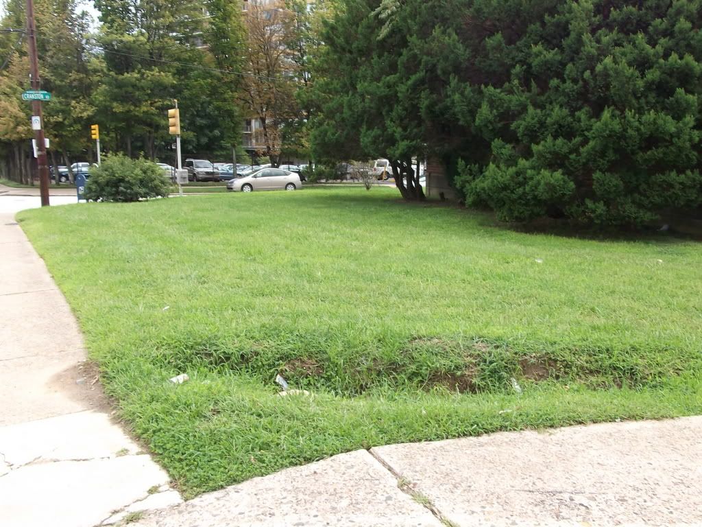
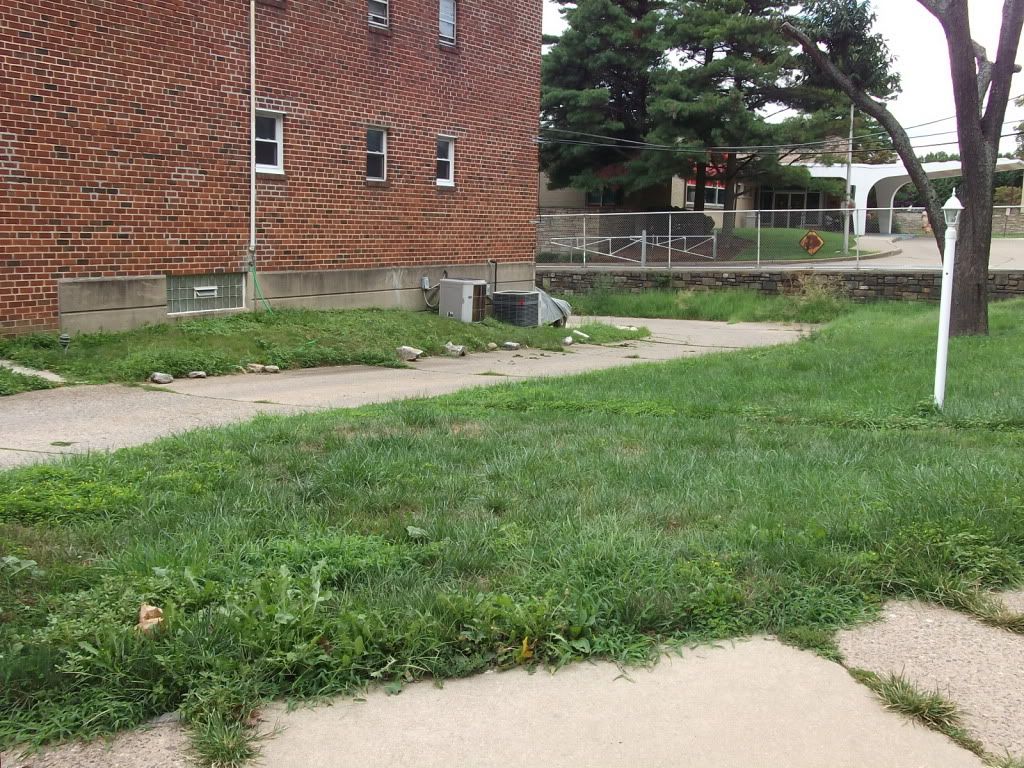
One of the great stories--and academic problems--of recent years has been the explosion of shanty, or squatters', settlements on the urban periphery in the developing world. Shantytowns are thought of as problems in much the same way--and for many of the same reasons--slums were in the late Victorian period.
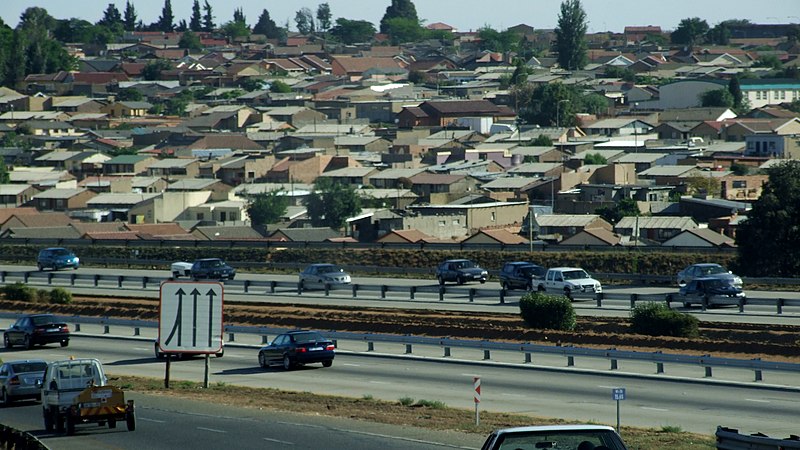
| Wealth-building in South Africa. View of improved section of Soweto. Cf. picture at bottom of post. |
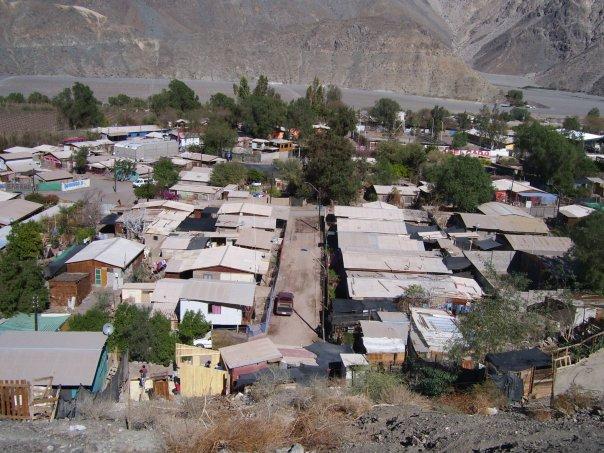
| A "campamento" in Chile, presumably in the suburbs of Santiago. |
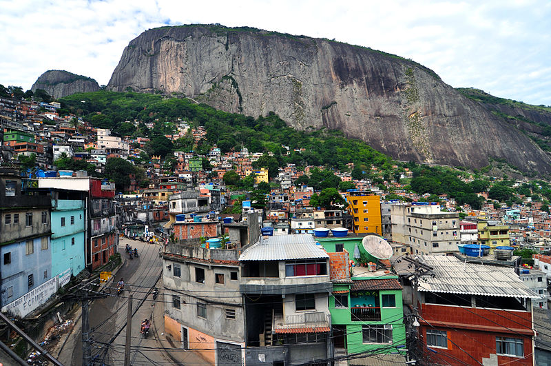
| Rocinha, Rio de Janeiro, Brazil |
| Ankara gecekondular |
| Villa 31, Buenos Aires, Argentina |
| A true slum: shack dwellings in Soweto, South Africa. |
___________
* In Planet of Slums, Mike Davis points out how occupation-and-squatting tactics employed in the initial development of many of these areas has been since superseded by a variety of other informal tactics.
** As opposed to the true slum, where the lack of generation of wealth (equity, often, in U.S. parlance) over the long term is a key economic attribute.
*** Pronounced gay-gee-con-do. "C" has a J sound in Turkish (which goes a long way towards explaining why Azerbaijan has a "c" instead of "j" in Azeri--a language closely related to Turkish). The word is a compound word meaning "built by night" or "built overnight"; the plural is gecekondular, with the addition of a syllable that is spectacularly impossible for East Asians to pronounce (r and l are assonant phonemes in most East Asian tongues, and assonant in a way that is precisely opposite the pronunciation of -lar).
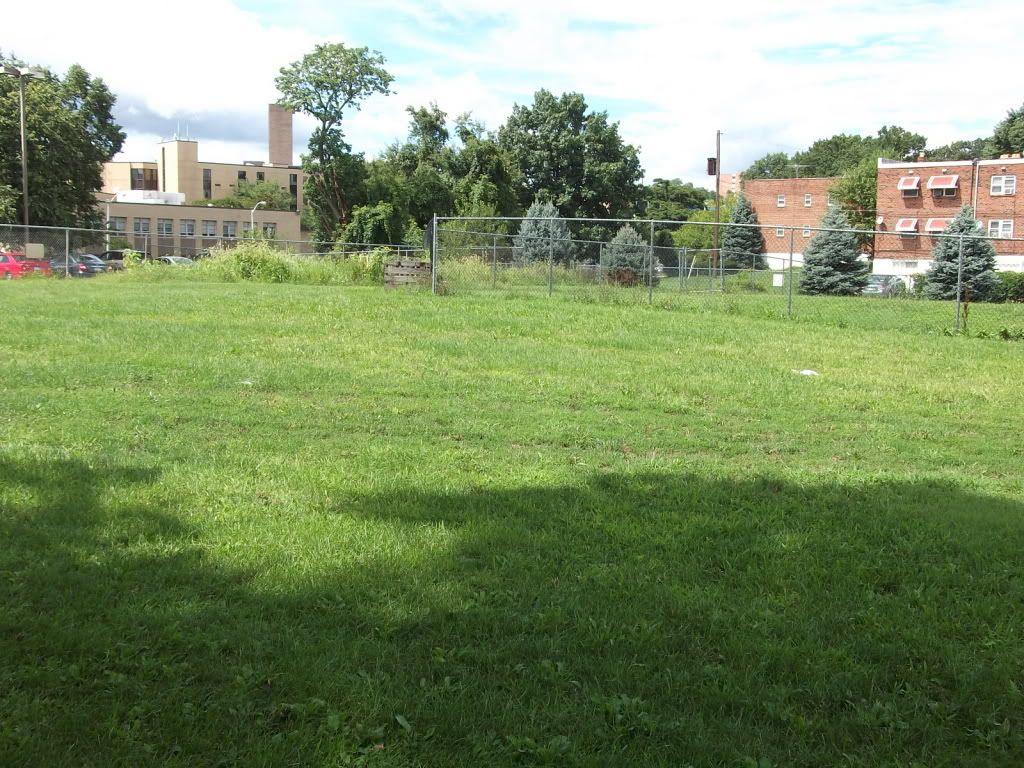
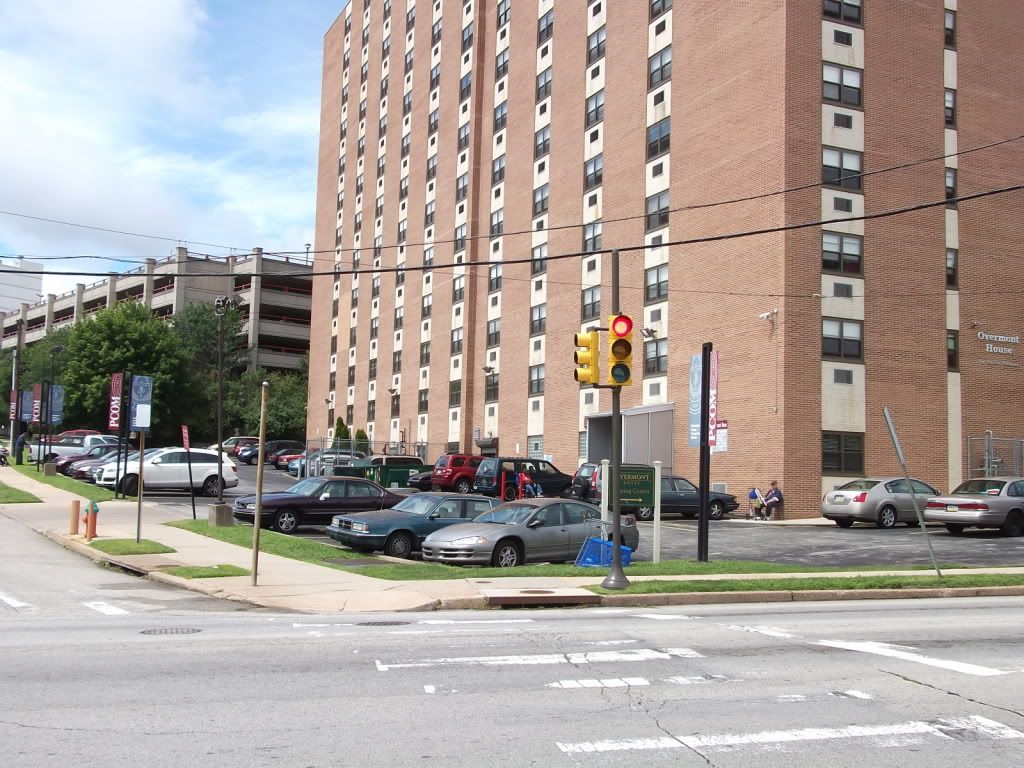
^ The history of South African townships is actually an interesting topic (albeit one for another day). Suffice it to say right now that Soweto actually happens to be one of the wealthier historically-black townships in South Africa; a better example of true slum informal settlement on a large scale is Cape Town's Khayelitsha.
Tuesday, September 6, 2011
Costing the City Branch Line
Long ago, I suggested the possibility of a long-term subway line running from 8th/Oregon (Pennsport) to Ridge/Henry (Andorra), the first phase of which would run between 8th/Market and Girard via the City Branch cut and part of the Ridge Avenue Spur. It looks like this.
The next obvious question is, how much does it cost? Actually, answering this question is substantially more advantageous than other potential heavy rail lines (or even Phase Is of lines), as the routing proposed runs along a former (abandoned?) freight right-of-way in heavily redeveloped (or redeveloping) areas where industrial uses are obsolescent: Franklin Town* and Callowhill. People live--not work--in these areas today.
This routing has four key components:
-The Philadelphia Branch from Girard to Noble. This follows the last mile or so of what was once the B&O's Philadelphia mainline, and is parallel to the single-track CSX main on what is at least a four-track (possibly six-track) right-of-way. It also includes a 1/3-mile section in the Fairmount tunnel, between Noble and Park portals.
-The City Branch, along the former course of Noble St. between Broad and the Noble portal, just west of 22nd. Like the ex-B&O ROW, this is a very wide route that is in disuse due to the postindustrial evaporation of its customer base. East of Broad, the City Branch continues on an elevated structure to connect into the 9th St. Branch and the approach to the former Reading Terminal. This elevated structure network (extant from Vine to Fairmount, and from 9th to 13th) is now known as the Reading Viaduct.
-A new tunnel from Broad, along Noble, to an at-grade (no flyunder) junction with the Ridge Avenue spur between 10th and 11th Sts. This tunnel would include a new Callowhill station between 11th and 12th Sts. and a short stretch of 4% grade in order to clear under 13th and between Broad and the existing subway tunnel and portal onto the City Branch's former elevation.
-The Ridge Spur from Noble south to 8th and Market.
Acquisition of the existing parts of this right-of-way is the initial hurdle: CSX is infamously recalcitrant when it comes to giving away parts of its right-of-way. However, there is little economic justification for holding onto this stretch, as the Fairmount Tunnel has been single-tracked to maximize clearance**, particularly due to the ancient (and constraining) south portal, just under the proposed Paine Park site, the duplication with the double-stack clearing ex-PRR High Line trestle across the river, and the single-track bottleneck of a concrete-lined cut by Wayne Jct.; the lack of any active customer in the immediate area; and finally the slow speed limit of this stretch caused not by engineering so much as the sheer congestion encountered in an urban area--particularly the approaches to the Schuylkill Banks. However, as the Banks themselves have proven, CSX is willing to let go of obsolescent stretches of its right-of-way***, and a good deal of the right-of-way width between Fairmount Tunnel and Fairmount Jct. is nothing if not obsolescent.
Procurement of (portions of) the existing railroad easement, wherever not already in the public realm, is thus the first major expense this project encounters. Mercifully, however, it is short: one mile along an obsolescent section of an active right-of-way, and two-thirds of one along an inactive one. $30 million for acquisition costs seems like a reasonable estimate.
Since the meat of the project is basically the linking two separate railroad rights-of-way together, the greatest cost would be expected to be in the actual interlinking itself, especially one that (a) is underground and (b) requires engineering with finesse. While tunnel construction should be (for the most part) cheaply done via cut-and-cover, due in part to the lack of major commercial or residential uses along the vast majority of the 3.5-block-long section, it would also have to be built under 13th, into the Branch between Broad's street grade and its subway grade, and with a gallery area for the Callowhill subway stop between 11th and 12th^, would be done for close to the minimum possible cost of a true subway under U.S. labor conditions--but it is still a subway, and may well breach the water table when it passes under 13th, and thus will be expensive. $50 million sounds like a reasonable cost estimate^^.
The final major expense is what could be best called "installation of railroad technology", namely, the rails and ties, equipment, third rail, platforms, platform access, and turnstiles. Since I'm attempting to utilize the most cost-effective possible alignment, most further savings (howsoever incremental on an individual basis) can be made in this arena. For instance, the cars currently in use on the Broad-Ridge Spur would be re-assigned for this line. No new equipment = $40 million cost savings. Platforms would be 100 feet long, or just about the length of two BSL subway cars (why would they need to be longer?) and built out of wood, wherever feasible (Broad, Franklin Town Park, Rodin Museum, Lemon Hill, Girard), offering a cost savings of a few million. Instead of needing to install an expensive new ventilation system in the Fairmount tunnel in order to deal with the diesel fumes, the CSX section would be simply walled off from the rapid transit section, and the two tunnel sections would alternate between the existing ventilation shafts (which were originally engineered for the significantly greater emissions of steam traction). Few barriers are as effective as physical barriers, anyway. Cost savings: Quite a lot.
While an elevator (or two) would have to be installed at Callowhill, Fairmount, and Art Museum each--due to these stations' being underground--at all of the other stations, a pedestrian ramp (also made of wood) would be able to satisfy ADA requirements.
So there are essentially three elements that spending actually has to be done on to finish this project: (1) extending the track down our fresh new ROW, along with the third rail needed to power our equipment, (2) building a cinder block wall down the middle of Fairmount Tunnel to divide diesel and metro ventilation districts (and the masons would be used to build the Fairmount and Art Museum station platforms too)--the tunnel being shallow enough that approximately 1/2 of the current ventilation shafts should allow acceptable air exchange--and (3) installing wood platforms at all of the other stations. Where the ROW parallels the CSX line, a chain-link fence is also a must-install, but that should frankly be about the same as what an exurban homeowner would expect to spend at the Home Depot to completely fence a two-acre lot in. Perimeters rake up mileage real quick. I recall that laying track costs about a million per mile, so we'll cost this at about $10 million and give the masons and carpenters $4.5 million each to play with.
The final cost is a contingency fund, a hedge or allotment set aside to deal with unexpected expenses. This is usually about 10% of the project's total projected cost, which at this point would be $9 million ((50+30+10)/10); since we are already costing out with a tight cost ceiling, we'll give this contingency fund an extra mil, and make the total cost projection $100 million even.
$100 million is borderline for Small Starts (unusual for heavy rail projects; Small Starts as a grant mechanism favors light rail and commuter rail), and since we're aiming for about 10,000 daily riders (~1,111 riders/station)--not too bad considering that the combined population of the Census tracts immediately abutting this proposed line is 27,344, and thus fully in line with relative ridership on heavy rail lines in similarly dense areas in New York, Boston, Chicago, and Washington, D.C. At these (optimistic) projections, the cost per mile is $33 million, and per passenger, $10,000. Even if half the proposed ridership is actually attained, the cost per rider would be $20,000, still extremely low by heavy rail standards and well in line with light rail standards.
Sometime in the near future I hope to dwell on non-financial justifications for this line's existence and programs that SEPTA can run in concert with lineside destinations to increase usage.
_________
* Fun fact: The Baldwin Locomotive Works, the biggest American steam locomotive builder, was once located in Franklin Town, running between Callowhill and Spring Garden and Broad and ca. 20th. This helps explain the paucity of historical rowhomes in the area.
** Like the Howard Street Tunnel in Baltimore.
*** To my knowledge, the B&O easement originally extended to the river. Part of the Banks is, for example, built over 24th St. Sta.'s coach yard.
^ With the expectation of, if not a wholesale plan for, redevelopment of what is currently a transformer array in the station's immediate area--an array that is supposedly being replaced by a new one along the former Viaduct; such station-side development tends to greatly improve ridership.
^^ Based on the assumption that a mile of subway costs $100 million (a number I've heard thrown around for the Navy Yard extension) and considering that the actual tunnel length will be just shy of half a mile, with a bit extra thrown in for a cost cushion; an electrical substation, for example, may need to be built out by Girard somewhere.
![]() |
| A very old map. For one thing, my station naming principles have changed since. |
This routing has four key components:
-The Philadelphia Branch from Girard to Noble. This follows the last mile or so of what was once the B&O's Philadelphia mainline, and is parallel to the single-track CSX main on what is at least a four-track (possibly six-track) right-of-way. It also includes a 1/3-mile section in the Fairmount tunnel, between Noble and Park portals.
-The City Branch, along the former course of Noble St. between Broad and the Noble portal, just west of 22nd. Like the ex-B&O ROW, this is a very wide route that is in disuse due to the postindustrial evaporation of its customer base. East of Broad, the City Branch continues on an elevated structure to connect into the 9th St. Branch and the approach to the former Reading Terminal. This elevated structure network (extant from Vine to Fairmount, and from 9th to 13th) is now known as the Reading Viaduct.
-A new tunnel from Broad, along Noble, to an at-grade (no flyunder) junction with the Ridge Avenue spur between 10th and 11th Sts. This tunnel would include a new Callowhill station between 11th and 12th Sts. and a short stretch of 4% grade in order to clear under 13th and between Broad and the existing subway tunnel and portal onto the City Branch's former elevation.
-The Ridge Spur from Noble south to 8th and Market.
Acquisition of the existing parts of this right-of-way is the initial hurdle: CSX is infamously recalcitrant when it comes to giving away parts of its right-of-way. However, there is little economic justification for holding onto this stretch, as the Fairmount Tunnel has been single-tracked to maximize clearance**, particularly due to the ancient (and constraining) south portal, just under the proposed Paine Park site, the duplication with the double-stack clearing ex-PRR High Line trestle across the river, and the single-track bottleneck of a concrete-lined cut by Wayne Jct.; the lack of any active customer in the immediate area; and finally the slow speed limit of this stretch caused not by engineering so much as the sheer congestion encountered in an urban area--particularly the approaches to the Schuylkill Banks. However, as the Banks themselves have proven, CSX is willing to let go of obsolescent stretches of its right-of-way***, and a good deal of the right-of-way width between Fairmount Tunnel and Fairmount Jct. is nothing if not obsolescent.
Procurement of (portions of) the existing railroad easement, wherever not already in the public realm, is thus the first major expense this project encounters. Mercifully, however, it is short: one mile along an obsolescent section of an active right-of-way, and two-thirds of one along an inactive one. $30 million for acquisition costs seems like a reasonable estimate.
Since the meat of the project is basically the linking two separate railroad rights-of-way together, the greatest cost would be expected to be in the actual interlinking itself, especially one that (a) is underground and (b) requires engineering with finesse. While tunnel construction should be (for the most part) cheaply done via cut-and-cover, due in part to the lack of major commercial or residential uses along the vast majority of the 3.5-block-long section, it would also have to be built under 13th, into the Branch between Broad's street grade and its subway grade, and with a gallery area for the Callowhill subway stop between 11th and 12th^, would be done for close to the minimum possible cost of a true subway under U.S. labor conditions--but it is still a subway, and may well breach the water table when it passes under 13th, and thus will be expensive. $50 million sounds like a reasonable cost estimate^^.
The final major expense is what could be best called "installation of railroad technology", namely, the rails and ties, equipment, third rail, platforms, platform access, and turnstiles. Since I'm attempting to utilize the most cost-effective possible alignment, most further savings (howsoever incremental on an individual basis) can be made in this arena. For instance, the cars currently in use on the Broad-Ridge Spur would be re-assigned for this line. No new equipment = $40 million cost savings. Platforms would be 100 feet long, or just about the length of two BSL subway cars (why would they need to be longer?) and built out of wood, wherever feasible (Broad, Franklin Town Park, Rodin Museum, Lemon Hill, Girard), offering a cost savings of a few million. Instead of needing to install an expensive new ventilation system in the Fairmount tunnel in order to deal with the diesel fumes, the CSX section would be simply walled off from the rapid transit section, and the two tunnel sections would alternate between the existing ventilation shafts (which were originally engineered for the significantly greater emissions of steam traction). Few barriers are as effective as physical barriers, anyway. Cost savings: Quite a lot.
While an elevator (or two) would have to be installed at Callowhill, Fairmount, and Art Museum each--due to these stations' being underground--at all of the other stations, a pedestrian ramp (also made of wood) would be able to satisfy ADA requirements.
So there are essentially three elements that spending actually has to be done on to finish this project: (1) extending the track down our fresh new ROW, along with the third rail needed to power our equipment, (2) building a cinder block wall down the middle of Fairmount Tunnel to divide diesel and metro ventilation districts (and the masons would be used to build the Fairmount and Art Museum station platforms too)--the tunnel being shallow enough that approximately 1/2 of the current ventilation shafts should allow acceptable air exchange--and (3) installing wood platforms at all of the other stations. Where the ROW parallels the CSX line, a chain-link fence is also a must-install, but that should frankly be about the same as what an exurban homeowner would expect to spend at the Home Depot to completely fence a two-acre lot in. Perimeters rake up mileage real quick. I recall that laying track costs about a million per mile, so we'll cost this at about $10 million and give the masons and carpenters $4.5 million each to play with.
The final cost is a contingency fund, a hedge or allotment set aside to deal with unexpected expenses. This is usually about 10% of the project's total projected cost, which at this point would be $9 million ((50+30+10)/10); since we are already costing out with a tight cost ceiling, we'll give this contingency fund an extra mil, and make the total cost projection $100 million even.
$100 million is borderline for Small Starts (unusual for heavy rail projects; Small Starts as a grant mechanism favors light rail and commuter rail), and since we're aiming for about 10,000 daily riders (~1,111 riders/station)--not too bad considering that the combined population of the Census tracts immediately abutting this proposed line is 27,344, and thus fully in line with relative ridership on heavy rail lines in similarly dense areas in New York, Boston, Chicago, and Washington, D.C. At these (optimistic) projections, the cost per mile is $33 million, and per passenger, $10,000. Even if half the proposed ridership is actually attained, the cost per rider would be $20,000, still extremely low by heavy rail standards and well in line with light rail standards.
Sometime in the near future I hope to dwell on non-financial justifications for this line's existence and programs that SEPTA can run in concert with lineside destinations to increase usage.
_________
* Fun fact: The Baldwin Locomotive Works, the biggest American steam locomotive builder, was once located in Franklin Town, running between Callowhill and Spring Garden and Broad and ca. 20th. This helps explain the paucity of historical rowhomes in the area.
** Like the Howard Street Tunnel in Baltimore.
*** To my knowledge, the B&O easement originally extended to the river. Part of the Banks is, for example, built over 24th St. Sta.'s coach yard.
^ With the expectation of, if not a wholesale plan for, redevelopment of what is currently a transformer array in the station's immediate area--an array that is supposedly being replaced by a new one along the former Viaduct; such station-side development tends to greatly improve ridership.
^^ Based on the assumption that a mile of subway costs $100 million (a number I've heard thrown around for the Navy Yard extension) and considering that the actual tunnel length will be just shy of half a mile, with a bit extra thrown in for a cost cushion; an electrical substation, for example, may need to be built out by Girard somewhere.
Wednesday, August 31, 2011
Ten Pieces of Train Equipment That Need to Be Street Legal In America
...Metaphorically speaking, to a certain degree, of course. But this short list includes a couple of locos, coaches, EMUs, and DMUs, none of which are currently allowed to mix with American mainline freight traffic. Given this equipment's global ubiquity, this points to a failure of the American regulatory body rather than a lack of safety inherent in the equipment.
10. Siemens EuroSprinter/EuroRunner (diesel variant). This piece of equipment is actually coming to our shores soon, as the Amtrak Cities Sprinter, but it has been in use as mainline freight and passenger equipment in practically every other country with standard gauge for decades now, and in fact is being phased out by Siemens in favor of a new product, the Vectron. In this case, the EuroSprinter represents not so much a single unit as a class of unit types, namely Europe's general-use diesels and electrics, such as Bombardier's TRAXX, Alstom's Prima, Vossloh's Euro, Voith's Maxima, EMD's Series 66, and Škoda's 109E, among others.
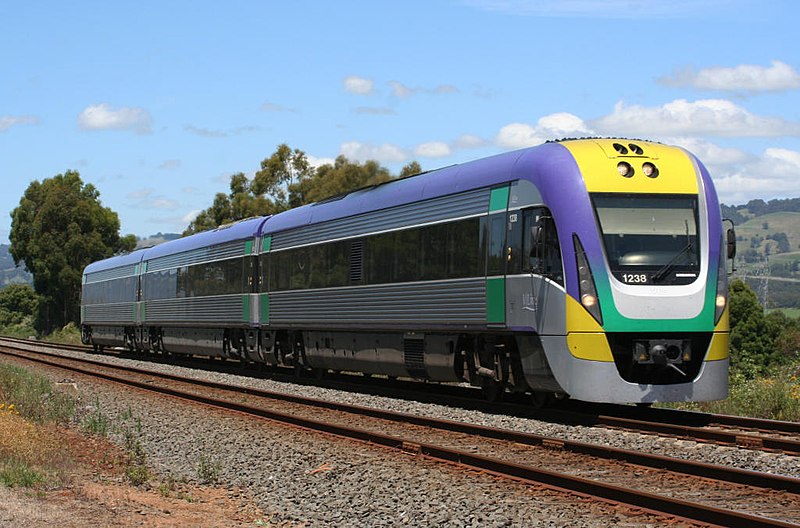
9. Bombardier VLocity 160. Victoria, Australia's, standard DMU. These trains operate a regional level in much the same fashion as the MPE-coach push-pull sets now standard in the U.S., but are far lighter and faster. Other than their rail gauge problem, Australian operating conditions are very similar to American ones--far more than Europe's--and as such Australian best practices and equipment may be American models--such as CountryLink's Xplorer or TransAdelaide's 3000 Class.
8. British Rail Mark III Coach. The coach of the British rail fleet. Its tough and highly durable monocoque design, combined with its double suspension, combine to make the coach exceedingly safe and comfortable. Too bad repressive FRA regulations prevent such an elegant design from being used on American rails, in favor of heavier, inferior designs. It also goes well with the Class 43 (see below), and is also the basis of a bunch of MU designs.
7. CGL Rail C44aci. Australia's most modern freight locomotive. Equipment like this regularly mixes with equipment such as the Vlocity mentioned above, and, like American equipment, is designed primarily for (a) coal unit trains and (b) intermodal service. American-built locomotives, or locomotives built with American components, in fact have a long history in Australia; this is essentially a GE Dash 9-44CW on a more lightweight frame. Similar equipment includes the older 90, AN, EL, and NR classes, and the competition includes Downer EDI Rail's GT46C ACe--essentially an EMD SD70ACe on a more lightweight frame. (This, by the way, proves that even mainline American freight equipment is absurdly heavy.)
6. Alstom Pendolino. The standard European tilting-train EMU. Originally developed by Fiat, these trains are designed for high-speed operation on legacy track: they are, in other words, ideal for the Northeast Corridor, far more than the all-too-slow and not-really-tilting Acela. The New Pendolino is the most recent variant and is also in use in China, a country whose freight network, like Australia's, emulates American conditions.
5. Stadler GTW/FLIRT. Common European DMUs and EMUs. Despite their surprisingly common application in the U.S. (the River Line is one such example), these units are not FRA-compliant and are thus treated as light rail, despite their all-around utility elsewhere. Similar equipment includes Siemens' Desiro, Bombardier's AGC, Alstom's SNCF Class Z 26500, and Nederlandse Spoorwegen's VIRM.
4. British Rail Class 43. The oldest unit on this list, it's here because of one major reason: the fastest way to bring express passenger trains to the U.S. is simply to purchase express passenger trains that were designed for high-speed service on legacy unelectrified lines. Therefore, simply making these trains street legal and acquiring them as the (proposed) Super Express enters service would massively--and rapidly--improve American rail passenger service. And create demand for a domestic version, too. Heck, Australia did the same thing (pictured above). Caveat: Class 43s are designed to operate in conjunction with Mark III coaches (see above)--or Aussie-style Budds--or possibly with a Class 91 and/or a driving van trailer.
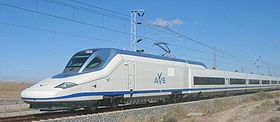
3. Talgo 350. Spain's native high-speed equipment, and one of the premier loco-hauled high-speed trainsets in the world (Talgo's Pendular system pre-empts distributed-power equipment). If the U.S. is ever to get a proper passenger service and passenger hierarchy, equipment such as this, Alstom's TGV Réseau, AnsaldoBreda's ETR 500, SJ's X2, or Rotem's KTX-II, would need to be allowable wherever service and merit demanded.
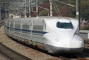
2. N700 Shinkansen. The only Japanese model on this list--and for good reason (bullet trains are Japan's only standard gauge trains)--the N700 is also built by all four of Japan's major rail builders (Kawasaki, Hitachi, Kinki Sharyo, and Nippon Sharyo) and is also the only Shinkansen model that has been exported (to China and Taiwan, respectively). Similar to this is Hitachi's Super Express program over in Britain, another model that needs to be street legal in the U.S. from Day 1.
1. Siemens Velaro. The high-speed rail gold standard, and has been for a decade now. The pioneer in distributed-traction trainsets, and still the fastest train in Europe, the Velaro represents a generational leap forward in European high-speed technology. Only now, with the Zefiro and AGV, are Bombardier and Alstom catching up with Siemens; Italian AnsaldoBreda and Spanish CAF now offer the less expensive V250 and HT65000; and Rotem and Talgo are busy at work creating the KTX-III and AVRIL. This is the forefront of global high-speed rail, and will be, short of another breakthrough being made.
These ten pieces of equipment (and their competition and derivatives) need to be made street legal in the U.S. forthwith. For freight equipment, it's a matter of maintenance: lighter locomotives that can develop the same kind of power are easier on the rails and can allow for faster train speeds, improving the industry's competitiveness (and the Aussie examples prove it can be done); and for passenger equipment, a matter of usefulness and accessibility. Better, lighter, faster, safer trains and operations would help make our laggard mass transit world-class once again, especially as things like the Hubbert peak theory work their magic and nonrenewable resources cease to be affordable.
We need to see this kind of equipment operational in the U.S. We need to see modern signaling such as ERTMS in the U.S. And we need to see rail geometries at modern standards in the U.S. How can we say we're the best at anything involving trains anymore? Our freight trains are long and slow, and passenger trains heavy and slow. Our rail system is a laughingstock! We need to get rid of the current asinine governmental railroad regulation in favor of something leaner, more international, and more in tune with the UIC.
10. Siemens EuroSprinter/EuroRunner (diesel variant). This piece of equipment is actually coming to our shores soon, as the Amtrak Cities Sprinter, but it has been in use as mainline freight and passenger equipment in practically every other country with standard gauge for decades now, and in fact is being phased out by Siemens in favor of a new product, the Vectron. In this case, the EuroSprinter represents not so much a single unit as a class of unit types, namely Europe's general-use diesels and electrics, such as Bombardier's TRAXX, Alstom's Prima, Vossloh's Euro, Voith's Maxima, EMD's Series 66, and Škoda's 109E, among others.
9. Bombardier VLocity 160. Victoria, Australia's, standard DMU. These trains operate a regional level in much the same fashion as the MPE-coach push-pull sets now standard in the U.S., but are far lighter and faster. Other than their rail gauge problem, Australian operating conditions are very similar to American ones--far more than Europe's--and as such Australian best practices and equipment may be American models--such as CountryLink's Xplorer or TransAdelaide's 3000 Class.
8. British Rail Mark III Coach. The coach of the British rail fleet. Its tough and highly durable monocoque design, combined with its double suspension, combine to make the coach exceedingly safe and comfortable. Too bad repressive FRA regulations prevent such an elegant design from being used on American rails, in favor of heavier, inferior designs. It also goes well with the Class 43 (see below), and is also the basis of a bunch of MU designs.
7. CGL Rail C44aci. Australia's most modern freight locomotive. Equipment like this regularly mixes with equipment such as the Vlocity mentioned above, and, like American equipment, is designed primarily for (a) coal unit trains and (b) intermodal service. American-built locomotives, or locomotives built with American components, in fact have a long history in Australia; this is essentially a GE Dash 9-44CW on a more lightweight frame. Similar equipment includes the older 90, AN, EL, and NR classes, and the competition includes Downer EDI Rail's GT46C ACe--essentially an EMD SD70ACe on a more lightweight frame. (This, by the way, proves that even mainline American freight equipment is absurdly heavy.)
6. Alstom Pendolino. The standard European tilting-train EMU. Originally developed by Fiat, these trains are designed for high-speed operation on legacy track: they are, in other words, ideal for the Northeast Corridor, far more than the all-too-slow and not-really-tilting Acela. The New Pendolino is the most recent variant and is also in use in China, a country whose freight network, like Australia's, emulates American conditions.
5. Stadler GTW/FLIRT. Common European DMUs and EMUs. Despite their surprisingly common application in the U.S. (the River Line is one such example), these units are not FRA-compliant and are thus treated as light rail, despite their all-around utility elsewhere. Similar equipment includes Siemens' Desiro, Bombardier's AGC, Alstom's SNCF Class Z 26500, and Nederlandse Spoorwegen's VIRM.
4. British Rail Class 43. The oldest unit on this list, it's here because of one major reason: the fastest way to bring express passenger trains to the U.S. is simply to purchase express passenger trains that were designed for high-speed service on legacy unelectrified lines. Therefore, simply making these trains street legal and acquiring them as the (proposed) Super Express enters service would massively--and rapidly--improve American rail passenger service. And create demand for a domestic version, too. Heck, Australia did the same thing (pictured above). Caveat: Class 43s are designed to operate in conjunction with Mark III coaches (see above)--or Aussie-style Budds--or possibly with a Class 91 and/or a driving van trailer.
3. Talgo 350. Spain's native high-speed equipment, and one of the premier loco-hauled high-speed trainsets in the world (Talgo's Pendular system pre-empts distributed-power equipment). If the U.S. is ever to get a proper passenger service and passenger hierarchy, equipment such as this, Alstom's TGV Réseau, AnsaldoBreda's ETR 500, SJ's X2, or Rotem's KTX-II, would need to be allowable wherever service and merit demanded.
2. N700 Shinkansen. The only Japanese model on this list--and for good reason (bullet trains are Japan's only standard gauge trains)--the N700 is also built by all four of Japan's major rail builders (Kawasaki, Hitachi, Kinki Sharyo, and Nippon Sharyo) and is also the only Shinkansen model that has been exported (to China and Taiwan, respectively). Similar to this is Hitachi's Super Express program over in Britain, another model that needs to be street legal in the U.S. from Day 1.
1. Siemens Velaro. The high-speed rail gold standard, and has been for a decade now. The pioneer in distributed-traction trainsets, and still the fastest train in Europe, the Velaro represents a generational leap forward in European high-speed technology. Only now, with the Zefiro and AGV, are Bombardier and Alstom catching up with Siemens; Italian AnsaldoBreda and Spanish CAF now offer the less expensive V250 and HT65000; and Rotem and Talgo are busy at work creating the KTX-III and AVRIL. This is the forefront of global high-speed rail, and will be, short of another breakthrough being made.
These ten pieces of equipment (and their competition and derivatives) need to be made street legal in the U.S. forthwith. For freight equipment, it's a matter of maintenance: lighter locomotives that can develop the same kind of power are easier on the rails and can allow for faster train speeds, improving the industry's competitiveness (and the Aussie examples prove it can be done); and for passenger equipment, a matter of usefulness and accessibility. Better, lighter, faster, safer trains and operations would help make our laggard mass transit world-class once again, especially as things like the Hubbert peak theory work their magic and nonrenewable resources cease to be affordable.
We need to see this kind of equipment operational in the U.S. We need to see modern signaling such as ERTMS in the U.S. And we need to see rail geometries at modern standards in the U.S. How can we say we're the best at anything involving trains anymore? Our freight trains are long and slow, and passenger trains heavy and slow. Our rail system is a laughingstock! We need to get rid of the current asinine governmental railroad regulation in favor of something leaner, more international, and more in tune with the UIC.
A Picture Is Worth a Thousand Words
How things should be done. In this image, the Indian Pacific, Australia's premier transcontinental train, using engines and equipment very similar to American norms, passes a Transperth service. Because of Australia's ongoing gauge issues, Western Australia's rail network is dominantly the narrower Cape gauge, while the national network utilizes standard gauge. On either gauge, however, equipment and operating practices are similar to Chinese or American counterparts: those two Indian Pacific locos are essentially GE AC4400CWs in a different bodyshell.
In this image, heavy and light trains are operating safely alongside one another, on the same tracks. That FRA regulations prevent this--speaks volumes about the FRA.
Tuesday, August 30, 2011
Modifying Center City's Market Street Tunnel
Built in 1907 (and extended during the Great Depression), Center City's Market Street tunnel is an example both of the possibilities and the realities of the subway. Originally envisioned as an express subway-local trolley tunnel, the Philadelphia Rapid Transit Corp. (PRT) ran out of money less than halfway through construction from the original 23rd St. portal and was forced to terminate the trolleys at City Hall, resulting in a situation where all subways have to run local east of it, stopping at 13th, 11th, 8th, 5th, and 2nd Streets, while not stopping at all along the axis of postwar skyscraper development along Market west of City Hall.
Never a great fit, even in the best of times, the Market-Frankford Line now stops too frequently, particularly in Market East (where two, rather than three, stops are really called for), or not at all, relative to Center City's major employment and retail destinations*. The trolley transfer at 15th is confusing (you have to access the westbound trolley platform, from 15th, via the Broad Street Line platform), and a full subway stop--not just a local trolley stop--at 19th is necessary to capitalize on the strong demand for Penn Center, Logan Square, and Rittenhouse Square access.
Fixes for this are, needless to say, expensive.
The easiest-to-implement partial "solution" to Market East's too-close-together subway stops is to implement stop-skip service at 11th and 13th, much as occurs elsewhere in the system (particularly on the Frankford Elevated). The free trolley transfer at 13th can also be done at 15th (despite its complexity) and 30th, making it a relatively minor loss if half of the rush-hour trains don't stop there, and the line's stop-skip service has been in use for so long that it's fairly simple just to add an extra "A" and "B" to the map. However--this is still a quick fix, a half-assed solution. And it doesn't remotely address the issue of unmet express-service demand along Market West.
To optimize the tunnel, relative to today's use patterns, would require (a) the consolidation of the 11th and 13th Street stations into a single stop**--certainly feasible from a technical standpoint; the tunnel is mirrored on either side by a pedestrian tunnel; and so opening the pedestrian tunnel to the rail tracks at 12th, along with adding some new fare gates and punching an entrance into the former Reading Terminal's basement, along with some barricades along the former 11th and 13th Street platform edges--nothing too fancy, but nothing ugly--along with a fare-gated passage down to the Juniper station, to maintain the free transfer. This costs some money, of course, but is relatively inexpensive--probably about the same as the already-needed-anyway refurbishment of '70s-garish 11th Street Station.
Market West, on the opposite side, is much more expensive. There the need is to widen the tunnel approximately 10 feet from the western side of the current 19th Street station down to 20th; and were a new 19th Street trolley station elected to be built, two new platform niches for that, too. Like at 30th, the maximal cross-section for a full stop could be as much as 80 feet (Market is 100 feet wide), requiring significant utilities relocation in an underground that is more like Swiss cheese than schist. Furthermore, a new second-level concourse would need to be bored under the rail tunnel; access to an MFL platform without it is impossible. The most cost-effective solution may be to maintain the current 19th Street carstop with a deep new elevator niche and fare barrier*** and access to the sublevel concourse at its western end^, coupled with a brand-new concourse access at 20th^^. Either way, retrofitting an existing four-track subway for a new express stop cannot be cheap.
UPDATE: It occurs to me that this discussion is incomplete without a discussion of 30th Street access improvements. Currently, there is no direct route between the main station and the subway concourse^^^; there used to be one that followed an indirect and winding route, but that has long since been closed, with one entrance being obscured by a pub.
An obvious immediate improvement is to cover the (heavily used) pathway between the main station and subway concourse.
In the longer term, the major access issues are caused by the layout of the area. There is little space to effect direct access; this, indeed, was the reason the original implementation was winding and circuitous, which led to its lack of safety and eventual closure. The only good spot to extend the underground concourse in such a manner as to create a direct connection with the main (intercity) station is currently occupied by the lower level of 30th Street, a route which is also an access road to the coach yards on the north side of the station. The obvious answer to this conundrum is to open a new access path to the coach yards, allowing this access road to be closed and the concourse extended across it towards a direct station connection.
But what if it can't be? Not in the short or medium terms, at least?
A good medium-term plan to offer direct main station-to-concourse access at 30th may be to enclose a pathway connecting the main station to the concourse along the side of this quite wide lower level, with a sort of gated ped-road crossing (as an access road, it's lightly used) where the pedestrian access pathway must needs cross the carriageway. Moveable glass fixtures may be used, allowing the pathway to be climate controlled. No matter what the solution is, however, the space must be well lit and securitized. It must be safe and feel safe. Safety (or the perception thereof) was what did the previous connection in, in the end; just as important as solving access issues is the solving of safety issues in the area.
_______
* Those actually fronting Market Street, remember.
** Why this was not done in the first place, I have no idea. The closest stop to the former Reading Terminal would have been 11th; it is frankly bizarre that there was never direct subway station access. 11th and 13th were obviously built to facilitate department store access (Wanamaker's at 13th; Snellenburg's and Frank & Seder at 11th), but access would still have been possible at 12th, particularly since pedestrian tunnels have been built parallel to the subway from 11th Street west. (These, note, are almost certainly later additions.)
*** Cheaper than a niche for a whole carstop, that's for sure.
^ This setup also has the advantage of making the existing carstop an access concourse for a potential 19th Street subway. The MFL concourse would then terminate in the new line's southbound platform, while the northbound platform would be accessed from the carstop's east end.
^^ This is assuming that the El stop would be built between 19th and 20th Streets. A case can also be made for locating Market West between 18th and 19th Streets, in which case just switch all my "wests" to "easts" and "easts" to "wests" and provision for access to the Penn Center concourse (currently terminating in the BNY Mellon Building at 18th and Market). 19th-20th is more equidistant between 15th and 30th; 18th-19th has better connections access and is slightly closer to the major draws.
^^^ A perception issue as much as anything else. Cities without these sorts of connections just don't quite feel large and worldly--whatever the reality may be. As an example: New York's Grand Central Terminal and Penn Station, Boston's North and South Stations, and D.C.'s Union Station all have these interconnections. Camden and Penn Stations, Baltimore, by contrast, do not.
Never a great fit, even in the best of times, the Market-Frankford Line now stops too frequently, particularly in Market East (where two, rather than three, stops are really called for), or not at all, relative to Center City's major employment and retail destinations*. The trolley transfer at 15th is confusing (you have to access the westbound trolley platform, from 15th, via the Broad Street Line platform), and a full subway stop--not just a local trolley stop--at 19th is necessary to capitalize on the strong demand for Penn Center, Logan Square, and Rittenhouse Square access.
Fixes for this are, needless to say, expensive.
The easiest-to-implement partial "solution" to Market East's too-close-together subway stops is to implement stop-skip service at 11th and 13th, much as occurs elsewhere in the system (particularly on the Frankford Elevated). The free trolley transfer at 13th can also be done at 15th (despite its complexity) and 30th, making it a relatively minor loss if half of the rush-hour trains don't stop there, and the line's stop-skip service has been in use for so long that it's fairly simple just to add an extra "A" and "B" to the map. However--this is still a quick fix, a half-assed solution. And it doesn't remotely address the issue of unmet express-service demand along Market West.
To optimize the tunnel, relative to today's use patterns, would require (a) the consolidation of the 11th and 13th Street stations into a single stop**--certainly feasible from a technical standpoint; the tunnel is mirrored on either side by a pedestrian tunnel; and so opening the pedestrian tunnel to the rail tracks at 12th, along with adding some new fare gates and punching an entrance into the former Reading Terminal's basement, along with some barricades along the former 11th and 13th Street platform edges--nothing too fancy, but nothing ugly--along with a fare-gated passage down to the Juniper station, to maintain the free transfer. This costs some money, of course, but is relatively inexpensive--probably about the same as the already-needed-anyway refurbishment of '70s-garish 11th Street Station.
Market West, on the opposite side, is much more expensive. There the need is to widen the tunnel approximately 10 feet from the western side of the current 19th Street station down to 20th; and were a new 19th Street trolley station elected to be built, two new platform niches for that, too. Like at 30th, the maximal cross-section for a full stop could be as much as 80 feet (Market is 100 feet wide), requiring significant utilities relocation in an underground that is more like Swiss cheese than schist. Furthermore, a new second-level concourse would need to be bored under the rail tunnel; access to an MFL platform without it is impossible. The most cost-effective solution may be to maintain the current 19th Street carstop with a deep new elevator niche and fare barrier*** and access to the sublevel concourse at its western end^, coupled with a brand-new concourse access at 20th^^. Either way, retrofitting an existing four-track subway for a new express stop cannot be cheap.
UPDATE: It occurs to me that this discussion is incomplete without a discussion of 30th Street access improvements. Currently, there is no direct route between the main station and the subway concourse^^^; there used to be one that followed an indirect and winding route, but that has long since been closed, with one entrance being obscured by a pub.
An obvious immediate improvement is to cover the (heavily used) pathway between the main station and subway concourse.
In the longer term, the major access issues are caused by the layout of the area. There is little space to effect direct access; this, indeed, was the reason the original implementation was winding and circuitous, which led to its lack of safety and eventual closure. The only good spot to extend the underground concourse in such a manner as to create a direct connection with the main (intercity) station is currently occupied by the lower level of 30th Street, a route which is also an access road to the coach yards on the north side of the station. The obvious answer to this conundrum is to open a new access path to the coach yards, allowing this access road to be closed and the concourse extended across it towards a direct station connection.
But what if it can't be? Not in the short or medium terms, at least?
A good medium-term plan to offer direct main station-to-concourse access at 30th may be to enclose a pathway connecting the main station to the concourse along the side of this quite wide lower level, with a sort of gated ped-road crossing (as an access road, it's lightly used) where the pedestrian access pathway must needs cross the carriageway. Moveable glass fixtures may be used, allowing the pathway to be climate controlled. No matter what the solution is, however, the space must be well lit and securitized. It must be safe and feel safe. Safety (or the perception thereof) was what did the previous connection in, in the end; just as important as solving access issues is the solving of safety issues in the area.
_______
* Those actually fronting Market Street, remember.
** Why this was not done in the first place, I have no idea. The closest stop to the former Reading Terminal would have been 11th; it is frankly bizarre that there was never direct subway station access. 11th and 13th were obviously built to facilitate department store access (Wanamaker's at 13th; Snellenburg's and Frank & Seder at 11th), but access would still have been possible at 12th, particularly since pedestrian tunnels have been built parallel to the subway from 11th Street west. (These, note, are almost certainly later additions.)
*** Cheaper than a niche for a whole carstop, that's for sure.
^ This setup also has the advantage of making the existing carstop an access concourse for a potential 19th Street subway. The MFL concourse would then terminate in the new line's southbound platform, while the northbound platform would be accessed from the carstop's east end.
^^ This is assuming that the El stop would be built between 19th and 20th Streets. A case can also be made for locating Market West between 18th and 19th Streets, in which case just switch all my "wests" to "easts" and "easts" to "wests" and provision for access to the Penn Center concourse (currently terminating in the BNY Mellon Building at 18th and Market). 19th-20th is more equidistant between 15th and 30th; 18th-19th has better connections access and is slightly closer to the major draws.
^^^ A perception issue as much as anything else. Cities without these sorts of connections just don't quite feel large and worldly--whatever the reality may be. As an example: New York's Grand Central Terminal and Penn Station, Boston's North and South Stations, and D.C.'s Union Station all have these interconnections. Camden and Penn Stations, Baltimore, by contrast, do not.
Thursday, August 25, 2011
The Odd Situation of Bala Station
Imagine...you've got a train station right along a busy regional arterial, and clustered around that station are pre-suburban type garden apartments, along with later type office commercial and retail; behind are more single-family homes in three Census tracts with a combined population of 6,928. The station is serviced by one of the most frequent regional rail networks in the country--effectively an S-Bahn type network. You'd think that that station'd get high ridership, right? Even if mass transit ridership was a tenth of the local population, it would still be getting about 693 daily boardings. Even though later development has all been transit-proximate rather than transit-oriented? After all, even with transit-proximate development, ridership does tend to rise.
Well, meet Bala Station. All of the things I've just described...but this station has very low ridership, between 92 and 111*. It, in fact, has one of the lowest ridership counts in the system (an older ridership breakdown on Wikipedia shows Bala as having 78 boardings, while Wynnefield Avenue has 90 and Cynwyd 128**). Meanwhile, Overbrook station--also along City Line Avenue, about a mile away and nowhere near the main retail hubs, has a daily ridership of about 770.
Why does this station have such low ridership?
Two major factors converge, it seems, to undercut Bala's ridership: infrequence and invisibility. Unlike the Paoli/Thorndale Line, which has 87 daily weekday trains (along with 58 on Saturdays and 34 on Sundays), the Cynwyd Line has just 21 daily weekday trains (and none on weekends). These trains are clustered into half-hourly peak service (four trains peak with a fifth train roughly halfway between peaks and a final train an hour after the end of peak)--in short, trains for commuters without regard for any other potential wells of ridership. This infrequence is due in no small part to the brevity of the line; commuter trains once ran all the way up to Norristown along this line, but it duplicated Reading service and was thus curtailed to Ivy Ridge; in the mid-1980s it had the fourth-highest ridership of the Pennsylvania-side lines and was thus paired (as the R6) with the Norristown Reading-side line; and in late 1986 service was curtailed down to Cynwyd due to the Pencoyd Viaduct being deemed structurally unsafe.
The station's invisibility comes from it being right under the City Line Avenue bridge, with few notable walkways or driveways to the platform; even the station's lollypop*** is hard-to-see, set back a few hundred feet or so along Conshohocken State Road. People who pass by it on an irregular or semi-regular basis cannot see the platform from the road, and so it seems abandoned.
Far more damaging than its infrequency (lots of commuter rail operations realize higher per-station ridership on similar schedules) is its invisibility. It's easy to tell when a train's coming when you can see people waiting at the platform (this is pretty certainly a big boost to Cynwyd's ridership); since it appears the PRR sold the former station area a long time ago, the current platform is crowded behind garden apartments, offices, and an abandoned service station.
This abandoned service station can, however, provide the key to making Bala Station more visible once again. Being in disuse for quite some time, it might be able to be qualified as "blighted" and thus begin the process for a taking. With that property, station improvements not dissimilar to this possible site plan might be made. And with the increased ridership from better-designed stations, a case can be made for improving service frequencies--extending them longer and adding bi-hourly Saturday service, say.
And building up an improved Cynwyd Line ridership is necessary for getting more ambitious plans rolling.
______________
* The most current given ridership of the Cynwyd line is 553, and there are 5 stops on this line. 553/5 = 111. However, a ridership breakdown shows that the bulk of the boardings come from Cynwyd, so that I was moved to consider Cynwyd as offering two stations' worth of ridership (553/6 = 92). The actual ridership count for Bala Station is thus roughly 100.
** (128+90+78)*365=108,040 (annualized ridership), suggesting that these figures are a decade old. Even so, the per-station ridership breakdown is useful.
*** Name given to a distinctive type of station sign SEPTA brands its Regional Rail with.
![]() |
| What kind of ridership would you expect from a neighborhood like this? |
Why does this station have such low ridership?
Two major factors converge, it seems, to undercut Bala's ridership: infrequence and invisibility. Unlike the Paoli/Thorndale Line, which has 87 daily weekday trains (along with 58 on Saturdays and 34 on Sundays), the Cynwyd Line has just 21 daily weekday trains (and none on weekends). These trains are clustered into half-hourly peak service (four trains peak with a fifth train roughly halfway between peaks and a final train an hour after the end of peak)--in short, trains for commuters without regard for any other potential wells of ridership. This infrequence is due in no small part to the brevity of the line; commuter trains once ran all the way up to Norristown along this line, but it duplicated Reading service and was thus curtailed to Ivy Ridge; in the mid-1980s it had the fourth-highest ridership of the Pennsylvania-side lines and was thus paired (as the R6) with the Norristown Reading-side line; and in late 1986 service was curtailed down to Cynwyd due to the Pencoyd Viaduct being deemed structurally unsafe.
The station's invisibility comes from it being right under the City Line Avenue bridge, with few notable walkways or driveways to the platform; even the station's lollypop*** is hard-to-see, set back a few hundred feet or so along Conshohocken State Road. People who pass by it on an irregular or semi-regular basis cannot see the platform from the road, and so it seems abandoned.
Far more damaging than its infrequency (lots of commuter rail operations realize higher per-station ridership on similar schedules) is its invisibility. It's easy to tell when a train's coming when you can see people waiting at the platform (this is pretty certainly a big boost to Cynwyd's ridership); since it appears the PRR sold the former station area a long time ago, the current platform is crowded behind garden apartments, offices, and an abandoned service station.
![]() |
| A simple site plan for Bala Station. |
And building up an improved Cynwyd Line ridership is necessary for getting more ambitious plans rolling.
______________
* The most current given ridership of the Cynwyd line is 553, and there are 5 stops on this line. 553/5 = 111. However, a ridership breakdown shows that the bulk of the boardings come from Cynwyd, so that I was moved to consider Cynwyd as offering two stations' worth of ridership (553/6 = 92). The actual ridership count for Bala Station is thus roughly 100.
** (128+90+78)*365=108,040 (annualized ridership), suggesting that these figures are a decade old. Even so, the per-station ridership breakdown is useful.
*** Name given to a distinctive type of station sign SEPTA brands its Regional Rail with.
Sunday, August 21, 2011
Wynnefield Heights 2: Creating Connectivity
A few days ago, I began this series with a critique of Wynnefield Heights' present conditions. The two major issues the neighborhood suffers from are a lack of interconnectivity and a poor built form. So, for this post, I am looking to make the Heights more interconnected. This is done through (a) a full streets and paths plan and (b) a transportation plan. The streets and paths ("connectivity") plan of course governs where new streets and paths need to be built, while the transportation plan governs how mass transit service runs through the Heights.
Connectivity Plan
Building Blocks
Wynnefield Heights, as it currently is, is highly disconnected, broken by arterials into a series of superblocks later split into subdivisions and towers-in-parks. From the five points at the center of Wynnefield Heights, where Monument and Ford Roads and Conshohocken Avenue all meet, no fewer than four of the radiating blocks are superblocks (see Figure A). Two of these are occupied by the mammoth Belmont Filters water plant; one is occupied by a row of towers-in-parks punctuated by a megachurch; and the last, by the Belmont Behavioral Health Center and a large Methodist facility constituting a former orphanage and a major assisted-living center.
Assisted-living centers, in fact, pockmark the neighborhood: besides the Methodists' Simpson House, there are also the Salvation Army's Ivy Residence, the Jews' B'rith Shalom and the more nondenominational Park Tower and Bala Nursing and Retirement Center, as well as Inglis House just across Belmont Avenue in Belmont Village. These centers have grounds of varying sizes, yet frequently have to be designed around in order to accommodate the goals of densification and urbanization here by the top of Fairmount Park.
Two interventions are needed to remedy this situation: the establishment of new streets to break the walls of the superblocks down (Figure B), and the establishment of new paths to interconnect in a non-automotive capacity, particularly into Fairmount Park (Figure C). Road additions, in particular, are engineered to follow the path of least resistance: they follow alignments that either (a) remain in the public realm, (b) run along property lines, or (c) follow existing access roads (particularly in the towers-in-parks) as much as possible. By contrast, trail network additions are engineered to be more picturesque: they wind around the backs of buildings and connect disconnected fragments of the road network, and also provide pedestrian access to both the City Line and Falls bridges, neither of which currently has anything near adequate connectivity for anybody who doesn't drive, and seeks to convert a deep glen in Fairmount Park next to Neill Drive--according to a 1910 topographical map of the park, Roberts Hollow--into a hiking and picnicking area as well as restore former Fairmount Park drives Midvale and Steinberg Avenues to use.
Both networks intermesh to provide a reasonably high level of neighborhood connectivity (Figure D). While certain curvilinear elements remain in this plan, pedestrian access points now come in the hundreds, rather than thousands, of feet; absurd superblocks are chopped down to size; and active park uses are bought to the section of Fairmount Park which cuts deepest into the neighborhood (i.e. Roberts Hollow).
How to Make It Happen
These extensions necessitate an expansion of the public realm in Wynnefield Heights. While there has only been one traditional way to extend the public realm--acquisition via eminent domain--in Wynnefield Heights, two other opportunities besides present themselves. These two are simply to build where the property is already public and to work out an agreement by which towers-in-parks allow public access on their already-existing streets in return for alternative compensation--such as density bonuses or a tax break. This latter method is employed as the predominant method to break up the Northern Superblock: instead of using eminent domain and transferring all the necessary private drives to the public realm, eminent domain is used only where major modifications need to be made to offer accessibility, while these public-private agreements--sort of like the City leasing rights to the existing private drive--ensure access into the heart of the superblock.
Another issue is the extreme grades from the plateau down to the Schuylkill--a drop of some 200 feet. A bridge is planned for over Roberts Hollow between tentatively-named Country Club Road and Neill Drive; this bridge allows a cutoff for people wishing to access eastern Wynnefield Heights without passing through the five points or dropping all the way down Neill Drive and winding all the way back up Conshohocken Avenue. Getting good trail access around this hollow will be tricky.
Transportation Plan
In the long term, however, consideration must be given to the viability of a light rail line along City Line Avenue; were this to be implemented, the City Line bus patterns would be significantly altered, affecting the Heights tangentially. A bus terminal facility at the corner of Monument and St. Asaph's would replace the overlapping termini loops the 39 and 40 would have in Phase 1. The 40 would either follow Monument straight up, or run along Belmont to Ford, to make this terminus; the 39 would run up Belmont to St. Asaph's and follow that route thence. Light rail would make current 1and 65 service west of City Line and Presidential duplicative, and so the 1 would terminate at this new Cynwyd anchor, and the 65 run through it and along St. Asaph's through Bala Village and then back down towards Wynnefield. (See Figure G.) Commuter buses--currently the 44--would of course, however, continue to follow City Line; they do not have the frequency expectations of the light rail, frequent network, or crosstowns.
Conclusions
Wynnefield Heights, as it currently is, is a highly disconnected and suburban neighborhood. By improving street and pedestrian interconnections, and by re-examining the bus network, the Heights can be a far more interconnected--and hence urbane--place to live.
Next time I will talk about built form modifications in Wynnefield Heights.
Connectivity Plan
Building Blocks
Wynnefield Heights, as it currently is, is highly disconnected, broken by arterials into a series of superblocks later split into subdivisions and towers-in-parks. From the five points at the center of Wynnefield Heights, where Monument and Ford Roads and Conshohocken Avenue all meet, no fewer than four of the radiating blocks are superblocks (see Figure A). Two of these are occupied by the mammoth Belmont Filters water plant; one is occupied by a row of towers-in-parks punctuated by a megachurch; and the last, by the Belmont Behavioral Health Center and a large Methodist facility constituting a former orphanage and a major assisted-living center.
![]() |
| Figure A: Current Road Network. Note disconnectedness. |
![]() |
| Figure B: Road network additions (in red) help cut the superblocks down to size. |
![]() |
| Figure C: Multi-use trails (in yellow) to be added in and around Wynnefield Heights. |
![]() |
| Figure D: Streets and trails intertwine to provide greater interconnectivity. |
These extensions necessitate an expansion of the public realm in Wynnefield Heights. While there has only been one traditional way to extend the public realm--acquisition via eminent domain--in Wynnefield Heights, two other opportunities besides present themselves. These two are simply to build where the property is already public and to work out an agreement by which towers-in-parks allow public access on their already-existing streets in return for alternative compensation--such as density bonuses or a tax break. This latter method is employed as the predominant method to break up the Northern Superblock: instead of using eminent domain and transferring all the necessary private drives to the public realm, eminent domain is used only where major modifications need to be made to offer accessibility, while these public-private agreements--sort of like the City leasing rights to the existing private drive--ensure access into the heart of the superblock.
Another issue is the extreme grades from the plateau down to the Schuylkill--a drop of some 200 feet. A bridge is planned for over Roberts Hollow between tentatively-named Country Club Road and Neill Drive; this bridge allows a cutoff for people wishing to access eastern Wynnefield Heights without passing through the five points or dropping all the way down Neill Drive and winding all the way back up Conshohocken Avenue. Getting good trail access around this hollow will be tricky.
Transportation Plan
![]() |
| Figure F: First phase of a transit plan. This network uses the 38, 39, 40, and 65 to access every important Heights location. |
![]() |
| Figure G: A longer-term outlook for Wynnefield Heights transit. On this map, the prospective light rail line is labeled "100". |
Wynnefield Heights, as it currently is, is a highly disconnected and suburban neighborhood. By improving street and pedestrian interconnections, and by re-examining the bus network, the Heights can be a far more interconnected--and hence urbane--place to live.
Next time I will talk about built form modifications in Wynnefield Heights.
Friday, August 19, 2011
Tide Light Rail Quick Note and Analysis
The Tide light rail opened today. According to the guys at Skyscraper Page it was $350m for 11.4 kilometers (=7.08 miles), or just over $30m/kilometer (=just under $50m/mile). Daily ridership is projected to be 12k-15k initially, which gives us a ridership of 1k-1.3k/kilometer (=1.7k-2.1k/mile). Or, for far more useful calculation: there are 11 stations on the line, which gives us 1.09k-1.36k trips generated per station, or $23k-$29k spent per rider.
And of course, since it is in highly urbanized downtown Norfolk, and ridership projections in these United States routinely underproject urban ridership by a factor of half (and routinely overproject suburban ridership by double), we have to refine our numbers to reflect that the real ridership of this line, after five years, will be closer to 25k, which gives us a ridership just under 2.2k/kilometer (=3.5k/mile), or an average station ridership of 2.27k, or an initialization cost of $14k/passenger.
The Tide is an electrified light rail line using Siemens S70s and substantial street running. I am certain there's an American premium tacked onto the S70 price (although it should be no more than the per-unit cost of e.g. Portland's or Houston's S70 orders*), but the overall costs seem extremely low, by American standards, and thus very reasonable, by global standards.
One last note: The Tide's current routing has two obvious extensions. The shorter, but possibly more expensive, and definitely generating higher ridership, is further north, past Old Dominion University to the Norfolk Naval Station, presumably mostly along VA 337. The longer and cheaper--but given the suburban terrain, less likely to generate higher ridership--follows what is apparently an old rail grade the current light rail line picks up between Harbor Park and Norfolk State University stations; this easement is a straight shot east from the current Newtown Road terminus all the way to Virginia Beach's beach.
In the long run, this extended Tide route would work best paired with another line running at least from Norfolk International Airport--preferably the Lynnhaven Roads, if not Fort Story--down to at least the Norfolk Naval Shipyard, if not Deep Creek, and a third line that would originate at the Chesapeake Square Mall, run through downtown Portsmouth with some interlining with the second line, and branch northwest to Churchland (first the shopping center, and then the Coast Guard base) and/or northeast to Virginia Wesleyan College and/or the international airport (possibly interlined with the second line). A final possibility to be considered is a line down the Virginia Beach spine, connecting with the second line up at Ft. Story and the first line just south of downtown Virginia Beach, and running down to Landstown via Virgina Beach Municipal Center with a possible branch to Sandbridge Beach via the Training Support Center; no route has been considered to Newport News, due to the inordinate expense of a cross-Roads connection. In all, though, the Hampton Roads are a classically "New South" metropolitan area--almost pure sprawl--and so any any further quality transit in the area is going to either have to take on the goal of densifying near itself or else surrounding itself with insurmountable park-and-rides.
Whatever the folks in Norfolk are doing right, it would make sense for other transit agencies to follow.
_________________
* If the Wikipedia numbers are to be trusted, it will cost Atlanta $17.2m for four units. That would make the cost per unit $4.3m, implying that the Tide order (nine units) must have been roughly $38.7m (or just over 1/10 the total cost).
And of course, since it is in highly urbanized downtown Norfolk, and ridership projections in these United States routinely underproject urban ridership by a factor of half (and routinely overproject suburban ridership by double), we have to refine our numbers to reflect that the real ridership of this line, after five years, will be closer to 25k, which gives us a ridership just under 2.2k/kilometer (=3.5k/mile), or an average station ridership of 2.27k, or an initialization cost of $14k/passenger.
The Tide is an electrified light rail line using Siemens S70s and substantial street running. I am certain there's an American premium tacked onto the S70 price (although it should be no more than the per-unit cost of e.g. Portland's or Houston's S70 orders*), but the overall costs seem extremely low, by American standards, and thus very reasonable, by global standards.
One last note: The Tide's current routing has two obvious extensions. The shorter, but possibly more expensive, and definitely generating higher ridership, is further north, past Old Dominion University to the Norfolk Naval Station, presumably mostly along VA 337. The longer and cheaper--but given the suburban terrain, less likely to generate higher ridership--follows what is apparently an old rail grade the current light rail line picks up between Harbor Park and Norfolk State University stations; this easement is a straight shot east from the current Newtown Road terminus all the way to Virginia Beach's beach.
In the long run, this extended Tide route would work best paired with another line running at least from Norfolk International Airport--preferably the Lynnhaven Roads, if not Fort Story--down to at least the Norfolk Naval Shipyard, if not Deep Creek, and a third line that would originate at the Chesapeake Square Mall, run through downtown Portsmouth with some interlining with the second line, and branch northwest to Churchland (first the shopping center, and then the Coast Guard base) and/or northeast to Virginia Wesleyan College and/or the international airport (possibly interlined with the second line). A final possibility to be considered is a line down the Virginia Beach spine, connecting with the second line up at Ft. Story and the first line just south of downtown Virginia Beach, and running down to Landstown via Virgina Beach Municipal Center with a possible branch to Sandbridge Beach via the Training Support Center; no route has been considered to Newport News, due to the inordinate expense of a cross-Roads connection. In all, though, the Hampton Roads are a classically "New South" metropolitan area--almost pure sprawl--and so any any further quality transit in the area is going to either have to take on the goal of densifying near itself or else surrounding itself with insurmountable park-and-rides.
Whatever the folks in Norfolk are doing right, it would make sense for other transit agencies to follow.
_________________
* If the Wikipedia numbers are to be trusted, it will cost Atlanta $17.2m for four units. That would make the cost per unit $4.3m, implying that the Tide order (nine units) must have been roughly $38.7m (or just over 1/10 the total cost).
Thursday, August 18, 2011
Wynnefield Heights 1: Current Conditions
With a recent surge of energy I've been once again working on my portfolio plan for Wynnefield Heights. Developed mainly during the period 1955-1965, the Heights is an exemplar of postwar scientistic planning--that is, very poorly planned indeed. The neighborhood is defined by towers-in-parks and airlites studded in a series of superblocks: one, which I call the North Superblock, extending from City Line all the way down to Conshohocken, and from Monument all the way over to Presidential Boulevard/Neill Drive/Fairmount Park boundaries; the second South Superblock from Ford Road down to the park and Edgely Avenue, and thence over to Monument (with the exception of Balwynne Park Drive); and the last two being the massive Belmont reservoir and filters plant. Even in the extremely small part of the neighborhood not defined by these immense superblocks and monolithic developments, a disconnected, hierarchical, overbuilt, autocentric street system holds sway. There is no way from Lankenau Road to Lankenau Avenue, for instance, without going all the way to Conshohocken Avenue. Even in the relatively few locales (especially given the proximity to Fairmount Park) in the neighborhood where the tower-in-a-park development type is relatively suitable (out-of-the-way, not contributing to excessive superblock typology), such as the development I currently reside in, there is a patina of underbuilt-ness.
Wynnefield Heights is, in short, not densely enough built. As midcentury planning writ large, it offers the strongest proof possible that "scientistic" planning was--and is--antiurban planning. For, despite being in a city, Wynnefield Heights is just that--antiurban.
Exhibit A: Missing Road Connections
The end of Presidential Boulevard, for example, happens to be a dead end at a slightly different grade than the Target entrance road. The current infrastructure is so bad that, as you can see by the second picture, drivers have actually pushed their own desire line clean across the grass. A T-road or crossroad should be called for here, as the easement for 40th Street meets Presidential/the access road here as well: this easement, as can be seen in the third picture, is basically jungle. Furthermore, the sloping lawn along the side of the Target is 100 feet deep at all points--well and truly deep enough to provide some townhouses facing Presidential, across the street from the garden city Lincoln Green development.
Strangely enough, while there is no vehicular connection here, there is a sidewalk connection. Despite the obvious lack of maintenance on it, it is heavily--and frequently--used by pedestrians from Presidential City and Lincoln Green looking to access the nearby Pathmark. Once I even saw a State Trooper riding down it! This sidewalk connection is the southernmost point of substantive pedestrian permeability of this superblock.
This mowed field is, in fact, the bed of Woodbine Avenue. Woodbine here is inaccessible save through a small apartment complex from Edgely Avenue, presumably run by the Methodists, and one I learned upon egress is supposed to be gated. In theory, access to this section of Woodbine would be effected via the former bed of 41st Street--but that easement has also been fenced off, possibly illegally, by a transmission tower right next door. The sum effect of all this is that there is a substantial area of public right-of-way unavailable to public use.
Exhibit B: Underbuilt/Poorly Built Development
This is a catalog of several Wynnefield Heights towers-in-parks, most of them along Conshohocken Avenue. These developments are almost uniformly never built to a high degree of density, despite their verticality, and instead sit on small pads in the middle of the plot wreathed by parking lot. Space that would be good for townhouses, townhouse-style apartments or condos, annexes, wings, or even whole new buildings is instead used for--parking! And to make it worse, in two locations the complex presents prime streetside land blank walls, at least one of which is for a parking garage.
Also note these developments are all gated. For pedestrians, it is like a cattle chute: you're herded onto Conshohocken Avenue or Ford Road.
Check this out! This assisted-living facility offers a pleasant, if blasé, stucco face to Ford Road, but Cranston gets a...blank wall. There seems to be no good reason for the blank wall here; even the older wing managed to put in some basement windows. And perhaps some of their, er, customers would feel more empowered if you gave them a chance to run a small business, especially considering what's right next door:
Nor does the underbuilt-ness end there. The airlite development along the former property of Woodside Amusement Park (think Philadelphia's Coney Island) too has a series of missteps: along Ford Road, a 30-foot-deep front yard*, one which houses facing Cranston or Balwynne Park but whose sides face Ford also replicate, and secondly, an alley built into one of these setbacks instead of being built straight out to Ford:
Frankly, the only part of the whole area that doesn't feel grotesquely underbuilt is the development along Country Club Road, built to the same dimensions as Belmont Village but with more Modernist architecture, and where, at 50 feet, some of Wynnefield Heights' narrowest roads reside.
Since these two issues make up the substance of my complaint about Wynnefield Heights, my plan for it must obviously (a) improve connections for all modes but principally for pedestrians (and cyclists), and (b) promote densification. So--more roads and upzoning. These two issues will be explored (hopefully) soon.
_____________________
*This when the relevant zoning, R10, doesn't prescribe any setbacks. I stand corrected. The relevant zoning is R9, which requires a 9-foot front and back setbacks. Even so, the setbacks along Ford exceed zoning by an excessive amount.
Wynnefield Heights is, in short, not densely enough built. As midcentury planning writ large, it offers the strongest proof possible that "scientistic" planning was--and is--antiurban planning. For, despite being in a city, Wynnefield Heights is just that--antiurban.
Exhibit A: Missing Road Connections
The end of Presidential Boulevard, for example, happens to be a dead end at a slightly different grade than the Target entrance road. The current infrastructure is so bad that, as you can see by the second picture, drivers have actually pushed their own desire line clean across the grass. A T-road or crossroad should be called for here, as the easement for 40th Street meets Presidential/the access road here as well: this easement, as can be seen in the third picture, is basically jungle. Furthermore, the sloping lawn along the side of the Target is 100 feet deep at all points--well and truly deep enough to provide some townhouses facing Presidential, across the street from the garden city Lincoln Green development.
Strangely enough, while there is no vehicular connection here, there is a sidewalk connection. Despite the obvious lack of maintenance on it, it is heavily--and frequently--used by pedestrians from Presidential City and Lincoln Green looking to access the nearby Pathmark. Once I even saw a State Trooper riding down it! This sidewalk connection is the southernmost point of substantive pedestrian permeability of this superblock.
This mowed field is, in fact, the bed of Woodbine Avenue. Woodbine here is inaccessible save through a small apartment complex from Edgely Avenue, presumably run by the Methodists, and one I learned upon egress is supposed to be gated. In theory, access to this section of Woodbine would be effected via the former bed of 41st Street--but that easement has also been fenced off, possibly illegally, by a transmission tower right next door. The sum effect of all this is that there is a substantial area of public right-of-way unavailable to public use.
Exhibit B: Underbuilt/Poorly Built Development
This is a catalog of several Wynnefield Heights towers-in-parks, most of them along Conshohocken Avenue. These developments are almost uniformly never built to a high degree of density, despite their verticality, and instead sit on small pads in the middle of the plot wreathed by parking lot. Space that would be good for townhouses, townhouse-style apartments or condos, annexes, wings, or even whole new buildings is instead used for--parking! And to make it worse, in two locations the complex presents prime streetside land blank walls, at least one of which is for a parking garage.
Also note these developments are all gated. For pedestrians, it is like a cattle chute: you're herded onto Conshohocken Avenue or Ford Road.
Check this out! This assisted-living facility offers a pleasant, if blasé, stucco face to Ford Road, but Cranston gets a...blank wall. There seems to be no good reason for the blank wall here; even the older wing managed to put in some basement windows. And perhaps some of their, er, customers would feel more empowered if you gave them a chance to run a small business, especially considering what's right next door:
Nor does the underbuilt-ness end there. The airlite development along the former property of Woodside Amusement Park (think Philadelphia's Coney Island) too has a series of missteps: along Ford Road, a 30-foot-deep front yard*, one which houses facing Cranston or Balwynne Park but whose sides face Ford also replicate, and secondly, an alley built into one of these setbacks instead of being built straight out to Ford:
![]() |
| Prime buildable area. |
![]() |
| Also prime buildable area. |
Since these two issues make up the substance of my complaint about Wynnefield Heights, my plan for it must obviously (a) improve connections for all modes but principally for pedestrians (and cyclists), and (b) promote densification. So--more roads and upzoning. These two issues will be explored (hopefully) soon.
_____________________
*
Subscribe to:
Posts (Atom)