Monday, February 10, 2014

Realigning Providence

Note: This post supersedes Providence Alignments (PA) and part of Regional Rail from Providence, East (RRPE). Both will be referred to in the text, however.

Having developed a high-quality regional rail network focused on Providence, we find ourselves in a bit of a pickle. Figure 1 shows what it is.
Fig. 1. Diagram of ultimate RRI operations + MBTA P.L. under current track alignments
The problem is that, under current conditions, the whole network is highly unbalanced; of the four lines (plus one branch each) and the MBTA Providence Line (P.L.), fully 80% approach Providence Station from the east. Figure 2 shows what we want instead. Specifically, we want the Blackstone Valley Line to approach Providence from the west. That way, it can feed into the Mount Hope Bay Line (cf. RRPE), thereby forming an X-frame S-Bahn-esque structure.
Fig. 2. Desired RRI +MBTA P.L. operations.
To do this, however, we'll have to take a new look at central Providence. Figure 3 shows Providence Station's current and attainable alignments, unchanged from PA Fig. 9.
Fig. 3. PA core network (Fig. 9 there)
But to bring the Blackstone Valley Line in from the west, we need an entirely new station approach, and that implies an entirely new station; using Union Station as our template (Figure 4) would continue to yield an eastern--rather than western--approach for that line.
Fig. 4. Providence Union Station
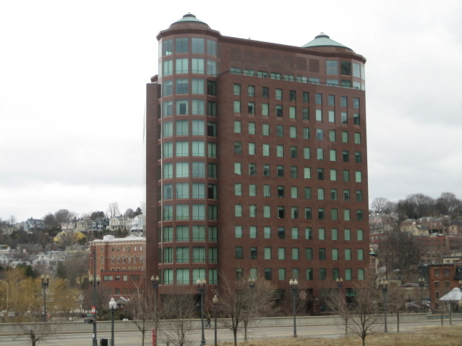
The historic alignment suggests that the least disruptive path, Figure 5, would be to recurve on the old Union Station alignment, forming, essentially, a tight wye. This would undoubtedly require the demolition of One Citizens Plaza and/or the partial culverting of the Mossashuck at its mouth. It also requires a new Providence Station facility along Main Street between Steeple Street and Throop Alley. However, the curvature required for this alignment is ... problematic ... to say the least. And One Citizens Plaza (Figure 6) presents its own problems.
Fig. 5. Tight curve
A better alignment is available, however. Thanks to highway engineers, (Figure 7) we have decent, if still tight, curvature from Memorial Drive to the I-95 alignment. Continue on it a short way (about a thousand feet) and you can recurve back onto the existing alignment. And with this curve, we can bring Union Station back into play, instead of needing a new facility in tight confines.
Fig. 6. Like a giant middle finger sticking into the air
At this point, the existing Providence Station is outmoded, and so too are the central Providence discussions in PA and RRPE. There is no way to make it from the 95 alignment onto its west approach--the curvature is just too tight. And because it is outmoded, once the replacement is built, the old facilities can be closed, subdivided, and resold.
Fig. 7. I-95 alignment
A Headache

The biggest problem, however, is that of rethreading a reasonable facsimile of the old New Haven alignment through from I-95 to the East Side Rail Tunnel portal. While some of it is easy--there's a fairly clear station box from the Courtyard to the Woonasquatucket--much of it is difficult.

Chief among the difficulties are (a) those of weaving a rail line through the I-95/US-6/Memorial Drive interchange, and (b) dealing with One Citizens Plaza.
Fig. 8. Weaving a rail alignment into Providence's core
First of all, however, we'll note that (c) that the East Side Tunnel portal has what appears to be +15' elevation with respect to Main Street. While we could undercut the tunnel's west approach and the westernmost part of the tunnel itself, the least expensive option requires utilizing as much of the old rail grade as is salvageable. As there is no room to grade a -30' difference (to -15' elevation with respect to Canal Street)--that would require 3,000' at a 1% ruling grade--and hence have a sunken station box and low bridge, and as route utilization mandates grade separation, we'll assume that the station box is at the historic Union Station level, i.e. +15' relative to Exchange Street. This drives elevation*.

This means that the solution to (b) is to route the station's east approach through One Citizens Plaza's south, well, plaza. In place of the plaza, a lobby extension and/or other use would front the Woonasquatucket-Moshassuck confluence; minor takings would be required for the necessary curvature to return to the original alignment. (Unfortunately, those buildings are obviously historic, but since some idiot went and built an office building right in the middle of the old alignment, you're kind of stuck between a rock and a hard place.) This section would be built on a trestle in order to encourage integration of "ground rights" under it by adjacent owners.
Fig. 9. New rail alignments in Providence's core
For (a), this drives the elevation of the trestle over the intersection of Memorial and Francis; the trestle's existence also has the handy side effect of forcibly road-dieting what is, by all appearances, a fairly ugly stroad. Further on, several interchange flyovers would need to be regraded and rebuilt as the railroad curves onto an embankment and heads down a 1.6% grade to make a 30' elevation change in 1900'. (Use Figures 8 and 9, and this file to help understand how the rebuilt grade is integrated into existing infrastructure.)**

Our final consideration is the station plant itself. We renovate and reopen the old Union Station waiting room and ticket offices, as well as provide a sheltered concourse in the old underpass; secondary platform accesses are on Exchange Street. The box, trestled, allows for active uses under it; the smallish, redundant greenspace cater-corner to Burnside Park--a beautiful common--would be eliminated in favor of TOD, as would the larger, also-redundant greenspace between the current Providence Station, Providence Place mall, and the State House greensward. (Among other things, development would better frame the State House along Francis St.)
_____________
*Much to my chagrin. I really wanted it to be sunken.
**One elegant solution would be to rebuild the interchange as one large surface roundabout, with routes feeding into it from US-6, I-95, and Memorial Drive.

Friday, February 7, 2014

Comments Extracted

Part of a discussion between Jon Geeting and I on Next City piece "It's Time to Cap and Trade Parking Permits":
Me: Jon, thanks for the excellent article. Since I'm sure the data I've collected on SWCC's parking supply formed part of its inspiration, I'm happy to offer a few comments:
1. My first gut reaction was that it was going to be a bad idea. The image the policy's name conjured in my mind was of what would be a wholesale privatization of the (already subsidized) onstreet parking spaces. Reading through the plan eased my fears somewhat, but I believe it is important that a permit is not tied to the space itself (again, because that would amount to wholesale privatization of street space).
2. An issue going forward would be maintaining a certain amount of flexibility. For example, if a neighborhood wished to convert a street to a woonerf, that would entail the removal of a certain amount of spaces. The system you propose increases the flexibility to do this somewhat relative to the status quo (by changing the cap), but increasing administrative layers and distance from neighborhood concerns would increase opportunities for vetoes of changes. So you could go to the PPA and say "here's a close estimate of the parking inventory in Neighborhood X, cap permits for the neighborhood at that estimate", but later changes to the inventory (either for net loss or net gain of parking spaces) would not be so easily ascertained at a citywide level.

What I am getting at is that, under a good cap-and-trade system, permit control needs to be devolved to the neighborhoods--or, more accurately, neighborhood investment districts. (Cf. Shoup, and his work on parking spaces in commercial districts.) This way, a neighborhood would have a dedicated funding stream*, control over how many spaces are permitted (so as to remove them as it sees fit), and an ability to assess parking demand of redevelopment projects...

No, I am not just saying this make myself more work ;). I am also saying this because it's the right thing to do--devolve power over a commons to the most local "stakeholders" (much as I detest that term).
______________
*Assuming permits are periodically reissued...this is an idea that needs a bit more work.
Jon: I completely agree that the permit should not be tied to the space itself, and should be free to migrate to the areas of the city where there is more parking demand, and cut car ownership in areas where there is less.
For example, I imagine that some of the most central neighborhoods would tip to a lower car ownership equilibrium under this plan, since many of these folks probably use their cars infrequently, and could get several years' worth of Zipcar membership paid for by selling the permit.

I am torn on the issue of whether we should use the Planning Districts as new permit zones, to make sure they don't all migrate to the more auto-oriented areas of the city, or if I think that would actually be a feature of the plan.

Not sure I agree with your assessment of the political economy of the parking removal example. Suppose that under the cap and trade policy, some group pushes to enact my somewhat radical plan for the Bainbridge Green, which would take away about 175 parking spaces.

On one side, you'd have a lot of people who would not want those spaces to go away. But on the other side, you'd have a group of people whose permits stand to get more valuable if 175 spaces go away, since a tighter market would make the permits more valuable. You might have some people showing up to support the new park just to increase the value of their assets.

Could you also elaborate a bit on what you have in mind for neighborhood control over "how many spaces are permitted" and "assess parking demand of redevelopment projects?" My preference would be to stop printing permits altogether, starting ASAP, and let people work these things out on an informal market. I'd like to get the city out of the business of assessing parking demand altogether, and leave it to housing and parking garage developers to gauge how much parking demand there is, and how much people are willing to pay for it.

I see it as an opportunity to reorient the political economy of development around a much lower car ownership equilibrium. I would expect to see a cycle of more infill development in the high-demand areas, followed by growth in transit ridership, and a subsequent sell-off of permits, with permits filtering outward through the successive neighborhood rings over the years.
Me: 1. I agree with your last paragraph.

2. As you may recall, I found that there is a very physical maximum of possible parking spaces in a neighborhood. Beyond this limit, any further permit you issue devalues the parking space.

3. What I have in mind is for a neighborhood to have local control over its parking. Among other things, this means that I would devolve (onstreet) parking permits from the PPA and into the hands of formally-recognized NIDs (there would be certain basic conditions tied to demonstrations of competency, like paid staff, the ability to maintain space inventory, and a certain amount of liquidity *necessary to hire a certain reasonably-priced consultant, heh*). Because parking permits are thus controlled and managed at the neighborhood level, parking policy--and hence transportation policy--comes to be managed at this level, too.
(This is not to downplay the need for a citywide transportation policy, but rather is meant to reflect that most transportation needs are best locally determined; I imagine we could build the system such that the City can exert its natural claim to street space if they wish to put e.g. a protected cycle track or bus bumpout in.)
This limits "migration" more than your proposal, but I don't see that as a bad thing in and of itself, as neighborhoods like Mayfair and Oxford Circle don't have remotely close to the same kinds of supply/demand issues neighborhoods like SWCC, Fairmount, or Bella Vista do. Heck, even Whitman doesn't have the same level of parking issues.

4. Note that I said that one of the measures of competency a neighborhood organization (usually an NID, although other high-compentency organizations such as SOSNA or NLNA should also qualify) has to show to control its parking is an inventory. This is because (a) a strong, well-maintained local inventory will be able to capture minute changes in parking supply, and (b) the group controlling that inventory can use it to further their own goals.

For example, say that a group wished to make Bainbridge Green green. They could then either (a) organize in a bid to control Bainbridge Green's parking inventory in order to reduce/eliminate it, or (b) work with another group, such as the QVNA or a QVNID, which would have a parking inventory (~2000 spaces as a first-order estimation) including the 170-odd spaces on the "green"...

...At this point I find a particular difficulty between your idea and my work: My work is based on the idea (a long-term policy goal, actually) that parking should be treated as a neighborhood "commons" and thus come under the control of that neighborhood. While this is not directly in opposition to your idea, significant difficulties exist in co-implementation. My hunch is that both of our ideas ultimately result in the same end-state: they just come to it differently. (An NID that derives most of its income from parking permits has a significant incentive to optimally price those permits i.e. make them a scarcer commodity i.e. reduce inventory. This is in agreement with Shoupian devolution of Main Street metered spaces to BIDs; they're the ones with the most incentive to get things right.)


Thursday, February 6, 2014

Colonias

Stumbled on this post about what are called colonias (colonies) down by the border.
A colonia is actually produced the same way most neighborhoods usually are: Take a plot of land and subdivide, subdivide, and subdivide again. Property owners can build as they wish.
This usually starts out as a collection of trailers or other types of temporary dwellings.
Over time, intensification happens. Soon enough, it is impossible to tell colonias apart from their township and hutment brethren.

But it doesn't stop there. Over time a colonia starts to look like a gecekondu, campamento, or favela--that is, it has become essentially identical in built form to a "formal" neighborhood. This is emergent urbanism, the purest manifestation of our community-building impulse.
That isn't to say they don't have problems, of course. Infrastructure provision is weak to nonexistent. The water is filthy, and illnesses spread like wildfire. More than a few commentators call colonias "third-world slums".
But that's the problem, isn't it? Slum is too general a word, and we confuse ourselves when we use it. There are two classes of slum problems--infrastructural problems and socioeconomic problems. We often assume all "slums" have both, and that all neighborhoods inhabited by the less well-off are "slums", and in so doing, not infrequently, offer exactly the wrong solutions for the problems at hand.

The real problem of mature informal settlements--like mature favelas, campamentos, gecekondular, or, yes, colonias--are not socioeconomic. Attaining maturity by definition means intensification, which implies adequate internal solutions to socioeconomic issues to maintain a positive economic trajectory. No, the real problems of such communities are infrastructural.
And to solve infrastructural issues--requires formalization. It requires that the community be recognized as a community and not derided as a slum. It requires, in short, that we stop assuming that every place that isn't as well-off as Suburban America is "poor", a "slum", and needs to be "cleared"--a bias inherent in certain advocacy organizations--
--and instead work to identify what causes socioeconomic problems, understand a community's socioeconomic trajectory, install physical and social infrastructure as needed, and allow the community to continue incremental progress.
See, here's the bulldozer problem, the bulldozer bias, the bulldozer fallacy: When you flatten a slum, you don't make the slum go away. You make it go somewhere else. But what you do make go away--are the solutions embedded within the slum. The bulldozers just make the problem worse.
Some* people, fortunately, understand. But they are the minority.
__________
*That said, "solid homes with garages and paved driveways"? Really?? That's your idea of incremental improvement? Can you be more biased???

Wednesday, February 5, 2014

No Girder Rail Is Made In America Whatsoever

Yep, this is a problem for light-rail and especially streetcar projects.

(Girder rail is the best kind of rail for street running.)

In fact, there's only one producer of it in the world--in Austria.

But look on the bright side: Build enough streetcar track and you can catalyze domestic girder rail orders.

But Buy America is a major block between A and B.

Oh look--protectionism run amok undermining the development of domestic industry. Again.

Tuesday, February 4, 2014

Quinnipiac Bypass

An extension of the Along the Shore program developed earlier.
This thingy
In that post, I worried about bypassing strong curvature just east of New Haven, and I put in a tangent line at the best alignment I thought I could find.
Original tangent line
My worrying is all for naught, though, because I had confused the locations of Union Station and State Street station. Having fixed that, I followed Alon's recommendation that
[t]his project ... start right at New Haven Union Station, cross the Quinnipiac River at a new bridge near US 1 and the new I-95 bridge, follow I-95 to the state line, and then cut across barely-populated territory to the Shore Line at Kingston, where it straightens.
as far as Lake Saltonsall, because I think the existing line has adequate curvature from there to Old Saybrook, and certainly an adequate curvature envelope to further improve speeds.
Quinnipiac Bypass of sharp curvature northeast of New Haven
The replacement Quinnipiac Bypass is shown above.

Monday, February 3, 2014

Rail Rhode Island

Where we last left off, we discussed the infrastructural challenges associated with bring regional rail to southeastern Rhode Island. This was precipitated by a consideration of Providence alignments.
New Haven map of Boston and Providence rail networks
Now I'd like to come full circle, and pare the New Haven alignments maps down to a good state network for Rhode Island.
New Haven alignments from Providence
Why a state network?

Rhode Island is perhaps unique in a couple of core attributes. First, it is dominated by a single city, Providence. This in itself is not unique. But second, it is such a size that the state is very nearly ringed by natural destinations--and a system serving these destinations would have approximately the same dimensions as a typical commuter rail system. That is, what makes Rhode Island unique, from a transportation planning standpoint, is that its state needs are fulfilled by what is essentially a large commuter system.
Natural destinations from Providence--cities and places surrounding, but not far, from Rhode Island. At right, Cape Cod.
The actual commuter elements are concentrated in a far smaller part of the network: to Bristol, to Fall River, to Woonsocket, to Kingston, to Mansfield, to West Warwick. The greater system is built on a series of "Lancaster Model" regional links.

The Lancaster Model

Consider the city of Lancaster, PA. It is a small city of only about 60k--a third of Providence's. It is linked, however, to Harrisburg, Philadelphia, and New York with regular (almost hourly) trains. And this regularity drives ridership both to the east and west. So, despite Lancaster and Harrisburg's small sizes--the latter is 50k--regular service drives outsize ridership.

Actually, what makes Lancaster a useful model is that, globally, it is typical. A midsize city with good rail service realizes good ridership, much better than what most American examples have been capable of. The small cities along the Empire Corridor--Rochester, Syracuse, Schenectady, Utica, Albany--likewise realize outsize ridership. So do the smaller cities on the San Joaquin in California. And so do New Haven and New London. So an optimal regional model strings services between these cities.

This, in turn, allows us to see natural termini at
  • Worcester
  • Framingham
  • Putnam
  • Norwich
  • New London
  • Newport
  • New Bedford
  • Boston
  • Cape Cod
in addition to the tighter belt of commuter services.
Rail Rhode Island
And from New Haven lines from Providence to these natural termini flows this nine-line network. From northwest counterclockwise:
  1. Blackstone Line. Service to Worcester via Woonsocket and the Blackstone Valley.
  2. New York-New England Line. Splits from Blackstone Line at Blackstone; heads to Putnam via its eponymous right-of-way.
  3. Thames River Line. Follows the old New York-New England Providence branch to Plainfield, and the Thames Valley subdivision (New London-Worcester) from there down to Norwich. It would be reduced back to Plainfield in the presence of Connecticut regional rail.
  4. Mystic Line. Follows the Northeast Corridor to Waverly; there meets Shore Line East trains. (Extension of the latter is already on the drawing boards.)
  5. Narragansett Bay Line. Dubbed "Bristol-Newport Line" last post, renamed after the bay it runs alongside.
  6. Mount Hope Bay Line. Formerly dubbed "Fall River-New Bedford Line", likewise renamed after a bay it passes.
  7. Cape Cod Line. Extends from Providence to Middleborough via Attleboro and Taunton. Formerly route of the Cape Codder. You may note it doesn't actually reach the Cape; more on this later.
  8. Providence Line. Existing MBTA alignment along Northeast Corridor.
  9. Patriot Line. Service to Framingham via Foxborough. Named for the fact it passes Gillette Stadium.
Services on these lines would run hourly, while services from the commuter termini run fifteen minutes.

What's the Deal with Cape Cod, Anyway?

Cape Cod is a resort area, and a bit different than the type of service Rail Rhode Island is geared to offer. In fact, service to the Cape mainly needs to target weekenders, with vacationers and Cape denizens both being secondary categories. For this reason, peak service needs to be Friday-Sunday, rather than the workweek core of the commuter networks feeding into the Cape. And because a weekending population is less transfer-sensitive, it makes sense to run (or franchise) service from Middleborough on separately. (That said, a good connection is still self-evidently necessary.)
Cape Cod route/franchise
An Operations Agency

While Rail Rhode Island by itself is essentially built to offer service indistinguishable from other commuter/regional rail services in the United States and abroad, it does also have the potential to connect into a broader regional network. Most of New England can, in fact, be united by such a network. So a further avenue of exploration of development of a larger New England rail network, which large chunks of proposed Rail Rhode Island would be subsumed into.

A Providence Pickle

Providence has a bit of a pickle. Its track alignment only allows for through-running from all other lines onto either the Mystic or Thames Valley lines. This is untenable. Among other considerations, the Blackstone Valley and Mount Hope Bay Lines have, between them, the highest ridership potential; a through-routing for them must be found. Expect further discussion on this matter soon.

Friday, January 31, 2014

Railroad Suburbia 2.0

A lot of the New Urbanist corpus--particularly the town planning elements--focuses on the traditional town planning model. Their ultimate desire is to build communities like these:
Now the thing is the communities the New Urbanists have built
have tended to look a lot like
each of which happens to be a railroad suburb.

Railroad suburbs were primarily developed during the Victorian era, fin-de-siècle, and into the 1920s. Aping developers' success in using streetcar lines to sell new housing, several railroads decided to enter the development game themselves and build "New Towns" lineside. This pattern--small, semi-dispersed centers of population highly centralized around train stations (a major railroad suburb giveaway is when a train station lies at one end of Main Street) became a primary mode of outward urban expansion for the better part of a century, and has left us a rich heritage of the nicest, leafiest communities in cities all across the nation. And, despite catastrophic disinvestment in anything that wasn't a house farm from the 1950s to the early 2000s, railroad suburbs continued to be the effective archetype of quality American community.
(And sometimes they became something more.)

New Urbanism got its start replicating railroad suburbs as new towns--even if the original railroad discontinued passenger service, the railroad suburb is, for all intents and purposes, a new town. Duany and Plater-Zyberk folded in some Southern Baroque town planning tradition, and--voilà!--an alternative to house farms, Levittown tracts, and meandering anti-grids was born.

There are profound implications to this. First, one of the great successes of the movement is the re-creation of the railroad suburb. Transit-Oriented Development, an idea about as old as New Urbanism, is (in essence) a manner of development built on the workings of a railroad suburb.
In the eventuality transportation policy changes--as it must, if Italy is at the vanguard of the trend--we have reclaimed the development model associated with a smaller, smarter, more compact type of urbanism and town-building.

The key becomes, then, developing the right transportation policy: Most cities have enormous wealths of historical (largely disused) potential commuter rail lines--lines on which, were they active, we can hang New Urbanist (re)developments and intensification...These should be the avenues of growth in metros.


Thursday, January 30, 2014

Not a Guaranteed Income, But Income Guaranteed to Cover Certain Costs

A comment I made on an Atlantic Cities article:
A minimum wage indexed to (a) local CoL and (b) inflation would (should) yield a minimum wage with equivalent local buying power, which I would argue constitutes the key "equal protection" here.

That is to say: a standard minimum wage of $10/hr buys a lot more in Alabama than California. But an indexed minimum wage should be designed such that the same amount of work-hours would be needed to buy, for example, a month of rent in Alabama as in California (and furthermore, that the amount of work-hours needed to buy a month of rent in either would be the same at any given time). That would be the equal protection a minimum wage provides.

One way of implementing this idea would be for the federal government to not set any minimum wage, but rather set a standard buying power for a minimum wage. States would have a legal obligation (mandate) so set a minimum wage equivalent to this buying power; other entities (like cities, counties, and municipalities) can augment this as they see fit, based on local buying power.
 A few comments:
  1. This standard buying power would be an assertion of certain economic rights extended to all Americans. (At a certain level, this is actually a stronger assertion than a basic income, as the latter only states you have the right to make x, whereas the former states you have the right to make enough to cover the cost of x. This harks to the x-f(x) distinction in Taleb's work; it is easier to find f(x) in a system defined {x|f(x)} than x itself--that is, in very complex systems, it is often easier to to isolate a function of a variable than the variable itself. Combine this with a couple of other provisions and you have the framework for a guaranteed minimum income.) 
  2. Such economic rights could be informally stated as:
    1. The right to shelter
    2. The right to transportation
    3. The right to healthcare
    4. The right to adequate nutrition
    5. The right to adequate clothing
    6. The right to save
  3. A better formalization for (2) would be that the minimum wage standard would be such that a person making the minimum wage would be guaranteed to make enough to cover:
    1. one month's studio apartment rent + basic utilities*;
    2. one monthly bus pass**;
    3. one month of health insurance;
    4. 60,000-90,000 Calories/month***;
    5. 1/36 the cost of a standard 10-day wardrobe, monthly^;
    6. Σ(i=1, n=5)a(i), that is, the summation of the other costs^^.
  4. The state's responsibility, then, would be to index these requirements to prevailing local costs. Once those costs are ascertained, the minimum hourly wage becomes 1/160 this cost^^^. Cost-indexing it also has the nice side effect of inflation-indexing it; the state's cost index would be required to be updated annually; a state found to be using a cost index more than three years out of date would be subject to the withholding of federal funds (and class-action suits).
  5. These economic guarantees also allow for a shrinkage in the welfare-state bureaucracy, as the 90k Cal/mth guaranteed obviates the need for food stamps for any employed person, and the health insurance purchase guarantee likewise obviates the need for Medicaid for any employed person. These two programs, in particular, form one of the most insidious forms of corporate welfare: corporations paying workers below the CoL, thereby forcing them into public programs to make up for the shortfall, such that the financial benefits from such programs accrues from the government to corporations. (The housing guarantee likewise obviates the need for public housing.)
  6. These guarantees are extended on the condition of employment (as is implied by their structure as a minimum wage cost index). To have truly universal economic freedoms, however, one needs to find some way of extending certain of these guarantees to the unemployed. This, then becomes the next challenge.
__________
*Gas, water, electric, (mobile, not home) phone, Internet. Yes, this implies a right to Internet access. I think it's essential for doing much of anything nowadays, don't you?
**Why? Well, (a) regardless of what zoning enforces, at this level of income, car ownership is a very expensive luxury, and we don't want to encode low cost/benefit ratio things (like car ownership giving access to jobs), and (b) our nation's bike system and bike culture are not yet developed to the point where universal bike access would be a fair formal statement of the right to transportation.
***60k Cal = 2k Cal/day * 30 days; 90k Cal = 3k Cal/day * 30 days; that is, the daily caloric intake generally needed to maintain weight for women and (slightly greater than) men, respectively.
^TBH, I have no idea how to calculate this cost, although what I have in mind is the cost of completely replacing a "professional" wardrobe, at outlet prices, every three years--hence 1/3 the cost/year, 1/12 that cost/month, 1/3*1/12=1/36.
^^Based on the budgeting principle that half of one's income should go to the aforementioned outlays; that is, the minimum wage should be tailored to the lowest feasible rate which one can keep a balanced budget.
^^^The costs being computed monthly: four weeks in a month, so 1/4 the cost weekly; 40 hours in a full-time workweek, so 1/40 the weekly cost hourly; 1/4*1/40=1/160, i.e. one works 90 hrs/mth to make ends meet, and 160 hrs/mth to make a living wage.

Wednesday, January 29, 2014

Tail Fattening in Practice

Some fun stuff:

A recent Strong Towns post tells us that (1) sales taxes are increasingly being used as DOT slush funds (due to excessive restrictions on local tax collection),
while (2) this table suggests there is a mighty overhang in retail in this country (made worse by the fact that such counts routinely undercount antifragile retail),

thereby (3) heading into the teeth of a likely large-scale retail downsizing,

which would (4) extirpate sales tax revenues in most locations--shrinking the size footprint of the transportation slush fund.

This is consistent with "tail fattening" (think Nassim Taleb)--especially the kind that, to reduce or mitigate risk now, kicks it down the road, compounding it when the interest's due.
The only real long-term solution is--as  I have said before and I will say again--conversion to a user fees-based system for access-managed roads, and massive reductions in maintained infrastructure for all general-access byways.

Tuesday, January 28, 2014

Polar Vortices and Other Fun Things

Well fuck.
This image is the global temperature-deviation-from-mean chart as of December 2013. It is published by NASA's Goddard Institute. On it, you can clearly see two things: the polar vortex, and where the polar vortex is supposed to be.

It turns out that the circumpolar whirl over the Arctic is elliptical and hence has two nodes. One normally lies over Baffin Island; the other, northeastern Siberia (Yakutia? Chukotka?). This is contrasted with Antarctica's polar vortex, which is stabler with only one node over the Ross Ice Shelf; the best guess for why that is, is because the Southern Hemisphere has a landmass at the pole, and the Northern, an ocean.

The thing about an ellipse, though, is that it is less stable than a circle. Right now the Antarctic whirl looks to be between Ross and Graham Land. But look at that deep burgundy in Siberia!

Hypothesis time: Warm air is pushing the Siberian node of the Arctic whirl into the ocean; this in turn is displacing the Baffin Island node into eastern continental North America.

Hypothesis #2: The greater variability of the Arctic whirl (relative to the Antarctic's) has something to do with the ice age cycle of the past five million years. It is notable, for example, that the southernmost extent of the recent polar vortex broadly parallels, in latitude, the southernmost extent of glaciation historically associated with ice ages.

...And #3: Perhaps the proximate cause of the ice age cycle is the destabilization of the Arctic whirl? But if that is the case, what catalyzes it?