Showing posts with label HSR. Show all posts

Friday, August 7, 2015

Looking At High Speed in the Keystone Corridor

The Keystone Service is a quiet giant. A simple, more-or-less hourly regional train, it only takes an hour to get from Philadelphia to Lancaster and a bit more to Harrisburg. It also adds extra hourly trains on the most-heavily-traveled intercity railroad in North America: the Northeast Corridor between Philadelphia and New York.

It does all of this through simple, done-under-the-radar improvement of the old Pennsylvania Railroad mainline between Philadelphia and Harrisburg to 110 mph running.

Right now, Harrisburg is where improvements end, though. This is not an accident. While Norfolk Southern bypasses the former PRR mainline east of the Susquehanna, it uses it -- intensively -- to Pittsburgh. Electrification, and therefore the territory Keystone Service push-pulls can cover, also ends at Harrisburg. And finally, the terrain becomes significantly more mountainous, and the railroad more curvy, as it follows the Juniata River valley deep into core Appalachia's corduroy, up and across the Alleghenies, and back down the Conemaugh River valley.

As it stands, with more operating funds (i.e. enough to purchase a couple of trainsets, engineers, conductors, and slots) integrating a few more daily trains between Harrisburg and Pittsburgh appears perfectly viable. A push-pull setup with an electric at one end and a diesel at the other would also allow these runs to be integrated into the Keystone's existing schedule. And there is the tantalizing possibility of night trains, which Sic Transit Philadelphia discussed a couple of years ago.

And, with relatively simple improvements (bringing back the fourth track, increasing superelevation on the passenger tracks) speed can be brought up for passenger runs, making them more competitive than the Daily Pennsylvanian's current 45 mph average speed.

But that's all for regional trains using the classic track to access the hill towns, towns which have relatively high ridership due to (a) the trains arriving in the afternoon and (b) a general lack of Interstate/freeway competition in the area.* Good regional service is important, but Pittsburgh is a large city and therefore a large travel market; it sits at the crossroads of the Northeast and Midwest; if Pennsylvania wants to compete with New York's Water Level Route and get a slice of that pie for themselves, it's going to need a new passenger route built to significantly more modern standards than the old PRR line.

Through the corduroy mountains.

Keystone West

Approaching the Problem

If Keystone East is an experiment, it's one of the most successful in all of American passenger railroading. It established not only the existence of a rail travel market from a larger city to smaller ones out in its hinterland, it also established that high ridership is a function both of frequent service and a reasonable fare.

But it is also an experiment abetted by advantageous geography and the civil engineering prowess of the Pennsylvania Railroad, and when the PRR electrified their Northeast Corridor in the 1930s, the Main Line section only went to Harrisburg and Enola. Plans to electrify the Middle Division, the section through the mountains to Pittsburgh, were discussed, but came to naught with postwar dieselization.

It's also arguable Harrisburg and Lancaster play outsize cultural roles in the state. Lancaster is, after all, its eponymous county's seat and the heart and cultural center of Pennsylvania Dutch Country (there's a reason Turkey Hill's motto is "Imported from Lancaster County"!) Harrisburg is the state capital ... not much more needs to be said.

Head east down the PRR mainline from Pittsburgh and the same opportunities don't present themselves. Johnstown and Altoona are fair-sized burghs,* yes, but one data-lite argument that can be made is that the relatively greater importance of Keystone East would naturally drive a higher ridership than a similar service profile on Keystone West.

I don't buy this argument. Not because I think population doesn't matter -- it obviously does; more people means more potential riders -- but rather because it attempts to explain a particular result a particular political class doesn't like by avoiding having to deal with, you know, actual data and competent modeling. Data-lite arguments often tend to carry exceptionalist undertones, too, seeking ways any result can be construed as a "special case" instead of looking for commonalities to build generalizations. Alan Garfinkel had a thing or two to say about that kind of reasoning.

All that said, however, it is clearly not easy to get from Harrisburg west. But it may be easier than often given credit for.
The West Side

The cost of building a new line, as J. Edgar Thomson appreciated when he engineered the PRR's mainline, is a function both of its length and the relative difficulty of its construction. Length scales linearly, difficulty exponentially. This is why he decided to concentrate nearly all of the mainline's most challenging features in one spot: between Altoona and the Conemaugh River's water gaps through Laurel and Chestnut ridges to the west of Johnstown. East of Altoona, the line follows the water level route of the Juniata River; west of Chestnut Ridge, the mainline crosses the Allegheny Plateau while a low-grade freight line follows the Conemaugh down to the Kiskimentas and eventually Allegheny rivers.

Norfolk Southern currently runs heavy eastbound (uphill) trains up the Conemaugh Line and lighter eastbound and all westbound traffic along the mainline. The lines rejoin by Heinz Stadium in Pittsburgh and pretty much anything that isn't a unit train's going to originate or terminate in Conway Yard a few miles down the Ohio. This is a traffic pattern of convenience, though: were there heavier passenger service in the Pittsburgh area, the Conemaugh Line would be able (by double-tracking it again and upgrading the signaling) to bypass most of it.

What I'm getting at here is that, from Pittsburgh all the way to Conpit Jct., where the mainline and Conemaugh Line meet, it's perfectly possible to convert the mainline to a passenger line. Which is useful, seeing how it's a natural commuter and regional rail route. It also offers a useful terminus for a fast passenger route through the mountains at Latrobe, a burgh sitting snugly at the foot of Chestnut Ridge, and where the line curves from following the ridgeline and instead heads directly west.

Like Keystone East, this "Keystone West" uses the PRR's civil engineering prowess to its advantage, upgrading an existing line to high-speed standard. It also offers an easy commuter rail corridor extending from Pittsburgh either to Greensburg, Latrobe, or Johnstown, along with improved regional services along the classic corridor.

This latter is necessary because a high-speed bypass through Appalachia's Ridge and Valley province must be just that -- a bypass. Like all trellis river systems, the Juniata curves too sharply as it crosses from water gap to water gap to be useful for faster travel. Instead, the Keystone Corridor's new middle division must punch through the mountains on an extremely low-curvature corridor.
________________
* The Pennsylvania Turnpike (I-76) runs well south, along the former South Penn RR right-of-way; I-80 runs well north, and if it could avoid trees along with everything else in these parts, it probably would, too.

** The combined population of Harrisburg (49,673) and Lancaster (59,322) is 108,995; their MSA's, better for intercity planning, are 509,074 and 507,766 for 1,016,840. For Johnstown (20,978, 140,499) and Altoona (46,320, 127,089), that's 67,298 and 267,588.

Monday, February 10, 2014

Realigning Providence

Note: This post supersedes Providence Alignments (PA) and part of Regional Rail from Providence, East (RRPE). Both will be referred to in the text, however.

Having developed a high-quality regional rail network focused on Providence, we find ourselves in a bit of a pickle. Figure 1 shows what it is.
Fig. 1. Diagram of ultimate RRI operations + MBTA P.L. under current track alignments
The problem is that, under current conditions, the whole network is highly unbalanced; of the four lines (plus one branch each) and the MBTA Providence Line (P.L.), fully 80% approach Providence Station from the east. Figure 2 shows what we want instead. Specifically, we want the Blackstone Valley Line to approach Providence from the west. That way, it can feed into the Mount Hope Bay Line (cf. RRPE), thereby forming an X-frame S-Bahn-esque structure.
Fig. 2. Desired RRI +MBTA P.L. operations.
To do this, however, we'll have to take a new look at central Providence. Figure 3 shows Providence Station's current and attainable alignments, unchanged from PA Fig. 9.
Fig. 3. PA core network (Fig. 9 there)
But to bring the Blackstone Valley Line in from the west, we need an entirely new station approach, and that implies an entirely new station; using Union Station as our template (Figure 4) would continue to yield an eastern--rather than western--approach for that line.
Fig. 4. Providence Union Station
The historic alignment suggests that the least disruptive path, Figure 5, would be to recurve on the old Union Station alignment, forming, essentially, a tight wye. This would undoubtedly require the demolition of One Citizens Plaza and/or the partial culverting of the Mossashuck at its mouth. It also requires a new Providence Station facility along Main Street between Steeple Street and Throop Alley. However, the curvature required for this alignment is ... problematic ... to say the least. And One Citizens Plaza (Figure 6) presents its own problems.
Fig. 5. Tight curve
A better alignment is available, however. Thanks to highway engineers, (Figure 7) we have decent, if still tight, curvature from Memorial Drive to the I-95 alignment. Continue on it a short way (about a thousand feet) and you can recurve back onto the existing alignment. And with this curve, we can bring Union Station back into play, instead of needing a new facility in tight confines.
Fig. 6. Like a giant middle finger sticking into the air
At this point, the existing Providence Station is outmoded, and so too are the central Providence discussions in PA and RRPE. There is no way to make it from the 95 alignment onto its west approach--the curvature is just too tight. And because it is outmoded, once the replacement is built, the old facilities can be closed, subdivided, and resold.
Fig. 7. I-95 alignment
A Headache

The biggest problem, however, is that of rethreading a reasonable facsimile of the old New Haven alignment through from I-95 to the East Side Rail Tunnel portal. While some of it is easy--there's a fairly clear station box from the Courtyard to the Woonasquatucket--much of it is difficult.

Chief among the difficulties are (a) those of weaving a rail line through the I-95/US-6/Memorial Drive interchange, and (b) dealing with One Citizens Plaza.
Fig. 8. Weaving a rail alignment into Providence's core
First of all, however, we'll note that (c) that the East Side Tunnel portal has what appears to be +15' elevation with respect to Main Street. While we could undercut the tunnel's west approach and the westernmost part of the tunnel itself, the least expensive option requires utilizing as much of the old rail grade as is salvageable. As there is no room to grade a -30' difference (to -15' elevation with respect to Canal Street)--that would require 3,000' at a 1% ruling grade--and hence have a sunken station box and low bridge, and as route utilization mandates grade separation, we'll assume that the station box is at the historic Union Station level, i.e. +15' relative to Exchange Street. This drives elevation*.

This means that the solution to (b) is to route the station's east approach through One Citizens Plaza's south, well, plaza. In place of the plaza, a lobby extension and/or other use would front the Woonasquatucket-Moshassuck confluence; minor takings would be required for the necessary curvature to return to the original alignment. (Unfortunately, those buildings are obviously historic, but since some idiot went and built an office building right in the middle of the old alignment, you're kind of stuck between a rock and a hard place.) This section would be built on a trestle in order to encourage integration of "ground rights" under it by adjacent owners.
Fig. 9. New rail alignments in Providence's core
For (a), this drives the elevation of the trestle over the intersection of Memorial and Francis; the trestle's existence also has the handy side effect of forcibly road-dieting what is, by all appearances, a fairly ugly stroad. Further on, several interchange flyovers would need to be regraded and rebuilt as the railroad curves onto an embankment and heads down a 1.6% grade to make a 30' elevation change in 1900'. (Use Figures 8 and 9, and this file to help understand how the rebuilt grade is integrated into existing infrastructure.)**

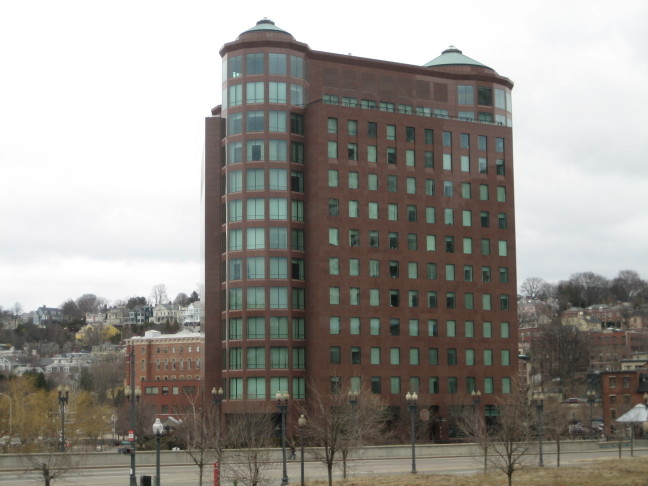
Our final consideration is the station plant itself. We renovate and reopen the old Union Station waiting room and ticket offices, as well as provide a sheltered concourse in the old underpass; secondary platform accesses are on Exchange Street. The box, trestled, allows for active uses under it; the smallish, redundant greenspace cater-corner to Burnside Park--a beautiful common--would be eliminated in favor of TOD, as would the larger, also-redundant greenspace between the current Providence Station, Providence Place mall, and the State House greensward. (Among other things, development would better frame the State House along Francis St.)
_____________
*Much to my chagrin. I really wanted it to be sunken.
**One elegant solution would be to rebuild the interchange as one large surface roundabout, with routes feeding into it from US-6, I-95, and Memorial Drive.

Tuesday, February 4, 2014

Quinnipiac Bypass

An extension of the Along the Shore program developed earlier.
This thingy
In that post, I worried about bypassing strong curvature just east of New Haven, and I put in a tangent line at the best alignment I thought I could find.
Original tangent line
My worrying is all for naught, though, because I had confused the locations of Union Station and State Street station. Having fixed that, I followed Alon's recommendation that
[t]his project ... start right at New Haven Union Station, cross the Quinnipiac River at a new bridge near US 1 and the new I-95 bridge, follow I-95 to the state line, and then cut across barely-populated territory to the Shore Line at Kingston, where it straightens.
as far as Lake Saltonsall, because I think the existing line has adequate curvature from there to Old Saybrook, and certainly an adequate curvature envelope to further improve speeds.
Quinnipiac Bypass of sharp curvature northeast of New Haven
The replacement Quinnipiac Bypass is shown above.

Friday, January 24, 2014

Providence Alignments

Of all the cities served by the Northeast Corridor (NEC), Providence has the most severe alignment problem.
Providence Station: Inadequate for the purpose
Providence's current alignment is relatively new. It was installed in the 1980s, to reach a new train station replacing one being decommissioned. It is also, in every way, objectively inferior to the alignment it replaced. There are two major deficiencies associated with this alignment: (1) excessively sharp curvature in the station approach, and (2) undersized station facilities. Figure 1 shows the current alignment (in red) and the old New Haven (NH) alignment, where divergent from the modern one (in purple).
Figure 1: NEC and NH legacy alignment
Figure 2 shows the difference in curvature between the modern and historical alignments.
Figure 2: NEC and NH alignments in DT Providence
From these figures we can ascertain characteristics of the two alignments. The original NH alignment bypassed Providence city--still in use--to reach its main train station, along Exchange Terrace. There, it crossed the Woonasquatucket and Moshassuck Rivers just above their confluence into the Providence River, and diverged. One route headed north to Pawtucket, where it split into routes to Woonsocket and Attleboro. The other crossed Main and Canal streets, and ran through the East Side railroad tunnel, across the Crook Point bridge, and through Rumford and North Seekonk, returning to the NH mainline south of Attleboro. This latter route was built as a freight bypass, but it also proved an important commuter connection from Providence to Bristol and Fall River. The NEC, meanwhile, follows the old NH (originally: Boston & Providence) mainline north to Pawtucket and then east to Attleboro.
Providence Union Station: Adequately sized, unusable
Providence Station, meanwhile, was built to replace Union Station in the mid-1980s. While it improves on the curvature characteristics viz. the old NH mainline, it appears that planners never considered the superior track geometry the old freight bypass offers. Furthermore, the station was built to handle rail traffic at its nadir, and as traffic is increasing, the station is reaching capacity. Indeed, were Providence to have a fully built-out commuter rail network--one possibility is shown as Figure 3--the station would be utterly incapable of handling the demand load. Worse, its predecessor--although still in place--has seen irreparable damage against any possible return of the railroad. The ROW is unusable between I-95 and Canal Street.
Figure 3. Providence commuter rail possibility.
So we now turn our attention to what it would take to actually introduce heavy infrastructure so as to solve these stated problems. Looking to implement low-curvature routes, three options present themselves--each would have its own station facilities. None are cheap.
The waiting room is a bit...small...for a major NEC station
To see the maps I generated for this post, see linked here and here.

The Options
Figure 4. Option A: Providence-state line tunnel
Figure 4 shows Option A. This option parallels the existing NEC, but eases curvature through the construction of a cut-and-cover tunnel under US 1 to Pawtucket, and along Cottage Ave. thence to the state line. Almost incidentally, it eases the moderate curvature around Pawtucket. The diagram shows some curvature around the Blackstone crossing, as it's assumed to follow existing easements wherever available; a deep bore nullifies that.

However, this is a lengthy tunnel--the distance from downtown Providence to the state line is about the same as the length of the Philadelphia tunnel proposal I demolished at length some time ago. And while Providence's infrastructural need is greater than Philadelphia's, one look at the old NH freight bypass suggests it's not that much greater.
Figure 5. Option B: Providence River tunnel
Figure 5 shows Option B. This was the first option that drew my eye on the map--the idea is to eliminate the station curve entirely, something none of the other options do. Unlike Option A, the tunnel is of moderate length.

But also unlike any other option, this one suffers from multiple shortfalls. First, it's the only option with extensive sub-water-table tunneling. The alignment is quite literally waterside. Unlike any other alignment, an entirely new intercity station site must be built--and the best place looks to be quite literally under the confluence of the Woonasquatucket and Moshassuck rivers into the Providence. Part of this alignment lies under semi-active port facilities. And finally, this alignment has a sharp curve that just will not go away. It offers no time savings over the existing Providence bypass.
Figure 6. Option C: New East Side tunnel
Figure 6 shows Option C. This alignment would run a new deep-bore tunnel under the East Side and link up with the old NH freight bypass--with excellent track geometry--in East Providence. Its curvature, while constant, is also gentle, and it has far less length, and hence cost, associated with it than Option A.

It is still, however, a deep bore tunnel.
Figure 7. Option D: "Option-C-cheap"
Figure 7 shows Option D, or perhaps "Option-C-cheap". Like Option C, it links Providence Station with the old East Side line. Unlike Option C, it does so far closer to the city, linking a short bore tunnel under the Moshassuck and part of College Hill with the existing East Side Railroad Tunnel and running across the Crook Point Bridge.

However, in some ways this proposal reeks of a penny-wise, pound-foolish attitude. Not only does it itself have the sharpest curve of all the proposals, despite its brevity, it also fails to ameliorate the lone sharp curve on the NH alignment--at Crook Point. It is perhaps better suited to regional rail than true HSR.
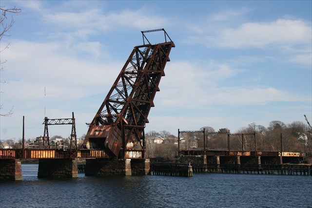
Crook Point bascule bridge, abandoned 1976
Finally, please note Figure 8 below, with all four options superimposed on the legacy alignments, to give one a sense of how each of these stack up against each other.
Figure 8. All four proposals to the same scale.
Ranking the Options

Ranking is somewhat subjective, but my primary criteria, in order of importance, are
  • Cost
  • Length
  • Curvature
As all of these proposals involve a new platform level (at the very least), we can assume that cost is fixed. What we are therefore looking at is thus cost per unit length of tunnel. Of these, Option A is (probably) the least expensive, and Option B (definitely) the most expensive. But looking at the criteria, we find
  • Option A. Cost: -. Length: -. Curvature: +
  • Option B. Cost: -. Length: +. Curvature: -
  • Option C. Cost: +. Length: +. Curvature: +
  • Option D. Cost: +. Length: +. Curvature: -
Option C clearly wins out--but it is not quite the most incrementalist approach available.  
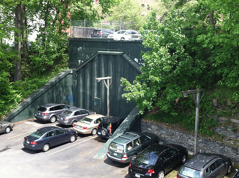
East Side Railroad Tunnel--West Portal
That would be to start with Option D, implementing Option C as and when further funds become available--perhaps as part of a package dedicated to fixing Along the Shore's significant curvature issues in Connecticut. In the meantime, Option D offers expanded station facilities, a better Amtrak alignment, and a platform to develop better--and perhaps, eventually, comprehensive--Rhode Island rail service.
New Haven operations in MA and RI
A look at the core of Figure 3's schematic--Figure 9--displays this, with the East Side line and Option D linked up to create an S-Bahn-esque core.
Figure 9. Figure 3's core network
Conclusion

Ultimately, while Providence's future is its own, what the New Haven left behind was a framework of easements that can provide it with excellent commuter rail. And what the Northeast Corridor needs today is HSR geometry. Hopefully we can do the right, the incremental thing--reactivating the substantial underutilized/disused infrastructure, while judiciously inserting HSR infrastructure where needed. This needs Organisation vor Elektronik vor Beton to happen, though--not the Beton-first mindset our transit agencies always seem to have.

Thursday, January 23, 2014

An Along the Shore HSR Program

Yesterday, Alon Levy offered a critique of the Regional Plan Association's Metro-North critique. As this post is framed in the context of his Northeast Corridor--and especially his Connecticut--recommendations, it aims to do two things: clarify visually his ideas, and offer my own.

The Along the Shore Line
Figure 1. The NEC from New York to Providence, with incremental improvements
The "Along the Shore" Line is the name I have heard given to the New Haven's (NH) principal mainline through Connecticut, running, well, along the shore. In Figure 1, above, Along the Shore is the thin red line; the blue blisters are various HSR bypasses of curvature or clearance issues; and the placemarks are important standalone features. See the map here.
Figure 2. Shell Interlocking. Flat junction; reverse curvature
Working from west to east, the first major feature is Shell Interlocking, where the Hell Gate line--the NH's connection to the former Pennsylvania Railroad--meets the NH mainline, which connects to the former New York Central Railroad in nearby Mount Vernon. Shell (Fig. 2) is a flat junction in a reverse curve; to ensure good performance, track straightening is needed, as is a flyover or duckunder for conflicting moves.
Figure 3. Port Chester bypass alignment. Cos Cob is dot upper right
North of Shell is the first major bypass of NH curves, at Port Chester. This bypass begins just east of Rye Station (new interlocking RYE) and follows I-95 as a bypass of three major curves and a moderate one through Port Chester and Greenwich before returning to the mainline just west of Cos Cob station (new interlocking COB) (Fig. 3).
Figure 4. Cos Cob Bridge
The Cos Cob bridge over the Mianus River is the next placemark (Fig. 4). This bridge is an aging bascule bridge; as HSR cannot afford delays due to lift bridges, this needs to be replaced, and raised to allow marina traffic to clear the span.

Figure 5. Noroton bypass
East of Stamford is the second major bypass, at Noroton (Fig. 5). This begins just east of Stamford yard (at new interlocking NOROTON) and bypasses the flat junction Glenbrook Interlocking and curvature associated with it (Fig. 6, below).
Figure 6. Glenbrook Interlocking
This bypass terminates just east of Darien (at new interlocking DARIEN), where it connects to the mainline and also to Norwalk bypass (sub.). This is because Noroton bypass is meant to be used not just by nonstops, but also by limited-stops that stop at Norwalk and Stamford, but none of the intervening stops, thereby relegating the flat junction to locals.
Figure 7. Norwalk bypass
From Darien Interlocking, the Norwalk bypass extends along I-95 through Norwalk (Fig. 7). This bypass eases some sharp curvature just west of town.
Figure 8. Walk Bridge
But more importantly, it bypasses Walk (Fig. 8) and Saga (Fig. 9) bridges across the Norwalk and Saugatuck rivers, respectively.
Figure 9. Saga Bridge
That it does the latter is a quirk of geometry--but it also means that neither bridge will carry HSR.
Figure 10. Bridgeport bypass
Bridgeport has a pair of severe curves on either side of its station. I-95 also has a moderate curve here; mitigating this will require a new easement (Fig. 10) from just prior of the south curve (new interlocking BRIDGE*) to just west of Stratford station (new interlocking PORT).
Figure 11. Peck Bridge
Incidentally, this will require a fixed-link bypass of Peck bridge across the Pequonnock river (Fig. 11).
Figure 12. Devon Bridge
Northeast of here is Devon bridge across the Housatonic (Fig. 12). This bridge, like the Cos Cob bridge, needs replacing and raising, in order to be a fixed link.
Figure 13. Ferry Street junction
While New Haven is all-stops, and this observation is relatively minor, it is worth noting that the junction under Ferry Street (Fig. 13) is, unsurprisingly, flat.
Figure 14. East Haven easement issue
A new easement is needed just east of New Haven, due to two other reasons: (a) the curve from New Haven to East Haven needs bypassing, and (b) the I-95 alignment does not offer a viable substitution. Fig. 14 shows a the tangent such an easement would roughly need to follow.
Figure 15. Long bypass
The Long Bypass is the longest of the major bypasses (Fig. 15). Its length is due to two facts: (a) the Along the Shore east of Old Saybrook is marked by a combination of lift bridges and sharp curvature, and (b) the replacement alignment, I-95, follows a markedly inland course. An issue of note is the "hump" above the Niantic river, where 95 converges with 395. A virgin easement may be required across the Niantic's top--fingers crossed, I hope not.
Figure 16. Connecticut River Bridge
Figure 17. Niantic River Bridge
Figure 18. Mystic River Bridge
Three of these bridges (Figs. 16, 17, and 18) cross the Connecticut, Niantic, and Mystic rivers, respectively.
Of particular interest is the fourth crossing (Fig. 19) of the Thames River.
Figure 19. Thames crossing alignments
Figure 20. Thames Bridge
This is because of two reasons: (a) the Long Bypass and Along the Shore at at their closest here, and (b) the old bridge (Fig. 20) can be replaced with a high-span fixed link that accommodates both expresses (utilizing the Long Bypass) and regionals (utilizing Along the Shore). Space is available for bridge spirals, thereby reducing the amount of times the old bridge--now utilized by freight--needs to be opened.
Figure 21. Rhode Island easement concern?
A final note (Fig. 21) pertains to a couple of moderate curves in rural Rhode Island, north of Charlestown. While replacement is not necessarily a priority, takings are inexpensive here, and a straighter easement (such as along my tangent line) could be developed.

Past this point, the line has excellent track geometry--the Acela hits its full speed here--north to Providence. Providence has some curvature issues of its own, but we'll talk more about those later.
___________________
*Which would also replace current Port Interlocking in functionality, incidentally.