Of all the cities served by the Northeast Corridor (NEC),
Providence has the most severe alignment problem.
 |
| Providence Station: Inadequate for the purpose |
Providence's current alignment is relatively new. It was installed in the 1980s, to reach a new train station replacing one being decommissioned. It is also, in every way, objectively
inferior to the alignment it replaced. There are two major deficiencies associated with this alignment: (1) excessively sharp curvature in the station approach, and (2) undersized station facilities. Figure 1 shows the current alignment (in red) and the old New Haven (NH) alignment, where divergent from the modern one (in purple).
 |
| Figure 1: NEC and NH legacy alignment |
Figure 2 shows the difference in curvature between the modern and historical alignments.
 |
| Figure 2: NEC and NH alignments in DT Providence |
From these figures we can ascertain characteristics of the two alignments. The original NH alignment bypassed Providence city--still in use--to reach its main train station, along Exchange Terrace. There, it crossed the Woonasquatucket and Moshassuck Rivers just above their confluence into the Providence River, and diverged. One route headed north to Pawtucket, where it split into routes to Woonsocket and Attleboro. The other crossed Main and Canal streets, and ran through the
East Side railroad tunnel, across the
Crook Point bridge, and through Rumford and North Seekonk, returning to the NH mainline south of Attleboro. This latter route was built as a freight bypass, but it also proved an important commuter connection from Providence to Bristol and Fall River. The NEC, meanwhile, follows the old NH (originally: Boston & Providence) mainline north to Pawtucket and then east to Attleboro.
 |
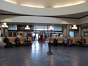
| Providence Union Station: Adequately sized, unusable |
Providence Station, meanwhile, was built to replace Union Station in the mid-1980s. While it improves on the curvature characteristics viz. the old NH mainline, it appears that planners never considered the superior track geometry the old freight bypass offers. Furthermore, the station was built to handle rail traffic at its nadir, and as traffic is increasing, the station is reaching capacity. Indeed, were Providence to have a fully built-out commuter rail network--one possibility is shown as Figure 3--the station would be utterly incapable of handling the demand load. Worse, its predecessor--although still in place--has seen irreparable damage against any possible return of the railroad. The ROW is unusable between I-95 and Canal Street.
 |
| Figure 3. Providence commuter rail possibility. |
So we now turn our attention to what it would take to actually introduce heavy infrastructure so as to solve these stated problems. Looking to implement low-curvature routes, three options present themselves
--each would have its own station facilities. None are cheap.
 |
| The waiting room is a bit...small...for a major NEC station |
To see the maps I generated for this post, see linked
here and
here.
The Options
 |
| Figure 4. Option A: Providence-state line tunnel |
Figure 4 shows
Option A. This option parallels the existing NEC, but eases curvature through the construction of a cut-and-cover tunnel under US 1 to Pawtucket, and along Cottage Ave. thence to the state line. Almost incidentally, it eases the moderate curvature around Pawtucket. The diagram shows some curvature around the Blackstone crossing, as it's assumed to follow existing easements wherever available; a deep bore nullifies that.
However, this is a lengthy tunnel--the distance from downtown Providence to the state line is about the same as the length of the Philadelphia tunnel proposal I
demolished at length some time ago. And while Providence's infrastructural need
is greater than Philadelphia's, one look at the old NH freight bypass suggests it's not
that much greater.
 |
| Figure 5. Option B: Providence River tunnel |
Figure 5 shows
Option B. This was the first option that drew my eye on the map--the idea is to eliminate the station curve entirely, something none of the other options do. Unlike Option A, the tunnel is of moderate length.
But also unlike any other option, this one suffers from multiple shortfalls. First, it's the only option with extensive sub-water-table tunneling. The alignment is quite literally waterside. Unlike any other alignment, an entirely new intercity station site must be built--and the best place looks to be quite literally
under the confluence of the Woonasquatucket and Moshassuck rivers into the Providence. Part of this alignment lies under semi-active port facilities. And finally, this alignment has a sharp curve that just will not go away. It offers no time savings over the existing Providence bypass.
 |
| Figure 6. Option C: New East Side tunnel |
Figure 6 shows
Option C. This alignment would run a new deep-bore tunnel under the East Side and link up with the old NH freight bypass--with excellent track geometry--in East Providence. Its curvature, while constant, is also gentle, and it has far less length, and hence cost, associated with it than Option A.
It is still, however, a deep bore tunnel.
 |
| Figure 7. Option D: "Option-C-cheap" |
Figure 7 shows
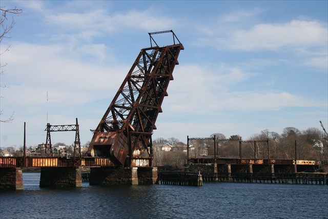
Option D, or perhaps "Option-C-cheap". Like Option C, it links Providence Station with the old East Side line. Unlike Option C, it does so far closer to the city, linking a short bore tunnel under the Moshassuck and part of College Hill with the existing East Side Railroad Tunnel and running across the Crook Point Bridge.
However, in some ways this proposal reeks of a penny-wise, pound-foolish attitude. Not only does it itself have the sharpest curve of all the proposals, despite its brevity, it also fails to ameliorate the lone sharp curve on the NH alignment--at Crook Point. It is perhaps better suited to regional rail than true HSR.
 |
| Crook Point bascule bridge, abandoned 1976 |
Finally, please note Figure 8 below, with all four options superimposed on the legacy alignments, to give one a sense of how each of these stack up against each other.
 |
| Figure 8. All four proposals to the same scale. |
Ranking the Options
Ranking is somewhat subjective, but my primary criteria, in order of importance, are
As all of these proposals involve a new platform level (at the very least), we can assume that cost is fixed. What we are therefore looking at is thus cost per unit length of tunnel. Of these, Option A is (probably) the least expensive, and Option B (definitely) the most expensive. But looking at the criteria, we find
- Option A. Cost: -. Length: -. Curvature: +
- Option B. Cost: -. Length: +. Curvature: -
- Option C. Cost: +. Length: +. Curvature: +
- Option D. Cost: +. Length: +. Curvature: -
Option C clearly wins out--but it is not quite the most incrementalist approach available.
 |
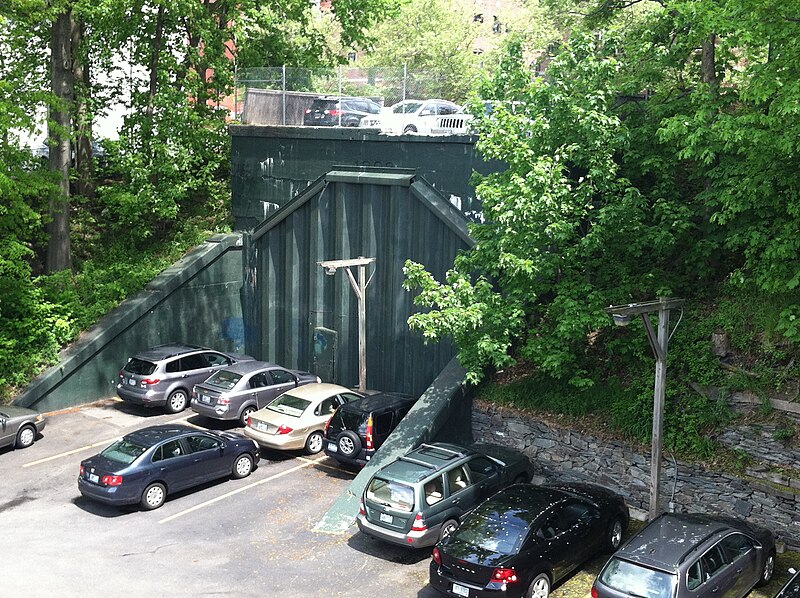
| East Side Railroad Tunnel--West Portal |
That would be to start with
Option D, implementing
Option C as and when further funds become available--perhaps as part of a package dedicated to fixing Along the Shore's significant curvature issues in Connecticut. In the meantime,
Option D offers expanded station facilities, a better Amtrak alignment, and a platform to develop better--and perhaps, eventually, comprehensive--Rhode Island rail service.
 |
| New Haven operations in MA and RI |
A look at the core of Figure 3's schematic--Figure 9--displays this, with the East Side line and
Option D linked up to create an S-Bahn-esque core.
 |
| Figure 9. Figure 3's core network |
Conclusion
Ultimately, while Providence's future is its own, what the New Haven left behind was a framework of easements that can provide it with excellent commuter rail. And what the Northeast Corridor needs today is HSR geometry. Hopefully we can do the right, the incremental thing--reactivating the substantial underutilized/disused infrastructure, while judiciously inserting HSR infrastructure where needed. This needs
Organisation vor Elektronik vor Beton to happen, though--not the
Beton-first mindset our transit agencies always seem to have.


I had a long comment (tl;dr: it's pointless for HSR since the time saving would be trivial unless you're skipping Providence; but for Providence-centric regional rail, it would be interesting to demolish either One Citizens Plaza or the buildings at the northeast corner of Steeple and Canal and go elevated over either Memorial or Kennedy Plaza). It was eaten by Blogger.
ReplyDeletePerhaps. I pretty clearly found that the most geographically intuitive alignments were the ones that made the least amount of sense...
ReplyDeleteSomething else that's interesting is that the third option also yields a bypass of the moderate curves (a) up by Pawtucket, and (b) at the junction between the NEC mainline and the old freight bypass. The curves don't yield a large speed restriction, but they yield one nonetheless. Being a bit too lazy to pull the info out and do the math right now, I'd guesstimate that that option would see more time savings than what a narrow reading of Providence station's curvature would indicate--probably in the 1-2 minute range.
But you are absolutely right, that the greatest utility of any rail investment of this nature in Providence comes not for intercity rail, but for regional rail instead: you get access to three major routes through the eastern part of the Providence metro, and, with a fixed link across the Mt. Hope bay, a viable regional rail route between RI's two largest cities. Newport-Providence alone is enough to start thinking about the investments needed to make it happen.
Now here's the next question: From a regional rail standpoint, the best route from Providence to the southeast clearly runs through the East Side tunnel and across the Crook Point bridge--but--since the link from it to the A.T.S. mainline is severed, what is the optimal connection? Is is creating a short bored link from the existing tunnel to the station (with concomitant facilities expansions)--or a new elevated alignment roughly paralleling the old Union Station alignment, as you suggested? Keep in mind that, as far as water bodies go, crossing the Moshassuck is about as trivial as it gets--where I come from, we'd call it a "creek".
The time savings from using the East Side tunnel and going up to Boston via the old B&P alignment is 30 seconds. This assumes that the Crook Point bridge is replaced with a high bridge with a wide curve, of radius about a kilometer. A few years ago I convinced myself that the maximum speed through the East Side tunnel would be in the 120-140 km/h range, but I don't have any work to show for it now. Past Crook Point there's no real speed limit, and this is what produces the time saving. The reason the time saving is this small is that the curves on the existing line aren't such a big deal. The curve east of Providence Station allows 80-90 km/h, depending on whether cant excess at levels similar to those of cant deficiency maximums is permitted. The Pawtucket curves are 150, and Boston Switch is (or can be straightened to) 225. It's much easier to run at reasonable speed on the legacy Providence Line on than on the Connecticut clusterfuck, with all the viaducts and tunnels required as in your last post.
ReplyDeleteAlso, the second largest city in Rhode Island is Warwick, and the legacy line is perfectly fine for Warwick-Cranston-Providence-Pawtucket service. This is why I'm a bit skeptical about using the East Side line: the areas it opens, i.e. Fall River, New Bedford, and Newport are all hard to get to, with more bridge reconstruction required. In the case of Newport the alignment is also circuitous unless a greenfield line is built following the highways.
1. Okay, then the core conceit of the original post doesn't really matter (unless line saturation dictates the construction of an overflow). That still leaves regional rail as a viable option for East Providence.
Delete2. Then I clarify--I meant second-largest metro. (Newport was historically RI's second-largest city; Warwick is to Providence what Upper Darby is to Philadelphia.)
3. I agree that new service to the cities best served by the East Side-Crook Point alignment would require surmounting significant difficulties. As the New Haven had a monopoly in the area, you may find this map to be of some use in ascertaining available alignments; it is < 90% accurate, but fails to show the historical Slade's Ferry Bridge and access alignment (implying it was abandoned before ca. 1948, the year the map seems to have been published).
Infrastructural works required to connect Providence to Newport, Fall River, and New Bedford are indeed quite interesting, and would effectively function (as Chuck Marohn points out as a new road--creating new mobility...
That said, we have not done any greenfield mainline passenger railroad construction in this country for about 90 years now, so for this, we'd have to learn more-or-less from scratch.
You bring up some interesting ideas, but I agree with Alon regarding HSR. The costs of such long deep tunneling would not be justifiable for such an incremental decrease in time.
ReplyDeleteFigure 3 shows the historic rail alignments as having potential for commuter rail service. With 1.6-million people, the Providence metropolitan area isn’t that big. The commutation demands are not that of Boston or Philadelphia, which have over double or triple the population.
Referencing the 1948 NHRR map informs where revived commuter rail routes should or should not go. The freight only routes go to western RI and eastern CT, northwest RI, and the RI east bay area and Aquidneck Island (Newport). Those locations probably wouldn’t work well for commuter rail from Providence today.
The two easiest routes to reestablish would be the Blackstone Valley north to Worcester and east to Taunton, since active rail tracks are in place. The population of the cities and towns east of Providence to Taunton is only about 130,000. The only way that this commuter rail route might be justified, is that if it went all the way to Cape Cod? The population in between Providence and Worcester is roughly 260,000 with some densely populated cities that have concentrations of low-income people who generally demonstrate a higher usage of mass transit.
The most logical route is the most difficult to develop, which is the roughly 30-mile long stretch from Providence to Fall River and New Bedford. It would serve a population, not including Providence, of roughly 330,000. This line would have many of the same characteristics as the Blackstone Valley, but at a larger scale. The legacy tracks are too disconnected from the three cities and the main suburbs between them. In spite of the relationship between RI and MA with shared MBTA service, the two states are not always that cooperative. It’s unlikely that MA would be interested in developing mass transit that isn’t Boston centered.
However, if such a line were to be developed, one route could be to reuse the East Side Rail Tunnel to the unfinished Henderson Expressway following the state line south to I-195 east. Most of I-195 in MA has a wide median where new tracks could be located. From the west portal of the tunnel the tracks could arc north (avoiding Citizens Bank) and be elevated over the tracks/platforms on the north side of Providence Station where an upper platform could be built. Then the track could extend to points north.
It has been discussed that Newport could be accessed from Fall River by extending the proposed, partially funded, South Coast Rail from Boston.
Peter--
DeleteThank you for your informative comments.
This whole post grew out of something that has been nagging me for some time: the curvature into Providence. And especially after what happened in Spain last year, I am increasingly wary of sharp curvature unless evidence for its inclusion is overwhelming.
Even so, from this debate I find myself in agreement with Alon, with a slight rider associated with Option 3 (i.e. that it is a long-term possibility if congestion issues have to be dealt with at some point in the future).
Now onto regional rail.
You are right that the map reflects the New Haven alignments from Providence. I've updated it to better reflect that. Finding the easements is one of the first necessary steps in creating a commuter rail network, and a couple (like the route up the Woonasquatucket) didn't exactly want to be found. That said--
1. The idea with a Middleborough terminus is that it would link to service from there to Cape Cod. Indeed, I suspect that the transfer penalty is much reduced due to the Cape's resort nature. Weekenders can transfer at Middleborough, and daily or semi-daily trains out of New York (à la the Cape Codder) and Boston can be made available for folks toting luggage with them. One can almost see a short line running up the Cape, with tickets from Boston or Providence cross-honored.
2. Fall River/New Bedford actually requires a great deal less greenfield infrastructure than you think. I'm working on a post now that details easement locations and infrastructure concerns in southeastern Rhode Island.
3. It may be a good idea to consider Providence-centric regional rail as having two responsibilities: (1) commuter service to/from Providence as a medium-sized metro, and (2) a statewide rail plan. Rhode Island is small enough, easements centralized enough, and out-of-state natural destinations close enough, that a plan built to fulfill the latter responsibility that a statewide rail plan will almost certainly wind up looking like an oversized commuter rail system for its city.
I intend to have more on this.
Steve,
ReplyDeleteImpacts whether to HSR or commuter service are interchangeable. The heart of the Providence Station issue is not as much about curved tracks, but more about curved high-platforms, a constrained undersized station, and the disconnect and misalignment between key infrastructure, the abandoned rail tunnel.
There have been many positive results with the tracks and station being moved and the river being uncovered and realigned. The Waterfire event, which occurs every couple of weeks during the warmer seasons can attract up to 100,000 people and in large part has changed the perception of the city. More than a handful of mid- and high-rise buildings have been constructed including hotels, residential, and office, plus the 1.4-million SF shopping mall near the station. This new neighborhood set the stage to expand and develop the restaurant/foodie culture throughout downtown that the city has become renowned for. The transformation of the area is profound.
The effects on transportation have only begun to be revealed more recently. Besides the tunnel connection, the old Union Station had straight platforms and more tracks. It was directly connected to city core and transit system. The old elevated tracks weren’t as much of a “Chinese Wall” as is the present day shopping mall.
The new station is awkwardly placed in relation to transit and though very close to the historic core is separated by an unpleasant highway-ish boulevard. When the new station was designed, nationally the interstates had been finished only a few years earlier and train travel was just limping along. There was little or no thought into how a wide mix of rail options (commuter, intercity, and HSR) would interact or impact the station. Further when Amtrak electrified the NEC north of New Haven in the 1990s, they offset the tracks in the Providence area to allow for the Acela tilting feature within what was mostly a four-track corridor or reserved for four-tracks. Now there are only three tracks, two passenger and one freight/commuter and in some places no room for a fourth.
All of the new construction around the station makes modifying it difficult at best. This series of rail infrastructure oversights or lack of vision could be insurmountable? Providence started out as a multi train terminal town in the 1830s. Maybe that’s its future?
Peter,
DeleteAt this point very nearly the entirety of this post has been superseded, in my mind, by further work and more information. Please do keep that in mind.
At this point, I have come to the conclusion that there are fundamental problems with Providence Station's siting that require an entirely new station to fix. These problems are actually rather tangential to intercity rail, but are significant issues for state rail.
The core issue is that, no matter how I sliced it, rail approaches into Providence Station (and historical Union Station, for that matter) are fundamentally unbalanced: while a regional rail network for Rhode Island would (should) have an X-shape, with a southwest-northeast route along the NEC spine, and a northwest-southeast route down the Blackstone and to New Bedford. But station alignments into the current station preclude the second alignment, as do all of the options I laid out in this post, as did the historic Union Station's trackwork. There is a solution to this problem, but (as I've already noted) what it requires, requires significant changes to Providence's core's rail alignments' routings (but, luckily, only minor takings)...
Regarding your idea about rail through southeast RI to Fall River. Keep in mind that in MA much of the former Prov-Fall River line right-of-way has been sold off to become suburban houses and a coal-fired power plant. In RI proposing to reuse the East Bay rail line for trains would face stiff opposition in particular from one affluent suburb. The former rail line has been transformed to the most popular of RI bikeways. Also the East Bay rail routes were only ever one-track.
ReplyDeleteOne of the more important things with rail (and not as important with the bikeway) is to route it through populated areas. The freeway alignment is a little too far north, especially west of Warren, to hit existing communities.
DeleteThe old branch from Warren east is traceable as far east as Lee River, where it disappears into the power station. You could bypass the plant, but it's supposed to close down soon, so I'd just reestablish an alignment straight through connecting to I-195 when it does.
BTW I've had a change in my mind of the equipment I need to design for, which in turn means I'll have to reevaluate Bristol (I think there's an alignment that would pass through the town and require only one taking for this new, lighter, class of equipment).
I'm not opposed to the East Bay Bikeway, but I am of the opinion that it's of secondary purpose and use if higher-grade transit in the alignment becomes viable. It's easier to realign a bike route than to rebuild a rail alignment for high ridership.
I agree that a bikeway to rail concept should be a priority, but there's a political component to the given success of any transportation project. Push back by locals shouldn't be underestimated.
ReplyDeleteWhether in suburban Barrington or more urban parts of Warren or Bristol, the single-track East Bay right-of-way is immediately adjacent to side and back yards and in other cases only a few feet from houses or multi-family structures. Even with quieter light rail equipment, residents would protest because of potential noise and disturbance.
In the 60s the East Bay towns killed a first proposal for an Interstate, which was to cross the bay from TF Green Airport to I-195. A second proposal was later killed by both Aquidneck Island and the Bristol County RI towns.
County government is very weak in New England and non-existant in RI and CT. Towns and individuals have a great potential and ability to block projects.
For a project to be successful the obvious is that it has to fulfill a need, but less tangible is that it needs to be visionary and inspire. A critical aspect that's often overlooked is finding the path of least resistance to achieve a project.
I'm not suggesting that you don't look at an East Bay option, as it could work beautifully, but an easier path could be a highway median that no one cares about. The key population for rail is not as much the East Bay towns or the suburban towns along I-195, but is the roughly 200,000 people of urban Fall River and New Bedford.
The problems you cite are in the realm of the political. The problems I'm focusing on tend to be more in the realm of the technical--such as how do I build the line with the highest ridership? In any event, there are enough rail reactivations that go through people's backyards to show that, once it's there, it isn't obtrusive. From this lens the problem becomes reframed as: How do I show this?; using an alternate, usually inferior, alignment is, in a certain sense, a cop-out.
ReplyDeleteAmong other things, avoiding the East Providence suburbs might make sense for New Bedford or Fall River passengers--fine for the regional aspect--but it also, for rather self-evident reasons, undermines the secondary commuter element. Bristol, in particular, needs to be a commuter terminus; it is a natural one, with the largest, strongest town center in the immediate area.
Also of note, I'm still using the existing freight alignment on Aquidneck Island, which is strong enough for its purpose. Alignment concerns bedevil the Bristol Peninsula, but solving them offers the greatest overall benefit to the system, largely due to branching control.
The balancing act between regional and commuter needs is very delicate, and a lot of the best "political" solutions wind up unbalancing the "technical" equilibrium.