Friday, June 19, 2015

A Minneapolis Councilwoman's Land-Use Masterstroke

Saw this quote in this article:
The Minneapolis policy, proposed by Council Member Lisa Bender, would eliminate all parking requirements for new residential units built within 350 feet, or about a block, of bus or rail service offering frequent, all-day service (every 15 minutes at midday). Within a quarter-mile of frequent bus service and a half-mile of frequent rail service, the policy change would eliminate all requirements for buildings with 50 or fewer housing units, and reduce them to one space per two units for projects larger than that. For developments within 350 feet of infrequent bus service—coming only 30 minutes at midday—the policy would reduce current parking requirements by 10 percent.
Mrs. Bender is truly brilliant. Not only is she proposing what is perhaps the most progressive parking reform in the country, she is doing so in such a way that ties parking to mass transit accessibility. IOW, the closer you are to mass transit, the less parking you need.

She isn't just proposing a law, she's proposing a template of a law. One that can easily be replicated anywhere with a good mass transit core.

For instance, if you applied a similar requirement here in Philadelphia, the scale of our core network is such that parking requirements would be waived entirely for the overwhelming majority of the inner city. It would look not dissimilar to Yonah Freemark's map of Chicago parking requirements.

Wednesday, June 17, 2015

Success ... by a hair's breadth?

As if in a coda to my post the other day, Plan Philly brings news of the apartment project at 43rd and Baltimore -- across the street from Clark Park. It went before the Zoning Board seeking variances, doing so after:

  • Extensive community input shaping the development vision
  • Jannie Blackwell rejecting spot-zoning proposal
By the time it got to the ZBA, the project had racked up letters of support or nonopposition from every single involved party. Yet there were, in the meeting, two dissenters:
At a hearing in April, the developers sought variances for height, 35 feet more than the underlying zoning allows, and commercial space. It was supported by local civic groups and Councilwoman Blackwell’s office, but opposed vociferously by two neighborhood residents who live a few blocks from the property. 
Mary McGettigan and Larry Caputo, the opponents of the project, noted that the project didn’t conform to either the existing or proposed zoning of the property. They argued that the developers hadn’t made their case that the zoning designation represented a hardship on the property.
The ZBA voted to support this project. But it only did so by a 3-2 margin. This, despite the fact that the developers had gone above and beyond in incorporating the community voice in their design. It's fairly clear that -- had there been no dissenters who showed up at the meeting -- the project would have sailed through the ZBA.

Two dissenters.

That's all it took to nearly derail a small apartment building that is in scale with a number of similar buildings scattered throughout the neighborhood.

As if you needed any more evidence modern zoning is excessively restrictive!

Tuesday, June 16, 2015

What works

These concrete tree thingies that seem to be generally Brutalist have proven to be aesthetically successful over time. A combination of simple geometric features emphasizing the use of (reinforced) concrete and glass, a simple cantilevering, and a layout that manages to evoke traditional columnular layouts while at the same time offering characteristically Modernist light airy spareness.

The example shown above is the Katowice train station, demonstrating how this style is particularly effective for structures whose principal organizing element is a large, open main hall.

Monday, June 15, 2015

Zoning, the Static City, The Dynamic City

At the beginning of the year, Charlie Gardner at Old Urbanist offered an academic's findings on zoning, especially where American practice is in conflict with European practice. Perhaps the most important part, however, is a paragraph buried deep in the piece:
How this exceptionally American land-use system came into being during the late 1800s and through to the 1930s is the primary focus of Hirt's book.  In chronicling this period, many apparent paradoxes present themselves: for instance, although the United States of the late 19th century prided itself on being the most democratic nation in the world, its citizens had a low level of trust in their elected municipal officials.  The progressive municipal reformers of the time might therefore have campaigned for planning to be guided by state or federal governments, but instead pushed for non-discretionary municipal-level zoning.  As Hirt observes, zoning reformers such as Lawrence Veiller argued that "zoning rules should vary as little as possible in districts that were as large as possible and that zoning relief should be granted only under a very limited set of circumstances, if at all." 
But if the planning powers were delegated from state to city, and the city was to have little power to alter the apparently infallible choices of the initial zoning commissions, who was left to actually engage in city planning?  No one, as it turns out.  Planning commissioners were seemingly intended to be little more than curators of the city zoning map, and Hirt finds, as I have also noted, that zoning maps have changed relatively little in their basic allocation of space since the 1920s.  As I've written about before, the actual policy that zoning was intended to serve was almost an afterthought, and was primarily concerned with protecting the investments of wealthy homeowners.  By default, and perhaps unintentionally, city planning (to the extent it existed at all) was turned over to the emerging highway engineering profession. 
American zoning policy, in sum, was a negative and reactive vision -- through its implementation, it viewed cities as incapable of honest and effective self-government, and by its actual regulations, it viewed urbanization as a threat to not only investments but to civic spirit and even the American way of life itself. As Hirt writes, "[t]he single-family home had the right to the city: it was always seen as being there first. It was the gracious host, the delicate victim, and the original citizen that was always haunted, followed, invaded, and taken advantage of by other housing types." In this sense, Hirt's book echoes the conclusions of Steven Conn's recent Americans Against the City: Anti-Urbanism in the Twentieth Century.
The key takeaway of this is fairly simple: American zoning was already being used as a tool to prevent redevelopment as early as the 1920s. Zoning theory, while it grew out of nuisance law and European (especially German) practice, was already being adapted to exclude rather than include -- zoning, by design, is a hyperlocally-devolved tool. Indeed, the basic idea seems to have been to zone land such that intensification of existing development was made impossible, a practice which inevitably would concentrate redevelopment in the most intensively-used areas -- and on the greenbelt edges. 

And because there was no systemic planning practice designed to rezone, it has been left to politicians' whims, which often result in downzonings once communities realize that existing zones allow more intensive land use than what currently exists, and state DOTs -- whose highway extensions (and not mass transit extensions) have been, since midcentury, what has opened new land up to development.

What is curious to note, then, is that American sprawl is driven by what is essentially a units problem. In the hard sciences, units problems rise when units are misapplied, or when they're inadvertently mixed. For example, while a velocity calculation might be mathematically simple under constant acceleration, the result has to be in the same units as the inputs (e.g. m/s, cm/s, mi/h, etc.). Mix up the units -- say, by measuring an object's weight when what you want is its mass -- and you throw your calculations off. Similarly, inappropriate aggregation can often hide more than it illuminates: this is one of Jane Jacobs' key critiques of mainstream macroeconomics, that the sovereign nation is fundamentally an inappropriate unit for economic measurements, as it almost always represents an aggregation of very much economically disparate regions. 

By over-empowering land use planning at the hyperlocal scale, we inadvertently disempower reasonable land-use planning at the scale where it matters most, as far as optimizing spatial efficiency relative to amenitization is concerned: the greater conurbation. Static land use paradigms undercut the efficacy of mass transit (as has often been pointed out at Urban Kchose); because zoning law is not designed with spatial efficiency in mind -- and, indeed, almost every solution to any given land-use problem increases spatial inefficiency -- we find ourselves unable to respond save by sprawling more ... and more ... and more.

Sometimes small-scale intensification is not aesthetically pleasing: witness D.C.'s pop-up house, which, now that one has been built, has been banned. Indeed, this has generally been zoning's modus operandi -- regulate nonconformity into nonexistence. The problem with this is, however, that at a certain level, small-scale intensification requires aesthetic flexibility. Indeed, this may be old urbanists' strongest criticism of New Urbanism: that it overfocuses on form, while underfocusing on the land-use development process -- the true locus of the sprawl process. This is perhaps where Strong Towns has come into play: it has gained traction and has been growing, as a grassroots movement, precisely because it has correctly identified the core problem: a broken process: a process that enshrines a static, rather than dynamic, vision of the city.

But here is an interesting issue, and once where there might actually be natural friction between Strong Towns and old urbanists: short of total curtailment of land use regulation (an extremely libertarian solution), while the issues in transportation engineering are clearly defined by its excessively top-down paradigm, the problems with spatial planning are caused by it being excessively bottom-up. That is, resistance to change is driven not by new inhabitants but by the ones who already live there, and have the time and energy to mount opposition (which, due to the way the playing field is skewed, is almost always effective opposition). Even very simple changes -- for example, liquidation of excessive parking regulation, making small multiunit structures legal, moderate height increases, and other examples of incremental redevelopment -- are opposed so fiercely that, outside of large urban cores where an effective development counterpresence can be built, they are unlikely to get any traction.

The long and the short of this can be summed up by saying: The current land-use planning paradigm is fundamentally broken. Moreso, it is fundamentally broken because current American regulation creates a static vision of the city, rather than a dynamic one; this fundamentally empowers interests that favor their static vision (NIMBYs) while disempowering ones whose vision is dynamic (developers). And, despite many planners' attempts to make dynamic redevelopment easier, the truth is that the discipline's entire toolkit, over-oriented towards a static vision, greatly inhibits what can be done, and yields marginal results of even the most sweeping efforts.

Thursday, June 11, 2015

South Newport: Or, A Case Study On Why "Open Space" Is Bad

So I stumbled across this post the other day. In it, the poster argues that, while the northern half of Jersey City's Newport district seems to have made an attempt at Vancouver-style urbanism, it does not succeed to the degree Vancouver's does.
Newport, Jersey City. It's telling this -- not a streetscape -- is the beauty shot.
This is not an unfair claim. Having been in Newport a couple of weeks ago (because Reasons), I can confirm with my own eyes that, while the River Drive is a reasonable urbanism, and the corner of Washington Boulevard and Town Square place has -- even when it decides to rain -- more than enough people to overcome its inferior site design, the southeast corner of Newport is a weird corner of buildings spaced too far apart: a sense of enclosure is lacking, and the buildings don't really capture as much commercial energy as they ought to (despite the existence of excellent sushi and boba tea joints).
Abandoned Pavonia Terminal from sometime in the '70s
In large part, this is because Newport's first phase dates to the late '80s: up to about 1960, the site was home to the Erie Railroad's Pavonia Terminal, a handsome Victorian edifice. Photos from the '70s show the passenger terminal as having fallen into ruin (though it is unclear whether the Erie's successor, the Erie-Lackawanna, had freight facilities in the area). By the early '80s, the bankrupt E-L was absorbed into Conrail, along with a whole bunch of other railroads; it focused its freight landport at the old Lehigh Valley (another bankrupt railroad)'s Oak Island Yard in Newark's Ironbound.* The complete abandonment of  the E-L's waterfront facilities soon followed.

The developer promptly razed the site flat (including the old terminal building)** and built a shopping mall and office park in its stead. As site development -- still incomplete -- continued, modern retail has been built west of Washington Ave. (in particular, a large power center north of Newport Parkway), and more recent residential shows the effects of radical change in urban theory.***
Building mass models of north and south Newport
The Urban Prospector shows a Sketchup mockup of both the southern and northern parts of Newport, focusing on the long streetscape gaps to the south. Those gaps are the ultimate end-result of the planning of the day, which favored generous "open space": the Modernist tower-in-a-park paradigm. While towers-in-parks and commercial aren't necessarily antithetical to each other, it is notable that in examples where commercial has successfully been integrated into towers-in-parks, such as Metropolitan Ave. in Parkchester, the Bronx,^ it is built to the street, taking over the green space.

That's because the eye is caught by proximate activity. When this activity is not well displayed, or is broken up by excessive greenswards (which also serve to decant park use, thereby making each greensward less interesting) -- both of which are the case in south Newport -- the street becomes significantly less pleasant. The more green "open space" a site has, the worse it's framed, the less concentrated its use, the less urban the neighborhood. Despite the river walk -- a key amenity -- this is clearly seen in south Newport.

Fortunately, it's easy to calculate open space -- it's how much of the site isn't, in fact, built on. That is, it's the opposite of a site's building coverage.
North and south Newport
For this exercise, I decided to consider "North Newport" the developed part of River Drive north of Newport Parkway. (The southwest corner of Newport Drive and 14th Street is clearly a parcel that hasn't been developed yet, not a public or semipublic green space; the same holds true for the piers.) South Newport is considered the part of Newport that extends from Newport Parkway down to Thomas Gangemi Drive east of Washington Boulevard. I was also interested in how much of the open space is given over to car use (storage, mostly). Finally, I disregarded the street, considering it public right-of-way. Here is the map yielding the polygons I used.

So, for north Newport, we find that:

  • 3.83 acres are covered by buildings
  • 1.46 acres are green space
  • 0.00 acres are "car" space
This means that there are a total of 5.29 developed acres in North Newport, of which a mere 27.6% is "open space", arranged as part of the riverside park and a small plaza.

For south Newport, by contrast:

  • 12.48 acres are covered by buildings
  • 10.32 acres are green space
  • 3.48 acres are "car" space
Summing this up, we see that there are 26.28 total acres in south Newport, of which 13.8 acres are "open space", some 52.5% of the site. A surprisingly low 33.7% of the "open space" is actually devoted to cars: its high visibility has urban fabric-destroying impact, however.
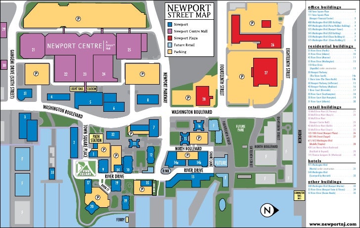
Actually, the site plan shows even more open space, perhaps as much as 60%
But what about the undeveloped parcels? There are three undeveloped sites around Newport Green Park, totaling 13.06 acres. Assuming they are developed to the same density as north Newport^^, that yields 3.60 acres of open space, or 9.6 acres covered by buildings^^^.

If we consider "greater north Newport" to be the sum of developed north Newport + undeveloped north Newport + Newport Green Park (4.93 ac), that yields 24.02 acres. According to our methodology, 9.99 acres of that will be open, or 49.6% of the site. This compares favorably with south Newport's 52.5%.
Can this be replicated elsewhere in Newport?
Yet because of choices in how the "open space" is placed, north Newport's 49.6% will be far more effective, and far more heavily used, than south Newport's 52.5%.

That's because north Newport's open space won't be decanted into small enclosure-destroying plazas and port-cocheres the way south Newport's were. Instead, it'll be concentrated into one well-sized neighborhood park, a place that's already well-loved, despite the fact that but a single development abuts it.

_________
* It is notable that the Erie-Lackawanna's other predecessor railroad, the Delaware, Lackawanna & Western, had built what was perhaps the best non-Pennsylvania Railroad freight route from New York west. But when I-80 was built through Paterson, the State bought part of the E-L's low-grade mainline; freight movements on the replacement route, a commuter branch now part of the New Jersey Transit's Montclair-Boonton Line, proved less than ideal (and is, in fact, cited as a contributing factor as to why the E-L failed to outcompete its collapsing competition). Had the E-L retained the track connection through Paterson, it is likely that Conrail would have favored that -- shorter -- mainline to Buffalo, which in its turn would have favored more intensive passenger use of the Water Level Route -- today's Empire Corridor.

** Which should have been preserved and renovated IMO.

*** Or possibly just the success of Battery Park City (built by the same developer). Though, that said, Battery Park City has perhaps the blandest streetscape of any Manhattan neighborhood.

^ Incidentally, fully planned as early as 1939, which helps explain the unusual insertion of a Main Street when similar postwar projects (cf. Lafayette Park, Co-op City) favored small strip malls.

^^ Which may or may not be likely.

^^^ But what about streets? There has to be automobile access, especially on the huge northernmost parcel!

Wednesday, June 10, 2015

What does $777.3 million buy you?

According to the Business Journal, American Water is getting a $164 million tax break to move to Camden.

This is on top of this short list of other companies who have been bribed into moving into Camden:

Here are a few other companies that have moved to Camden as part of a 2013 state law that increased incentives for employers who moved to Camden:
• Volunteers of America Delaware Valley(VOADV) was approved for $6.3 millionto consolidate administrative offices into one facility in Camden rather than a location in Bensalem, Pa.
• Subaru of America netted $118 million in tax breaks to move its U.S. headquarters from Cherry Hill to Camden.
• Cooper Health System received $40 million to move about 350 administrative jobs now located in Cherry Hill and Mount Laurel back to its main campus in Camden.
• The Philadelphia 76ers obtained $82 million in tax breaks to build a practice facility and corporate headquarters.
• Holtec International received $260 million in tax breaks to build a manufacturing facility.
• Lockheed Martin was provided with $107 million in assistance to relocate employees from Moorestown to Camden.
All told, this is about $777.3 million, more than three-quarters of a billion dollars to get companies to locate in Camden.

While Camden is a challenged market in all sorts of ways, and it is likely significant public subsidy is needed to jump start it, this isn't how to do it. This is just sheer economic poaching -- shuffling jobs around without actually creating new jobs. What impact to the region's economy is there if VOADV is in Bensalem instead of Camden? The Sixers in Philadelphia instead of Camden? Lockheed Martin in Morrestown instead of Camden? The article says:
If American Water leaves its Voorhees, N.J. headquarters for Pennsylvania, then New Jersey will lose about 600 jobs on top of hundreds of potential new jobs that would go into constructing American Water's new campus.
If American Water was to move their corporate HQ to Pennsylvania, would they move it to Moon Township? Of course not: that would involve uprooting ensconced executives. It would stay in the Philadelphia area (winding up, most likely, in Bensalem).

The economic impact of this strategy is nil. There is no net change in regional economic productivity. There are no new jobs, no new work. All this does is marginally change commuting patterns. And while it's nice that the new Camden jobs would be close to PATCO, is this marginal access improvement really worth $777.3 million in public money? Instead of subsidizing existing jobs, wouldn't that $777.3 million be better spent elsewhere?

If the goal really were to make more jobs instead of simply bribing companies to go where you want them to, wouldn't a far more effective program be a small business incubator in Camden?

Wednesday, May 27, 2015

Quick Note On PATH

Found this AP wire today: http://www.philly.com/philly/business/transportation/304536631.html

Mayor Zimmer is right not to be happy, and to be suspicious of PATH's stated motives. Decreasing the frequency from six minutes to seven does indeed decrease the line's throughput and capacity -- by almost 15%, in fact, assuming all else remains the same (same consists, etc.) Given the fact that the trains are already congested, this move will only further increase congestion within New York's largely transit-dependent commute market.

In other words, this move will not increase capacity. In fact, it will only make the capacity problem worse. The rank hypocrisy in the press release is appalling.

There are good reasons for reducing the frequency. The rolling stock might need to be rebuilt; this reduces the trains on hand and so requires frequency reduction. Perhaps the tunnel needs some work. (Though that can be done off-peak.) But to judge whether the plan has merit, PATH needs to be transparent.

And in lying, it proves it is not.

Saturday, May 2, 2015

A New Vision for Reyburn Plaza

With JFK Plaza (aka LOVE Park)'s redesign plans being released --  to Inga Saffron's acclaim -- the city is now reinvesting in two of the three large parks surrounding City Hall. Each of the parcels is different: Dilworth Park was created to provide a large plaza abutting City Hall itself (it destroyed the Arcade Building and part of the Broad Street Station headhouse to do so) and was recently transformed from the underwhelming, sunken, dreary, depressing Dilworth Plaza into Dilworth Park, a gracious front entrance to City Hall facing West Market; LOVE Park is set atop a sunken parking garage at the base of the Parkway and is currently a semi-successful granite-stepped mess; and lastly there was Reyburn Plaza.
LOVE Park Redesign
The oldest of them all, Reyburn was built to replace Penn Square when City Hall was finished. Once home to the Municipal Bandshell, Reyburn was built between North Penn Square (now JFK Boulevard) and Arch, Broad and 15th, and later extended west to 16th. It's hard to ascertain how successful a public space it was in the prewar era, but it was quadrisected by streets: a cutoff of Broad Street the subway ran under, the foot of the Parkway, 15th Street. It had probably failed by some point or another as the space was split into the modern-day LOVE Park and the Municipal Services Building (whose hardscape plaza is still officially called Reyburn) by the 1960s.
Dilworth Park
In any event, Reyburn is definitely the black sheep of City Hall's park collection.

The Planning Commission is very much aware of this. Indeed, in the Central District Plan, the Commission recommended several small-scale fixes for the plaza. As This Old City noted some time ago, these proposals amount to a small-scale fix filling the plaza's edge with pavilions instead of large granite retaining walls. These pavilions would have rooftop plaza space, providing a unique park feature as well.
Possible vision for Reyburn
But the real problem is that Reyburn Plaza is a failed park. Even as the area around City Hall has redeveloped, Reyburn also has the fewest residences around it -- both today and potentially: it is almost ringed by public structures. And -- competing with two viewshed-protecting parks (one heavily funded and programmed) -- it has few, if any, advantages to set itself apart.
Infrastructure under Reyburn Plaza
The biggest issue Reyburn faces, though, is the underground infrastructure. The Broad Street Line subway was built under the cutoff; the Center City Commuter Connection (Regional Rail tunnel) runs under the southern edge of the site; the southwest corner is nicked by the Parkway's viewshed. None of these issues are insurmountable, especially with the use of creative engineering.

And finally, there's the Municipal Services Building itself. Half a century old, the structure is aging, hard to navigate, and poorly laid out (despite the dramatic payment spaces in the basement). Mechanicals abut 15th, which makes opening the wall facing LOVE Park difficult; much of the office space lies in a dark, underlit basement. The structure needs a top-to-bottom overhaul, and the City could well consider rightsizing the space.

Develop Reyburn Plaza

Park space is only as valuable as how well it's used. Even on good days, Reyburn is an empty, windswept, trash-strewn cartoon of a plaza with its giant Sorry pieces scattered about. Its bleak desolation sets North Broad's fourth-fiddle tone, and there are few opportunities to capture value from the blocks abutting it, given the wealth of public and nonprofit development. The city owns some juicy development parcels of its own nearby (the Gallery's three unused tower bases, Blanche Levy Park at 16th and the Parkway, and the parking lots at 13th and Arch and 15th and Cherry) to put a new, better-designed MSB on -- if not an outright long-term lease. Sale of Reyburn Park's land would offer a cash stream for this. And it's not like this is the only park in the area: indeed, it's one of three in addition to sitting at the foot of the Parkway in its own right.

A Program For Development


The sketch above shows a proposed program of development. The MSB (in red) would be retained, but subject to a gut reno like Southwest DC's Sky House was. Once the EPA's offices, Sky House is today a large condo building. Kling's lobby and cashiering spaces would be maintained, but the building's mechanicals would be moved to where the basement office floor today lies; this frees up the Kling spaces, as well as the spaces facing 15th, for active ground-floor uses.

Above that, on the deck, an al fresco dining area would be established overlooking LOVE Park. This could be treated like the cafe in the Comcast Center plaza -- or like the Independence Beer Garden at the base of the former Rohm & Haas building. A pavilion, bus shelter, and small headhouse would be established at the corner of 15th and JFK.

Ten North Broad would extend along the Broad Street side. A large mixed-use structure, Ten North Broad would share loading and mechanicals facilities with the new MSB; its main mass would lie along the Broad Street side, while its load would be diffused on either side of the subway tunnel. The elevator core would lie in its southeast corner.

Finally, the plaza would be split into two smaller components: first, at the corner of 15th and JFK, it would preserve the Parkway viewshed; second, an interior plaza between the two buildings would provide an amenity space for the project's residential component.

Reyburn Plaza is obsolete, outmoded, and underutilized. It's not a public amenity anymore. It's time to return it to private hands.

Monday, September 29, 2014

Kansas City Can Do It Better

(This post started as a fork from the previous post, The Streetcar Fiasco.)

Let us recall, for reference,  Width, and the Perception of Width and Multiway Boulevards, Transit Avenues.

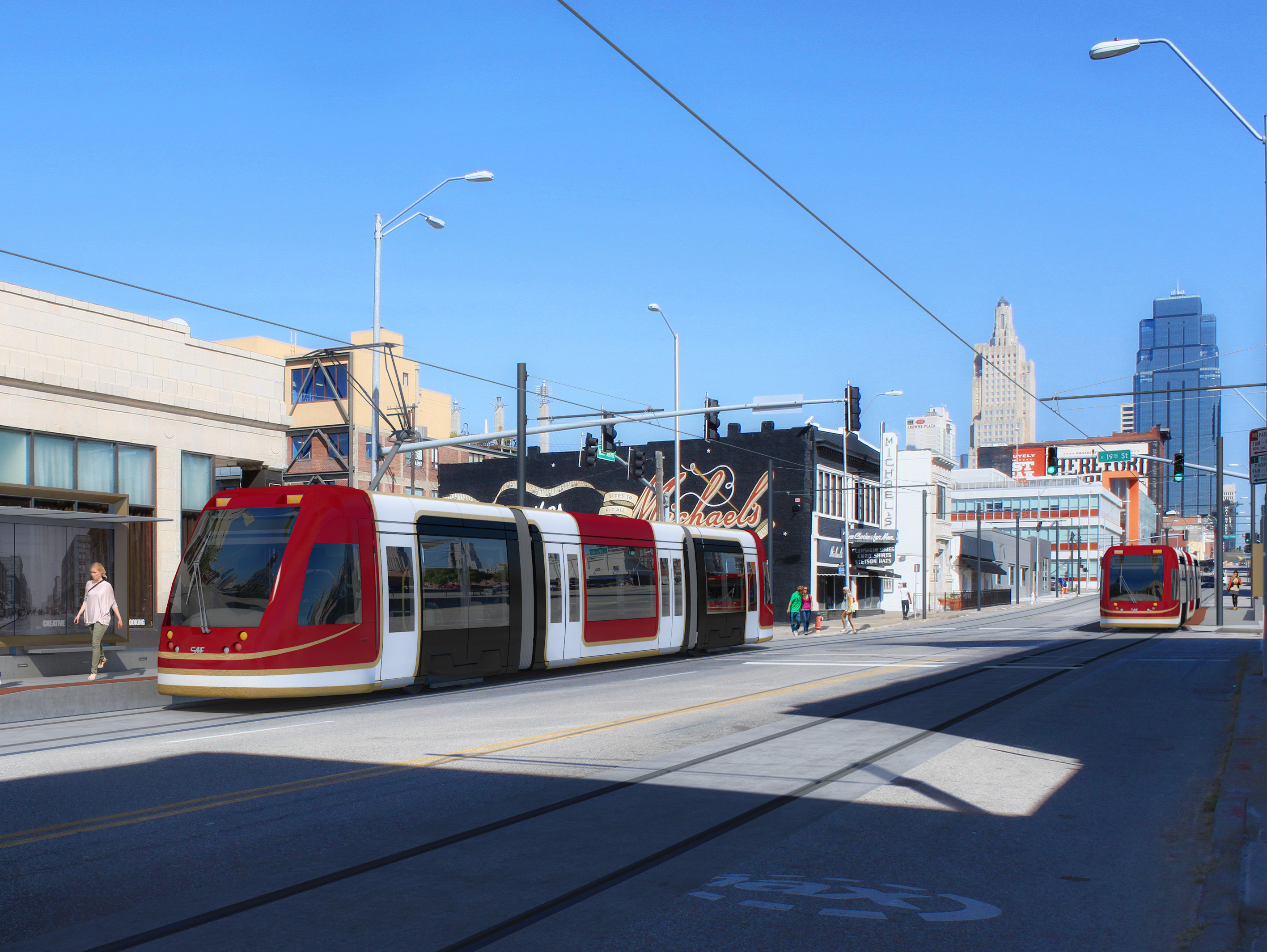
Kansas City Streetcar render
Kansas City's Main Street is only 80 feet wide -- 10 feet narrower than H Street -- but has nothing like the latter's congestion. Yet there are two southbound lanes and one northbound lane, and during "peak" periods the parking lanes turn into bus lanes. The streetcar is a mere drag-and-drop effort into the existing system.
The narrowest a street can be and still have full light rail is a mere 70 feet. At this width, several compromises have to be made, sure -- in particular, on blocks hosting stops, parking lanes need to be removed -- but they are as nothing compared to the scale of the compromises that need to be made on
60-foot streets. And remember, Kansas City's Main Street is a -- measured -- 80 feet wide.
Sample (pre-Streetmix) sections
In fact, we can have our cake here and eat it too. The nature of Kansas City's layout allows us to route core bike infrastructure on Broadway Boulevard and Grand Boulevard, which gives Main Street plenty of room to handle all of light rail's needs. Like so (with a parking space where the stop isn't).
A second option would be to kill parking spaces on one side of the street. It may be preferable to construct a street layout like this between stops. (Note that, in this layout, the parking space may also be claimed as a parklet where sufficient pedestrian energy to do so exists.)
In both, however, it becomes evident there is plenty of space for proper light rail, instead of copying a failed experiment from elsewhere in the country. More creative thinking's all that's needed.

Well, that, and a willingness to give up traffic lanes.

Friday, September 26, 2014

The Streetcar Fiasco

Streetcars have become a major fad over the past few years, ever since Portland put in theirs.
Portland Streetcar
In Portland's case, the streetcar is a pretty decent investment: it acts as a circulator overlay on a high-quality light rail system. But after they put theirs in a bunch of other cities began to construct streetcars for themselves.
H Street Line, Washington, DC
DC's H Street line was the second major streetcar; it is also the first that suggested an underlying problem. You see, H Street is supposed to be a spine corridor, linking the city's east side with its west. It thus needs to be built to a higher standard capacity than ... that.
This particular design -- at the time, novel* -- contains two catastrophic mistakes that permanently mar this line's capacity:
  1. The line has been built in a mixed traffic lane rather than be given its own dedicated lane. This reduces the streetcar's speed and makes it no better than a bigger bus on rails. Part of what makes light rail successful** is the dedicated lane. Without this lane the line is unable to bypass car congestion and thus provide the positive time differential that helped justify e.g. Salt Lake's investment.
  2. The line has been built in the outer lane. This second point makes it own strange kind of sense -- once you've decided not to build a dedicated ROW, there's something vaguely suicidal about asking passengers to run across a traffic lane unless you're willing to put carstops in, and if you're doing curb bumpouts as well, then why not put those there? However -- by putting the streetcar track in the outer lane you create conflicts between the streetcar and parallel parkers, delaying the transit vehicle for a single driver. These kinds of conflicts slow down vehicles on our country's remaining historic streetcar lines all the time -- one of the reasons Boston's Green Line is one of the most reliable is because (unlike the examples in Philly, Toronto, and San Francisco) the vast majority of the surface system lies in dedicated medians.
H Street was a difficult design challenge. The street is, surprisingly, 90 feet wide, and it is fairly congested -- its AADT hovers a little above the max capacity of a two-lane street -- and a full light-rail buildout would have likely required (among other things) taking of a parking lane significant street reconfiguration, much like 1st Street in San José, a bright spot in the VTA system.
1st Street, San José
Indeed, it is arguable that the H Street Line's optimal placement would have been for the light rail to lie between the sidewalk and the parking lanes, with a road diet reducing auto capacity just enough to convince (some) drivers to Take Other Routes. This arrangement, however, remains problematic in its own right, and is not the thrust of this post -- and I have talked about these kinds of things before.
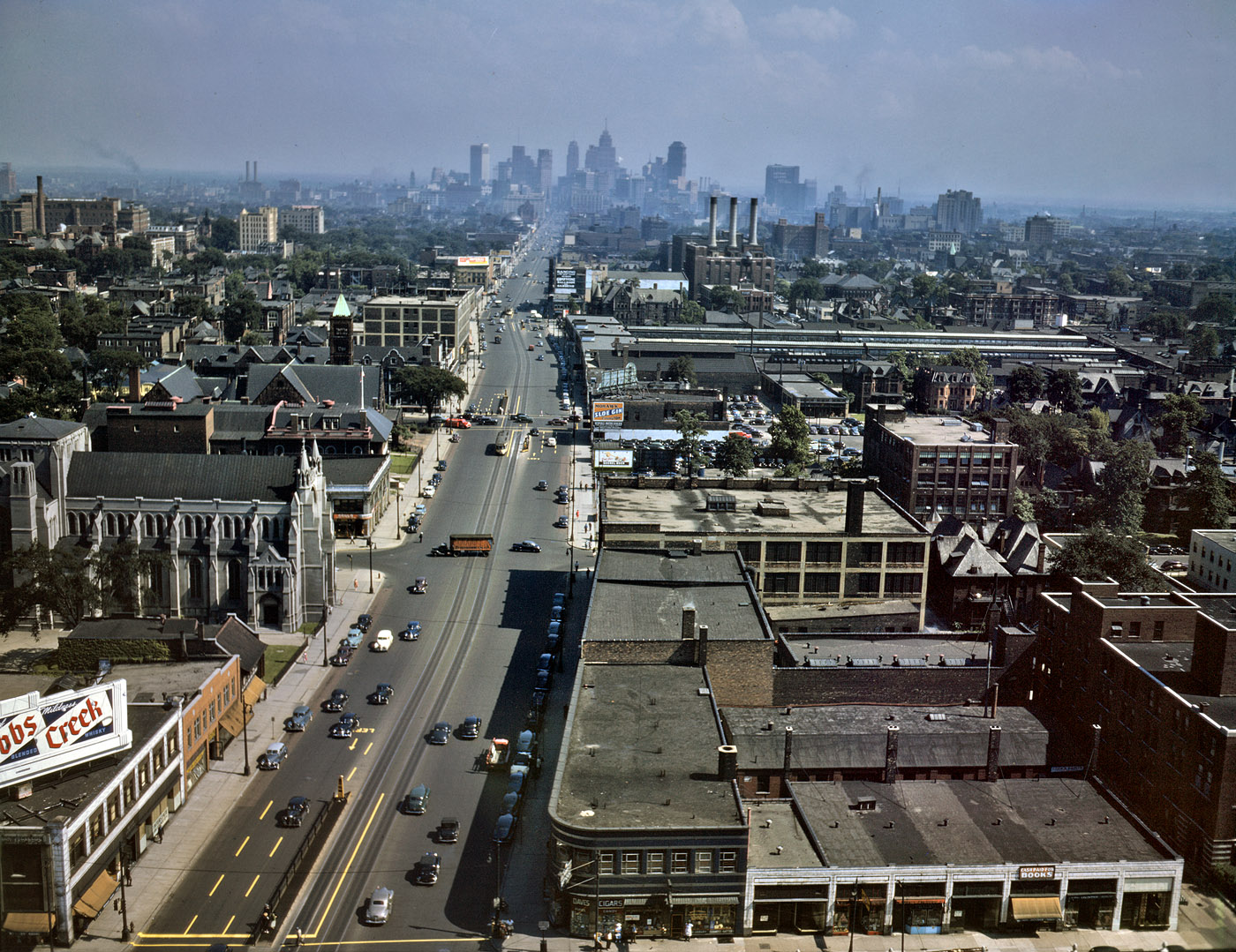
Woodward Avenue, ca. 1942. Note that even then there was little real congestion.
M-1 Streetcar plan reveals same engineering failures as H Street -- this time, with even less excuse.
At least two Midwestern cities have taken the (failed) H Street approach and applied it to themselves: Detroit and Kansas City. I haven't been to Detroit, but I will note that Woodward Avenue, which is eye-poppingly wide relative to traffic, can easily accommodate every single mode, if the designers chose to.
Kansas City Streetcar render
What is perhaps most shameful is that within these ... things ... lies the fact that the powers-that-be continue to refuse to give up any street space for cars, no matter how ridiculous the car gluttony may be *cough cough Detroit, Kansas City cough cough*, and are packaging it as a political sop to Millennials.

No. The transportation investment that would please us the most is in quality bike infrastructure. We want to ride around everywhere. Bike-friendly cities are Millennials' cities.
____________
* Portland's downtown streets are only 40 feet wide; historic streetcars ran in the middle of the street. (See, for example, Philly's trolleys.)
** And good BRT -- Cleveland's Euclid Avenue being the only such example in the United States today.

Thursday, September 25, 2014

Kansas City: Challenges

In my last post I talked about the potential Kansas City's rail alignments offer. Now I want to discuss the challenges.
Fig 1. Here we see Kansas City's essential commuter rail problem: the rail axis (red) is essentially orthogonal to the urban axis (black). The red and the black. Heh.
Locals and expatriates may have already realized the most significant challenge: namely that, unlike in e.g. Munich, Kansas City's urban core is pretty much orthogonal to the proposed regional rail core (Fig. 1). They intersect, in fact, at Union Station. This undermines the vast majority of urban-centered uses (although the Peculiar Line offers a connection to Swopes Park and hence the Zoo). To put it bluntly, Kansas City's urbanity and attractions are on a different axis entirely relative to where the trains go.

While a challenge, this is not an insurmountable problem. Union Station is adjacent to two major districts in its own right, and skillful connection-making with the Main Street corridor -- which is the urban axis, and one that desperately needs light rail -- allows for the distribution pattern, north to downtown and the River Market, and south to Westport, Country Club Plaza, and Brookside, needed to tie the regional system in with the urban system.

It is notable that the Market-Frankford Line (the El),  Broad Street Line (subway), and Subway-Surface Lines (trolleys) have similar roles in Philadelphia; our major urban playgrounds -- Fishtown/Northern Liberties, Old City, Passyunk Square, Fairmount, and University City -- are about as far afield of each other as they are of Center City proper. We often come in on Regional Rail and transfer to these other modes.*

Fig 2. Here we see the lack of routes to KCI. A potential alignment (black) is given.
A second issue (Fig. 2) is the lack of any route to Kansas City International (KCI). While several commentators point out the relative lack of cost-effectiveness of airport links in their own right, if one is "on the way" service to it is naturally justifiable. Wheeler Airport is alongside the Missouri Bluffs Line, for example; service to it is natural and intuitive. But KCI is a far larger and more important facility, and is extremely far from anything on-the-way. Reaching it would require some sort of shuttle service, if not a new alignment (redirection of the Missouri Bluffs Line? AirTrain?) of some sort.
Fig 3. Rail v. highway alignments in eastern Kansas City. Note how rail will be hard-pressed to compete on any sort of time advantage.
Finally (Fig. 3) one of the most difficult aspects of commuter rail is the fact that all the various alignments funnel into the Union Station approach in the northeast of the city proper. While not a particular issue for intercity rail, it is problematic for commuter rail -- especially the Peculiar Line -- whose run from Grandview to Union Station (Crown Center) is about 4.5 miles longer (~22 miles) than the shortest highway alignment -- US 71 to the south Loop (~17.5 miles). Assuming the train's mean velocity is 30 mph, this yields a 45 minute schedule time; contrast this with half an hour in clear traffic (50 mph average velocity**) and broadly equivalent time (42 mins) in free flow modulated by the worst stop-and-go Kansas City has to offer (average velocity: 25 mph)***.

On the coasts, we often find that riders are willing to sacrifice a certain percentage of their time for the luxury of not having to drive^. Even so, we find that commuters shy away from commutes lasting more than an hour. This leaves open the question: if the runtime into Union Station is 45 minutes, then can we ensure that the final phase of the trip (assuming it's not terminating at Crown Center) is only in the 15-minute range? This, too, can be solved by offering close connections with a light rail trunk along Main Street (as noted above)^^.

To summarize: Kansas City has significant advantages in developing a commuter rail network -- but the currently available alignments are not without their drawbacks. And since the city core was developed along streetcar trunks and grand boulevards rather than along the railroads (the paucity of railroad suburbs is notable, and is probably one of the major reasons the urban region remains relatively compact), there are going to be investment thresholds that have to be met to offer service at a quality good enough to tap the necessary markets to be justifiable.

The largest challenge is that -- in Kansas City especially -- for commuter rail to be viable, it will have to be linked into a high-quality mass transit system^^^. In much of the Midwest, here included, "quality" and "mass transit" remain a contradiction in terms.
___________
* A second aspect is that other playgrounds, further out (Mount Airy, Chestnut Hill, Manayunk, the Main Line) are well-connected with the Regional Rail system as well. Consider, then, the Turkey Creek Line, which goes to Olathe, the Independent Line to Lee's Summit, and the Lawrence Line to, well, Lawrence.
** There are random traffic lights and a not-insignificant 45 mph stretch along this route. Also people do weird things in Kansas City like follow the speed limit -- even in the 90+% of instances where it's nonsensical.
*** Maths: We are not attempting to calculate acceleration (i.e. acceleration is being considered a zero vector). Therefore the normal position equation under constant acceleration, s=vt-(at^2)/2, where s is position, v velocity, a acceleration, and t time, collapses to s=vt, which we then rebalance to t=s/v to obtain time (and convert from hours to minutes).
^ This needs to be modeled. We can see it anecdotally, and it happens often enough that it can no doubt be statistically aggregated -- but how much is it?
^^ We're going to deal with what's currently being built on Main Street soon enough.
^^^ At least in the urban core.

Wednesday, September 24, 2014

Kansas City: Potential

So for various reasons -- some of which are probably related to hormones and such -- my thoughts have taken a recent Midwestern turn. In particular, I find myself interested in the two largest cities in Missouri, a state that is essentially two Pittsburghs with a whole lot of Lancaster County in between. Being interested in commuter networks, I immediately set about applying my tried-and-true coastal methodology to these cities to see what would pop out.

Since I was there recently, my first target is Kansas City.

I found myself surprised that there was a more substantive rail network there than I'd expected; indeed, when I did some research into it I discovered that the city used to be the Midwest's second-largest rail hub (a role I had assumed fell to Omaha, the Union Pacific's historic railhead and the reason why there were once easily half a dozen mainlines traversing Iowa). Considering it, however, reveals that it makes sense: all of the four major Eastern through routes -- Pennsylvania, New York Central, Baltimore & Ohio, and Alphabet route (via the Nickel Plate) had termini in Chicago and St. Louis; while the latter's role is customarily understated, it quickly becomes evident that there were few direct linkages between it and Omaha, and four between it and Kansas City (i.e. the Burlington, Rock Island, Missouri Pacific, and Katy). Kansas City thus served as a transshipment point for freight following the transcontinental alphabet route that began with the Western Pacific and followed the Rio Grande mainline across the Rockies, spreading into a raft of competing lines from Denver east. This trade route is followed by the modern I-70 corridor. It was also a principal interchange point of the Santa Fe and a handoff point where the mainlines of the major Texas-Midwest railroads (Katy, Missouri Pacific, Frisco, and Kansas City Southern) met those of the lines following the Missouri (or heading into Iowa) heading further north, towards Omaha and Minnesota. (This trade route is followed by the I-35 corridor.) All of this made for a list of about half a dozen major railroads heading into Kansas City: the Santa Fe, Burlington Route, Rock Island, Katy, Mo-Pac, Frisco, and Kansas City Southern. Nearly all of these had lines in from multiple compass directions.
Fig 1. Major alignments into Kansas City
We can see  this in Fig. 1, which shows the identifiable freight corridors into the city. Count 'em up -- there are sixteen of them! And that doesn't count lines that were almost certainly abandoned between then and now; it is easy to forget that railroads built the Midwest, and the largest cities were -- and still are -- rail hubs.

From these we winnow out several routes. Some pass through populated areas but are too circuitous; others run out through largely rural regions. We seek out a string of populous towns en route -- town center stations generally help revitalize these places while also providing a built-in ridership base. Kansas City's metro region is relatively small -- most lines are about 30 - 40 miles long. It is also one that does not have any significant all-day congestion (indeed, it clearly has auto capacity overbuild: you're lucky to get the 8:00 AM stop-and-go on US 71 at noon out on the Schuylkill heading towards King of Prussia, and many surface streets -- especially the most heavily-engineered ones -- have desertion issues, a clear sign of excessive capacity relative to demand); we thus need seek the most direct routes to Union Station, the city's lone major rail hub. A system such as we would demand in Chicago and the large coastal cities -- frequent all-day service -- is probably beyond any reasonable resource allocation; instead, we'll have to settle for high-frequency rush-and-periphery* service on the weekdays, medium-high frequency all-day service Saturdays**, and medium-low all-day service on Sundays. Union Station is a through-station so we'll be able to immediately run regional service; this requires line balance. Finally, the station approaches -- especially immediately west -- present extremely high-grade grade-separated passenger rail alignments; we seek to make use of these.
Fig 2. Key Corridors
From this we define the eight route (plus one branch) system shown in blue on Fig. 2.
  1. Beginning along the Missouri northwest of town and moving counterclockwise, we have the Leavenworth Line, which links Kansas City, MO, with Kansas City, KS, and with Leavenworth, KS, with its prison and fort.
  2. Next we have the Lawrence Line, which runs along the Kansas River west to Lawrence, tapping KU.
  3. Down in the southwest, we have the Turkey Creek Line, which runs along the Turkey Creek corridor through the richest part of the region towards Olathe and Spring Hill. If at all possible, we would like to add a branch to Gardner to this route (however, it does not appear this is possible).
  4. Directly south of the city is the Peculiar Line, which runs along the Blue River into the city and connects with Grandview and namesake Peculiar.
  5. Southeast of that, we have the Independent Line, which connects with Independence and Lee's Summit. This route should be the most heavily-trafficked on the east side.
  6. To its northeast is the Eastside Line, which runs out to Blue Springs.
  7. Jumping across the Missouri, we have the Excelsior Line, named after its Excelsior Springs terminus. It also sports a branch north to Kearney.
  8. Finally, we have the Missouri Bluffs Line, serving an area along the Bluffs.
Projected line pairings are as follows:
  • the Turkey Springs Line is paired with the Independent Line;
  • the Leavenworth Line is paired with the Peculiar Line;
  • the Lawrence Line is paired with the Eastside Line; and
  • the Missouri Bluffs Line is paired with the Excelsior Line.
These pairings strive to match considerations of demographics and length -- that is, we're seeking a Lagrangian balance of ridership and runtime. We're also attempting to have similar runtime throughout the system -- we want no run to take more than 60 minutes. Kansas City is small enough that none should.

Next we'll talk about Kansas City's major challenges.

___________
* I.e. around "the periphery of" rush hour. We'll also need late-night service more than noontime.**
** This is because we'll be seeking to tap two markets: first, conventional commuters (particularly to Crown Center, and secondarily towards downtown via the streetcar), and second, the out-on-the-town crowd that would prefer leaving their cars at home. There's also a student market, as most of the lines have at least a midsize school along them, and the terminus of the Lawrence line is KU. Finally, in one case, there's a major prison -- Leavenworth -- and its concomitant visitors' market.

Wednesday, March 26, 2014

The Definition of Insanity

From Landscape Urbanism and its Discontents, courtesy Envision Baltimore:
Rather than having an urban fabric based on spatial definition by buildings, landscape would be the 'structuring medium.' The 'look and shape of the city' was to be a matter of 'open space within which buildings are set'.
It didn't work the first time; it's not going to work again.

Monday, March 24, 2014

Bouncing around my mind

Pertinent to this post:

Since the PPA has no inkling of what the actual supply of any of their permit zones actually is, they routinely issue far more permits than spaces that can possibly handle those permits. Anecdotal evidence (courtesy a certain foulmouthed blogger) suggests, for example, that PPA Zone 4 currently has ~2x the permits its physical constraints can possibly handle.

Their ignorance--abetted by the fact that one has ever found a way to assess onstreet supply (until now)--is the only way they can get away with this. The implicit guarantee of a permit is that you are entitled to a place to park in the area where it's issued; if you have more outstanding residential permits than residential spaces, you've reneged on that implicit guarantee. Hint hint.

Wednesday, March 19, 2014

That Eureka Moment

One of my long-term projects has been developing a mathematical model for scheduling in Jarrett Walker-type transit systems. Today, I made a breakthrough--

I had previously realized that a model of such a system would yield two intersecting planes in my defined 3-space, and that desired overall frequencies could be model by stacking instances of these planes atop each other. But I'd been at a loss as to how to model the routes within the planes (other than the fact that they were vectors).

What I realized today, however, is that the planes are actually a set of null space vectors; this means that a prescribed eigenvalue in the null space will seed an eigenvector that corresponds to that value. What that means is that the entire system can be modeled with nothing more than the equations of the two intersecting planes, and the set of eigenvalues that yield the eigenvectors corresponding to the known bus routes.

Fortunately, we remain in vector space so far, but it appears the apparatus I'm constructing will wind up generalizing into a differential equation, to accommodate "gridlike" systems which attempt to install a mass transit grid even over non-grid street networks.

Friday, March 14, 2014

Dominion

I've been playing a lot of Skyrim lately, and ruminating on Elder Scrolls lore, so if you pardon this nerding-out, I'd like to offer my opinions on what will happen in the next game.

1. It will be called Dominion, and be based in the heartland of the Aldmeri Dominion (Summerset Isle).

2. No matter how you play Skyrim, things turn out for the Dominion's benefit. Canonized lore will have it that the Dragonborn completed the Assassin's Guild questline (ends with the assassination of Emperor Titus Mede II), whose end results in the fragmentation and collapse of the Tamrielic Empire. The whole civil war questline ends up in the dustbin of history; in a certain sense, it does not matter whether or not the Empire or Ulfric wins, as the whole of Tamriel splits into a bevy of statelets which the Dominion then vacuums up.

3. Thalmor religious persecution has developed into full-blown genocide. And Mundus is worse off for it; in fact, it's buckling.

4. It will be the Hero's job to assume Talos' divinity and stabilize Nirn and the firmament. The second-most-important task is destabilization of the Dominion, by now roundly considered evil. 

Of course, this doesn't undermine the ability to make moral choices--an Elder Scrolls staple--any more than the Empire's overarching existence's does Daggerfall. It's likely that Dominion's principal moral hazard lies in how the Hero goes about unifying the resistance, and be informed by various groups having different degrees of moral rectitude and likelihood of carrying out their resistance.

5. Freedom of movement--to a significant degree--will be curtailed, especially in the early game. (Full freedom of movement occurs in the late game.) No matter how you go about it, the Hero will quickly be branded an enemy of the Thalmor state, and so will need to get quite good at avoiding Justiciars, at least until you're powerful enough to take them head-on. Much of the early game will thus take on elements of getting from Place A to Place B without attracting authorities' interest, and creating and inculcating friendly bases throughout Summerset. The Dragonborn you ain't.

Coll. Incidentally, the Shouts mechanic will be implemented here, but in a vastly different way. It's likely that, in the lore, under the Last Dragonborn's influence, Shouting was developed from a "special skill" to a school of magic built on the Greybeards' teachings.

Coll 2. It's likely that Summerset's traditional joinable factions will be closed to non-Altmer (particularly if they keep this Nazi thing going). I'd bet that the "real" joinable factions will involve some combination of hidden factions and under-the-table dealings with traditional ones closely associated with the Thalmor, and relative freedom for the ones that aren't. So, for example, the Assassins' and Thieves' Guilds will be significantly easier to join than the Fighters' Guild or local Mages' Guild variant (unless that turns out to be the Psijic Order, which has zero known relations with the Thalmor overlords).

I don't really know what's on Bethesda's storyboards, but these ideas seem like they'd make the best possible Elder Scrolls game to me. Certainly, gameplay mechanics in Dominion will have a very different, unique, and interesting twist to them, particularly since what we know of the Thalmor implies that the next game will have to encourage stealth-based gameplay to a far greater extent than previous installments ever did.

Thursday, March 13, 2014

A Sample Program

Some notes on what a sample elhi math program would look like...

Grades 1-3: Introducing Relations
  • What are relations?
  • What are operators?
  • What are numbers?*
  • Numbers in real life
  • Telling Time, Counting Money
  • Relations Between Numbers
  • Operators Symbolize Relations
  • Simple Arithmetical Operations
  • Add and Subtract any Pair of Numbers
  • Simple Multiplication and Division (to 10)
Grades 3-6: Greek Math, Intermediate Arithmetic
  • Geometry and Ratios
  • Plato's Meno
  • Archimedes and the Method of Exhaustion
  • Multiplying and Dividing Larger Numbers
  • Multiplying and Dividing Fractions
  • Decimals, Zeros, Negative Numbers
  • How to Use an Abacus
  • Pythagorean Theorem
  • etc. 
Grade 7: Geometry. Elements. Euclid.
Grade 8: Algebra. The Compendious Book. al-Khwarizmi.
Grade 9: Analytic Geometry. La géométrie, Descartes.
Grade 10a: Trigonometry.
Grade 10b: Calculus.
Grade 11: Discrete Math.
Grade 12: Elective (if so chosen)
  • Combinatorics
  • Boolean algebras (logic, set theory, etc.)
  • Linear algebra
  • Multivariable calculus
  • Graph theory
  • etc.
___________
*Note order. The relations are more important than the numbers. For example, a first-grade project could be to make a family tree (create a statement of relations), and then a way to link any two members of the tree together without long text block or, well, the tree (that is, create operations). We then introduce the standard operators (perhaps in the context of the family tree project). Numbers also have to be introduced early, but teaching relations and operations needs to be separate than numbers for a while because (1) we want students to have a major aha! moment when we merge the two together, and (2) by teaching the relational/operational aspects separately from numbers, we can focus students' attention on the fact that mathematics is really relational in nature.

Wednesday, March 12, 2014

Pedagogy

I am very much of the opinion that the way we teach math here is fundamentally broken. Here are a few places where I think it can be fixed:

1. Use Greek geometry to help teach children how to experiment in math. Consider texts like Plato's Meno as an inspiration. Projects at the elementary school level could replicate Socrates' solution for finding a square with half the area as the original square (and its--easier--natural extension, a square with double the area). Projects can grow more complex* until e.g. a fifth or sixth grader can prove the Pythagorean Theorem. Using Greek math also helps introduce a deeper understanding of ratios (fractions), something teachers have confided in me American students have gotten progressively worse at.

2. Emphasize the relation, not the input and output. This is for arithmetic. Right now our arithmetic is rote, tabular, a strict interpretation of inputs into outputs. But the core of mathematical analysis is relational. Operators are nothing more than a statement of relation: We need to find a way to teach as such, instead of getting bogged down in numbers to an inordinate degree.

3. Reclaim the ancients' works. Of particular note, there is no reason whatsoever why Euclid's Elements, the standard textbook on geometry for more than two millennia, is not used in high school classrooms today. Likewise, analytic geometry should be based on Descartes' La géométrie (with van Schooten commentary and an augment of Fermat etc. papers and more illustrations); algebra, al-Khwarizmi's Compendious Book. Euler's textbooks can also be considered, but his treatment of trigonometry with complex numbers is perhaps a bit too Baroque for a modern audience. The flow algebra -> analytic geometry -> calculus also needs to be emphasized, as it is actually quite a bit more natural than most people realize. There is a case to be made that the middle school curriculum can run Euclid -> al-Khwarizmi -> Descartes, with standard calculus instruction occurring no later than the sophomore year of high school (and is a freshman subject for most students).

4. Rebuild the calculus pedagogy. One of the reason why calculus is perceived to be "hard" is because it begins with limits, but limits are discussed with insufficient tools for their analysis; by the time differentiation and integration are gotten around to, too many minds have been closed to those operations' ease and intuitive arising. Instead the pedagogy should begin with the easier operations, and once a good handle has been gotten on differentiation and integration proceed to the discussion of limits, why they matter, and how calculus operators both depend on limits and make calculating limits bearable. In addition, calculus needs to be used to cement the relational nature of math, as the elementary system is just an augment of unary function operators on analytic geometry (the only unary operation most students are exposed to prior is arithmetical negation--the difference between 2 and -2). Making use of Newton's, Leibniz's, the Bernoulli's' etc. papers is also useful, although at this point the textbooks begin to massively improve in quality.

5. Make discrete mandatory, and prerequisite to linear algebra. There are several reasons for this: (1) discrete math effectively functions as Intro to Higher Math; (2) a lot of linear algebra is essentially set theory and function theory in vector spaces; (3) with programming-language knowledge now needed even in the fine arts (according to UArts students) understanding its underpinnings is more important than ever; and (4) being able to perform in other types of discrete math, like combinatorics, is becoming increasingly necessary in our modern-day world. Understanding iterated operations and floor and ceiling functions, for example, should be SAT-level expectations.

6. Embrace models. Current mathematical pedagogy ill prepares us to actually put math to real-world use--the construction of models. This is universally covered in the various applied disciplines, but being able to construct simple models such as speed v. time (yielding velocity, acceleration, and jerk) or simple binary-string-based programs should be a skill shared by all high-school graduates. Grasping the principles needed in such modeling allows students to develop significantly more complex models to fit and extrapolate available data.

7. Embrace tradition. My final major critique is that most (not all) math teachers I've had have had little interest in exploring the tradition of math. While there are always students that complain about classroom trivia, it does a serve an important pedagogical purpose: It links learners to the discipline's tradition, helps open avenues for exploration, is often entertaining and a break from the hard work of the day, and generally makes the discipline more human, and therefore more interesting. This is true throughout most disciplines--it is hard to imagine a physics class, for example, without mention of Galileo or Newton or Einstein, or a philosophy class without Descartes, Spinoza, Leibniz, or Nietzsche; why, then, does the mathematical pedagogy persist on undervaluing its human component?

My experience with math is that when I graduated high school, I had a deep, fundamental, abiding hatred of it; it took nearly a decade to learn what I needed to to overcome this hatred. Mathematics is not valued in our society (but nor is literature); the problems turn on deep-seated pedagogical issues that tend to idealize math as a sterile, mechanical thing, instead of embracing its true nature as a very human endeavor, and a very human logical construct. To teach math right--teachers must humanize it, no matter how great the temptation otherwise.
____________
*For example, utilizing Archimedes' method of exhaustion to find a range for π (for fifth graders, for example).

Tuesday, March 11, 2014

Rebuilding the Diesel Network

In Gunn's Great Mistake, I outlined what I believe was SEPTA's greatest failure during the Center City tunnel construction era--namely that, in the name of tunnel electrification, SEPTA eliminated all of its diesel commuter services. While it is fair to note that the tunnel construction itself consumed all of the agency's resources, and thus that staff wouldn't have wanted to touch diesel-network issues with a ten-foot pole, I am also certain that had there been a will, there would have been a way.

Now I want to concentrate, going forward, on the moves necessary to recreating this network.

1. Build the Swampoodle Connection. A Swampoodle Connection, in its strongest form, has multiple uses: Not only does it shunt the Chestnut Hill West Line down the Reading trunk, it also offers a grade-separated junction between the Northeast Corridor and the SEPTA mainline. This is because (incremental) construction of the Connection is, at each step, an order of magnitude less expensive than the expense needed to rehabilitate Pencoyd back to the standard necessary for active rail service.

Because of this, Swampoodle would naturally include another connection beyond the ones I previously noted, as it would need to provide the following paths:
  • NEC to SEPTA Mainline
  • NEC to R6 Line
  • Chestnut Hill West Branch to SEPTA Mainline
Of these, the first was never considered, but is not difficult to extend the design to add it in.

2. Work with NJ Transit for Newark Service. NJT's West Trenton proposal: After all, the combined SEPTA and NJT route reflects the Reading's Crusader alignment; a direct train would offer a secondary Philadelphia-New York commuter service to complement the very busy Keystone Service - Northeast Regional trains. With a high-quality Swampoodle Connection (and Kearny Connection at the other end), this would allow for regular Suburban Station-Newark Penn trains.

3. Integrate with Reading commuter rail. 'Nuff said.

4. Rebuild the Bethelehem Branch north of Shelly. Not only that, but extend it into Allentown. This would complement NJT's own Lehigh Valley designs. It would also help springboard work on the key (missing) regional connection from Philadelphia to Scranton and beyond.

5. Rebuild the Newtown Branch north of Fox Chase. 'Nuff said.

These projects--Swampoodle in the core supporting reconstructions and upgrading (return to service) of SEPTA's 1980 commuter rail network--would do more than just return our system (nearly) all the way to its Bicentennial extent, it would also offer a framework to hang more rail expansions from. For example:

6. Consider the Octoraro Branch. Kennett Square is a strong natural terminus, and the Brandywine Valley, while semi-rural, has centralized population centers. Reactivation of the Octoraro Branch, while requiring ROW reconstruction from Chadds Ford to Wawa, would also offer improved service to the Concordville/Painters Crossing/Brinton Lake area.

7. Consider the Perkiomen Branch. While the line up the Perkiomen has been abandoned for so long that the ROW has been severed in places, the region also holds several good conurbations crying out for better service: Collegeville, Schwenksville, and the Green Lane/Pennsburg/Red Hill complex, to name a few. Reclamation of this line would improve access to these towns.

8. Consider the New Hope Branch. While the line out of Ivyland runs through the at turns exurban and rural Buckingham Valley, New Hope, despite its size, offers strong destination value.

This list can be augmented until one runs out of historic easements. Pennsylvania has been blessed with a wealth of good, high-quality small towns--not all of them even near historic rail easements--and while their continued development is by no means tied to rail access, the access itself functions as an augment, offering improved transportation choices to these places. And the key is, a reborn diesel network functions as a framework for providing service to these awesome places. This is, more than anything, our ancestors' endowment to us: Isn't it time to make it be all it can be?