Showing posts with label regional rail. Show all posts

Thursday, September 25, 2014

Kansas City: Challenges

In my last post I talked about the potential Kansas City's rail alignments offer. Now I want to discuss the challenges.
Fig 1. Here we see Kansas City's essential commuter rail problem: the rail axis (red) is essentially orthogonal to the urban axis (black). The red and the black. Heh.
Locals and expatriates may have already realized the most significant challenge: namely that, unlike in e.g. Munich, Kansas City's urban core is pretty much orthogonal to the proposed regional rail core (Fig. 1). They intersect, in fact, at Union Station. This undermines the vast majority of urban-centered uses (although the Peculiar Line offers a connection to Swopes Park and hence the Zoo). To put it bluntly, Kansas City's urbanity and attractions are on a different axis entirely relative to where the trains go.

While a challenge, this is not an insurmountable problem. Union Station is adjacent to two major districts in its own right, and skillful connection-making with the Main Street corridor -- which is the urban axis, and one that desperately needs light rail -- allows for the distribution pattern, north to downtown and the River Market, and south to Westport, Country Club Plaza, and Brookside, needed to tie the regional system in with the urban system.

It is notable that the Market-Frankford Line (the El),  Broad Street Line (subway), and Subway-Surface Lines (trolleys) have similar roles in Philadelphia; our major urban playgrounds -- Fishtown/Northern Liberties, Old City, Passyunk Square, Fairmount, and University City -- are about as far afield of each other as they are of Center City proper. We often come in on Regional Rail and transfer to these other modes.*

Fig 2. Here we see the lack of routes to KCI. A potential alignment (black) is given.
A second issue (Fig. 2) is the lack of any route to Kansas City International (KCI). While several commentators point out the relative lack of cost-effectiveness of airport links in their own right, if one is "on the way" service to it is naturally justifiable. Wheeler Airport is alongside the Missouri Bluffs Line, for example; service to it is natural and intuitive. But KCI is a far larger and more important facility, and is extremely far from anything on-the-way. Reaching it would require some sort of shuttle service, if not a new alignment (redirection of the Missouri Bluffs Line? AirTrain?) of some sort.
Fig 3. Rail v. highway alignments in eastern Kansas City. Note how rail will be hard-pressed to compete on any sort of time advantage.
Finally (Fig. 3) one of the most difficult aspects of commuter rail is the fact that all the various alignments funnel into the Union Station approach in the northeast of the city proper. While not a particular issue for intercity rail, it is problematic for commuter rail -- especially the Peculiar Line -- whose run from Grandview to Union Station (Crown Center) is about 4.5 miles longer (~22 miles) than the shortest highway alignment -- US 71 to the south Loop (~17.5 miles). Assuming the train's mean velocity is 30 mph, this yields a 45 minute schedule time; contrast this with half an hour in clear traffic (50 mph average velocity**) and broadly equivalent time (42 mins) in free flow modulated by the worst stop-and-go Kansas City has to offer (average velocity: 25 mph)***.

On the coasts, we often find that riders are willing to sacrifice a certain percentage of their time for the luxury of not having to drive^. Even so, we find that commuters shy away from commutes lasting more than an hour. This leaves open the question: if the runtime into Union Station is 45 minutes, then can we ensure that the final phase of the trip (assuming it's not terminating at Crown Center) is only in the 15-minute range? This, too, can be solved by offering close connections with a light rail trunk along Main Street (as noted above)^^.

To summarize: Kansas City has significant advantages in developing a commuter rail network -- but the currently available alignments are not without their drawbacks. And since the city core was developed along streetcar trunks and grand boulevards rather than along the railroads (the paucity of railroad suburbs is notable, and is probably one of the major reasons the urban region remains relatively compact), there are going to be investment thresholds that have to be met to offer service at a quality good enough to tap the necessary markets to be justifiable.

The largest challenge is that -- in Kansas City especially -- for commuter rail to be viable, it will have to be linked into a high-quality mass transit system^^^. In much of the Midwest, here included, "quality" and "mass transit" remain a contradiction in terms.
___________
* A second aspect is that other playgrounds, further out (Mount Airy, Chestnut Hill, Manayunk, the Main Line) are well-connected with the Regional Rail system as well. Consider, then, the Turkey Creek Line, which goes to Olathe, the Independent Line to Lee's Summit, and the Lawrence Line to, well, Lawrence.
** There are random traffic lights and a not-insignificant 45 mph stretch along this route. Also people do weird things in Kansas City like follow the speed limit -- even in the 90+% of instances where it's nonsensical.
*** Maths: We are not attempting to calculate acceleration (i.e. acceleration is being considered a zero vector). Therefore the normal position equation under constant acceleration, s=vt-(at^2)/2, where s is position, v velocity, a acceleration, and t time, collapses to s=vt, which we then rebalance to t=s/v to obtain time (and convert from hours to minutes).
^ This needs to be modeled. We can see it anecdotally, and it happens often enough that it can no doubt be statistically aggregated -- but how much is it?
^^ We're going to deal with what's currently being built on Main Street soon enough.
^^^ At least in the urban core.

Wednesday, September 24, 2014

Kansas City: Potential

So for various reasons -- some of which are probably related to hormones and such -- my thoughts have taken a recent Midwestern turn. In particular, I find myself interested in the two largest cities in Missouri, a state that is essentially two Pittsburghs with a whole lot of Lancaster County in between. Being interested in commuter networks, I immediately set about applying my tried-and-true coastal methodology to these cities to see what would pop out.

Since I was there recently, my first target is Kansas City.

I found myself surprised that there was a more substantive rail network there than I'd expected; indeed, when I did some research into it I discovered that the city used to be the Midwest's second-largest rail hub (a role I had assumed fell to Omaha, the Union Pacific's historic railhead and the reason why there were once easily half a dozen mainlines traversing Iowa). Considering it, however, reveals that it makes sense: all of the four major Eastern through routes -- Pennsylvania, New York Central, Baltimore & Ohio, and Alphabet route (via the Nickel Plate) had termini in Chicago and St. Louis; while the latter's role is customarily understated, it quickly becomes evident that there were few direct linkages between it and Omaha, and four between it and Kansas City (i.e. the Burlington, Rock Island, Missouri Pacific, and Katy). Kansas City thus served as a transshipment point for freight following the transcontinental alphabet route that began with the Western Pacific and followed the Rio Grande mainline across the Rockies, spreading into a raft of competing lines from Denver east. This trade route is followed by the modern I-70 corridor. It was also a principal interchange point of the Santa Fe and a handoff point where the mainlines of the major Texas-Midwest railroads (Katy, Missouri Pacific, Frisco, and Kansas City Southern) met those of the lines following the Missouri (or heading into Iowa) heading further north, towards Omaha and Minnesota. (This trade route is followed by the I-35 corridor.) All of this made for a list of about half a dozen major railroads heading into Kansas City: the Santa Fe, Burlington Route, Rock Island, Katy, Mo-Pac, Frisco, and Kansas City Southern. Nearly all of these had lines in from multiple compass directions.
Fig 1. Major alignments into Kansas City
We can see  this in Fig. 1, which shows the identifiable freight corridors into the city. Count 'em up -- there are sixteen of them! And that doesn't count lines that were almost certainly abandoned between then and now; it is easy to forget that railroads built the Midwest, and the largest cities were -- and still are -- rail hubs.

From these we winnow out several routes. Some pass through populated areas but are too circuitous; others run out through largely rural regions. We seek out a string of populous towns en route -- town center stations generally help revitalize these places while also providing a built-in ridership base. Kansas City's metro region is relatively small -- most lines are about 30 - 40 miles long. It is also one that does not have any significant all-day congestion (indeed, it clearly has auto capacity overbuild: you're lucky to get the 8:00 AM stop-and-go on US 71 at noon out on the Schuylkill heading towards King of Prussia, and many surface streets -- especially the most heavily-engineered ones -- have desertion issues, a clear sign of excessive capacity relative to demand); we thus need seek the most direct routes to Union Station, the city's lone major rail hub. A system such as we would demand in Chicago and the large coastal cities -- frequent all-day service -- is probably beyond any reasonable resource allocation; instead, we'll have to settle for high-frequency rush-and-periphery* service on the weekdays, medium-high frequency all-day service Saturdays**, and medium-low all-day service on Sundays. Union Station is a through-station so we'll be able to immediately run regional service; this requires line balance. Finally, the station approaches -- especially immediately west -- present extremely high-grade grade-separated passenger rail alignments; we seek to make use of these.
Fig 2. Key Corridors
From this we define the eight route (plus one branch) system shown in blue on Fig. 2.
  1. Beginning along the Missouri northwest of town and moving counterclockwise, we have the Leavenworth Line, which links Kansas City, MO, with Kansas City, KS, and with Leavenworth, KS, with its prison and fort.
  2. Next we have the Lawrence Line, which runs along the Kansas River west to Lawrence, tapping KU.
  3. Down in the southwest, we have the Turkey Creek Line, which runs along the Turkey Creek corridor through the richest part of the region towards Olathe and Spring Hill. If at all possible, we would like to add a branch to Gardner to this route (however, it does not appear this is possible).
  4. Directly south of the city is the Peculiar Line, which runs along the Blue River into the city and connects with Grandview and namesake Peculiar.
  5. Southeast of that, we have the Independent Line, which connects with Independence and Lee's Summit. This route should be the most heavily-trafficked on the east side.
  6. To its northeast is the Eastside Line, which runs out to Blue Springs.
  7. Jumping across the Missouri, we have the Excelsior Line, named after its Excelsior Springs terminus. It also sports a branch north to Kearney.
  8. Finally, we have the Missouri Bluffs Line, serving an area along the Bluffs.
Projected line pairings are as follows:
  • the Turkey Springs Line is paired with the Independent Line;
  • the Leavenworth Line is paired with the Peculiar Line;
  • the Lawrence Line is paired with the Eastside Line; and
  • the Missouri Bluffs Line is paired with the Excelsior Line.
These pairings strive to match considerations of demographics and length -- that is, we're seeking a Lagrangian balance of ridership and runtime. We're also attempting to have similar runtime throughout the system -- we want no run to take more than 60 minutes. Kansas City is small enough that none should.

Next we'll talk about Kansas City's major challenges.

___________
* I.e. around "the periphery of" rush hour. We'll also need late-night service more than noontime.**
** This is because we'll be seeking to tap two markets: first, conventional commuters (particularly to Crown Center, and secondarily towards downtown via the streetcar), and second, the out-on-the-town crowd that would prefer leaving their cars at home. There's also a student market, as most of the lines have at least a midsize school along them, and the terminus of the Lawrence line is KU. Finally, in one case, there's a major prison -- Leavenworth -- and its concomitant visitors' market.

Tuesday, March 11, 2014

Rebuilding the Diesel Network

In Gunn's Great Mistake, I outlined what I believe was SEPTA's greatest failure during the Center City tunnel construction era--namely that, in the name of tunnel electrification, SEPTA eliminated all of its diesel commuter services. While it is fair to note that the tunnel construction itself consumed all of the agency's resources, and thus that staff wouldn't have wanted to touch diesel-network issues with a ten-foot pole, I am also certain that had there been a will, there would have been a way.

Now I want to concentrate, going forward, on the moves necessary to recreating this network.

1. Build the Swampoodle Connection. A Swampoodle Connection, in its strongest form, has multiple uses: Not only does it shunt the Chestnut Hill West Line down the Reading trunk, it also offers a grade-separated junction between the Northeast Corridor and the SEPTA mainline. This is because (incremental) construction of the Connection is, at each step, an order of magnitude less expensive than the expense needed to rehabilitate Pencoyd back to the standard necessary for active rail service.

Because of this, Swampoodle would naturally include another connection beyond the ones I previously noted, as it would need to provide the following paths:
  • NEC to SEPTA Mainline
  • NEC to R6 Line
  • Chestnut Hill West Branch to SEPTA Mainline
Of these, the first was never considered, but is not difficult to extend the design to add it in.

2. Work with NJ Transit for Newark Service. NJT's West Trenton proposal: After all, the combined SEPTA and NJT route reflects the Reading's Crusader alignment; a direct train would offer a secondary Philadelphia-New York commuter service to complement the very busy Keystone Service - Northeast Regional trains. With a high-quality Swampoodle Connection (and Kearny Connection at the other end), this would allow for regular Suburban Station-Newark Penn trains.

3. Integrate with Reading commuter rail. 'Nuff said.

4. Rebuild the Bethelehem Branch north of Shelly. Not only that, but extend it into Allentown. This would complement NJT's own Lehigh Valley designs. It would also help springboard work on the key (missing) regional connection from Philadelphia to Scranton and beyond.

5. Rebuild the Newtown Branch north of Fox Chase. 'Nuff said.

These projects--Swampoodle in the core supporting reconstructions and upgrading (return to service) of SEPTA's 1980 commuter rail network--would do more than just return our system (nearly) all the way to its Bicentennial extent, it would also offer a framework to hang more rail expansions from. For example:

6. Consider the Octoraro Branch. Kennett Square is a strong natural terminus, and the Brandywine Valley, while semi-rural, has centralized population centers. Reactivation of the Octoraro Branch, while requiring ROW reconstruction from Chadds Ford to Wawa, would also offer improved service to the Concordville/Painters Crossing/Brinton Lake area.

7. Consider the Perkiomen Branch. While the line up the Perkiomen has been abandoned for so long that the ROW has been severed in places, the region also holds several good conurbations crying out for better service: Collegeville, Schwenksville, and the Green Lane/Pennsburg/Red Hill complex, to name a few. Reclamation of this line would improve access to these towns.

8. Consider the New Hope Branch. While the line out of Ivyland runs through the at turns exurban and rural Buckingham Valley, New Hope, despite its size, offers strong destination value.

This list can be augmented until one runs out of historic easements. Pennsylvania has been blessed with a wealth of good, high-quality small towns--not all of them even near historic rail easements--and while their continued development is by no means tied to rail access, the access itself functions as an augment, offering improved transportation choices to these places. And the key is, a reborn diesel network functions as a framework for providing service to these awesome places. This is, more than anything, our ancestors' endowment to us: Isn't it time to make it be all it can be?

Monday, March 10, 2014

Gunn's Great Mistake

One of the major moves David Gunn made, while he was head of SEPTA back in the late '70s and early '80s, was the curtailment of its regional rail lines back into electrified territory, a move rail advocates have regretted ever since. The stated reason was that the new Center City Commuter Connection wouldn't allow scheduled diesel service, implicitly that the Reading Terminal was going to be closed down. But the problem is that this was a red herring: SEPTA's planners could have, with some clever easement tricks, retained diesel services into 30th Street or Suburban Stations. Below is one way I penciled out how.
That isn't to say there aren't structural weaknesses. Without a proper Swampoodle Connection, trains to Newtown and Newark (at minimum) are forced to use the freight alignment on the west side of the Schuylkill, for example; to avoid overloading this line, I use the Stony Creek Branch to bring trains out of Bethlehem into Philly via the R6 alignment. (A minor advantage of this setup is that it would have forced SEPTA to repair the Pencoyd Viaduct in 1986 instead of truncating the Ivy Ridge line back to Cynwyd.)

--The counter to this, though, is that the vehicles providing this service, Budd RDCs, were ending their design life at the time*, and their replacement, the SPV-2000, was so atrociously bad only the really clueless agencies ever ordered them.

--Countering that counter one would note that this was the era of the Comet I and the F40PH; again, had service retention been paramount, there would have been a way. But of course, all the political will of the era was focused on the tunnel, which leaves to us the task of picking up the pieces.

Monday, February 17, 2014

Regional Rail for Connecticut

This is my broad plan for regional rail throughout the state of Connecticut.
It would not be connected to any commuter network, though parts of it duplicate the New York commuter system. Rather, it would be Connecticut's part of a regional passenger rail network covering all of New England, as well as offering regular--hourly--intercity service.
Built from the framework of the now-defunct New Haven Connecticut network (the only non-NH line in all of CT, prior to Conrail, was the Central Vermont's line to New London in one of the state's most sparsely populated sections), this network is designed as a 2x4 grid. More routes access denser western Connecticut, while fewer routes reach its more rural eastern half.

The Lines
  • The Inland Trunkline, NH's predecessor railroad New York & New England's mainline, runs from Poughkeepsie to Woonsocket. It would here link to Providence via RRI's Blackstone Valley Line and Boston via the MBTA's Franklin Line*.
  • The Along the Shore Line, the former New Haven mainline and current Northeast Corridor mainline, runs from New York to Westerly en route to Boston**.
  • The Housatonic Valley Line runs from New York, diverging from Along the Shore at Norwalk, crossing the Inland Trunk at Danbury, and on up the eponymous river valley between the Taconics and Berkshires to North Canaan en route to Pittsfield and North Adams***.
  • The Naugatuck Valley Line runs from New Haven to Winsted via Bridgeport, Waterbury, and and the Housatonic's tributary, the Naugatuck. Alone of all of these lines, it does not have any connection at its northern end^.
  • The (Lower) Connecticut Valley Line runs from New Haven to Springfield via Hartford. It is a core service already offered by Amtrak and funded by CT DOT. Key scheduling improvements center around ensuring hourly clockface and excellent connections.
  • The Quinebaug Valley Line is named for the Thames River tributary it follows for most of its length. Located in relatively rural eastern Connecticut, it runs from New London to Worcester^^.
The Equipment
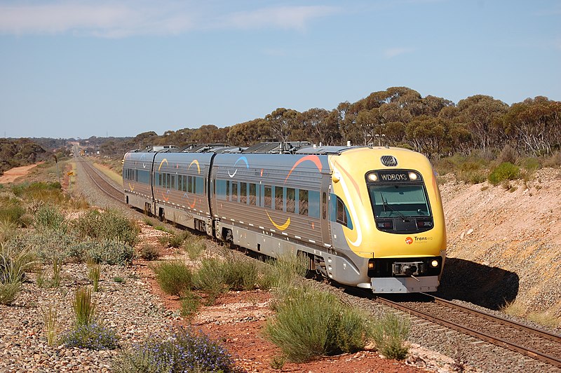
Just one of these lines is electrified; only two will require dual-mode locomotion. The majority of service will concentrate around DMUs, like UGL Limited's elegant Prospector model (top), Class 222 (above) the Stadler GTW (below), Siemens Desiro (bottom), or some other example (like Bombardier's Talent).
Such equipment would be used throughout the wider New England system, forming the fleet backbone; over time, each route would become electrified, until EMUs can provide most of the service. This would happen in an order of progression from higher-volume routes to lower-volume ones.

As New England is a collection of small states whose regional-level rail would need to be unified, Connecticut regional rail can be expected to be no more than a part of the overall system. To see the whole, then, requires understanding this project's connections to Rhode Island and Massachusetts systems.
___________
*At Woonsocket, it would connect to Rail Rhode Island's Blackstone Valley Line; it would also connect to an extension of the MBTA's Franklin Line to its natural terminus (i.e. Woonsocket). The section between Putnam and Blackstone would supersede RRI's Putnam Branch, which brings the alignment up the Woonasquatucket back into play--especially if the alignment can be reclaimed to Webster.
**The New Haven Line and Shore Line East currently inhabit this alignment. In fact, Shore Line East offers part of a convenient operations nucleus to build the network around, even if (as commuter services) it would be turned over to MNRR. Along the Shore would also need the least resources of any of these lines, principally filling in Northeast Regional service gaps (if any) and ensuring an MNRR-RRI connection at Westerly.
***From North Canaan to North Adams is Massachusetts' purview. North Canaan itself is a pretty poor terminus. The line itself would duplicate MNRR commuter/regional service to New Milford (extended from the current terminus at Danbury).
^This line duplicates MNRR from Bridgeport to Waterbury.
^^Incidentally, this also allows me to cut RRI's own Thames Valley Line back from Norwich to Plainfield.

Monday, February 10, 2014

Realigning Providence

Note: This post supersedes Providence Alignments (PA) and part of Regional Rail from Providence, East (RRPE). Both will be referred to in the text, however.

Having developed a high-quality regional rail network focused on Providence, we find ourselves in a bit of a pickle. Figure 1 shows what it is.
Fig. 1. Diagram of ultimate RRI operations + MBTA P.L. under current track alignments
The problem is that, under current conditions, the whole network is highly unbalanced; of the four lines (plus one branch each) and the MBTA Providence Line (P.L.), fully 80% approach Providence Station from the east. Figure 2 shows what we want instead. Specifically, we want the Blackstone Valley Line to approach Providence from the west. That way, it can feed into the Mount Hope Bay Line (cf. RRPE), thereby forming an X-frame S-Bahn-esque structure.
Fig. 2. Desired RRI +MBTA P.L. operations.
To do this, however, we'll have to take a new look at central Providence. Figure 3 shows Providence Station's current and attainable alignments, unchanged from PA Fig. 9.
Fig. 3. PA core network (Fig. 9 there)
But to bring the Blackstone Valley Line in from the west, we need an entirely new station approach, and that implies an entirely new station; using Union Station as our template (Figure 4) would continue to yield an eastern--rather than western--approach for that line.
Fig. 4. Providence Union Station
The historic alignment suggests that the least disruptive path, Figure 5, would be to recurve on the old Union Station alignment, forming, essentially, a tight wye. This would undoubtedly require the demolition of One Citizens Plaza and/or the partial culverting of the Mossashuck at its mouth. It also requires a new Providence Station facility along Main Street between Steeple Street and Throop Alley. However, the curvature required for this alignment is ... problematic ... to say the least. And One Citizens Plaza (Figure 6) presents its own problems.
Fig. 5. Tight curve
A better alignment is available, however. Thanks to highway engineers, (Figure 7) we have decent, if still tight, curvature from Memorial Drive to the I-95 alignment. Continue on it a short way (about a thousand feet) and you can recurve back onto the existing alignment. And with this curve, we can bring Union Station back into play, instead of needing a new facility in tight confines.
Fig. 6. Like a giant middle finger sticking into the air
At this point, the existing Providence Station is outmoded, and so too are the central Providence discussions in PA and RRPE. There is no way to make it from the 95 alignment onto its west approach--the curvature is just too tight. And because it is outmoded, once the replacement is built, the old facilities can be closed, subdivided, and resold.
Fig. 7. I-95 alignment
A Headache

The biggest problem, however, is that of rethreading a reasonable facsimile of the old New Haven alignment through from I-95 to the East Side Rail Tunnel portal. While some of it is easy--there's a fairly clear station box from the Courtyard to the Woonasquatucket--much of it is difficult.

Chief among the difficulties are (a) those of weaving a rail line through the I-95/US-6/Memorial Drive interchange, and (b) dealing with One Citizens Plaza.
Fig. 8. Weaving a rail alignment into Providence's core
First of all, however, we'll note that (c) that the East Side Tunnel portal has what appears to be +15' elevation with respect to Main Street. While we could undercut the tunnel's west approach and the westernmost part of the tunnel itself, the least expensive option requires utilizing as much of the old rail grade as is salvageable. As there is no room to grade a -30' difference (to -15' elevation with respect to Canal Street)--that would require 3,000' at a 1% ruling grade--and hence have a sunken station box and low bridge, and as route utilization mandates grade separation, we'll assume that the station box is at the historic Union Station level, i.e. +15' relative to Exchange Street. This drives elevation*.

This means that the solution to (b) is to route the station's east approach through One Citizens Plaza's south, well, plaza. In place of the plaza, a lobby extension and/or other use would front the Woonasquatucket-Moshassuck confluence; minor takings would be required for the necessary curvature to return to the original alignment. (Unfortunately, those buildings are obviously historic, but since some idiot went and built an office building right in the middle of the old alignment, you're kind of stuck between a rock and a hard place.) This section would be built on a trestle in order to encourage integration of "ground rights" under it by adjacent owners.
Fig. 9. New rail alignments in Providence's core
For (a), this drives the elevation of the trestle over the intersection of Memorial and Francis; the trestle's existence also has the handy side effect of forcibly road-dieting what is, by all appearances, a fairly ugly stroad. Further on, several interchange flyovers would need to be regraded and rebuilt as the railroad curves onto an embankment and heads down a 1.6% grade to make a 30' elevation change in 1900'. (Use Figures 8 and 9, and this file to help understand how the rebuilt grade is integrated into existing infrastructure.)**

Our final consideration is the station plant itself. We renovate and reopen the old Union Station waiting room and ticket offices, as well as provide a sheltered concourse in the old underpass; secondary platform accesses are on Exchange Street. The box, trestled, allows for active uses under it; the smallish, redundant greenspace cater-corner to Burnside Park--a beautiful common--would be eliminated in favor of TOD, as would the larger, also-redundant greenspace between the current Providence Station, Providence Place mall, and the State House greensward. (Among other things, development would better frame the State House along Francis St.)
_____________
*Much to my chagrin. I really wanted it to be sunken.
**One elegant solution would be to rebuild the interchange as one large surface roundabout, with routes feeding into it from US-6, I-95, and Memorial Drive.

Monday, February 3, 2014

Rail Rhode Island

Where we last left off, we discussed the infrastructural challenges associated with bring regional rail to southeastern Rhode Island. This was precipitated by a consideration of Providence alignments.
New Haven map of Boston and Providence rail networks
Now I'd like to come full circle, and pare the New Haven alignments maps down to a good state network for Rhode Island.
New Haven alignments from Providence
Why a state network?

Rhode Island is perhaps unique in a couple of core attributes. First, it is dominated by a single city, Providence. This in itself is not unique. But second, it is such a size that the state is very nearly ringed by natural destinations--and a system serving these destinations would have approximately the same dimensions as a typical commuter rail system. That is, what makes Rhode Island unique, from a transportation planning standpoint, is that its state needs are fulfilled by what is essentially a large commuter system.
Natural destinations from Providence--cities and places surrounding, but not far, from Rhode Island. At right, Cape Cod.
The actual commuter elements are concentrated in a far smaller part of the network: to Bristol, to Fall River, to Woonsocket, to Kingston, to Mansfield, to West Warwick. The greater system is built on a series of "Lancaster Model" regional links.

The Lancaster Model

Consider the city of Lancaster, PA. It is a small city of only about 60k--a third of Providence's. It is linked, however, to Harrisburg, Philadelphia, and New York with regular (almost hourly) trains. And this regularity drives ridership both to the east and west. So, despite Lancaster and Harrisburg's small sizes--the latter is 50k--regular service drives outsize ridership.

Actually, what makes Lancaster a useful model is that, globally, it is typical. A midsize city with good rail service realizes good ridership, much better than what most American examples have been capable of. The small cities along the Empire Corridor--Rochester, Syracuse, Schenectady, Utica, Albany--likewise realize outsize ridership. So do the smaller cities on the San Joaquin in California. And so do New Haven and New London. So an optimal regional model strings services between these cities.

This, in turn, allows us to see natural termini at
  • Worcester
  • Framingham
  • Putnam
  • Norwich
  • New London
  • Newport
  • New Bedford
  • Boston
  • Cape Cod
in addition to the tighter belt of commuter services.
Rail Rhode Island
And from New Haven lines from Providence to these natural termini flows this nine-line network. From northwest counterclockwise:
  1. Blackstone Line. Service to Worcester via Woonsocket and the Blackstone Valley.
  2. New York-New England Line. Splits from Blackstone Line at Blackstone; heads to Putnam via its eponymous right-of-way.
  3. Thames River Line. Follows the old New York-New England Providence branch to Plainfield, and the Thames Valley subdivision (New London-Worcester) from there down to Norwich. It would be reduced back to Plainfield in the presence of Connecticut regional rail.
  4. Mystic Line. Follows the Northeast Corridor to Waverly; there meets Shore Line East trains. (Extension of the latter is already on the drawing boards.)
  5. Narragansett Bay Line. Dubbed "Bristol-Newport Line" last post, renamed after the bay it runs alongside.
  6. Mount Hope Bay Line. Formerly dubbed "Fall River-New Bedford Line", likewise renamed after a bay it passes.
  7. Cape Cod Line. Extends from Providence to Middleborough via Attleboro and Taunton. Formerly route of the Cape Codder. You may note it doesn't actually reach the Cape; more on this later.
  8. Providence Line. Existing MBTA alignment along Northeast Corridor.
  9. Patriot Line. Service to Framingham via Foxborough. Named for the fact it passes Gillette Stadium.
Services on these lines would run hourly, while services from the commuter termini run fifteen minutes.

What's the Deal with Cape Cod, Anyway?

Cape Cod is a resort area, and a bit different than the type of service Rail Rhode Island is geared to offer. In fact, service to the Cape mainly needs to target weekenders, with vacationers and Cape denizens both being secondary categories. For this reason, peak service needs to be Friday-Sunday, rather than the workweek core of the commuter networks feeding into the Cape. And because a weekending population is less transfer-sensitive, it makes sense to run (or franchise) service from Middleborough on separately. (That said, a good connection is still self-evidently necessary.)
Cape Cod route/franchise
An Operations Agency

While Rail Rhode Island by itself is essentially built to offer service indistinguishable from other commuter/regional rail services in the United States and abroad, it does also have the potential to connect into a broader regional network. Most of New England can, in fact, be united by such a network. So a further avenue of exploration of development of a larger New England rail network, which large chunks of proposed Rail Rhode Island would be subsumed into.

A Providence Pickle

Providence has a bit of a pickle. Its track alignment only allows for through-running from all other lines onto either the Mystic or Thames Valley lines. This is untenable. Among other considerations, the Blackstone Valley and Mount Hope Bay Lines have, between them, the highest ridership potential; a through-routing for them must be found. Expect further discussion on this matter soon.

Friday, January 31, 2014

Railroad Suburbia 2.0

A lot of the New Urbanist corpus--particularly the town planning elements--focuses on the traditional town planning model. Their ultimate desire is to build communities like these:
Now the thing is the communities the New Urbanists have built
have tended to look a lot like
each of which happens to be a railroad suburb.

Railroad suburbs were primarily developed during the Victorian era, fin-de-siècle, and into the 1920s. Aping developers' success in using streetcar lines to sell new housing, several railroads decided to enter the development game themselves and build "New Towns" lineside. This pattern--small, semi-dispersed centers of population highly centralized around train stations (a major railroad suburb giveaway is when a train station lies at one end of Main Street) became a primary mode of outward urban expansion for the better part of a century, and has left us a rich heritage of the nicest, leafiest communities in cities all across the nation. And, despite catastrophic disinvestment in anything that wasn't a house farm from the 1950s to the early 2000s, railroad suburbs continued to be the effective archetype of quality American community.
(And sometimes they became something more.)

New Urbanism got its start replicating railroad suburbs as new towns--even if the original railroad discontinued passenger service, the railroad suburb is, for all intents and purposes, a new town. Duany and Plater-Zyberk folded in some Southern Baroque town planning tradition, and--voilà!--an alternative to house farms, Levittown tracts, and meandering anti-grids was born.

There are profound implications to this. First, one of the great successes of the movement is the re-creation of the railroad suburb. Transit-Oriented Development, an idea about as old as New Urbanism, is (in essence) a manner of development built on the workings of a railroad suburb.
In the eventuality transportation policy changes--as it must, if Italy is at the vanguard of the trend--we have reclaimed the development model associated with a smaller, smarter, more compact type of urbanism and town-building.

The key becomes, then, developing the right transportation policy: Most cities have enormous wealths of historical (largely disused) potential commuter rail lines--lines on which, were they active, we can hang New Urbanist (re)developments and intensification...These should be the avenues of growth in metros.


Monday, January 27, 2014

Regional Rail from Providence, East

Providence Union Station--back in the day
Alon Levy has kindly pointed out to me that none of the bypasses of the Providence curve really make sense for the stated purpose in the last post; time savings are minimal relative to expense for all of them. (That said, I maintain that the New Haven freight bypass alignment would be an all-around superior route had Union Station trackwork not been removed and erased in the 1970s. It is true, however, that there were excellent urban planning reasons to do something with the existing alignment--it's just that rail access was not considered a a high planning priority.)
New Haven in eastern MA and RI
Even so, the East Side Tunnel continues to have regional use. It is by far the best access alignment from Providence to cities to the southeast--Newport, Bristol, Fall River, and New Bedford. Indeed, it was historically used to provide commuter service from Providence to those latter two cities.
Slade's Ferry Bridge--a lost asset
While the closure and demolition of the Slade's Ferry Bridge severed the link between Providence and Fall River and thence Newport, it does not appear that the New Haven ever actually linked the route from Fall River to New Bedford with its line from Myricks to Newport. Figure 1 shows commuter rail to southeastern Rhode Island using only former New Haven lines.
Fig. 1. Historical NH alignments from Providence SE.
A Circular Argument

Follow the alignments, however, and you'll notice a pattern. Two major alignments historically linked Providence and Newport; they diverged at Fall River. One route linked to the Bristol branch at Warren; the other route ran up to Taunton and around via Attleboro back to Providence. Both are highly inferior alignments today. The implication is that any workable commuter rail from Providence southeast, which hits the four natural termini, must of necessity deal with the region's challenging topography--specifically its strewn-about fjordlike bays.
Mount Hope Bay
Of particular interest is the Mount Hope Bay, whose head is the Taunton River estuary up by Fall River, and mouth flows into the Narragansett Bay just south of Bristol, at the conveniently-named Bristol Point. New Haven easements are available all around Mount Hope Bay, but none provide a good crossing of Mount Hope Bay.
Fig. 2. Hypothetical single crossing of Mt. Hope Bay, superimposed on existing or available rail easements in the area. Reasons against further pursuit--long high bridge requiring access lines to New Bedford (right), Newport (bottom), and Fall River, as well as an excessive greenfield alignment cf. a two-crossing approach--are self-evident. Nearly every other potential single crossing of the bay yields the same, inferior, results.
The bay also demands two crossings. While a single crossing through its middle would theoretically be superior, such a crossing would (a) happen at its widest extent, requiring more than double the superstructure required by crossings at its head and mouth, (b) demand construction of lengthy new alignments to the crossing, and (c) induce excessive branching, needing no less than four different lines to reach each terminus. By contrast, the two-crossing approach allows for two lines--Bristol and Newport would be served by the same line, and Fall River and New Bedford the other.

Across the Taunton

Let us first turn our attention to the Fall River-New Bedford line (FRNB for short). This route is the unification of three discrete routes:
  1. The Somerset Branch, a trace alignment the New Haven abandoned at least prior to 1948. This alignment is salvageable from the junction with the Bristol Branch east to the Lee River crossing, just beyond which the Brayton Point power plant has obliterated the ROW*. This route used to extend across Slade's Ferry Bridge into Fall River.
  2. A Taunton River crossing.
  3. The Watuppa Branch, a good-quality easement from the former mills at the head of the Quequechan to New Bedford.
As good easements are available both east and west of the crossing, most of the time needs to be focused on the crossing itself. As it stands, there are two possible crossing routes:
  • The I-195 alignment across the Braga Bridge and under Falls River
  • The Slade's Ferry alignment with a new alignment built up the Quequechan's remnants to the Watuppa Branch.
These are shown in Figure 3, below. Note that the I-195 alignment, in green, is a good mile less than the Slade's Ferry alignment--thereby optimizing the former.
Fig. 3. Links across the Taunton. In red: the Slade's Ferry alignment that "more-or-less" shadows what's left of the NH alignment; in green, a more direct alignment up the I-195 corridor. Notice how green is dramatically shorter.
Over Bristol Point

The other connection needing to be made is the on the Bristol-Newport line (BN for short, heh). This line has been assembled together for the following three reasons:
  1. Remember what we said about a single-bridge alignment and excessive branching?
  2. A Taunton crossing following the I-195 alignment will by necessity make a cutoff down to the old NH alignment extremely difficult, and furthermore, impinge on potential station sites. No, it is better here to have the station to Boston riverside, and the one to Providence downtown.
  3. As previously stated, a Providence-Fall River-Newport alignment is relatively circuitous. If we want to optimize for straightness (and stay of out Massachusetts), we want a Providence-Bristol-Newport alignment.
Such a line demands a crossing of the Mount Hope Bay by Bristol Point.

On the Aquidneck Island (Newport) side of the bay, this is easy. The NH alignment closely parallels the shore, and the geography allows for a gentle turn onto a bay crossing. Any ramp up can be built alongside the existing alignment.

Far harder is the Bristol Peninsula. The former NH alignment there ran water level as well, but ended in downtown Bristol. Extending from it would require carving out a new waterfront easement, as well as raising track level to the clearance required across Mount Hope Bay.

Far better is a power alignment heading straight down the center of the peninsula. This alignment only extends as far south as Gooding Avenue, however. Extending it further requires cutting through a smallish park and following metes-and-bounds boundaries to minimize takings; it is possible to continue the alignment without significant disruption until between State and Franklin Streets.

At State, entering into a section of town becomes unavoidable; even with an alignment designed to run behind street lots, properties will have to be taken at the cross streets. At Mount Hope Avenue, the optimal easement course curves across Dewolf Avenue through a couple of largish empty lots to run behind Antony Avenue. This, among other things, brings it across the buildup border at Woodlawn Avenue in the woods south of Wolf Cemetery. The proposed route then curves along Metacom Avenue and Ferry Road, alongside Roger Williams University, as it prepares to cross Mount Hope Bay.

Finally, a note: Accessing the power line easement from the Somerset branch in Warren will almost certainly require construction over a fairly large cemetery.

The new Bristol train station would be sited at Franklin Street, where some light industry would be redeveloped into TOD. Indeed, this whole route parallels an extended section of light industry on the east side of Bristol. This may be of use in developing lineside customers.
Mount Hope Bridge
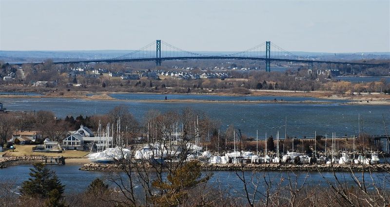
Crossing the bay itself could be done with either (a) a new crossing, or (b) a retrofit of the Mount Hope bridge. For (b) to happen, minor takings of curvature in Bristol Ferry would have to occur, but far more significant would be essentially rebuilding the entire span to significantly heavier loads (not freight-heavy, though) and to have two decks. The current bridge's approach viaducts are rather...spindly...as it is.

Actually, due to the relative age of the current bridge (while the structure is pretty, several obvious deficiencies make it a poster child for functional obsolescence), a multimodal reconstruction may well be called for. Figure 4 below shows how a new alignment through Bristol would work with the existing ones.
Fig. 4. Mount Hope Bay crossing and a new alignment through Bristol, up to Warren.
Into Providence

Two potential alignments could be made into central Providence from the East Side Railroad Tunnel. The first is Option D, as I described the other day as
...link[ing] Providence Station with the old East Side line. Unlike Option C, it does so far closer to the city, linking a short bore tunnel under the Moshassuck and part of College Hill with the existing East Side Railroad Tunnel and running across the Crook Point Bridge.
and the second is Alon Levy's countersuggestion that
for Providence-centric regional rail, it would be interesting to demolish either One Citizens Plaza or the buildings at the northeast corner of Steeple and Canal and go elevated over either Memorial or Kennedy Plaza).
One Citizens Plaza
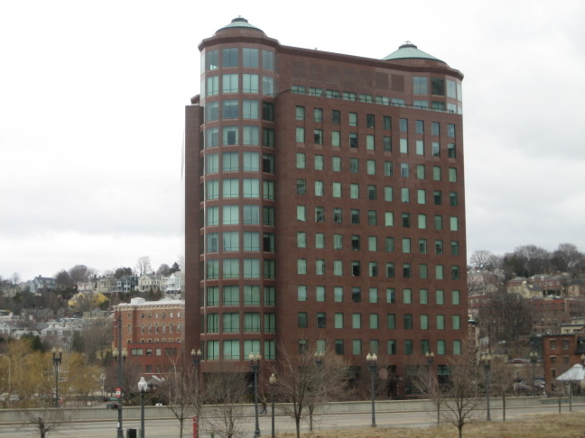
(I would note that we may not necessarily need to demolish One Citizens Plaza so much as reorient it to Moshassuck Place; the small plaza between the building and the street appears to be sufficient to hold a two-track elevated facility. It's pretty much built over the old NH alignment as it is.)

While either way works, I am of the opinion that the short (~4400 feet or 1.4 km) cutoff tunnel to the existing station works better in a larger picture. S-Bahn networks, in particular, like to cluster at the core. That said, since Alon's alignment is a reflection of the NH one, and the railroad also had an alignment up the Seekonk--one still in use today--a network built around a new station over Memorial Drive at Union Station is very much practicable as well. Figure 5 shows how the bored (red) and elevated (black) alignments interact with the existing one (blue).
Fig. 5. Tunneled (red) and elevated (black) approaches to DT Providence from the East Side Tunnel (blue).
The Whole Picture 

Having found the existing easements out of Providence southeast, and analyzed the infrastructural challenges required in turning them into a line (or two), we now have the beginnings of a high-quality statewide network centered in Providence. These southeastern routes are infrastructurally the most challenging; we'll look at other routes later. For now, our final result is Figure 6.
Fig. 6. Regional rail from Providence southeast
___________________
*Note that, with Brayton Point's planned 2017 shutdown, opportunity may be had to re-establish the ROW. This would greatly ease curvature from the Somerset Branch onto the I-195 alignment.