Showing posts with label Light Rail. Show all posts

Monday, September 29, 2014

Kansas City Can Do It Better

(This post started as a fork from the previous post, The Streetcar Fiasco.)

Let us recall, for reference,  Width, and the Perception of Width and Multiway Boulevards, Transit Avenues.

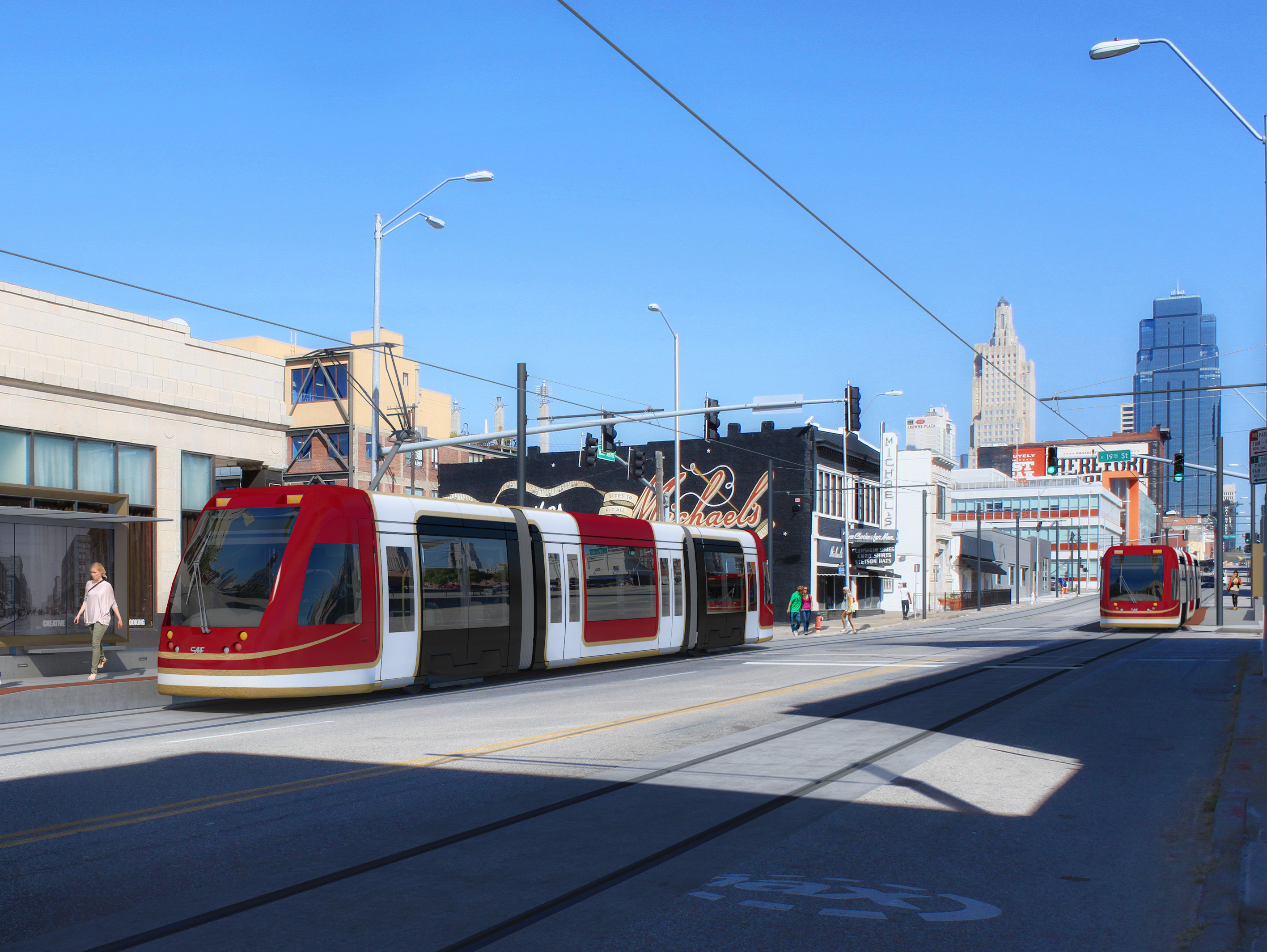
Kansas City Streetcar render
Kansas City's Main Street is only 80 feet wide -- 10 feet narrower than H Street -- but has nothing like the latter's congestion. Yet there are two southbound lanes and one northbound lane, and during "peak" periods the parking lanes turn into bus lanes. The streetcar is a mere drag-and-drop effort into the existing system.
The narrowest a street can be and still have full light rail is a mere 70 feet. At this width, several compromises have to be made, sure -- in particular, on blocks hosting stops, parking lanes need to be removed -- but they are as nothing compared to the scale of the compromises that need to be made on
60-foot streets. And remember, Kansas City's Main Street is a -- measured -- 80 feet wide.
Sample (pre-Streetmix) sections
In fact, we can have our cake here and eat it too. The nature of Kansas City's layout allows us to route core bike infrastructure on Broadway Boulevard and Grand Boulevard, which gives Main Street plenty of room to handle all of light rail's needs. Like so (with a parking space where the stop isn't).
A second option would be to kill parking spaces on one side of the street. It may be preferable to construct a street layout like this between stops. (Note that, in this layout, the parking space may also be claimed as a parklet where sufficient pedestrian energy to do so exists.)
In both, however, it becomes evident there is plenty of space for proper light rail, instead of copying a failed experiment from elsewhere in the country. More creative thinking's all that's needed.

Well, that, and a willingness to give up traffic lanes.

Friday, September 26, 2014

The Streetcar Fiasco

Streetcars have become a major fad over the past few years, ever since Portland put in theirs.
Portland Streetcar
In Portland's case, the streetcar is a pretty decent investment: it acts as a circulator overlay on a high-quality light rail system. But after they put theirs in a bunch of other cities began to construct streetcars for themselves.
H Street Line, Washington, DC
DC's H Street line was the second major streetcar; it is also the first that suggested an underlying problem. You see, H Street is supposed to be a spine corridor, linking the city's east side with its west. It thus needs to be built to a higher standard capacity than ... that.
This particular design -- at the time, novel* -- contains two catastrophic mistakes that permanently mar this line's capacity:
  1. The line has been built in a mixed traffic lane rather than be given its own dedicated lane. This reduces the streetcar's speed and makes it no better than a bigger bus on rails. Part of what makes light rail successful** is the dedicated lane. Without this lane the line is unable to bypass car congestion and thus provide the positive time differential that helped justify e.g. Salt Lake's investment.
  2. The line has been built in the outer lane. This second point makes it own strange kind of sense -- once you've decided not to build a dedicated ROW, there's something vaguely suicidal about asking passengers to run across a traffic lane unless you're willing to put carstops in, and if you're doing curb bumpouts as well, then why not put those there? However -- by putting the streetcar track in the outer lane you create conflicts between the streetcar and parallel parkers, delaying the transit vehicle for a single driver. These kinds of conflicts slow down vehicles on our country's remaining historic streetcar lines all the time -- one of the reasons Boston's Green Line is one of the most reliable is because (unlike the examples in Philly, Toronto, and San Francisco) the vast majority of the surface system lies in dedicated medians.
H Street was a difficult design challenge. The street is, surprisingly, 90 feet wide, and it is fairly congested -- its AADT hovers a little above the max capacity of a two-lane street -- and a full light-rail buildout would have likely required (among other things) taking of a parking lane significant street reconfiguration, much like 1st Street in San José, a bright spot in the VTA system.
1st Street, San José
Indeed, it is arguable that the H Street Line's optimal placement would have been for the light rail to lie between the sidewalk and the parking lanes, with a road diet reducing auto capacity just enough to convince (some) drivers to Take Other Routes. This arrangement, however, remains problematic in its own right, and is not the thrust of this post -- and I have talked about these kinds of things before.
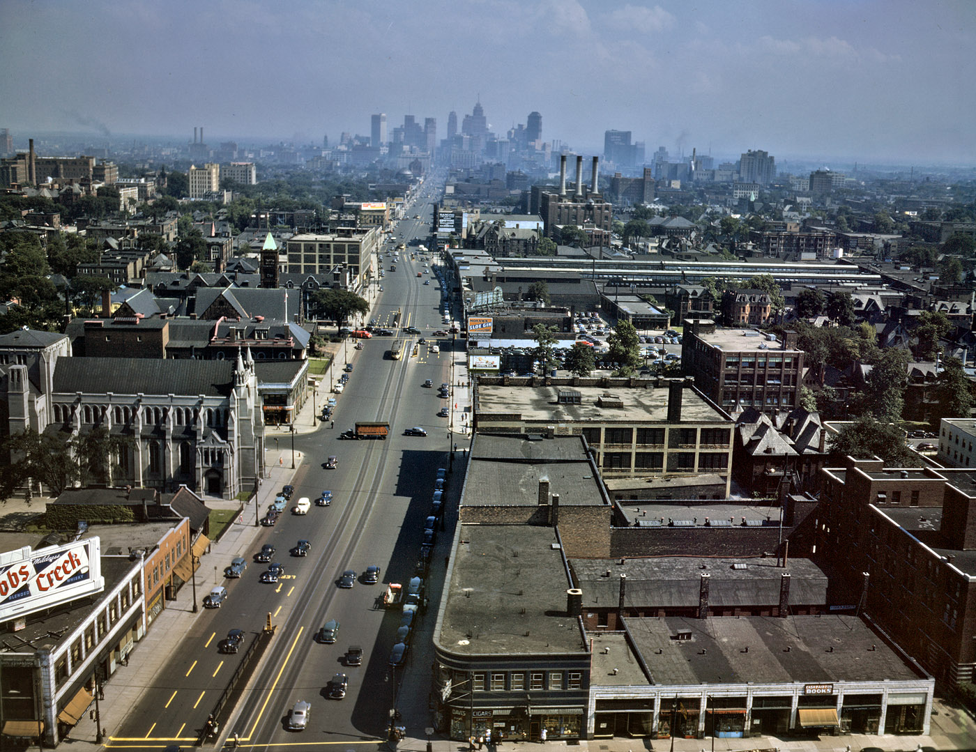
Woodward Avenue, ca. 1942. Note that even then there was little real congestion.
M-1 Streetcar plan reveals same engineering failures as H Street -- this time, with even less excuse.
At least two Midwestern cities have taken the (failed) H Street approach and applied it to themselves: Detroit and Kansas City. I haven't been to Detroit, but I will note that Woodward Avenue, which is eye-poppingly wide relative to traffic, can easily accommodate every single mode, if the designers chose to.
Kansas City Streetcar render
What is perhaps most shameful is that within these ... things ... lies the fact that the powers-that-be continue to refuse to give up any street space for cars, no matter how ridiculous the car gluttony may be *cough cough Detroit, Kansas City cough cough*, and are packaging it as a political sop to Millennials.

No. The transportation investment that would please us the most is in quality bike infrastructure. We want to ride around everywhere. Bike-friendly cities are Millennials' cities.
____________
* Portland's downtown streets are only 40 feet wide; historic streetcars ran in the middle of the street. (See, for example, Philly's trolleys.)
** And good BRT -- Cleveland's Euclid Avenue being the only such example in the United States today.

Friday, June 8, 2012

What To Do With The City Branch: Return It To Transit

(Author's note: Ed. put the "...As Light Rail" at the end of Hidden City title.)
Reading Crusader model from Reading Terminal Market display | Photo: website Found Connections
The ViaductGreene proposal being entertained is for a sunken linear park between the Rodin Museum and 13th Street, where it would meet the Reading Viaduct (at Noble). This proposal has proved controversial. In fact, the majority of readers who commented on the Hidden City report announcing a planning grant for the linear park were strongly opposed to the idea.

What are its problems?

First off, it doesn’t fill an immediate need for parkland, the way the Reading Viaduct does. The Callowhill neighborhood doesn’t have any parks. By contrast, the small Matthias Baldwin Park at 19th and Hamilton ... Read more at Hidden City Philadelphia.

Sunday, May 22, 2011

Skirting Light Rail around Center City

Light rail is one of the most difficult aspects of Philadelphia2050 to figure out. In my initial conception of the network, I had crammed both of planned new West Philadelphia light rail lines, the 37 from Eastwick via Lindbergh Boulevard, and the 49 from St. Joseph's University and Wynnefield via the West Park, into the existing Subway-Surface tunnel running from the corner of 40th, Woodland, and Baltimore to Juniper and Market with an additional exit at 35th and Ranstead. Since light rail is essentially a bus on rails, capacity for this tunnel is about as high as you'd expect. Even with five lines (10, 11, 13, 34, 36) accessing this tunnel, there is definitely still space for more.
But then I read this post on Human Transit, and a light bulb went on: why am I cramming everything into the tunnel? Just because I can? I had noticed some SEPTA routes which originate in Overbrook and Wynnefield running to South Philly--the 40 originates at the corner of Monument, Conshohocken, and Ford and terminates at Headhouse Square and the G originates at Lankenau Hospital and terminates at Columbus and Oregon, for example--and I wondered if there might not be some efficiency involved. Then I thought about my heavy rail network (to be explained in a later post) and how both my Ridge-8th and 19th-Society Hill lines are essentially two lines which inter-run via the Center City Loop and I realized that the 40 and G aren't one line so much as they are two lines which have been merged.
Using this, I could justify running my new routes onto Girard and Washington Avenues, thus bolstering frequency on the two east-west roads which bound Center City. The 15 doesn't come any more frequently than 15 minutes where the headway really needs to be 7 minutes, and the 64 is even worse*. As a result, crowding is a frequent issue on both routes.
The modification is thus that Girard and Washington will both get one of my two new routes (37 and 49). But which one? By running the 37 on Washington and the 49 on Girard, I would keep both routes relatively short, but that would also require relying on the 64 for the 40th Street section. So, the opposite was chosen: the 37 would run from Lindbergh up the 40th Street connection to Girard, and the 49 from Parkside down the connection to the Grays Ferry Bridge and access Washington from there**.
But this proposal also undermines the usefulness of the 64, which runs from Queen Village to Parkside via Washington and 49th. Previously under Philadelphia2050, the 64's route had been modified to make the run via the 40th Street Connection, such that it, combined with the 15 along Girard and the waterfront light rail proposal, would form an outer loop around Center City. With the 37 and 49 following 40th, this would give the west side of the loop triple service--too much service. But if the 64 were to be scrapped entirely, Washington would still only have one route servicing it (while 40th and Girard would both have two routes), thus negating the stated aim of this restructuring.
So the 64 was given a new purpose: accessing the job-rich, transit-poor University City Health Center, home to CHoP and Penn where a collector is very definitely needed between the two main points of transit access, both on the district's periphery--University City Station on the Regional Rail, and the 40th Street Portal--and the main jobs center along Civic Center Boulevard. The route shown in the diagrams is very provisional (at best) and will be expanded on in a later post.
 
The waterfront line wasn't considered in large part because it appears there may be compatibility issues between this line and the others. The waterfront proposal, due to the need to preserve a freight spur accessing the port facilities further south, will, in all likelihood, use standard gauge DMU equipment, time-separated à la the River Line, while the other lines will all use broad-gauge electrified LRV equipment, like that used on Boston's Green Line. This compatibility issue will allow for connections, but not interoperability. If, on the other hand, the waterfront line is built in such a way as to be interoperable, or able to be converted into being interoperable, with the other lines, then that opens up a raft of new possibilities for the 64, one of the most delicious being the use of American Street to reach Fairhill, a neighborhood where the addition of new rail service is at or near its most difficult.
A final note about the light-rail map: like heavy rail, Philadelphia2050's light rail system is composed of interwoven overlain networks, which are broadly classifiable as urban and suburban. Urban can be further classified into four networks: the Subway-Surface, the Loop, the Upper Network, and the Waterfront Line; suburban can be further classified into suburban light rail (concentrated at 69th Street Terminal), New Jersey light rail (concentrated at Walter Rand), and interurban lines, like the former 100***, where the lack of concentration is the establishing feature. The ideal solution with all this is to give each network in the system its own color, but the sheer amount of colors (three heavy rail networks + four urban light rail networks + three suburban light rail networks + the regional rail network = 11(!) separate networks in the system) makes this something of a Sisyphean task. Untangling this maze is one of the major cartographic challenges of the proposed system.
________________
* The 64 being a bus line which would be upgraded, under Philadelphia2050, to light rail.
** Technically, the 40th Street connection is a one-way pair: the southbound line runs along 40th from its corner with Parkside and Girard south to Spruce and thence down 42nd to Woodland; the northbound line up 42nd from Woodland to Spruce, then up 38th to Filbert, then up 41st to Ogden back to 40th and across the bridge over the Main Line just west of Zoo. In the maps, the 37 line runs the northbound section of this connection and the 49 the southbound. Additionally, since the 11 and 34 both use Woodland east of 49th, I decided to run the 37 up 49th (which has available trolley tracks) to Chester, following the 13, in order to not inordinately overload Woodland; since the Grays Ferry Bridge's optimal access follows 47th, to keep costs down, the 49 follows Woodland for a brief section from 42nd to 47th.
*** The 100 is now called the Norristown High-Speed Line, or NHSL for short; in Philadelphia2050, the 100 number is to be given to a new route extending from 69th Street Station to Ivy Ridge Transportation Center (another later post).