Showing posts with label PhilaHSR. Show all posts

Wednesday, September 19, 2012

Dealing with Zoo

In the comments on the last post, the conversation--inevitably--turned back to Zoo, and I pointed out in the comments that
...Zoo does have a very real time cost, and the only way to ameliorate it is to, well, bypass it. And the only way to bypass Zoo is to build a new Schuylkill crossing.
So, now that we have established how to provide high-speed Airport service and augment the 30th Street approaches; so, now that we have established that the existing alignment is operationally superior and that neither speed nor capacity is an issue south of 30th Street, we must take a look at what is the real crux of Philadelphia's rail transportation problems: Zoo.

Before we begin this discussion, keep in mind that (a) Zoo has unused capacity and (b) of all the speed restrictions to address between New York and Philadelphia, Zoo has, or should have, the lowest priority. What this means is that we can compromise on Zoo and still get good or very good service before needing to actually address it as a problem. There is no way to solve Zoo as a speed problem without concrete, and organization and electronics need to be optimized before concrete goes in. What this means is that rebuilding Zoo is a project with a long-term outlook: 2045 or later. It is also the final element of my program of improvements for HSR in Philadelphia (see here).

The least expensive feasible HSR bypass of Zoo is this one: all bypasses will necessarily involve a new Schuylkill crossing, as the existing interlocking is optimized to provide the fastest north-south path from 30th St. onto the bridge. And due to all paths across the river needing to pass through the park, we can assume that all new sections of the alignment will be wholly underground (else we risk regulatory wrath).

The other--straighter--option would be a tunnel under Lemon Hill and Boathouse Row. Such a tunnel would, however, cancel out many of the savings achieved by abandoning Market East for a time gain of mere seconds, and would necessarily involve disturbing Boathouse Row, which lies on top of where the bored tunnel would meet the immersed-tube one. So we will not pursue this option, and instead pursue the option with the least amount of tunneling. Hence the one I provided.

This tunnel has (hopefully) a geometry offering 150 mph service, significantly faster than the 60 mph service we can optimize Zoo proper for; however, if the curvature requires a 120 mph speed limit, that would be acceptable, as the time difference would be infinitesimal. It also maximizes utilization of existing easements, beginning its approach alongside, and then under, the Schuylkill Expressway, and then curving back under the NEC ROW via an immersed tube crossing the Schuylkill under Girard Ave. It would then have to clear under Fairmount Jct.'s approach before returning to the NEC main in the Strawberry Mansion area. Designed for Velaro-, Zefiro-, AGV-, and N700-type equipment (i.e. HSR EMU trainsets) to the exclusion of all else*, this tunnel would allow for significantly steeper max gradients than elsewhere on the NEC as it is strictly a speed bypass of a complex interlocking.

Its expense--though a fraction of the total Market East tunnel's--combined with the relatively marginal improvements it offers is what cements its low priority; as I have mentioned before, upgrading the intercity network to 25kV 60Hz (with the possible exception of bypassable individual terminal systems, if clearance is an issue in urban cores) will single-handedly generate the most time savings, and be the primary mover chopping PHL-NYP time to an hour. The most expensive PHL-NYP improvement needed is, of course, Gateway, which would double the available Hudson tubes and address the choke points on the New York approach. All other projects on the line, such as what Alon Levy suggested, see time improvements of only a few seconds, which, while important, do not get the bang for the buck that addressing the archaic overhead system and the Hudson capacity issue do.

That said, this is my cost breakdown of my program of improvements, in terms of priority:
1. Zoo Interlocking Improvements
has the highest priority, as it costs the least and offers the most significant immediate speed improvement. Let's peg it at $100 million, tied up mainly in incremental track upgrades and path-sorting improvements.

It's followed by the 
2. Chester Branch HSR Line, including
2a. Hospital Interlocking,
2b. Grays Ferry Interlocking,
2c. Double-Decked Chester Branch Grays Ferry-Bartram's Gardens,
2d. PHL AirTrain**,
2e. Darby Creek Viaduct (Essington Aerial), and
2f. Eddy Interlocking, along with
2g. Local Stations (a) Bartram's Gardens, (b) 63rd St., (c) 70th St., (d) Eastwick, (e) Airport, (f) Tinicum, (g) Essington, and (h) Industrial Hwy., combined with freight improvements
3. 52nd St. Branch Reactivation, including
3a. Brill Interlocking, and
3b. Baldwin Interlocking,
that is, the integrated and interrelated complex associated with bringing HSR to the Airport via the Chester Branch. This would be the most expensive element of the whole package, as the relatively simple and low-cost interlockings are dependent on the higher-cost line optimizations and reactivations. Of particular note is the Darby Creek Viaduct, extending all the way from proposed Eddy interlocking to Tinicum, essentially a second deck over the freight Chester Branch. The cost of this complex would be in the neighborhood of $2 billion, most of which--that is, all of it railroad south of the Airport--would have to be borne by the Market East Tunnel as well (see why I say Amtrak is dangerously lowballing Market East's costs?).

Finally, the lowest-priority element of my program is
4. New Zoo Bypass,
which, as has been detailed earlier in this post, offers a minute or two time savings, but at a cost of around $1b. The Northeast Corridor is neither congested nor time-optimized enough for this cost to make sense at this time, which is why I stress incrementally improving the rest of the corridor in order to make it viable, if it must be done.

Let me repeat myself. The Northeast Corridor is currently neither congested nor time-optimized enough for a Zoo bypass to be economically feasible.
_________________
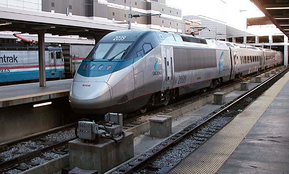
* Push-pull equipment and motor-based HSR trainsets (like the Acela, KTX-II, and Duck), none of which can achieve the maximum speed EMU-based ones can, would still be routed via the existing Zoo interlocking.
** An automated train along the Airport Line's current fishhook. The Airport Line would be extended to Chester/Wilmington via Tinicum and Essington stations.

Tuesday, September 18, 2012

30th St. Footnote: Hospital Interlocking

In the main post on this matter, I mentioned that the actual pinch point on 30th St.'s southern approach occurs where it passes under the High Line, as what were clearly the SB approach tracks (let's call them 3 and 4) pinch down from two to one to accommodate a large bridge pier where Track 4 should nominally go. I mentioned that I did not believe this pinch point was an issue, since it was clearly in place during the 1930s and '40s, when more passenger rail was operated than any other time in our history, and does not appear to have ever negatively impacted 30th Street Station operations. So creative dispatching can deal with a three-track approach.

The footnote is that if the inclination to apply concrete to simplify dispatching is pursued, then there is a simple way to ensure a four-track approach at all times into the station: duck Track 4 under Track 3. As (what was) the interlocking between the SEPTA and Amtrak 30th St. approaches is immediately west, or railroad south, of the High Line pinch point (see here), Track 3 can sort at the east end, and Track 4 at the west end, of this area^.

University Ave. is where it gets complicated. As it turns out, there are only four available passenger tracks across it, and split onto two different girder structures to boot. It's fairly apparent the PRR originally had at least an at-grade interlocking to sort here (a tower is still in place), but Amtrak and SEPTA, through agency fiefdom, have completely disassembled it, each crossing University Ave. on its own girder.

Fixing this so that Tracks 1-2-3-4 are N-N-S-S at University Ave.--important for implementing the proposed Chester Branch interlocking, not far to the west--will require agency cooperation as well as figuring out how the SEPTA NB track can fly over Amtrak's and still wind up at ground level to service University City station. This will be easier if we can replace the girder so that it has five tracks of space to work with, but let us try to deal with current site congestion to create "Hospital" interlocking.

This map shows how Hospital works assuming a Track 4 duckunder: Track 3 NB of Hospital becomes Track 4 SB of it, and the station throat interlocking would need to take it into account. Accepting the pinch point makes it far easier, as Track 4 can simply diverge railroad south of the Track 5 flyover (West Chester Branch EB). In either case, however, the need to end the incline at University City's railroad-west end will likely require the 30th St. approach tracks to depress slightly to make clearance; this depression will translate into a lengthening of the Track 3/4 incline between South and Walnut, with its technical limit station throat limits^.

Hospital Interlocking is the east half of a pair of interlockings intended to sort between the NEC, Chester Branch, and West Chester Branch railroad south, and 30th St.'s two approaches railroad north. The freight High Line/Chester Branch interlocking does not interact with these two in any way, and so will not be considered aside from noting that Chester Branch tracks 1 and 2 are 20 feet directly beneath two* CSX tracks.

Edited to add: One of my concerns about the Track 5 flyover was the lack of distance between the end of the University City station and the NEC main (Tracks 2 and 3). A quick check revealed, however, that there is 500 feet distance between those two points, which allows a flyover to just make an 18-foot girder clearance, 20 ft track clearance, at a 4% grade.
____________________
^ Addendum 9/20: Another possibility that occurred to me after I completed this post is to simply run Track 4 on the surface and Track 3 underneath it. That does away with the excessively complicated wayfinding necessary in what I had first described.
* The High Line has the capacity to be a two-track main; the second track is disused. This exercise assumes that freight traffic growth allows NS and CSX to rebuild the second track and CSX to run a two-track line from its main to it.

Monday, September 17, 2012

30th St. Approach Capacity?

Professional transportation engineer Liam left me this comment on my previous post, The Alternative to the Market East Tunnel:
What would be your response to criticisms that you're overlooking capacity issues at 30th Street? There are only two tracks headed south from the station, after all; the line doesn't open up to 4 until the Regional Rail tracks come in from University City.

I think it's a manageable constraint, but there's definitely more going on here than just Zoo.
This is true. Agency turf wars are a continuing problem, and have resulted, more than once, in extraneous concrete dedicated to eliminating versatility and redundancy previously built into the system--Zoo is a good example of this, where no fewer than half of the paths through the interlocking have been removed. And when the Market East tunnel was first proposed, a popular theory was that Amtrak didn't want to to have to share space with SEPTA anymore (never mind the fact they have different concourses, and different platforms with different approaches)...To put it another way, the Market East tunnel, like lobotomizing Zoo, is a concrete solution to an organizational problem.


Now we move to the real meat of Liam's specific question. There are two questions embedded within this query: (1) how do we increase the capacity of 30th St.'s south approach, and (2) (what he assumes the answer to is yes) does the 30th St. approach present a capacity problem?


The answer to (1) is that only 2/3rds of the approach's capacity, at its narrowest point, is currently in use. The ROW pinch occurs under the High Line overpass right before the Amtrak and SEPTA approaches meet; under this overpass there is room for three tracks, two of which are currently in use. Those two were originally the northbound approach; the southbound approaches have been converted into two spur tracks. Originally, they merged just before the High Line underpass and would have merged again where the upper- and lower-level approaches met, resulting in four passenger-dedicated tracks at the University Ave. overpass, tracks which would then sort into NEC tracks 1-4 and the two West Chester Branch ones.


So we can assume that--if full capacity can be reactivated--30th St.'s south lower-level approach is (technically) three tracks at its greatest pinch, and with smart dispatching (effectively) four tracks. Plenty of capacity, especially since through trains really only need four or six tracks (three platforms), half the station's current capacity (five platforms, ten tracks).


Of greater concern is the north approach, which runs straight into one of the most complex pieces of rail infrastructure in the United States: Zoo Interlocking. Remember in this discussion that the historical owner of this infrastructure, the Pennsylvania Railroad, maintained two different paths for any possible movement through the interlocking, and that there are six feeds into it (Main Line, Northeast Corridor, Reading interchange, High Line, Upper Station Approach, Lower Station Approach). For our purposes, that means the PRR maintained a four-track north lower approach, only half of which is now in use*--this is what I mean when I say Zoo has been lobotomized.

The simple solution of reconnecting several switches, and putting the Schuylkill River bridge's fifth track back in, grows the capacity of this, the busier side of the station.

Now we can address the second question. Passenger rail growth will demand capacity improvements, indubitably, but 30th Street Station was one of the last prewar passenger rail termini built in the United States, and as such, was engineered with a far greater capacity than e.g. the original layouts of any of the stations Broad Street Station was built to replace. Its approaches were state-of-the-art and able to handle 1940s-scale rail traffic without a hitch; it's very unlikely that the approach tracks within the existing PRR footprint (not all of which, remember, are currently in use) will hit "concrete" capacity limits even in the most optimistic future traffic projections (such as those Corey Best produces).


That said, as with any finite structure, there certainly is a capacity ceiling--but the traffic scale one would expect near it, which we are currently far from--would be able to justify even the most futuristic infrastructure improvements--much as the Chuo Shinkansen has become viable largely because traffic demand between Osaka and Tokyo has surpassed every capacity ceiling the Tokaido Shinkansen has to offer. Then, and only then, would a Market East tunnel become feasible.

____________
* The current situation offers two possible southbound approach tracks, but only one northbound one, through the interlocking. Only one of the southbound approaches, however, shows high-grade maintenance.

Wednesday, September 12, 2012

The Alternative to the Market East Tunnel

I have already spoken about my criticism of Amtrak's proposed Market East tunnel, a cogent enough piece Alon Levy relies on it and The Economist has quoted from it--but I have yet cogently articulated what the alternative is.

Part of it is, it's simple. Really simple. But it's complex. It's not complex in the way the Market East tunnel proposal is--that is, as an engineering challenge--but rather as an organizational one--that is, getting the right players at the table talking the right tones.

There are two, and exactly two, transportation elements to the Market East tunnel proposal; everything else is highly speculative land-use development claims. These are to (1) connect regional/high-speed service to Philadelphia International Airport, and (2) bypass Zoo Interlocking, which, for this proposal, is seen as one of the corridor's major pinch points.

My response to Zoo to begin with. It is true it is a pinch point, but a necessary one. There is no better way to provide a wye junction between the Northeast and Keystone Corridors, two high-speed lines, without egregious tunneling and investment. Much better, then, to simply optimize Zoo for 100 kph (~60 mph) traversal, particularly since one goes directly from it into the 30th St. yards and station throat.

Certain transit proponents claim Zoo traversal takes 45 minutes; this is demonstrably false: a much more accurate time penalty can be ascertained by comparing the commuter rail times from North Philadelphia to 30th Street and North Broad to Market East, respectively, to one another. This is approximately four minutes, and for local services; express trains can run the same route more quickly. The reality is that, for the fastest services (the Acela and Northeast Regionals), the time penalty is more like 45 seconds, and can be reduced to 30 with an optimized interlocking. Besides, there are improvements elsewhere on the corridors that can ameliorate Zoo's impact--switching to modern 25kV 60MHz constant-tension catenary (the most advanced currently available), for example, will effectively double speed limits throughout the corridor.

So, because (a) it's a junction between two high-speed lines, (b) no form of restructuring is economically feasible, and (c) far greater speed (and thus time) gains are available through a far less expensive project, I urge ignoring the, er, urge to bypass Zoo. Keeping structures like Zoo in place are one of the major compromises one has to make when implementing a high-speed system on top of an existing medium-speed one, as the Italians, French, Germans, Belgians, Dutch, Koreans, Russians, and (soon) British have all found out*.

The second problem this proposal purports to solve is bringing intercity rail to the Airport. The proposed route would break off the existing NEC in the Eddystone area, follow I-95 or the Chester Branch into the Airport area, provide a new station, and then delve under the Schuylkill and the tunnel, coming back out around Frankford Junction--but this is not really the most optimum way to bring passenger rail there.

The Chester Branch is arrow-straight. Don't be fooled by the SEPTA line, which comes off the NEC following the 52nd St. Branch and then curves onto the Chester Branch; look on Google Maps. It diverges from the NEC right under the Grays Ferry bridge and extends past the Airport with no noticeable curvature whatsoever. It continues this pattern, though now with minimal curvature to avoid geographic obstacles, all the way to Eddystone. SEPTA's line makes use of a part of this alignment, but to put it bluntly, it is about as tailored to high-speed rail as you're going to get. Ignoring it is thus foolhardy.

The big issue the Chester Branch has is its mixed traffic. This comes in two flavors: local traffic to Chester (well, duh) and through traffic using its uppermost mile as a cutoff linking the CSX (ex-B&O) main with the (ex-PRR) High Line; this latter section is pretty important for double-stacks originating from the Ports of Baltimore and Wilmington, particularly as the Charles Street Tunnel down in Baltimore and Fairmount Tunnel up here are too squat for them.

This is, however, mostly an organizational issue that can be solved with limited, but judicious, application of concrete (and concrete needed to provide grade separations, anyway). In this case, this involves (a) grade-separating the line through Essington and Tinicum--this will involve an aerial due to the shallow water table and Darby Creek crossing--as well as flying over Industrial Highway to meet the NEC (the existing freight line would be retained underneath this aerial), (b) re-activating the rather more circuitous 52nd St. Branch for freight traffic with a new junction with CSX about a football field north of the apex of the existing SEPTA flyover, a reactivation which would service industrial development along Essington Ave. and parts of the Industrial Hwy. near the Penrose Ave. bridge, and any potential Port expansion around the mouth of the Schuylkill, and (c) a double-deck railroad between the CSX line and the High Line, with the passenger section underneath and the freight section on top. At the NEC, the freight line would veer onto the High Line right-of-way and the passenger one would integrate with the NEC main via either flyovers or duckunders.

While this slate of improvements is not insignificant, keep in mind that the Essington/Tinicum aerial would be necessary anyway, due to the Darby Creek crossing, and that each improvement utilizes existing rights-of-way with technically minimalist solutions for handling passenger/freight traffic separation and the grade separation necessary for true high-speed rail. Costing isn't too hard: I do not believe double-stacks move along the Chester Branch and so undercutting shouldn't be necessary, and the two-level box structure between the NEC and CSX puts Plate K clearance (the double-stacks) up on the highest level. Total costs shouldn't be more than $100 million to $250 million.

There are significant operational advantages to this alignment. Firstly, trains not calling at the Airport can use the existing NEC alignment to bypass it completely, which means that the line can be (re)built to handle lower capacity than the tunnel proposal (which would shove all trains through the Airport station, whether they stopped there or not).

It also offers a new local alignment to Chester, allowing for stops at Tinicum and/or Essington, as well as 70th, 63rd, and Bartram's Gardens in the city. The Airport fishhook can then be repurposed into an AirTrain-type setup.

And finally, there are concrete land-development advantages.

Biggest of these is that the 52nd St. Branch alignment offers freight access to a large swampy area across the Schuylkill from the Navy Yard--an area which, with the completion of the current Port expansion (called Southport, I believe), will become the next logical place for a new Port terminal to handle growing Northeast port traffic. A natural terminus, it lies between a large industrial area and the Airport, and would make the Navy Yard a natural place to handle the Port's administrative (office) functions, lying, as it would, between two of Port's three largest termini.

More importantly for passengers, local stops can be leveraged for transit-oriented development. This is particularly useful around 63rd and 70th Sts. and Bartram's Garden.

Finally, with the speed boost from catenary modernization, PHL would lie about an hour from Midtown--the same time, coincidentally, that JFK is on the subway. Instead of attempting to use less and less tenable suburban airports to handle NYC's congestion, PHL's roomy international terminus can provide necessary space.

This is the alternative vision I have: Airport service provided along a natural corridor, Zoo improved inasmuch as is geometrically feasible, and none of that asinine Market East tunnel proposal--which, I may remind you, would be a bored tunnel through alluvial soil under the water table in a heavily-urbanized area, which can be read as f(x) = Extreme Cost Overruns. There is no way on this earth, or any other, that that project will cost "merely" $3 billion, as Amtrak is attempting to sell us on; peg it more between $10 and $15 billion, and that is at its technical cheapest: a 300%-500% cost increase.

By contrast, my proposal will add in reasonable intercity PHL service for $250 million (note m) on top of the flat cost of modernizing the NEC--that is, catenary conversion plus the costs of Gateway and the Great Circle tunnels under the Hudson and in Baltimore, respectively.
_______________
* The Japanese, Taiwanese, and Spanish high-speed networks are all of a completely different gauge standard than the existing systems, and so don't run into this issue. China, meanwhile, has the resources and attitude to ignore this issue.

Friday, January 27, 2012

Zoo, and HSR in Philadelphia County

Zoo Interlocking is the junction between the Keystone Corridor and Northeast Corridor and one of the most complex interlockings in the nation, shifting passenger trains from two distinct main lines to two distinct station throats, and freight trains three ways.

In the past it was even more complex, with a fourth major direction for freight as well as two different paths for each major movement (that is, two different ways to get from the Northeast Corridor to Suburban Station, two different ways to get from the Main Line to the lower level of 30th St. Station, two different freight bypasses of 30th St. Station, etc.) Much of this redundancy has been stripped out by warring organizations over the years, leading to massive backups when any part of this intricate network fails.

However, Zoo has a key failure: although two of the main wye's three branches are able to handle high-speed interlocking, the third is not. This is not because of a failure of interlocking design, per se, but rather because the best engineering available at the time the interlocking was initially set up forced the third direction to run through a significantly tighter-radius curve than the other two.

As you may have guessed, the tightest-radius connection is the Northeast Corridor side, the east side closest to the zoo Zoo was named after. This connection was built the way it was because it had to simultaneously do two things: (1) elevate from the freight yards along the Schuylkill floodplain--now 30th St. Station, its two leads, and the Powelton Coach Yards--to the level of the river crossing, about 75 feet above the waterline, in only about a mile, while at the same time (2) accommodating the junction between this route and the Pennsylvania's mainline about halfway between.

No matter why it was built, however, it is obsolete if one wants to bring 200 mph trains into 30th Street Station. Since I have it on good authority that that atrocious tunnel proposal is dead even at Amtrak (and was always a consultant's dream to begin with), we have to look at smaller-scale (and cheaper) interventions to accomplish what we want.

Assuming an Airport routing is still desirable--it is certainly feasible--three major interventions are necessary to convert the NEC to a 200 mph + (250 kph +) route through Philadelphia County. They are:
1) Bypass Frankford Jct., which has to be traversed at ~75 mph,
2) Bypass Zoo Interlocking into 30th St. Station's north lead, and
3) Convert the former Reading's Chester Branch into an Airport routing.

See map here.

Bypassing Frankford Jct. is technically the easiest, and the least expensive: the path of Torresdale Avenue, which turns into Erie Avenue at Kensington Avenue is a natural bypass route, and a couple of takings in industrial properties--possibly little more than air-rights takings, as the HSR main would likely have to clear at least one local track before rejoining its own track--would be all the property acquisition needed. Takings would be exclusively industrial.

The trains can traverse Erie (Torresdale) either via an aerial structure or a cut-and-cover tunnel. All types of tunnels are somewhat more expensive than bridges; however, the aerial would have to clear the El at Erie-Torresdale Station, meaning it would have to be ~50 feet off the ground at its apex, rendering it somewhat more expensive than it would otherwise be (e.g. if the aerial could remain at ~30 feet off the ground). So both modes approach cost parity.

Since you can recruit DOT engineers to design an aerial (it's essentially a highway exit overpass, but for trains) whereas even the most basic cut-and-cover tunnel will likely require weaving through underground infrastructure, and since I prefer bridges over tunnels, I'll go with an aerial in this instance. Price tag's probably $250 million, once value-engineered.

Technically the most complex is the Airport routing. Its complexity has nothing to do with attempting an inner-city greenfield routing--it has everything to do with rail uses along the routing. Other than SEPTA's Airport Line, the principal use of the current line is a freight routing to (unsurprisingly enough) Marcus Hook. It is also the routing closest to the river, and thus the one with the most port-related spurs and traffic.

In order to close the Chester Branch east of Essington, CSX will almost certainly require a bypass. My proposed routing, the "Hog Island Freight Bypass", would utilize the former Pennsylvania R.R. 60th Street Branch, most of which is intact (ROW unused for freight is currently used for Auto Mall junk car storage). However, unlike the historical 60th St. Branch, the Hog Island Bypass would meet the CSX main through the former Brill property in Southwest Philly. The connection between the 60th St. Branch and the Chester Branch built for the Airport Line would remain in use as a freight spur for any traffic generated along this alignment (though I don't remember Eastwick's industries having freight rail access).

Now that we've dealt with the freight rail, the next step is to provide the optimal ROW for the passenger service. The Airport Line currently uses the 60th St. Branch to the Chester Branch, but this forces the train through a pair of slow and inefficient corners; a true high-speed routing would continue along the dead-straight Chester Branch until it meets the Northeast Corridor.

The problem with this is that this routing has a surface interchange with the CSX line across the Schuylkill; in addition, the Chester Branch between this interchange and the NEC junction is currently used by CSX as its High Line access line. However, because we moved the freight route for Marcus Hook trains from the Chester Branch to the Hog Island Cutoff, we can go ahead and run passenger trains under the High Line access line, coming out onto the Northeast Corridor. (This routing also allows Airport Line trains to stop at Bartram's Gardens.)

Next, we move to the Airport. The first look we have at the Airport is that we can add a new through cutoff between the Chester Branch and Airport termini, with a somewhat sharp curve by the station. However, this would likely be the more expensive option. A better proposal would be to instead have the through-train Airport station along the Chester Branch, due to the superior curvature (i.e. none). But this is on the wrong side of I-95. So, if this routing is the option decided upon, it will likely become necessary to convert the current Airport Line terminal access to an AirTrain-style light metro. (Fortunately, most of the infrastructure is in place for this; the primary expense would be acquisition of the proper equipment.)

While the Chester Branch has been grade-separated in Philadelphia, such is not the case in Essington, where the small town is hard against the rails. Grade separation, needless to say, is essential here; since we are close to the water line, this will likely take the form of an aerial about 20 feet above the existing freight line (i.e. Plate H double-stack clearance). As the fast passenger line being discussed would allow rerouting the Regional Rail line as well, this local will want a stop in downtown Essington--that is, where the line crosses Wanamaker Avenue. This aerial structure would thence continue across the mouth of Darby Creek and then parallel the Industrial Highway (on top of a disused rail line, possibly PRR, between the road and the Chester Branch) until it returns to the NEC, just south of Eddystone.

What kinds of expenses can be expected for such an undertaking?

1. New track installation (but no re-alignment) between the 60th St. Branch-Chester Branch junction, to the north, and the Penrose Avenue bridge (Penrose Ferry Road) to the south. This may need to be done with grade separation, as it appears to have historically been a grade junction. Assuming prior easement claims can be asserted... $300 million, most of it sunk into the grade separation at the Hog Island-Chester Branch junction.
2. Cut-and cover tunnel under the freight Chester Branch between the NEC and CSX mains... $500 million.
3. New east cutoff between Eastwick and Airport. / New Airport station, conversion of terminal network into AirTrain system... $300 million (whichever way).
4. 3-mile aerial structure from the 4th St.-Chester Branch level crossing west to new NEC junction... $700 million.
5. ~5 miles of new constant-tension electrification... $100 million.

All of these add up to an estimated price tag of... $1.9 billion. (This compares favorably with the asinine tunnel, whose initial cost estimate would be somewhere in the neighborhood of $8.5 billion and work its way up from there.)

It will cost at least $2 billion to bring HSR to PHI. This cost also includes a SEPTA expansion. (The cost of this expansion alone would be about half that, as it wouldn't need to worry about the extended aerial through Essington or grade-separating the junction between the 60th St. and Chester Branches, or restoration of the 60th St. Branch through the Auto Mall, but it would need to worry about a new alignment into the NEC on the east end, dealing with the Airport network, and extending electrification. And without the HSR line, the west-end return to the NEC isn't viable, making the line's natural terminus Essington.)

Station stops on this Airport Line would be: Bartram's Gardens, Elmwood (63rd St.), 70th St., Eastwick (84th St.), Airport (somewhat west of 90th and Bartram), Tinicum (4th Ave.), and Essington (Wanamaker Avenue). Service frequency would likely have to be half-hourly, due to the lack of slots on the SEPTA Main Line.

Let's return, then, to where we started: bypassing Zoo. Zoo sits between the Frankford Jct. bypass and Airport extension in terms of complexity and hence expense. One one hand, the Zoo bypass will be more complex than a Frankford Jct. bypass, due to the fact it has to deal with the Schuylkill; on the other, it has nowhere near as many moving parts as the Airport project.

Because of Lemon Hill, the only sensible place to diverge the bypass is where the NEC and Schuylkill Expressway split, just north of Spring Garden; a narrow easement opportunity is available between the Schuylkill and 34th St.

There are two ways of approaching this bypass: a bridge or a tunnel. Both have their challenges. The tunnel would be an immersed-tube (it's shallower) but the east approach would need to be drilled out of solid schist. On the other hand, the bridge would likely require a very steep west approach--it would have to clear the Schuylkill and the, er, Schuylkill--and it would also need a new easement through Fairmount Park. However, unlike the tunnel, the bridge would rejoin the existing line more quickly, and hence be quite a bit cheaper.

The tunnel offers superior engineering. The bridge offers advertising...but it would also attract NIMBYs who wouldn't want to change so much as a tree in the park.

My estimate is that the tunnel would cost about $1.5 billion and the bridge $750 million. In either event, however, both junctions would have to be squeezed between current infrastructure.

It is also my estimation that it is infeasible to attempt to bring 30th St. Station's north throat to speeds greater than about 120 mph (which would still lose the 1.5 minutes currently expended traversing Zoo). Both the bridge and tunnel routings I offer are likely going to have to be that speed.

Wednesday, May 18, 2011

What should high-speed rail look like in Philadelphia County?

Amtrak's current Northeast Corridor High-Speed Rail (NECHSR) plan, while it is admirable in many respects, contains an odd flaw: once it enters Philadelphia County all reason flies out the window and a contractor's wet dream sets in.

I am talking, of course, about the proposed tunnel running approximately ten miles from Frankford Jct. to the airport. This tunnel has a certain few advantages: (1) it avoids Zoo Interlocking, one of the most complex railroad junctions in the country; (2) by bringing HSR to Market East instead of 30th Street, it returns intercity rail to the heart of Center City; and (3) it allows for a fast, direct Center City-airport connection--indeed, this airport connection would bring PHI only about 40-45 minutes from Midtown Manhattan, which is (surprisingly enough) about as close as JFK currently is via rail, due to the time it takes the E and F trains to wind to the Airtrain connection and the need for the connection itself. (LIRR is no doubt somewhat quicker but also much more expensive.) The second reason, in particular, is why the normally levelheaded Paul Levy has been fawning over this plan.

But it's a bad plan. It's a bad plan because (1) it is freaking expensive to bore a ten-mile-long tunnel through an alluvial floodplain under a highly urbanized area--and to maintain it, since it will reside below the water table--(2) it bypasses the natural junction (Zoo) between two high-speed rail corridors and makes it supremely difficult (if not prohibitively expensive) for the Keystone Corridor to meet the NECHSR in a proper manner; (3) there is little to zero chance that a Market East HSR station, in any form, would amount to little more than an unappealing warren of tunnels; (4) the Pennsylvania Railroad left behind a legacy of a highly-engineered ROW amenable to high-speed use in an urban environment; and (5) said use conforms with European best practices, whereas the current proposal does not.

How expensive is freaking expensive? The kind of bore being proposed is the single most expensive type of tunnel possible: it runs through a soft geological environment with zero tolerance for surface subsidence. It would cost more, mile by mile, than even the Gotthard Base Tunnel. The expense of this tunnel is so great that it amounts to about a tenth of the total budget of the plan (about $10 billion, or a billion a mile, out of a budget of roughly a hundred billion). When a single budgetary item commands that much expense, one must analyze and ask why: why do we need to spend a ludicrous amount of money in Philadelphia for what amounts to marginal access improvements? Knowing SEPTA, politics--and SEPTA's "get-off-my-lawn" attitude--is most likely to blame.

What really rankles is there's a better, cheaper way of doing this. (1) Treat Zoo not as an obstacle but an opportunity. The interlocking is, after all, built for high-speed sorting from two main lines (the Northeast Corridor to New York and the Main Line to Harrisburg) onto two station leads* and a freight cutoff, as well as from the freight cutoff onto an interchange track with the former Reading Railroad--the line which is now Norfolk Southern's main route into Philadelphia from Harrisburg. Zoo is thus both (a) the juncture between the NECHSR (which roughly follows the Pennsylvania's New York-D.C. main) and the Keystone Corridor (which follows the Pennsy's Philadelphia-Pittsburgh main), and (b) the northernmost limit of 30th Street's station lead. (2) Straighten out the tightest curve--Frankford Junction. It can quite easily be done. Erie Avenue, which turns into Torresdale Avenue, almost kisses the NEC both just south of the junction and just north of it--an elevated cutoff along this road will allow HSR to develop to its full speed north of Zoo Interlocking while Frankford Junction still sorts commuter and freight trains towards New York, D.C./points west, and South Jersey. South of 30th Street, SEPTA already runs a regular, reliable airport train to Center City, and if Amtrak so chose to have a direct airport train, the opportunity--following historical freight easements along the west bank of the Schuylkill--is still there. Splitting the line like this furthermore allows the fastest trains to skip Airport entirely. This can be done with around a hundred million dollars, less than even a single mile of the tunnel proposal--and this proposal can be done even with FRA regulation as stingy as it is--so wide is the NEC main line!

For my money, the best place to spend $10 billion is not in the urban places, where high-speed lines can quickly and easily be connected into the existing urban rail network (see: France, Germany, Italy, the UK), but rather between the cities, straightening out onerously curvy routes and boring fast routes through mountains. The costs of building all-new HSR ROW in urban areas are, almost without exception, far too great for the limited service improvements they offer.
____________
*30th Street Station, Philadelphia's intercity rail station, has two platform levels. The lower level, parallel to the Schuylkill River, is the NEC, while the upper level crosses the Schuylkill River towards Suburban Station, the subterranean replacement of Broad Street Station.